Atherstone Hill

Hill, Mountain in Gloucestershire Stratford-on-Avon

England

Atherstone Hill

The B4632 passing Willicote Farm
The B4632 passing Willicote Farm Credit: Philip Halling

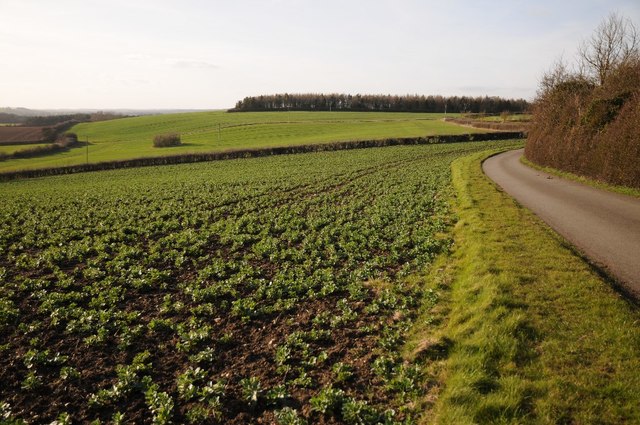
Atherstone Hill is a prominent and picturesque hill located in the county of Gloucestershire, England. As part of the Cotswold Hills, it is situated in the eastern region of the county, near the town of Atherstone-on-Stour. Rising to a height of approximately 580 feet (177 meters), Atherstone Hill offers breathtaking panoramic views of the surrounding countryside.

The hill is characterized by its gentle slopes covered with lush green pastures, interspersed with patches of dense woodland. Its grassy summit provides an ideal spot for leisurely walks and picnics, attracting both locals and tourists alike. The hill is also home to a variety of wildlife, including rabbits, squirrels, and a wide range of bird species, making it a haven for nature enthusiasts.

Atherstone Hill holds historical significance, as it is believed to have been formed during the Jurassic period, approximately 200 million years ago. This geological history is evident in the presence of limestone rock formations that can be found scattered across the hill.

Accessible by foot, Atherstone Hill offers various footpaths and trails for visitors to explore, allowing them to immerse themselves in the natural beauty of the area. The hill's location within the Cotswold Area of Outstanding Natural Beauty further enhances its appeal.

Overall, Atherstone Hill is a captivating destination that combines stunning landscapes, rich history, and abundant wildlife, making it a must-visit location for anyone seeking tranquility and natural beauty in Gloucestershire.

If you have any feedback on the listing, please let us know in the comments section below.

Atherstone Hill Images

Images are sourced within 2km of 52.159194/-1.7206335 or Grid Reference SP1951. Thanks to Geograph Open Source API. All images are credited.

The B4632 passing Willicote Farm
Road and farmland, Preston-on-Stour Country road and farmland to the west of Preston-on-Stour.
Road and farmland, Preston-on-Stour
Country road and farmland to the west of Preston-on-Stour.
Gated track to Church Farm
Minor road towards Preston-on-Stour
Preston-on-Stour, St. Mary's Church: Southern aspect
Preston-on-Stour, St. Mary's Church: Western aspect
Preston-on-Stour, St. Mary's Church: Montage including houses in the village to celebrate the millennium
Preston-on-Stour, St. Mary's Church: c18th baluster font
Preston-on-Stour, St. Mary's Church: c18th baluster font and balcony by Salmon of Stratford
Preston-on-Stour, St. Mary's Church: Royal Coat of Arms
Preston-on-Stour, St. Mary's Church: General Alston-Roberts-West memorial 1 'The Crucifixion' made from driftwood by Peter Bell.
Preston-on-Stour, St. Mary's Church: General Alston-Roberts-West memorial 1
'The Crucifixion' made from driftwood by Peter Bell.
Preston-on-Stour, St. Mary's Church: General Alston-Roberts-West memorial 2
Preston-on-Stour, St. Mary's Church: Early c20th pulpit
Preston-on-Stour, St. Mary's Church: Chancel ceiling rebuilt in 1970 after part of the original collapsed 1
Preston-on-Stour, St. Mary's Church: Chancel ceiling rebuilt in 1970 after part of the original collapsed 2
Preston-on-Stour, St. Mary's Church: Memorial for Major William Alston-Roberts-West
Preston-on-Stour, St. Mary's Church: Memorial for Capt. Harry Alston-Roberts-West and his wife, Olive
Preston-on-Stour, St. Mary's Church: Three West family memorials
Show me another place!

Atherstone Hill is located at Grid Ref: SP1951 (Lat: 52.159194, Lng: -1.7206335)

Administrative County: Warwickshire

District: Stratford-on-Avon

Police Authority: Warwickshire

What 3 Words

///reforming.mankind.shredding. Near Stratford-upon-Avon, Warwickshire

Nearby Locations

Atherstone Hill

Related Wikis

Clifford Chambers

Clifford Chambers is a village and former civil parish two miles south of Stratford-upon-Avon town centre, in Warwickshire, England. It is on the B4632...

Atherstone on Stour

Atherstone on Stour is a small village and civil parish about 3 miles (5 km) south of Stratford-upon-Avon in Warwickshire, England. The 2011 Census recorded...

Clifford Chambers and Milcote

Clifford Chambers and Milcote is a civil parish in the Stratford-on-Avon District, in the county of Warwickshire, England, formed on 1 April 2004. It is...

Milcote

Milcote is a village and former civil parish, now in the parish of Clifford Chambers and Milcote, in the Stratford-on-Avon district, in Warwickshire, England...

Nearby Amenities

Located within 500m of 52.159194,-1.7206335
Barrier: stile
Foot: yes
Lat/Long: 52.155758/-1.7200171
Ash Hill
Ele: 85
Man Made: survey_point
Ref: S5065
Source: survey
Tpuk Ref: TP0895
Lat/Long: 52.1592056/-1.7206128
Material: wood
Power: pole
Source: bing
Lat/Long: 52.1633989/-1.7230792
Material: wood
Power: pole
Source: bing
Lat/Long: 52.1626635/-1.7226595
Material: wood
Power: pole
Source: bing
Lat/Long: 52.1619025/-1.7222343
Material: wood
Power: pole
Source: bing
Lat/Long: 52.161223/-1.7218642
Material: wood
Power: pole
Source: bing
Lat/Long: 52.1605706/-1.7214927
Material: wood
Power: pole
Source: bing
Lat/Long: 52.1597273/-1.7211641
Material: wood
Power: pole
Source: bing
Lat/Long: 52.1590181/-1.7208825
Material: wood
Power: pole
Source: bing
Lat/Long: 52.1582085/-1.7205513
Material: wood
Power: pole
Source: bing
Lat/Long: 52.1574211/-1.7202307
Material: wood
Power: pole
Source: bing
Lat/Long: 52.1566099/-1.7199263
Material: wood
Power: pole
Source: bing
Lat/Long: 52.1557962/-1.719591
Material: wood
Power: pole
Source: bing
Lat/Long: 52.1550902/-1.7191538
Material: wood
Power: pole
Source: bing
Lat/Long: 52.1632303/-1.71884
Material: wood
Power: pole
Source: bing
Lat/Long: 52.1625639/-1.7198217
Material: wood
Power: pole
Source: bing
Lat/Long: 52.161942/-1.7207631
Material: wood
Power: pole
Source: bing
Lat/Long: 52.1552317/-1.7235178
Material: wood
Power: pole
Source: bing
Lat/Long: 52.1553749/-1.7225361
Material: wood
Power: pole
Source: bing
Lat/Long: 52.1555082/-1.7216027
Material: wood
Power: pole
Source: bing
Lat/Long: 52.1556563/-1.7205486
Location: overground
Marker: post
Utility: gas
Lat/Long: 52.1565433/-1.7205057
The data included in this document is from www.openstreetmap.org. The data is made available under ODbL.

Have you been to Atherstone Hill?

Leave your review of Atherstone Hill below (or comments, questions and feedback).