Win Hill

Hill, Mountain in Derbyshire High Peak

England

Win Hill

Ladybower reservoir  Ladybower reservoir seen from the reservoir dam. Built between 1935 and 1943 and opened in 1945, it supplies drinking water to the East Midlands via the Bamford water treatment works operated by Severn Trent.
Ladybower reservoir Credit: Daniel Parks

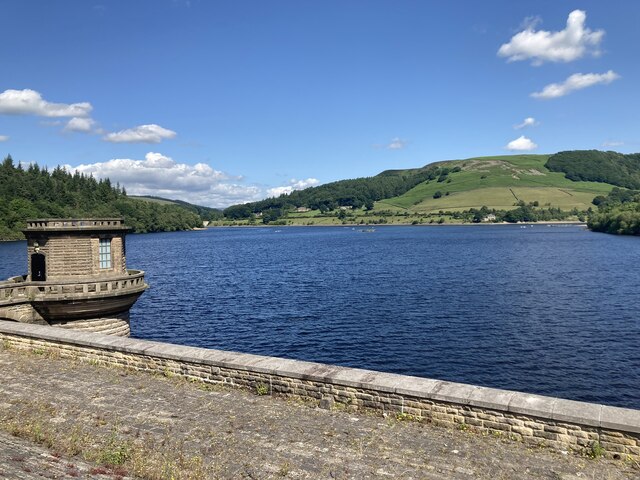
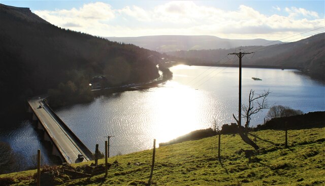
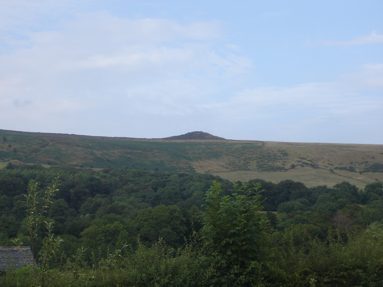
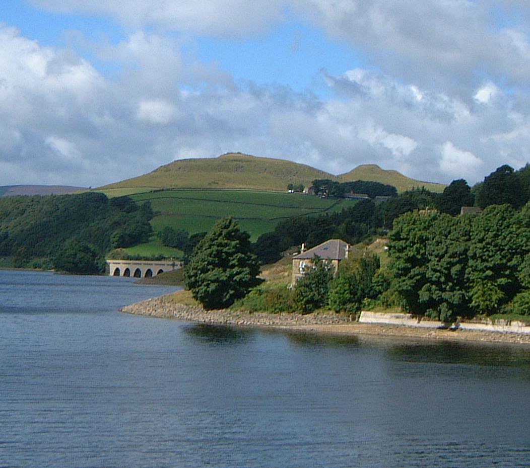
Win Hill is a prominent hill located in the Peak District National Park in Derbyshire, England. Rising to an elevation of 462 meters (1,516 feet), it offers breathtaking panoramic views of the surrounding countryside. The hill is situated on the eastern side of the Ladybower Reservoir, near the village of Bamford.

Known for its distinctive shape and prominence, Win Hill is a popular destination for hikers, walkers, and nature enthusiasts. It is often considered one of the most rewarding peaks to climb in the area due to its easily accessible trails and stunning vistas. The ascent to the summit can be challenging, but the effort is rewarded with stunning views over the Hope Valley, Kinder Scout, and the Derwent Valley.

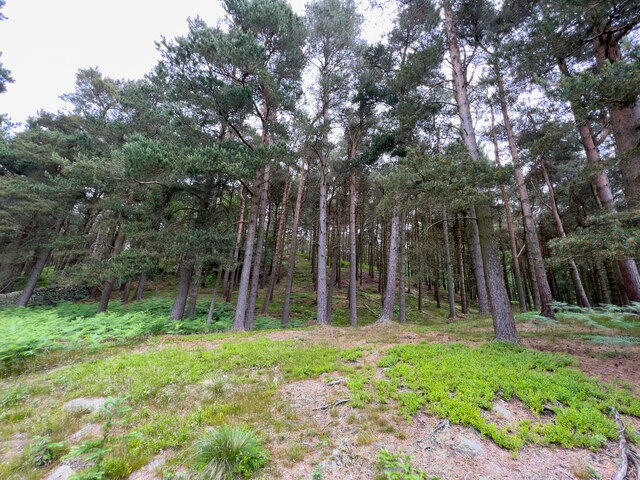
The hill is covered in heather and bracken, providing a vibrant display of color during the summer months. It is also home to a variety of wildlife, including birds of prey such as peregrine falcons and kestrels, as well as rabbits, foxes, and even the occasional deer. The diverse flora and fauna make Win Hill an important ecological site within the Peak District.

At the summit of Win Hill, there is a trig point and a stone cairn, which serves as a popular spot for visitors to rest and take in the breathtaking views. On a clear day, it is possible to see as far as the city of Sheffield and the distant Pennines.

Overall, Win Hill is a natural gem within the Peak District, offering a rewarding outdoor experience for visitors of all abilities.

If you have any feedback on the listing, please let us know in the comments section below.

Win Hill Images

Images are sourced within 2km of 53.362384/-1.720798 or Grid Reference SK1885. Thanks to Geograph Open Source API. All images are credited.

Ladybower reservoir  Ladybower reservoir seen from the reservoir dam. Built between 1935 and 1943 and opened in 1945, it supplies drinking water to the East Midlands via the Bamford water treatment works operated by Severn Trent.
Ladybower reservoir
Ladybower reservoir seen from the reservoir dam. Built between 1935 and 1943 and opened in 1945, it supplies drinking water to the East Midlands via the Bamford water treatment works operated by Severn Trent.
Ruined barn north west of Edge Farm On the northern  slopes of The Hope Valley.
Ruined barn north west of Edge Farm
On the northern slopes of The Hope Valley.
Twitchill Farm north of Hope On the northern slopes of The Hope Valley. Embracing diversification, the farm now offers self-catering cottages for paying visitors.
Twitchill Farm north of Hope
On the northern slopes of The Hope Valley. Embracing diversification, the farm now offers self-catering cottages for paying visitors.
Hope Station -  the Sheffield platform
Hope Station - the Sheffield platform
Platform 1 - Hope Station Trains for Manchester depart from this platform.
Platform 1 - Hope Station
Trains for Manchester depart from this platform.
Ladybower Reservoir
Ladybower Reservoir
Woodland View Just a quick view of the trees here.
Woodland View
Just a quick view of the trees here.
Bowden Lane and Edale Road On the right is Bowden Lane as it meets Edale Lane.
Bowden Lane and Edale Road
On the right is Bowden Lane as it meets Edale Lane.
Edale Road near Mill Farm Looking along Edale Road in Hope.
Edale Road near Mill Farm
Looking along Edale Road in Hope.
Edale Road and bridge The road passes under the railway line servicing the cement works in Hope.
Edale Road and bridge
The road passes under the railway line servicing the cement works in Hope.
Edale Road near The Barn Looking along Edale Road in Hope.
Edale Road near The Barn
Looking along Edale Road in Hope.
Railway bridge crossing Edale Road The railway links the cement works in Hope to the Hope Valley line.
Railway bridge crossing Edale Road
The railway links the cement works in Hope to the Hope Valley line.
Edale Road north of the railway Looking along Edale Road in Hope.
Edale Road north of the railway
Looking along Edale Road in Hope.
Along Edale Road Looking along Edale Road on the north side of Hope.
Along Edale Road
Looking along Edale Road on the north side of Hope.
Edale Road and Lose Hill Lane On the left is Lose Hill Lane with Edale Road on the right.
Edale Road and Lose Hill Lane
On the left is Lose Hill Lane with Edale Road on the right.
Looking along Edale Road The road between Hope and Edale.
Looking along Edale Road
The road between Hope and Edale.
Ladybower outflow Looking down the dam wall of Ladybower Reservoir.
Ladybower outflow
Looking down the dam wall of Ladybower Reservoir.
Across the dam wall Looking along the dam wall of Ladybower Reservoir. The water levels in the reservoir are pretty low following a prolonged period with little rain.
Across the dam wall
Looking along the dam wall of Ladybower Reservoir. The water levels in the reservoir are pretty low following a prolonged period with little rain.
Show me another place!

Win Hill is located at Grid Ref: SK1885 (Lat: 53.362384, Lng: -1.720798)

Administrative County: Derbyshire

District: High Peak

Police Authority: Derbyshire

What 3 Words

///corn.litigate.porch. Near Hope Valley, Derbyshire

Related Wikis

Win Hill

Win Hill is a hill north west of Bamford in the Derbyshire Peak District of England. Its summit is 462 m (1,516 ft) above sea level and it is bounded...

Ashopton

Ashopton was a small village in Derbyshire, England, in the valley of the River Ashop. The village population was less than 100. Details are included in...

Yorkshire Bridge

Yorkshire Bridge is a small hamlet at grid reference SK200850 near the Ladybower Reservoir dam in the English county of Derbyshire. Administratively the...

Aston, High Peak

Aston (Old English: East farm or settlement) is a village and civil parish in the High Peak district of Derbyshire, England, located in the Peak District...

River Ashop

The River Ashop is a river in the Derbyshire Peak District, England. Its source is on the eastern slopes of Mill Hill, three miles south east of Glossop...

Birchinlee

Birchinlee is the site of "Tin Town", a village built by the Derwent Valley Water Board for the workers (and their families) who constructed the Derwent...

Crook Hill

Crook Hill is a small hill in the Peak District National Park in the English county of Derbyshire, 5 kilometres (3.1 mi) northeast of Castleton. ��2�...

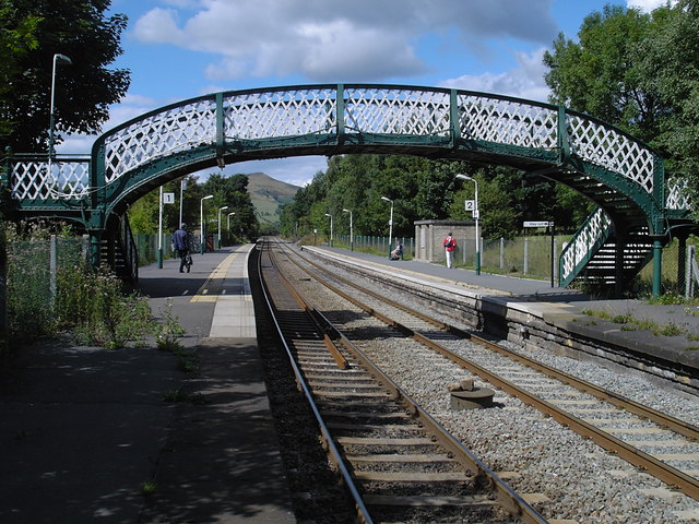
Hope railway station (England)

Hope railway station serves the villages of Hope and Brough in the Derbyshire Peak District of England, 14+3⁄4 miles (23.7 km) west of Sheffield. The station...

Nearby Amenities

Located within 500m of 53.362384,-1.720798
Win Hill
Ele: 464
Ele Ft: 1523ft
Natural: peak
Wikidata: Q8023629
Wikipedia: en:Win Hill
Lat/Long: 53.3623941/-1.7207242
Barrier: kissing_gate
Lat/Long: 53.3659483/-1.71884
Barrier: kissing_gate
Source: survey
Lat/Long: 53.3618931/-1.7267583
031
Ele: 412.047729
Wpt Description: 24-JUL-10 15:47:14
Wpt Symbol: Crossing
Lat/Long: 53.3610959/-1.7167821
032
Ele: 411.807251
Wpt Description: 24-JUL-10 15:47:44
Wpt Symbol: Crossing
Lat/Long: 53.3609884/-1.7166544
Barrier: kissing_gate
Source: survey
Lat/Long: 53.3619767/-1.724162
Ford: yes
Lat/Long: 53.3623998/-1.7135661
Ele: 464
Man Made: survey_point
Ref: S4228
Survey Point Structure: pillar
Lat/Long: 53.3624057/-1.7208186
Information: guidepost
Operator: Peak & Northern Footpaths Society
Ref: 25
Source: survey;gps
Tourism: information
Lat/Long: 53.3620534/-1.7241183
Information: guidepost
Operator: Peak & Northern Footpaths Society
Ref: 509
Source: survey;gps
Tourism: information
Lat/Long: 53.3658766/-1.7190644
Barrier: stile
Step Count: 1
Stile: stepover
Lat/Long: 53.3642353/-1.7159841
Fixme: stile of gate here?
Lat/Long: 53.3642525/-1.7159088
The data included in this document is from www.openstreetmap.org. The data is made available under ODbL.

Have you been to Win Hill?

Leave your review of Win Hill below (or comments, questions and feedback).