Madge Hill

Hill, Mountain in Yorkshire Harrogate

England

Madge Hill

Glasshouses Glasshouse mill is the large building over the river Nidd.  The mill is now a winery and tea rooms.
Glasshouses Credit: Paul Baxter

Madge Hill is a modest hill located in Yorkshire, England. Situated in the picturesque countryside, it offers breathtaking panoramic views of the surrounding landscape. With an elevation of approximately 300 meters, it is considered a small hill compared to the neighboring peaks.

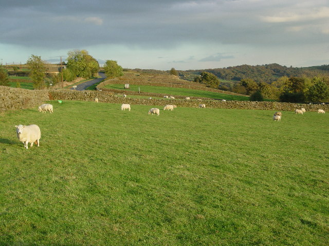
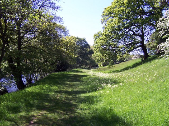
Covered in lush greenery, Madge Hill is home to a diverse range of flora and fauna, making it an ideal spot for nature enthusiasts and hikers. The hillside is adorned with vibrant wildflowers during the summer, creating a colorful and enchanting atmosphere. As visitors ascend the hill, they can encounter various species of birds, including robins, sparrows, and blackbirds.

The top of Madge Hill provides an unobstructed vista of the Yorkshire Dales, with rolling hills extending as far as the eye can see. On clear days, the hill offers a stunning view of the distant mountains, adding to its allure. Many visitors choose to bring a picnic and enjoy the peaceful surroundings while taking in the breathtaking scenery.

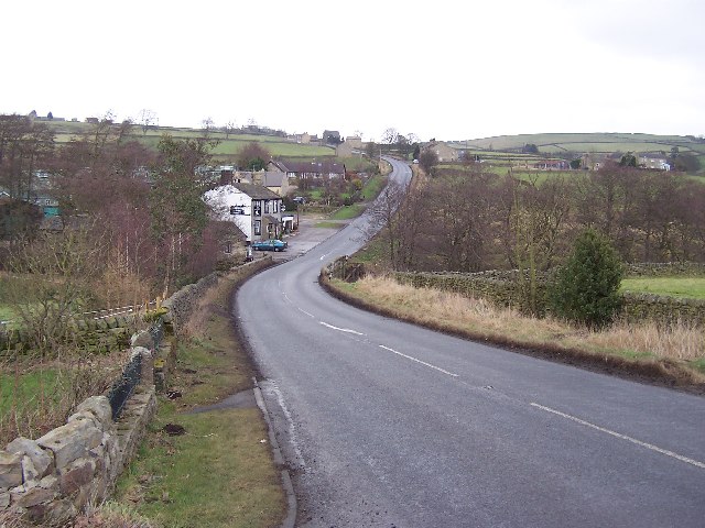
Access to Madge Hill is relatively easy, with a well-maintained footpath leading to the summit. The path is suitable for all fitness levels, making it accessible to a wide range of visitors. Additionally, there are designated resting spots along the way, allowing hikers to pause, catch their breath, and admire the beauty of the surroundings.

Overall, Madge Hill is a hidden gem in Yorkshire, offering a tranquil escape from the bustling city life. Its natural beauty and awe-inspiring views make it a must-visit destination for those seeking solace in nature.

If you have any feedback on the listing, please let us know in the comments section below.

Madge Hill Images

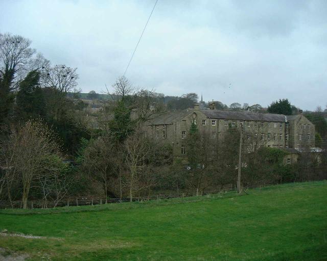
Images are sourced within 2km of 54.090282/-1.7234298 or Grid Reference SE1866. Thanks to Geograph Open Source API. All images are credited.

Glasshouses Glasshouse mill is the large building over the river Nidd.  The mill is now a winery and tea rooms.
Glasshouses
Glasshouse mill is the large building over the river Nidd. The mill is now a winery and tea rooms.
Wilsill Methodist Church
Fields & Sheep near Blazefield
North Oaks
North Oaks
The noisy cow Kingstone Farm in the background
The noisy cow
Kingstone Farm in the background
Moor Top Junction & Cattle Grid
Moorland and Fields in the distance is RAF Menwith Hill
Moorland and Fields
in the distance is RAF Menwith Hill
St Mary's Church (ruins) This ancient church fell closed in the early 19th century, the church of St Cuthbert being only a mile or so away. The tower, walls and graveyard still exist and the place is well worth a visit.
St Mary's Church (ruins)
This ancient church fell closed in the early 19th century, the church of St Cuthbert being only a mile or so away. The tower, walls and graveyard still exist and the place is well worth a visit.
Blazefield Road leading to Kings Farm
Blazefield
Road leading to Kings Farm
High Wild Carr
High Wild Carr
High Bishopside Moor Not much here besides sheep, wind, rough grass and tumbled down walls
High Bishopside Moor
Not much here besides sheep, wind, rough grass and tumbled down walls
Road at Madge Hill Farm The road that leads from Blazefield on the B6265, crossing Dallowgill Moor to Kirkby Malzeard.
Road at Madge Hill Farm
The road that leads from Blazefield on the B6265, crossing Dallowgill Moor to Kirkby Malzeard.
The Blazefield Road from Above North Oaks On Pateley Moor, looking SSW along the minor road to Blazefield from just above North Oaks towards Combs Ridge. The crossroads is clearly visible ahead.
The Blazefield Road from Above North Oaks
On Pateley Moor, looking SSW along the minor road to Blazefield from just above North Oaks towards Combs Ridge. The crossroads is clearly visible ahead.
Most of North Yorkshire Looking slightly east of south, this photograph covers many squares, from <a href="https://www.geograph.org.uk/gridref/SE1867">SE1867</a> (where I'm standing) to RAF Menwith Hill at <a href="https://www.geograph.org.uk/gridref/SE2057">SE2057</a> and the radio mast on the hill at <a href="https://www.geograph.org.uk/gridref/SE2151">SE2151</a>.
Most of North Yorkshire
Looking slightly east of south, this photograph covers many squares, from SE1867 (where I'm standing) to RAF Menwith Hill at SE2057 and the radio mast on the hill at SE2151.
B6265 near Braithwaite Syke This looks north east along the B6265 between Glasshouses and Fellbeck
B6265 near Braithwaite Syke
This looks north east along the B6265 between Glasshouses and Fellbeck
Fellbeck Looking north east along the B6265 as it descends to cross Fell Beck by the Half Moon Inn, centre of the scattered community bearing the same name as the watercourse
Fellbeck
Looking north east along the B6265 as it descends to cross Fell Beck by the Half Moon Inn, centre of the scattered community bearing the same name as the watercourse
Fields running down to Fell Beck Roughly eastern aspect while walking towards Fell Beck en route to Brimham Rocks from the nearby B6265
Fields running down to Fell Beck
Roughly eastern aspect while walking towards Fell Beck en route to Brimham Rocks from the nearby B6265
River Nidd near Wilsill Part of a superb riverside path that stretches from Low Laithe to Pateley Bridge
River Nidd near Wilsill
Part of a superb riverside path that stretches from Low Laithe to Pateley Bridge
Show me another place!

Madge Hill is located at Grid Ref: SE1866 (Lat: 54.090282, Lng: -1.7234298)

Division: West Riding

Administrative County: North Yorkshire

District: Harrogate

Police Authority: North Yorkshire

What 3 Words

///torches.sprouting.secondly. Near Pateley Bridge, North Yorkshire

Nearby Locations

Madge Hill

Related Wikis

Wilsill

Wilsill is a village in Nidderdale in the Harrogate district of North Yorkshire, England. It is about 2 miles (3 km) east of Pateley Bridge on the B6165...

Glasshouses, North Yorkshire

Glasshouses is a small village in Nidderdale, North Yorkshire, England. It lies 1 mile (1.6 km) south-east of Pateley Bridge on the east side of Nidderdale...

High and Low Bishopside

High and Low Bishopside is a civil parish in Nidderdale in the Harrogate district, in the county of North Yorkshire, England. It includes the town of Pateley...

Smelthouses

Smelthouses is a hamlet in Nidderdale in North Yorkshire, England. It lies about 2.3 miles (4 km) south-east of Pateley Bridge, on either side of Fell...

Nearby Amenities

Located within 500m of 54.090282,-1.7234298
Scout hut
Building: yes
Lat/Long: 54.0900441/-1.7191843
Place: farm
Lat/Long: 54.0900156/-1.7238381
The data included in this document is from www.openstreetmap.org. The data is made available under ODbL.

Have you been to Madge Hill?

Leave your review of Madge Hill below (or comments, questions and feedback).