Odda Hill

Hill, Mountain in Yorkshire

England

Odda Hill

Potter Brow Road, Baildon Moor
Potter Brow Road, Baildon Moor Credit: habiloid

Odda Hill is a prominent natural landmark located in the picturesque county of Yorkshire, England. Situated near the town of Malham, it is part of the Yorkshire Dales National Park, renowned for its stunning landscapes and rugged beauty. This hill, also known as Odda's Hill, stands at an impressive height of approximately 350 meters, making it a popular destination for hikers and nature enthusiasts.

The hill offers breathtaking panoramic views of the surrounding countryside, with its rolling green hills, meandering rivers, and quaint villages dotting the landscape. Its strategic location at the heart of the national park provides visitors with an unrivaled opportunity to immerse themselves in the natural beauty of the area.

Odda Hill is steeped in history, with its name believed to be derived from Odda, a prominent figure in Anglo-Saxon times. This historical significance adds to its allure, making it an intriguing destination for those interested in local heritage.

The hill is accessible via various walking trails, allowing visitors to explore the area at their own pace. The most popular route to reach the summit is through a well-maintained footpath that winds its way through lush meadows and ancient woodlands. Along the way, one can encounter a wide array of wildlife, including rare bird species and wildflowers that bloom in abundance during the spring and summer months.

Overall, Odda Hill is a captivating natural landmark that offers visitors a chance to experience the unspoiled beauty of the Yorkshire Dales. Its breathtaking vistas, rich history, and diverse flora and fauna make it a must-visit destination for nature lovers and those seeking an escape from the hustle and bustle of everyday life.

If you have any feedback on the listing, please let us know in the comments section below.
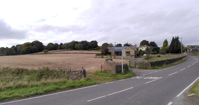
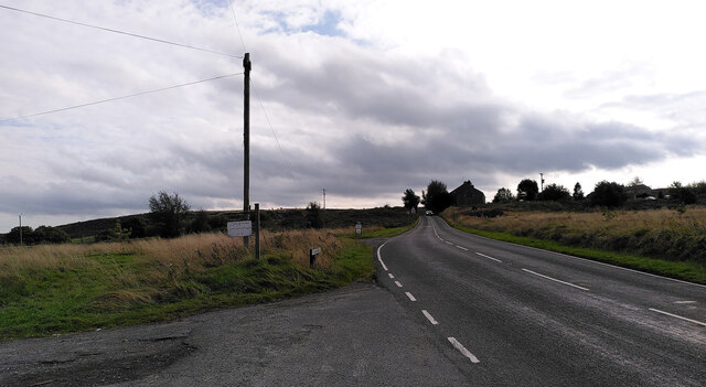
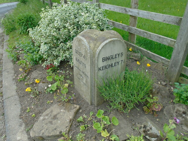
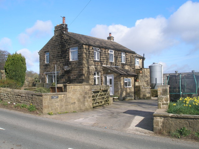
Odda Hill Images

Images are sourced within 2km of 53.875087/-1.7511175 or Grid Reference SE1642. Thanks to Geograph Open Source API. All images are credited.

Potter Brow Road, Baildon Moor
Hawksworth Road, Baildon Moor
High Royds Hospital, Menston The site of this former psychiatric hospital is being redeveloped for housing.
High Royds Hospital, Menston
The site of this former psychiatric hospital is being redeveloped for housing.
High Royds Hospital, Menston The site of this former psychiatric hospital is being redeveloped for housing.
High Royds Hospital, Menston
The site of this former psychiatric hospital is being redeveloped for housing.
Modern milestone On the north-west corner of the cross roads west of Hawksworth, Hillings Lane/Old Lane/Mill Lane/Goose Lane.  When this was set up in 2002 the faces were painted white with the top and lettering in black.
Modern milestone
On the north-west corner of the cross roads west of Hawksworth, Hillings Lane/Old Lane/Mill Lane/Goose Lane. When this was set up in 2002 the faces were painted white with the top and lettering in black.
The Wetherby Whaler
The Wetherby Whaler
HSL Shop
HSL Shop
White Cross
White Cross
Hillings Lane This road heads north towards Ilkley, skirting the edge of Rombalds Moor (left).
Hillings Lane
This road heads north towards Ilkley, skirting the edge of Rombalds Moor (left).
Hawksworth Equestrian Centre Off Hillings Lane.  Rombalds Moor in the background. See <a href="https://www.geograph.org.uk/photo/6625884">SE1542 : Hawksworth Equestrian Centre, Hillings Lane</a> for a closer view of the main building.
Hawksworth Equestrian Centre
Off Hillings Lane. Rombalds Moor in the background. See SE1542 : Hawksworth Equestrian Centre, Hillings Lane for a closer view of the main building.
New Dam The name is given to a very small reservoir on the Jum Beck and presumably supplied Hawksworth Mill <a href="https://www.geograph.org.uk/photo/4128675">SE1541 : Remains of Hawksworth Corn Mill</a>. See also <a href="https://www.geograph.org.uk/photo/996920">SE1542 : Lake viewed from Hillings Lane, Hawksworth</a>.
New Dam
The name is given to a very small reservoir on the Jum Beck and presumably supplied Hawksworth Mill SE1541 : Remains of Hawksworth Corn Mill. See also SE1542 : Lake viewed from Hillings Lane, Hawksworth.
Railway bridge at Hollins Hill The railway from Shipley to Ilkley is crossed by Hollins Hill on a skew bridge that amounts to a short tunnel. From the width of the bridge I presume it was originally double track, but is now only single, possibly because of the clearance needed for the electric catenary installed c.2000.
Railway bridge at Hollins Hill
The railway from Shipley to Ilkley is crossed by Hollins Hill on a skew bridge that amounts to a short tunnel. From the width of the bridge I presume it was originally double track, but is now only single, possibly because of the clearance needed for the electric catenary installed c.2000.
Railway west of Hollins Hill Looking from above the bridge <a href="https://www.geograph.org.uk/photo/5125051">SE1740 : Railway bridge at Hollins Hill</a>.  The electrified single track line links Esholt Junction on the Leeds-Ilkley line with Shipley.  The bridge in the distance is a farm accommodation bridge for Lamb Springs Farm.
Railway west of Hollins Hill
Looking from above the bridge SE1740 : Railway bridge at Hollins Hill. The electrified single track line links Esholt Junction on the Leeds-Ilkley line with Shipley. The bridge in the distance is a farm accommodation bridge for Lamb Springs Farm.
Pony and foal, Hollins Hill The animals are grazing in a field to the west of the main road.
Pony and foal, Hollins Hill
The animals are grazing in a field to the west of the main road.
Menston library
Menston library
New House Farm near Menston
High Royds Hall
High Royds Hall
Norcroft Farm, near Hawksworth
Show me another place!

Odda Hill is located at Grid Ref: SE1642 (Lat: 53.875087, Lng: -1.7511175)

Division: West Riding

Unitary Authority: Leeds

Police Authority: West Yorkshire

What 3 Words

///engineers.ultra.files. Near Menston, West Yorkshire

Nearby Locations

Odda Hill

Related Wikis

Hawksworth, Guiseley

Hawksworth is a village 1 mile (1.6 km) west of the town of Guiseley in West Yorkshire, England. It is located to the south of Menston and north of Baildon...

High Royds Hospital

High Royds Hospital is a former psychiatric hospital south of the village of Menston, West Yorkshire, England. The hospital, which opened in 1888, closed...

High Royds Hospital Railway

The High Royds Hospital Railway was a short railway connecting the West Riding County Asylum near Leeds in West Yorkshire with the Midland Railway line...

St Mary's Menston Catholic Voluntary Academy

St Mary's Menston Catholic Voluntary Academy (formerly St Mary's Catholic High School) is an 11–18 mixed, Roman Catholic, secondary school and sixth form...

Related Videos

dji osmo action 3 4k morning walk in woodland in Menston Leeds West Yorkshire,🇬🇧

walking trail in Menston west Yorkshire Leeds. Near Menston railway station .

Emmerdale Village #Esholt #Shipley #LeedsBradford

Today @DroningYorkshire have had a #BankHoliday trip to the old #Emmerdale setting in #Esholt #Bradford #Shipley #Leeds for ...

Gill Beck Waterfall

The hunt to find Gill Beck Waterfall (or Derrydiddle Weir) Starting from on-street parking outside Wharfebank Mills: LS21 3JP.

Nearby Amenities

Located within 500m of 53.875087,-1.7511175
Barrier: cattle_grid
Lat/Long: 53.8757306/-1.7443344
Barrier: stile
Foot: yes
Material: wood
Step Count: 2
Stile: stepover
Lat/Long: 53.8749993/-1.747633
Post Box
Collection Times: Mo-Fr 09:00; Sa 07:00
Operator: Royal Mail
Post Box Type: lamp
Ref: LS20 493D
Royal Cypher: EIIR
Royal Cypher Wikidata: Q33102113
Lat/Long: 53.8719833/-1.7496418
Telephone
Booth: K6
Covered: booth
Listed Status: Grade II
Operator: BT
Phone: +44 1943 873371
Lat/Long: 53.8719713/-1.7495799
Bus Stop
Main Street
Local Ref: 45018812
Naptan AtcoCode: 450018812
Naptan Bearing: SE
Naptan CommonName: Main Street
Naptan Crossing: Nr-At Odda Lane
Naptan Indicator: Stop 45018812
Naptan Landmark: Sunnyside Farm
Naptan PlusbusZoneRef: LEEDS
Naptan ShortCommonName: Old Lane
Naptan Street: Main Street
Naptan Verified: no
Source: naptan_import
Lat/Long: 53.8727295/-1.751815
Bus Stop
Main Street Dean Lane
Local Ref: 45023830
Naptan AtcoCode: 450023830
Naptan Bearing: E
Naptan CommonName: Main Street Dean Lane
Naptan Crossing: Dean Lane
Naptan Indicator: Stop 45023830
Naptan Landmark: Hawksworth Hall School
Naptan PlusbusZoneRef: LEEDS
Naptan ShortCommonName: Dean Lane
Naptan Street: Main Street
Naptan Verified: no
Source: naptan_import
Lat/Long: 53.8717154/-1.7482317
Bus Stop
Main Street
Bus: yes
Local Ref: 45050692
Naptan AtcoCode: 450050692
Naptan Bearing: NW
Naptan BusStopType: CUS
Naptan CommonName: Main Street
Naptan Indicator: Stop 45050692
Naptan PlusbusZoneRef: LEEDS
Naptan ShortCommonName: Odda Lane
Naptan Street: Main Street
Naptan Verified: no
Public Transport: platform
Source: naptan_import
Lat/Long: 53.8726488/-1.7518915
Bus Stop
Main Street Hawksworth Hall School
Bus: yes
Local Ref: 45051348
Naptan AtcoCode: 450051348
Naptan Bearing: W
Naptan BusStopType: CUS
Naptan CommonName: Main Street Hawksworth Hall School
Naptan Indicator: Stop 45051348
Naptan PlusbusZoneRef: LEEDS
Naptan ShortCommonName: Manor Farm
Naptan Street: Main Street
Naptan Verified: no
Public Transport: platform
Source: naptan_import
Lat/Long: 53.8716615/-1.7482624
Access: no
Barrier: stile
Foot: yes
Material: wood
Stile: stepover
Lat/Long: 53.8747792/-1.7478186
Traffic Calming: cushion
Lat/Long: 53.8716914/-1.7482885
Traffic Calming: cushion
Lat/Long: 53.8720379/-1.7497076
Traffic Calming: cushion
Lat/Long: 53.8737314/-1.7579474
Traffic Calming: cushion
Lat/Long: 53.8734857/-1.7569671
Traffic Calming: cushion
Lat/Long: 53.8732616/-1.7559548
Traffic Calming: cushion
Lat/Long: 53.8728863/-1.7524634
Traffic Calming: cushion
Lat/Long: 53.8724522/-1.7511169
Waste Basket
Collection Times: weekly
Condition: GOOD
Ref UK Leedscc Bin: 2031
Waste Basket Model: METAL SQUARE
Lat/Long: 53.872958/-1.752247
Barrier: kissing_gate
Foot: yes
Lat/Long: 53.8754802/-1.7470472
Access: no
Barrier: stile
Foot: yes
Material: wood
Stile: stepover
Lat/Long: 53.8719169/-1.7515931
Barrier: stile
Material: wood
Stile: stepover
Lat/Long: 53.8711614/-1.7522337
Access: no
Barrier: kissing_gate
Foot: yes
Lat/Long: 53.8735794/-1.7494126
Access: no
Barrier: stile
Foot: yes
Material: wood
Stile: stepover
Lat/Long: 53.8759819/-1.7464949
Barrier: stile
Foot: yes
Material: stone
Step Count: 1
Stile: stepover
Lat/Long: 53.8706961/-1.7523864
Description: Views of Wharfedale and Washburndale through the Guiseley gap, West Chevin, Guiseley, Yeadon and Rawdon up to Billings Hill.
Direction: NNE-ESE
Tourism: viewpoint
Lat/Long: 53.8741117/-1.7483403
Barrier: stile
Foot: yes
Material: wood
Step Count: 2
Stile: stepover
Vehicle: no
Lat/Long: 53.8757116/-1.7443239
Odda Farm
Abandoned Place: farm
Source: NLS OS 1:10,560; survey
Lat/Long: 53.8771995/-1.7534637
Disused: yes
Man Made: gate_post
Material: stone
Lat/Long: 53.8774084/-1.7538939
Disused: yes
Man Made: gate_post
Material: stone
Lat/Long: 53.8755646/-1.7445257
Disused: yes
Man Made: gate_post
Material: stone
Lat/Long: 53.8755731/-1.7445747
Access: private
Barrier: stile
Foot: yes
Material: wood
Stile: stepover
Lat/Long: 53.8770498/-1.7525569
Fixme: continue
Lat/Long: 53.8762054/-1.7466954
The data included in this document is from www.openstreetmap.org. The data is made available under ODbL.

Have you been to Odda Hill?

Leave your review of Odda Hill below (or comments, questions and feedback).