Bangley Hill

Hill, Mountain in Staffordshire Lichfield

England

Bangley Hill

Bassetts Pole Roundabout, A38
Bassetts Pole Roundabout, A38 Credit: Alex McGregor

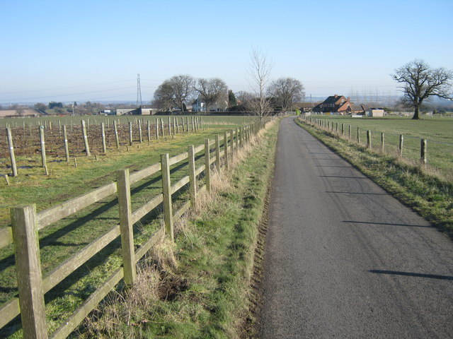
Bangley Hill is a prominent landmark located in the county of Staffordshire, England. Rising to an elevation of approximately 300 meters, it is considered a prominent hill in the region. Situated in the stunning countryside, Bangley Hill offers breathtaking panoramic views of the surrounding area.

The hill is characterized by its gentle slopes and lush greenery, making it a popular destination for outdoor enthusiasts and nature lovers. Its diverse terrain features undulating meadows, dense woodlands, and rocky outcrops, providing a diverse habitat for a variety of flora and fauna.

Due to its strategic location, Bangley Hill has played a significant role in the region's history. It is believed that ancient settlements once occupied the hilltop, evident from the remnants of archaeological sites and ancient earthworks found in the area. These historical artifacts contribute to the hill's cultural significance and provide insight into the lives of its early inhabitants.

Bangley Hill attracts visitors seeking recreational activities such as hiking, nature walks, and birdwatching. Several well-marked trails traverse the hill, allowing visitors to explore its natural beauty at their own pace. The hill's proximity to nearby towns and villages also makes it easily accessible for day trips and outdoor adventures.

Overall, Bangley Hill stands as a testament to the natural beauty and historical significance of Staffordshire. With its stunning vistas, diverse ecosystems, and rich cultural heritage, it continues to captivate visitors and locals alike, offering a memorable experience for all who venture to its summit.

If you have any feedback on the listing, please let us know in the comments section below.
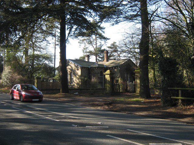
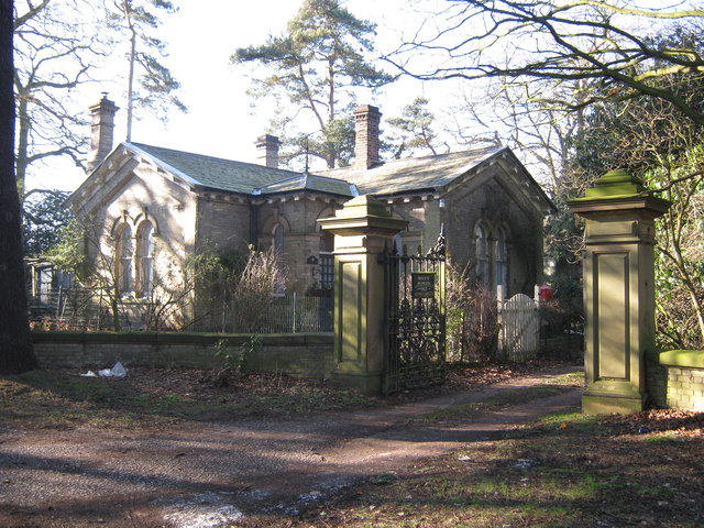
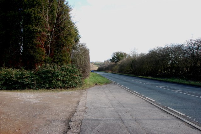
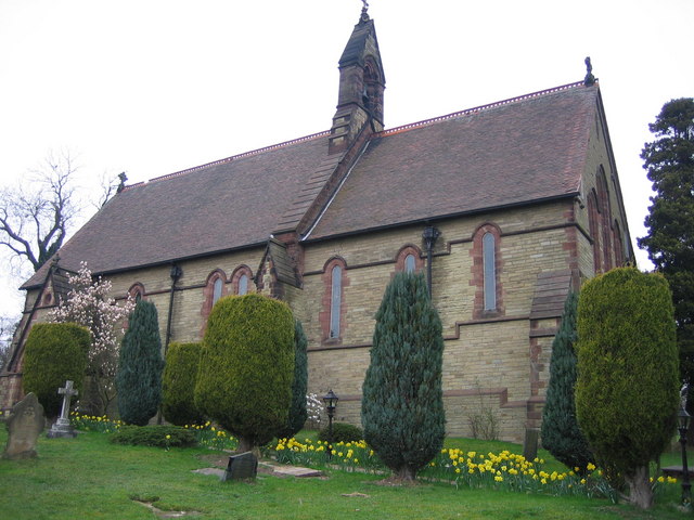
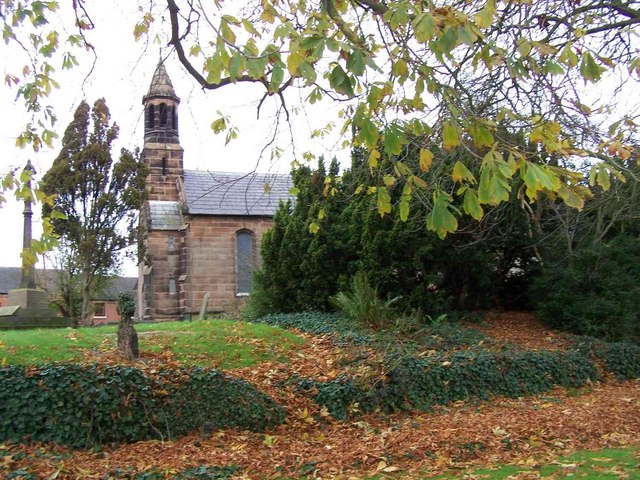
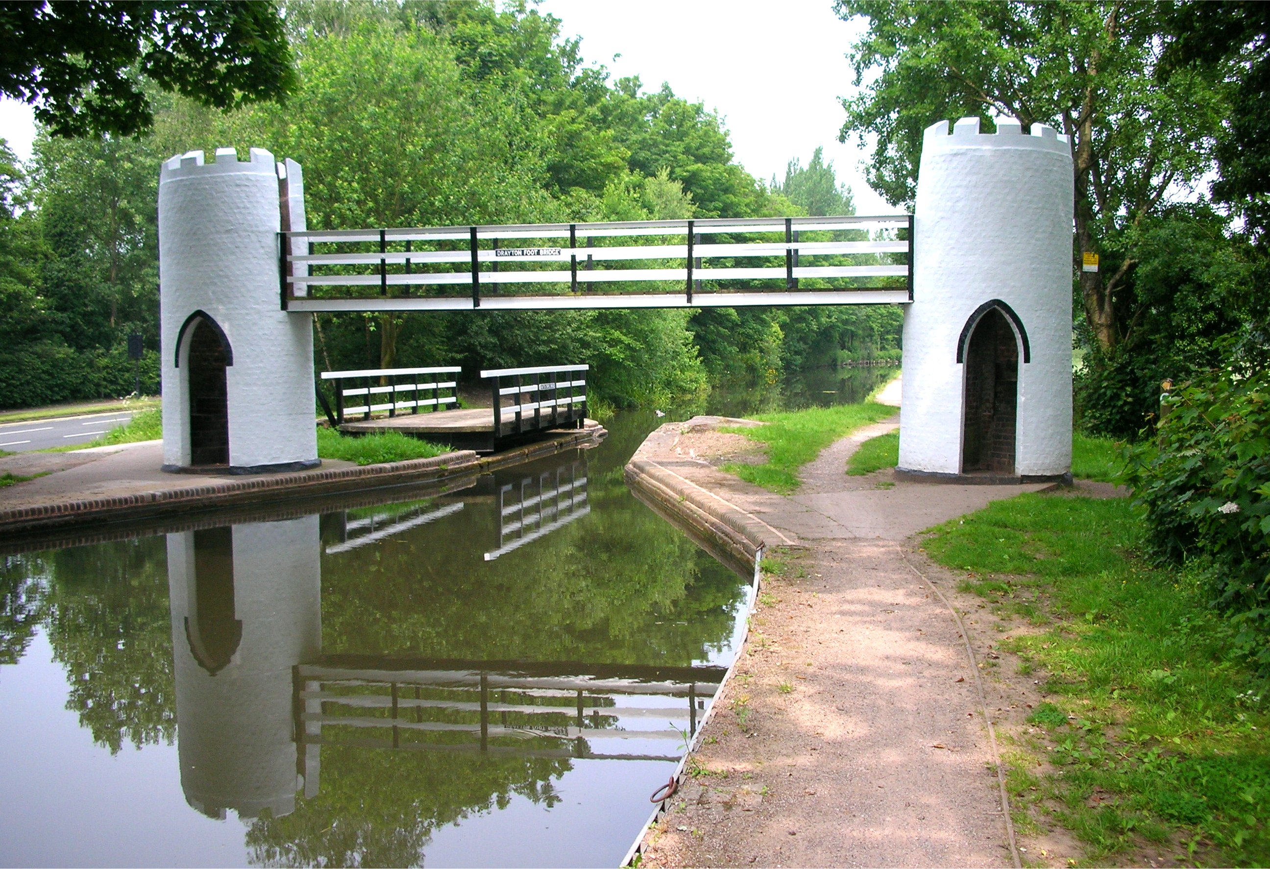
Bangley Hill Images

Images are sourced within 2km of 52.604111/-1.7683422 or Grid Reference SK1500. Thanks to Geograph Open Source API. All images are credited.

Bassetts Pole Roundabout, A38
Footsteps Pre School and Nursery On Slade Road, B4151 near Bassetts Pole, Canwell
Footsteps Pre School and Nursery
On Slade Road, B4151 near Bassetts Pole, Canwell
Quinney Hall, Canwell View of village hall from B4151
Quinney Hall, Canwell
View of village hall from B4151
London Road junction with Slade Road B4151 junction with London Road near Canwell
London Road junction with Slade Road
B4151 junction with London Road near Canwell
Shirrall Drive Country lane, next to vineyard, and Shirrall Hall Farm ahead
Shirrall Drive
Country lane, next to vineyard, and Shirrall Hall Farm ahead
Buzzards Valley Wholesale florist and vineyard on Shirrall Drive

<span class="nowrap"><a title="http://www.excelsiorwholesale.co.uk/page.asp?p=30002&usrID=A92F4FA1-70DD-4ABC-A70E-901F92FC95F1" rel="nofollow ugc noopener" href="http://www.excelsiorwholesale.co.uk/page.asp?p=30002&usrID=A92F4FA1-70DD-4ABC-A70E-901F92FC95F1">Link</a><img style="margin-left:2px;" alt="External link" title="External link - shift click to open in new window" src="https://s1.geograph.org.uk/img/external.png" width="10" height="10"/></span>
Buzzards Valley
Wholesale florist and vineyard on Shirrall Drive LinkExternal link
Gatehouse to Canwell Hall On A453,Carroway Head Hill
Gatehouse to Canwell Hall
On A453,Carroway Head Hill
Gatehouse to Canwell Hall Gatehouse at entrance to grounds of Canwell Hall, and remains of old priory
Gatehouse to Canwell Hall
Gatehouse at entrance to grounds of Canwell Hall, and remains of old priory
Bassetts Pole Plaque on back of Bassetts Pole memorial reads 'Erected to the memory of Captain J.H.W. Wilkinson and his comrades of the Staffordshire Regiments who fell in the Great War 1914 - 1918'

Capt. Wilkinson served with the Expeditionary Force in France and Flanders from July, 1915, and died at St Omer 5th May 1917.

<a href="https://www.geograph.org.uk/photo/2092734">SP1499 : Bassetts Pole memorial</a>

<span class="nowrap"><a title="http://1914-1918.invisionzone.com/forums/index.php?showtopic=37556" rel="nofollow ugc noopener" href="http://1914-1918.invisionzone.com/forums/index.php?showtopic=37556">Link</a><img style="margin-left:2px;" alt="External link" title="External link - shift click to open in new window" src="https://s1.geograph.org.uk/img/external.png" width="10" height="10"/></span> (forum thread about Captain Wilkinson)
Bassetts Pole
Plaque on back of Bassetts Pole memorial reads 'Erected to the memory of Captain J.H.W. Wilkinson and his comrades of the Staffordshire Regiments who fell in the Great War 1914 - 1918' Capt. Wilkinson served with the Expeditionary Force in France and Flanders from July, 1915, and died at St Omer 5th May 1917. SP1499 : Bassetts Pole memorial LinkExternal link (forum thread about Captain Wilkinson)
National Paintballing Centre, Bassetts Pole Entrance to extensive paintballing site at Bassetts Pole, north of Sutton Coldfield.

<span class="nowrap"><a title="http://www.nationalpaintballfields.com/" rel="nofollow ugc noopener" href="http://www.nationalpaintballfields.com/">Link</a><img style="margin-left:2px;" alt="External link" title="External link - shift click to open in new window" src="https://s1.geograph.org.uk/img/external.png" width="10" height="10"/></span>
National Paintballing Centre, Bassetts Pole
Entrance to extensive paintballing site at Bassetts Pole, north of Sutton Coldfield. LinkExternal link
Approaching Canwell on the B4151 Slade Road, Sutton Coldfield Having just gone under the M6 Toll, the tunnel under the A38 dual carriageway can be seen in the distance.
Approaching Canwell on the B4151 Slade Road, Sutton Coldfield
Having just gone under the M6 Toll, the tunnel under the A38 dual carriageway can be seen in the distance.
View down the Old London Road The new London Road, the A38 dual carriageway runs parallel with this road, behind the trees on the left. This is looking Northwards towards Lichfield.
View down the Old London Road
The new London Road, the A38 dual carriageway runs parallel with this road, behind the trees on the left. This is looking Northwards towards Lichfield.
Looking along the A453 in the direction of Fazeley
Bassetts Pole Pub and signpost This pole has given its name to the large modern roundabout that the A446 may be seen approaching behind the pub.
Bassetts Pole Pub and signpost
This pole has given its name to the large modern roundabout that the A446 may be seen approaching behind the pub.
Approaching the Bassett's Pole island The carriageways are splayed to allow room for an underpass to be built under the roundabout some day.
Approaching the Bassett's Pole island
The carriageways are splayed to allow room for an underpass to be built under the roundabout some day.
Cricket Nets, Coppice Lane Coppice Lane leads from Bassett's Pole to Middleton. These nets are part of a larger sports ground.
Cricket Nets, Coppice Lane
Coppice Lane leads from Bassett's Pole to Middleton. These nets are part of a larger sports ground.
Trickley Coppice from Coppice Lane On the 1940s OS maps Trickley Coppice is shown abutting Coppice Lane for its  entire length, but now only a small part of it touches the road, that's the bit seen here.
Trickley Coppice from Coppice Lane
On the 1940s OS maps Trickley Coppice is shown abutting Coppice Lane for its entire length, but now only a small part of it touches the road, that's the bit seen here.
View to Trickley Coppice This field used to be wooded as an extension of Trickley Coppice which can be seen in the background.
View to Trickley Coppice
This field used to be wooded as an extension of Trickley Coppice which can be seen in the background.
Show me another place!

Bangley Hill is located at Grid Ref: SK1500 (Lat: 52.604111, Lng: -1.7683422)

Administrative County: Staffordshire

District: Lichfield

Police Authority: Staffordshire

What 3 Words

///lightens.constants.putts. Near Fazeley, Staffordshire

Related Wikis

Hints, Staffordshire

Hints is a small village and civil parish between Lichfield and Tamworth in southeastern Staffordshire, within Lichfield local government district. The...

Roughley

Roughley is an electoral ward within the Royal Town of Sutton Coldfield, and is the most northerly part of the administrative area covered by the Royal...

Bassetts Pole

Bassetts Pole is an area at the Staffordshire–West Midlands–Warwickshire tripoint. Population details can be found under Middleton, Warwickshire. It is...

St John the Baptist's Church, Middleton

St John the Baptist is an Anglican parish church in Middleton, Warwickshire. It is a Grade II* listed building. The 17th-century ornithologist Francis...

Middleton, Warwickshire

Middleton is a small village in the North Warwickshire district of the county of Warwickshire, England. The population of the civil parish at the 2011...

Mile Oak Rovers & Youth F.C.

Mile Oak Rovers & Youth F.C. was a football club based in South Tamworth, Staffordshire, England. The club was established in 1958 and folded in 2010....

Weeford

Weeford is a village and civil parish in the Lichfield district of Staffordshire, England. According to the 2011 Census, the parish had a population of...

Drayton Bassett

Drayton Bassett is a village and civil parish since 1974 in Lichfield District in Staffordshire, England. The village is on the Heart of England Way,...

Nearby Amenities

Located within 500m of 52.604111,-1.7683422
Power: pole
Lat/Long: 52.6006717/-1.7715114
Power: pole
Lat/Long: 52.601248/-1.7709205
Power: pole
Lat/Long: 52.6019515/-1.7701991
Power: pole
Lat/Long: 52.6025865/-1.7695221
Power: pole
Lat/Long: 52.6032534/-1.7688241
Power: pole
Lat/Long: 52.6039329/-1.7681366
Power: pole
Lat/Long: 52.6046568/-1.7674046
Power: pole
Lat/Long: 52.6053754/-1.7666344
Power: pole
Lat/Long: 52.6056583/-1.7677361
Power: pole
Lat/Long: 52.6057436/-1.7660956
Power: pole
Lat/Long: 52.6059412/-1.7688821
Power: pole
Lat/Long: 52.6062196/-1.7699358
Power: pole
Lat/Long: 52.6065316/-1.7708083
Power: pole
Lat/Long: 52.6068617/-1.7716993
Power: pole
Lat/Long: 52.6073376/-1.7729377
Power: pole
Lat/Long: 52.6065744/-1.7650343
Power: pole
Lat/Long: 52.6071347/-1.7642913
Barrier: stile
Foot: yes
Lat/Long: 52.6074184/-1.7671346
The data included in this document is from www.openstreetmap.org. The data is made available under ODbL.

Have you been to Bangley Hill?

Leave your review of Bangley Hill below (or comments, questions and feedback).