Gib Hill

Hill, Mountain in Derbyshire Derbyshire Dales

England

Gib Hill

Green Lane A well maintained track near Caskinlow Farm
Green Lane Credit: Philip Cornwall

Gib Hill is a prominent hill located in the county of Derbyshire, England. Situated near the village of Cromford, it forms part of the picturesque landscape of the Peak District National Park. Rising to an elevation of approximately 300 meters (984 feet) above sea level, Gib Hill offers breathtaking panoramic views of the surrounding countryside.

The hill is primarily composed of gritstone, a type of sedimentary rock commonly found in the area. Its slopes are covered in lush grasses and scattered with heather, providing a habitat for a diverse range of flora and fauna. Wildflowers such as harebells and primroses can be spotted during the spring and summer months, adding to the hill's natural beauty.

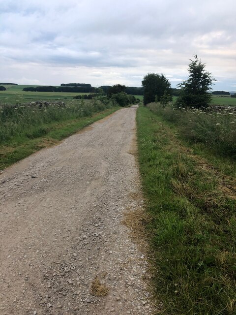
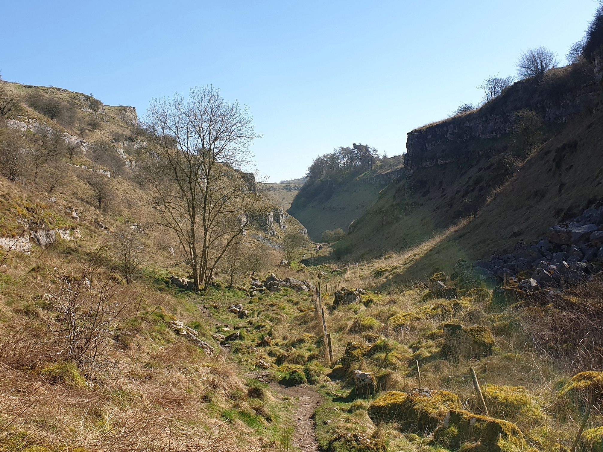
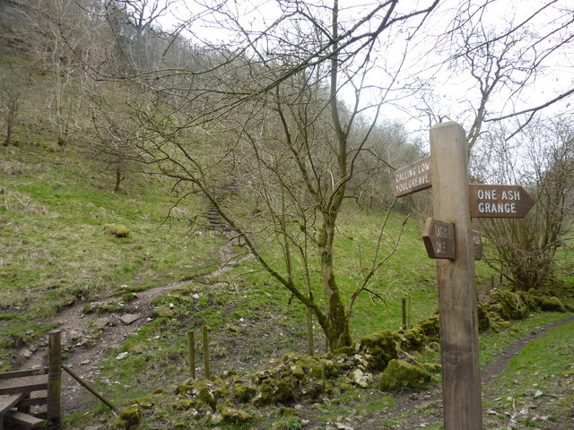
Gib Hill is a popular destination for outdoor enthusiasts, particularly hikers and walkers. Several well-marked trails traverse the hill, offering visitors the opportunity to explore its rugged terrain and enjoy the stunning vistas. The hill's proximity to nearby Cromford allows for easy access, and its relatively moderate gradient makes it suitable for people of various fitness levels.

Aside from its natural attractions, Gib Hill also holds historical significance. It is believed to have been used as a defensive site during ancient times, with remnants of earthworks and ditches still visible today. These features provide insight into the hill's past and add an element of intrigue for those interested in archaeology and history.

Overall, Gib Hill is a captivating destination that combines natural beauty, recreational opportunities, and historical interest. Whether one seeks adventure, tranquility, or a glimpse into the past, this hill in Derbyshire offers a memorable experience for all who visit.

If you have any feedback on the listing, please let us know in the comments section below.

Gib Hill Images

Images are sourced within 2km of 53.167975/-1.766906 or Grid Reference SK1563. Thanks to Geograph Open Source API. All images are credited.

Green Lane A well maintained track near Caskinlow Farm
Green Lane
A well maintained track near Caskinlow Farm
View from Tissington Trail looking NW towards Long Dale This is a 13 mile leisure track from Ashbourne in the south to Parsley Hay in the north, where it joins the High Peak Trail. It is in joint usage as a cycling trail, a bridleway and a walking route. 
The Tissington Trail used to be part of the former railway between Ashbourne and Buxton.
The Pennine Bridleway has adopted part of the northern portion of the  route.
View from Tissington Trail looking NW towards Long Dale
This is a 13 mile leisure track from Ashbourne in the south to Parsley Hay in the north, where it joins the High Peak Trail. It is in joint usage as a cycling trail, a bridleway and a walking route. The Tissington Trail used to be part of the former railway between Ashbourne and Buxton. The Pennine Bridleway has adopted part of the northern portion of the route.
Glamping Pods in field adjacent to Tissington Trail at New Vincent Farm New Vincent Farm is visible in the mid-ground.
Glamping Pods in field adjacent to Tissington Trail at New Vincent Farm
New Vincent Farm is visible in the mid-ground.
Arbor Low henge - flat stones One of the earliest sites in England to have been designated a scheduled ancient monument, and one of the few to have been given a fully detailed description by Historic England (list entry 1011087), the henge consists of a stone circle within an elliptical bank and ditch (40m by 52m) with two entrances and a later bowl barrow. The immediate surrounding area contains a number of other tumuli, barrows and ancient earthworks. The dating is roughly Late Neolithic to Late Bronze Age (c.2400-1500BC).  

The stone circle itself originally comprised 41-43 upright limestone slabs, with some further stones at the centre representing a burial chamber (more than one burial was found during excavations at the site). The stones have at some time in the past been laid flat on the ground. An interpretation board on site attributes this to mediaeval superstition or religious persecution, but someone we met on site who seemed to know it well said he believed it was a more recent (19th century?) action.
Arbor Low henge - flat stones
One of the earliest sites in England to have been designated a scheduled ancient monument, and one of the few to have been given a fully detailed description by Historic England (list entry 1011087), the henge consists of a stone circle within an elliptical bank and ditch (40m by 52m) with two entrances and a later bowl barrow. The immediate surrounding area contains a number of other tumuli, barrows and ancient earthworks. The dating is roughly Late Neolithic to Late Bronze Age (c.2400-1500BC). The stone circle itself originally comprised 41-43 upright limestone slabs, with some further stones at the centre representing a burial chamber (more than one burial was found during excavations at the site). The stones have at some time in the past been laid flat on the ground. An interpretation board on site attributes this to mediaeval superstition or religious persecution, but someone we met on site who seemed to know it well said he believed it was a more recent (19th century?) action.
Arbor Low henge - ditch and bank One of the earliest sites in England to have been designated a scheduled ancient monument, and one of the few to have been given a fully detailed description by Historic England (list entry 1011087), the henge consists of a stone circle within an elliptical bank and ditch (40m by 52m) with two entrances and a later bowl barrow. The immediate surrounding area contains a number of other tumuli, barrows and ancient earthworks. The dating is roughly Late Neolithic to Late Bronze Age (c.2400-1500BC).  

The ditch and bank are seen here from the top of the bank.  The site was fully excavated c.1902, so the exact profile of the bank is probably not original.
Arbor Low henge - ditch and bank
One of the earliest sites in England to have been designated a scheduled ancient monument, and one of the few to have been given a fully detailed description by Historic England (list entry 1011087), the henge consists of a stone circle within an elliptical bank and ditch (40m by 52m) with two entrances and a later bowl barrow. The immediate surrounding area contains a number of other tumuli, barrows and ancient earthworks. The dating is roughly Late Neolithic to Late Bronze Age (c.2400-1500BC). The ditch and bank are seen here from the top of the bank. The site was fully excavated c.1902, so the exact profile of the bank is probably not original.
Arbor Low henge - VR boundary stone The boundary stones around the henge are not ancient, but were added around the time the site was excavated c.1902 (at the end of the Victorian era). Some of them therefore have the initials VR, and some GR, for Victoria and her successor King George.
Arbor Low henge - VR boundary stone
The boundary stones around the henge are not ancient, but were added around the time the site was excavated c.1902 (at the end of the Victorian era). Some of them therefore have the initials VR, and some GR, for Victoria and her successor King George.
Field scabious Flowers growing on the bank of Arbor Low henge.
Field scabious
Flowers growing on the bank of Arbor Low henge.
Approaching the entrance to Arbor Low henge  The elliptical henge originally had two opposite entrances, but this is the one used by visitors approaching on the permitted route through Upper Oldhams Farm.
Approaching the entrance to Arbor Low henge
The elliptical henge originally had two opposite entrances, but this is the one used by visitors approaching on the permitted route through Upper Oldhams Farm.
View from Arbor Low towards Gib Hill  Gib Hill is a burial mound or barrow, somewhat camouflaged in this view against a distant hill (roughly in the centre of the picture, a bit to the left of the cow in the foreground).  The two sites are believed to be associated but are separately scheduled.
View from Arbor Low towards Gib Hill
Gib Hill is a burial mound or barrow, somewhat camouflaged in this view against a distant hill (roughly in the centre of the picture, a bit to the left of the cow in the foreground). The two sites are believed to be associated but are separately scheduled.
Upper Oldhams Farm A beef farm close to Arbor Low henge. There is no public right of way through this farm or its surrounding fields, but visitors are invited to contribute £1 by way of purchasing a temporary right of passage to the henge.
Upper Oldhams Farm
A beef farm close to Arbor Low henge. There is no public right of way through this farm or its surrounding fields, but visitors are invited to contribute £1 by way of purchasing a temporary right of passage to the henge.
Track to Upper Oldhams Farm A beef farm close to Arbor Low henge. There is no public right of way through this farm or its surrounding fields, but visitors are invited to contribute £1 by way of purchasing a temporary right of passage to the henge.
Track to Upper Oldhams Farm
A beef farm close to Arbor Low henge. There is no public right of way through this farm or its surrounding fields, but visitors are invited to contribute £1 by way of purchasing a temporary right of passage to the henge.
Signs to Arbor Low and Upper Oldhams A beef farm close to Arbor Low henge. There is no public right of way through this farm or its surrounding fields, but visitors are invited to contribute £1 by way of purchasing a temporary right of passage to the henge, and the English Heritage car park is part way up this track.
Signs to Arbor Low and Upper Oldhams
A beef farm close to Arbor Low henge. There is no public right of way through this farm or its surrounding fields, but visitors are invited to contribute £1 by way of purchasing a temporary right of passage to the henge, and the English Heritage car park is part way up this track.
Minor road below Arbor Low Note the rosebay-willowherb growing in the verge.  This plant seems to be generally less abundant than it was when I was young, but we saw quite a bit of it in Derbyshire on this occasion.
Minor road below Arbor Low
Note the rosebay-willowherb growing in the verge. This plant seems to be generally less abundant than it was when I was young, but we saw quite a bit of it in Derbyshire on this occasion.
Belt of trees on a ridge The line of these trees corresponds not only with a minor ridge in the landscape but also the parish boundary between Middleton and Smerrill (this side) and Hartington Middle Quarter the other. Even recent maps show a tumulus in this field but there's no obvious sign of it on the ground.
Belt of trees on a ridge
The line of these trees corresponds not only with a minor ridge in the landscape but also the parish boundary between Middleton and Smerrill (this side) and Hartington Middle Quarter the other. Even recent maps show a tumulus in this field but there's no obvious sign of it on the ground.
Slurry spreading The older practice of throwing slurry out of the top of a tanker has been replaced by spreading it evenly through a row of tubes on the back of the tanker. It still attracts the birds.
Slurry spreading
The older practice of throwing slurry out of the top of a tanker has been replaced by spreading it evenly through a row of tubes on the back of the tanker. It still attracts the birds.
A long wall This dry stone wall continues for 280 metres in a straight line, not unusual for this part of Derbyshire.
A long wall
This dry stone wall continues for 280 metres in a straight line, not unusual for this part of Derbyshire.
A view down Long Rake Looking into the distance is the distinctive profile of Sheen Hill in <a href="https://www.geograph.org.uk/gridref/SK1162">SK1162</a>.
A view down Long Rake
Looking into the distance is the distinctive profile of Sheen Hill in SK1162.
Cattle in a field above Parsley Hay I couldn't be sure from this distance but as all the farms in the area seemed to be beef rather than dairy, I expect these are bullocks.
Cattle in a field above Parsley Hay
I couldn't be sure from this distance but as all the farms in the area seemed to be beef rather than dairy, I expect these are bullocks.
Show me another place!

Gib Hill is located at Grid Ref: SK1563 (Lat: 53.167975, Lng: -1.766906)

Administrative County: Derbyshire

District: Derbyshire Dales

Police Authority: Derbyshire

What 3 Words

///upstarts.drumbeat.hobbyists. Near Newhaven, Derbyshire

Related Wikis

Gib Hill

Gib Hill is a large burial mound in the Peak District, Derbyshire, England. It is thought to be a Neolithic oval barrow with an Early Bronze Age round...

Arbor Low

Arbor Low is a well-preserved Neolithic henge in the Derbyshire Peak District, England. It lies on a Carboniferous Limestone plateau known as the White...

Newhaven Tunnel

Newhaven Tunnel was a railway tunnel located on the Cromford and High Peak Railway near the village of Newhaven in Derbyshire. Mostly used for moving mineral...

Parsley Hay railway station

Parsley Hay railway station served Parsley Hay, a hamlet within Hartington Middle Quarter civil parish, about 9.3 miles (15 km) south east of Buxton, Derbyshire...

Lathkill Dale

Lathkill Dale is the valley of the River Lathkill near Bakewell, Derbyshire in the Peak District of England. The river emerges into the dale from springs...

Cales Dale

Cales Dale is a short valley towards the head of Lathkill Dale near Monyash, Derbyshire in the Peak District of England. Cales Dale is included within...

Hartington railway station

Hartington railway station opened in 1899 about two miles away from the village it served - Hartington (grid reference SK129604) in Derbyshire, south...

Limey Way

The Limey Way is a 65-kilometre (40 mi) challenge walk through Derbyshire, England. It starts at Castleton and progresses through 15 major and 5 minor...

Nearby Amenities

Located within 500m of 53.167975,-1.766906
Arbor Low
Archaeological Site: megalith
Historic: archaeological_site
Megalith Type: stone_circle
Source: http://pastscape.org.uk/hob.aspx?hob_id=308656
Website: https://www.english-heritage.org.uk/visit/places/arbor-low-stone-circle-and-gib-hill-barrow/
Wikidata: Q630312
Wikipedia: en:Arbor Low
Lat/Long: 53.16893/-1.7615222
Gib Hill
Historic: archaeological_site
Wikidata: Q5558652
Lat/Long: 53.1668261/-1.7647766
Barrier: stile
Material: wood
Source: survey;gps
Stile: stepover
Lat/Long: 53.1670651/-1.7644061
Arbor Low
Hiking: yes
Information: map
Map Size: site
Map Type: scheme
Tourism: information
Lat/Long: 53.1708102/-1.7642639
Board Type: history
Information: board
Tourism: information
Lat/Long: 53.1678272/-1.7628588
Board Type: history
Information: board
Tourism: information
Lat/Long: 53.1690286/-1.763038
The data included in this document is from www.openstreetmap.org. The data is made available under ODbL.

Have you been to Gib Hill?

Leave your review of Gib Hill below (or comments, questions and feedback).