Barbury Hill

Hill, Mountain in Wiltshire

England

Barbury Hill

Burderop Down, Wiltshire Overlooking farmland on Burderop Down.
Burderop Down, Wiltshire Credit: Rebecca A Wills

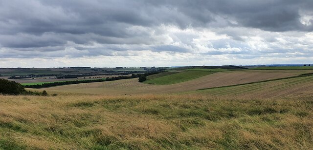
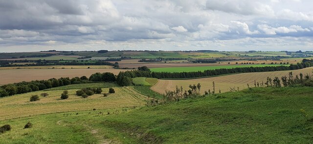
Barbury Hill is a prominent chalk hill located in the county of Wiltshire, England. It is situated near the village of Wroughton and is part of the Marlborough Downs. Standing at an elevation of 261 meters (856 feet), it is one of the highest points in the area and offers stunning panoramic views of the surrounding countryside.

The hill is known for its historical significance, as it has been inhabited for thousands of years. Archaeological excavations have revealed evidence of Iron Age settlements and hillforts, indicating human activity on the hill dating back to around 700 BC. The remains of a hillfort, known as Barbury Castle, can still be seen on the summit. It is believed to have been constructed during the Iron Age and was likely used for defensive purposes.

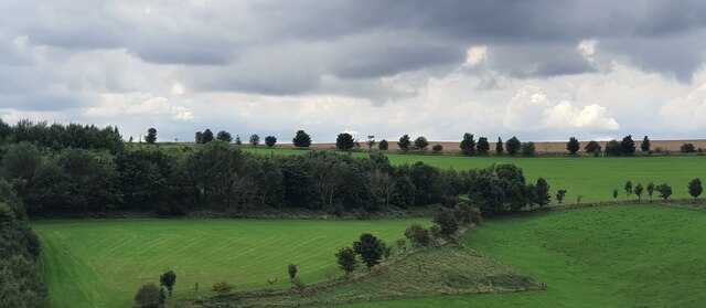
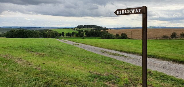
Today, Barbury Hill is a popular destination for outdoor enthusiasts and nature lovers. The hill is crisscrossed by a network of footpaths and bridleways, making it a great spot for walking, hiking, and horse riding. The area is also known for its rich biodiversity, with a variety of plant and animal species calling the hill home.

Barbury Hill is also renowned for hosting various events throughout the year. The hill is the site of the Barbury International Horse Trials, an annual equestrian competition that attracts riders from around the world. Additionally, the hill is a popular spot for kite flying, picnicking, and enjoying the scenic beauty of the Marlborough Downs.

In conclusion, Barbury Hill in Wiltshire is a historically significant and visually striking chalk hill that offers a range of outdoor activities and stunning views of the surrounding countryside.

If you have any feedback on the listing, please let us know in the comments section below.
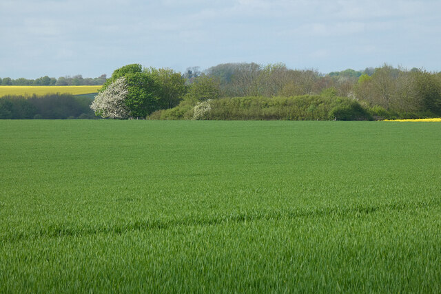
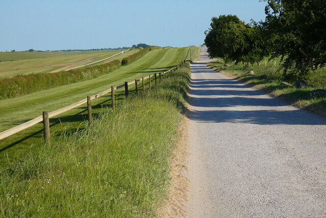
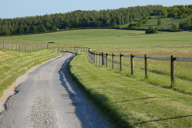
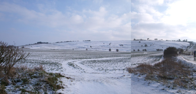
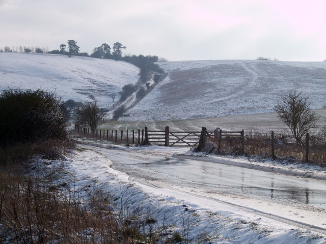
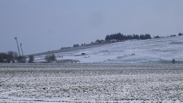
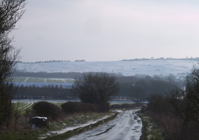
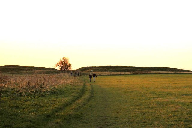
Barbury Hill Images

Images are sourced within 2km of 51.485268/-1.7860456 or Grid Reference SU1476. Thanks to Geograph Open Source API. All images are credited.

Burderop Down, Wiltshire Overlooking farmland on Burderop Down.
Burderop Down, Wiltshire
Overlooking farmland on Burderop Down.
Burderop Down, Wiltshire Looking southeast over farmland from Burderop Down.
Burderop Down, Wiltshire
Looking southeast over farmland from Burderop Down.
Burderop Down, Wiltshire Looking along a bridleway running over farmland on Burderop Down.
Burderop Down, Wiltshire
Looking along a bridleway running over farmland on Burderop Down.
Smeathe's Ridge, Wiltshire Overlooking farmland on Smeathe's Ridge, viewed from the Ridgeway Bridleway.
Smeathe's Ridge, Wiltshire
Overlooking farmland on Smeathe's Ridge, viewed from the Ridgeway Bridleway.
Smeathe's Ridge, Wiltshire Looking southeast over sheep grazing on Smeathe's Plantation.
Smeathe's Ridge, Wiltshire
Looking southeast over sheep grazing on Smeathe's Plantation.
Burderop Down, Wiltshire A signpost pointing the way along the Ridgeway on Burderop Down.
Burderop Down, Wiltshire
A signpost pointing the way along the Ridgeway on Burderop Down.
Farmland, Wroughton The clump of trees at Barbury Castle appears above a crop of oil-seed rape.
Farmland, Wroughton
The clump of trees at Barbury Castle appears above a crop of oil-seed rape.
Farmland, Wroughton A large field of barley to the west of the road below Barbury Castle.
Farmland, Wroughton
A large field of barley to the west of the road below Barbury Castle.
Byway, Ogbourne St Andrew With a gallop on the Barbury Castle Estate to its left.
Byway, Ogbourne St Andrew
With a gallop on the Barbury Castle Estate to its left.
Road, Ogbourne St Andrew The point-to-point course and arable farmland lie to the right of the road descending northwards below Barbury Castle.
Road, Ogbourne St Andrew
The point-to-point course and arable farmland lie to the right of the road descending northwards below Barbury Castle.
Undated field system, Burderop Down This is a well-preserved field system which extends for approximately 600m across the north-facing slopes of Burderop Down, just east of Barbury Castle. Individual fields vary in shape and include both long, narrow and smaller square examples. The enclosing field boundaries are formed by well preserved banks up to 1.5m high and 10m wide which define units of land ranging in size from 2ha to 3ha. <span class="nowrap"><a title="http://history.wiltshire.gov.uk/smr/getsmr.php?id=14881" rel="nofollow ugc noopener" href="http://history.wiltshire.gov.uk/smr/getsmr.php?id=14881">Link</a><img style="margin-left:2px;" alt="External link" title="External link - shift click to open in new window" src="https://s1.geograph.org.uk/img/external.png" width="10" height="10"/></span>
Although commonly called "Celtic" fields, it is not know whether they date from the Iron Age or even earlier. 
This image is stitched together from two photographs.
Undated field system, Burderop Down
This is a well-preserved field system which extends for approximately 600m across the north-facing slopes of Burderop Down, just east of Barbury Castle. Individual fields vary in shape and include both long, narrow and smaller square examples. The enclosing field boundaries are formed by well preserved banks up to 1.5m high and 10m wide which define units of land ranging in size from 2ha to 3ha. LinkExternal link Although commonly called "Celtic" fields, it is not know whether they date from the Iron Age or even earlier. This image is stitched together from two photographs.
Road to Barbury Castle The gradient and narrowness of this hill make it treacherous at the best of times.
Road to Barbury Castle
The gradient and narrowness of this hill make it treacherous at the best of times.
Shooting school, Burderop Down The strange objects to the left of the picture are extendable platforms from which clay pigeons are launched. More traps can be seen on the ground.
Shooting school, Burderop Down
The strange objects to the left of the picture are extendable platforms from which clay pigeons are launched. More traps can be seen on the ground.
Field system, Burderop Down This is a well-preserved field system on the north-facing slopes of Burderop Down, just east of Barbury Castle. <span class="nowrap"><a title="http://history.wiltshire.gov.uk/smr/getsmr.php?id=14881" rel="nofollow ugc noopener" href="http://history.wiltshire.gov.uk/smr/getsmr.php?id=14881">Link</a><img style="margin-left:2px;" alt="External link" title="External link - shift click to open in new window" src="https://s1.geograph.org.uk/img/external.png" width="10" height="10"/></span> Although commonly called "Celtic" fields, it is not know whether they date from the Iron Age or even earlier.
Field system, Burderop Down
This is a well-preserved field system on the north-facing slopes of Burderop Down, just east of Barbury Castle. LinkExternal link Although commonly called "Celtic" fields, it is not know whether they date from the Iron Age or even earlier.
The Ridgeway running to Barbury Castle
The Ridgeway running from Barbury Castle
Gates from Barbury Castle
Show me another place!

Barbury Hill is located at Grid Ref: SU1476 (Lat: 51.485268, Lng: -1.7860456)

Unitary Authority: Swindon

Police Authority: Wiltshire

What 3 Words

///career.tests.format. Near Wroughton, Wiltshire

Related Wikis

Barbury Castle

Barbury Castle is a scheduled hillfort in Wiltshire, England. It is one of several such forts found along the ancient Ridgeway route. The site, which lies...

Battle of Beran Byrig

At the Battle of Beran Byrig or Beranburh the West Saxons are said to have defeated the Britons at Barbury Castle Hill Fort near Swindon in the year 556...

RAF Wroughton

RAF Wroughton is a former Royal Air Force airfield near Wroughton, in Wiltshire, England, about 4 miles (6 km) south of Swindon. Ministry of Defence aviation...

National Collections Centre

The National Collections Centre, near Swindon, England, is the collections management facility for the Science Museum Group and the Science Museum Library...

Nearby Amenities

Located within 500m of 51.485268,-1.7860456
Historic: archaeological_site
Source: Bing
Lat/Long: 51.4858306/-1.7899198
Historic: archaeological_site
Source: Bing
Lat/Long: 51.4897242/-1.7869592
Information: guidepost
Tourism: information
Lat/Long: 51.4857352/-1.791558
Barbury Castle Country Park
Board Type: history
Information: board
Tourism: information
Lat/Long: 51.4851858/-1.789094
Barbury Castle Country Park
Board Type: history
Information: board
Tourism: information
Lat/Long: 51.4853224/-1.7838661
Barrier: kissing_gate
Lat/Long: 51.4856715/-1.7916665
Barrier: kissing_gate
Lat/Long: 51.4857718/-1.7914702
Barrier: kissing_gate
Lat/Long: 51.4879464/-1.7870594
Historic: archaeological_site
Source: Bing
Lat/Long: 51.486278/-1.7886115
Barrier: stile
Lat/Long: 51.4869275/-1.7870602
The data included in this document is from www.openstreetmap.org. The data is made available under ODbL.

Have you been to Barbury Hill?

Leave your review of Barbury Hill below (or comments, questions and feedback).