Cill Donnain

Settlement in Inverness-shire

Scotland

Cill Donnain

South Uist War Memorial
South Uist War Memorial Credit: Sandy Gerrard

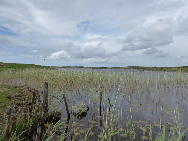
Cill Donnain is a small village located in Inverness-shire, Scotland. Situated on the Isle of Skye, Cill Donnain is known for its stunning natural beauty and picturesque surroundings. The village is surrounded by rugged mountains, lush greenery, and crystal-clear waters, making it a popular destination for outdoor enthusiasts and nature lovers.

Cill Donnain is home to a small population of residents, many of whom are involved in traditional industries such as fishing and agriculture. The village has a strong sense of community and a welcoming atmosphere, making it a charming place to visit or live.

Visitors to Cill Donnain can explore the surrounding countryside on foot or by bike, taking in the breathtaking scenery and enjoying the peace and tranquility of the area. The village is also within easy reach of several historic sites and attractions, including the iconic Eilean Donan Castle.

Overall, Cill Donnain is a hidden gem in Inverness-shire, offering visitors a unique opportunity to experience the beauty and serenity of the Scottish Highlands.

If you have any feedback on the listing, please let us know in the comments section below.

Cill Donnain Images

Images are sourced within 2km of 57.222774/-7.4176609 or Grid Reference NF7327. Thanks to Geograph Open Source API. All images are credited.

South Uist War Memorial
War memorial near Cill Donnain
Two Kingspan/Proven turbines Beside the South Uist Museum.
Two Kingspan/Proven turbines
Beside the South Uist Museum.
The beach at Kildonan, South Uist There was a lot of sea-weed on the shore - recent storms, perhaps?
The beach at Kildonan, South Uist
There was a lot of sea-weed on the shore - recent storms, perhaps?
The beach at Kildonan, South Uist Yet another perfect Hebridean beach.
The beach at Kildonan, South Uist
Yet another perfect Hebridean beach.
Road approaching a  causeway across Loch Chill Donnain
Road approaching a causeway across Loch Chill Donnain
Loch Upper Kildonan Looking north towards Bornish Church on the horizon.
Loch Upper Kildonan
Looking north towards Bornish Church on the horizon.
Loch Upper Kildonan Looking out across the island studded north end of the loch from the ruins on the west shore.
Loch Upper Kildonan
Looking out across the island studded north end of the loch from the ruins on the west shore.
Angling Boat, Upper Kildonan
Reeds, Loch Chill Donnain
Old walls above Loch Àird an Sgairbh
Dun, Loch na Muilne The OS map identifies this small island in Loch na Muilne as the site of a dun.   It appears that the island can be reached by a causeway or series of stepping stones.
Dun, Loch na Muilne
The OS map identifies this small island in Loch na Muilne as the site of a dun. It appears that the island can be reached by a causeway or series of stepping stones.
Visiting Flora MacDonald's birthplace
The beach at Kildonan Heading northwards on the west coast of South Uist.
The beach at Kildonan
Heading northwards on the west coast of South Uist.
Beach south of Rubha Àird a' Mhuile
Trolaisgeir A view from the top of the dunes where traffic from Cill Donnain arrives at the shore.
Trolaisgeir
A view from the top of the dunes where traffic from Cill Donnain arrives at the shore.
Loch Bhornais Uarach Viewed from Uist War Memorial.
Loch Bhornais Uarach
Viewed from Uist War Memorial.
Mill Loch Dun A ruined dun in Loch na Muilne. <span class="nowrap"><a title="https://canmore.org.uk/site/9846/south-uist-kildonan-mill-loch" rel="nofollow ugc noopener" href="https://canmore.org.uk/site/9846/south-uist-kildonan-mill-loch">Link</a><img style="margin-left:2px;" alt="External link" title="External link - shift click to open in new window" src="https://s1.geograph.org.uk/img/external.png" width="10" height="10"/></span>
Mill Loch Dun
A ruined dun in Loch na Muilne. LinkExternal link
Show me another place!

Cill Donnain is located at Grid Ref: NF7327 (Lat: 57.222774, Lng: -7.4176609)

Unitary Authority: Na h-Eileanan an Iar

Police Authority: Highlands and Islands

Also known as: Kildonan

What 3 Words

///miracles.jacuzzi.paler. Near Lochboisdale, Na h-Eileanan Siar

Related Wikis

Milton (South Uist)

Milton (Scottish Gaelic: Geàrraidh Bhailteas) is the name of a tack or tenant farm on the island of South Uist in the Outer Hebrides, Scotland. It was...

Bornish

Bornish (Scottish Gaelic: Bòrnais) is a village and community council area on South Uist in the Outer Hebrides, Scotland. Bornish is also within the civil...

Dun Vulan

Dun Vulan Broch (Scottish Gaelic: 'Dùn Mhùlan' or 'Dùn Mhaoilinn') is an Iron Age broch in South Uist, Scotland. == Location == Dun Vulan is located in...

Ormacleit Castle

Ormacleit Castle (Scottish Gaelic: Caisteal Ormacleit) is a ruined mansion house of the early 18th century. It is located on South Uist in the Western...

Nearby Amenities

Located within 500m of 57.222774,-7.4176609
Passing Place
Lat/Long: 57.2229943/-7.4099141
Turning Circle
Lat/Long: 57.2227466/-7.4247905
Turning Circle
Lat/Long: 57.2224986/-7.4198801
Power: pole
Lat/Long: 57.2224119/-7.4240832
Power: pole
Lat/Long: 57.2225252/-7.4228574
Power: pole
Lat/Long: 57.2226196/-7.4218891
Power: pole
Lat/Long: 57.2228534/-7.4209424
Power: pole
Lat/Long: 57.222711/-7.4209048
Power: pole
Lat/Long: 57.2228308/-7.4194336
Power: pole
Lat/Long: 57.2228417/-7.4183004
Power: pole
Lat/Long: 57.2228519/-7.4172114
Power: pole
Lat/Long: 57.222849/-7.4160688
Power: pole
Lat/Long: 57.2228534/-7.414953
Power: pole
Lat/Long: 57.2228519/-7.4138184
Power: pole
Lat/Long: 57.2228621/-7.4127026
Power: pole
Lat/Long: 57.2228635/-7.4113963
Power: pole
Lat/Long: 57.2228664/-7.4100928
Power: pole
Lat/Long: 57.2238314/-7.4193413
Power: pole
Lat/Long: 57.2241625/-7.4187941
Power: pole
Lat/Long: 57.2231678/-7.4204195
Power: pole
Lat/Long: 57.2235352/-7.4198536
Power: pole
Lat/Long: 57.2245197/-7.418208
Barrier: cattle_grid
Lat/Long: 57.2245713/-7.4175855
The data included in this document is from www.openstreetmap.org. The data is made available under ODbL.

Have you been to Cill Donnain?

Leave your review of Cill Donnain below (or comments, questions and feedback).