Calton Hill

Hill, Mountain in Derbyshire Derbyshire Dales

England

Calton Hill

Monsal Trail Viaduct
Monsal Trail Viaduct Credit: Bob Danylec

Calton Hill, located in Derbyshire, England, is a prominent hill that forms part of the Peak District National Park. Standing at an elevation of approximately 1,080 feet (329 meters), it is a popular destination for hikers, nature enthusiasts, and those seeking panoramic views of the surrounding landscape.

The hill is composed mainly of limestone and is characterized by its rugged terrain, with steep slopes and rocky outcrops. It is covered in a variety of vegetation, including heather, grasses, and scattered patches of woodland, providing a diverse habitat for local wildlife.

At the summit of Calton Hill, visitors are rewarded with breathtaking vistas of the surrounding countryside. On a clear day, one can see for miles, with views stretching across the rolling hills, valleys, and picturesque villages that make up the Derbyshire countryside.

Apart from its natural beauty, Calton Hill also boasts a rich historical heritage. The hill is home to several ancient burial mounds, known as barrows, which date back to the Bronze Age. These archaeological sites offer insight into the region's prehistoric past and are of great interest to archaeologists and history enthusiasts.

Additionally, Calton Hill is famous for its distinctive rock formation, known as the "Three Ships." This natural feature resembles three sailing ships when viewed from a specific angle, adding to the hill's allure and intrigue.

Overall, Calton Hill in Derbyshire is a captivating destination that combines stunning natural scenery, historical significance, and opportunities for outdoor exploration, making it a must-visit location for anyone seeking an authentic English countryside experience.

If you have any feedback on the listing, please let us know in the comments section below.
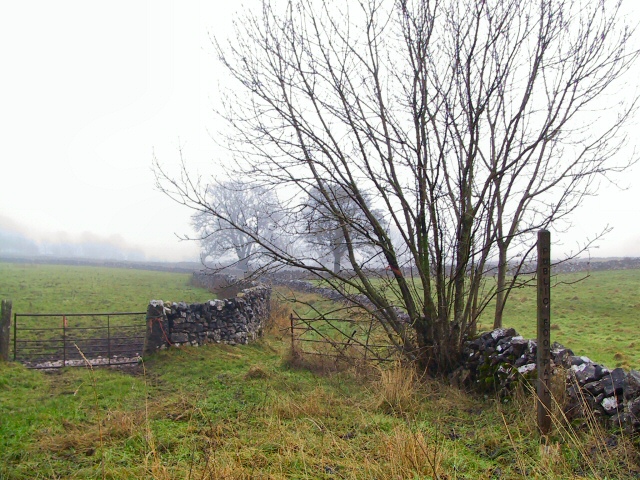
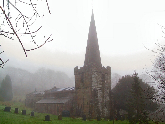
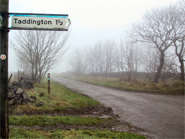
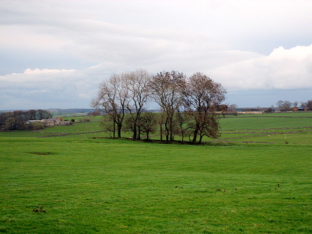
Calton Hill Images

Images are sourced within 2km of 53.239622/-1.8285341 or Grid Reference SK1171. Thanks to Geograph Open Source API. All images are credited.

Monsal Trail Viaduct
Chee Dale One of the stepping stone sections along Chee Dale.
Chee Dale
One of the stepping stone sections along Chee Dale.
Chee Dale One of the wider sections along Chee Dale. Heading towards Millers Dale
Chee Dale
One of the wider sections along Chee Dale. Heading towards Millers Dale
Green Lane to Chelmorton This green lane leads from Old Coalpit Lane into the village of Chelmorton, across the fields of Farditch farm, behind the sewage works.
Green Lane to Chelmorton
This green lane leads from Old Coalpit Lane into the village of Chelmorton, across the fields of Farditch farm, behind the sewage works.
Railway Bridge at Wye Dale The exit from Topley Pike quarry emerges onto the A6 trunk road by the railway bridge at Wye Dale
Railway Bridge at Wye Dale
The exit from Topley Pike quarry emerges onto the A6 trunk road by the railway bridge at Wye Dale
Calton Farm The entrance to the farm is in the layby on the A5270 just before its intersection with the A6 east of Buxton.
Calton Farm
The entrance to the farm is in the layby on the A5270 just before its intersection with the A6 east of Buxton.
St.John's, Chelmorton St.John the Baptist church at Chelmorton, in the diocese of Derby, just emerging from the morning mist. It stands opposite the Church Inn at the top of the village.
St.John's, Chelmorton
St.John the Baptist church at Chelmorton, in the diocese of Derby, just emerging from the morning mist. It stands opposite the Church Inn at the top of the village.
Pennine Bridleway The Pennine Bridleway carries straight on up Pillwell Lane, whilst Moor Lane takes a right here for Taddington.
Pennine Bridleway
The Pennine Bridleway carries straight on up Pillwell Lane, whilst Moor Lane takes a right here for Taddington.
Moor Grange I hope you'll take it as read, that Moor Grange stands at the head of this drive leading off Moor Lane near Taddington. The name of the grange is etched into the stone gateposts.
Moor Grange
I hope you'll take it as read, that Moor Grange stands at the head of this drive leading off Moor Lane near Taddington. The name of the grange is etched into the stone gateposts.
Blackwell mill Eight railway cottagers built in 1866 they used to have their own halt, it was said to be the smallest passenger station on British railways, it was closed in 1966. Several valleys and paths meet here.
Blackwell mill
Eight railway cottagers built in 1866 they used to have their own halt, it was said to be the smallest passenger station on British railways, it was closed in 1966. Several valleys and paths meet here.
Blackwell Mill cottagers Blackwell Mill railway cottages with the bridge crossing river Wye to the right. They used to have their own station built in 1866 closed 1966 it was the smallest on BR just one carriage long.
Blackwell Mill cottagers
Blackwell Mill railway cottages with the bridge crossing river Wye to the right. They used to have their own station built in 1866 closed 1966 it was the smallest on BR just one carriage long.
Senners Lane
Senners Lane
A  fair copse! Large exposed fields on the top of this limestone country are broken up only occasionally by clumps of trees.  This contrasts with the deep valleys cut into this limestone which support extensive areas of woodland.
A fair copse!
Large exposed fields on the top of this limestone country are broken up only occasionally by clumps of trees. This contrasts with the deep valleys cut into this limestone which support extensive areas of woodland.
Farmland outside Blackwell The evening sunset casts a haze over the fields outside the hamlet of Blackwell.  This is sheep and cattle grazing country.
Farmland outside Blackwell
The evening sunset casts a haze over the fields outside the hamlet of Blackwell. This is sheep and cattle grazing country.
Pennine Bridleway Way Marker Way marker on Sough Lane Other Route with Public Access.
Pennine Bridleway Way Marker
Way marker on Sough Lane Other Route with Public Access.
Farm track above Mosley Farm Abandoned farm equipment by a metalled track to the northwest of Mosley Farm; not a right-of-way.
Farm track above Mosley Farm
Abandoned farm equipment by a metalled track to the northwest of Mosley Farm; not a right-of-way.
Chee Dale from Mosley Farm Showing some of the limestone tors on the southern side of Chee Dale.
Chee Dale from Mosley Farm
Showing some of the limestone tors on the southern side of Chee Dale.
Pennine Bridleway, above Chee Dale Mountain biker just west of Mosley Farm steeling himself for the steep drop to the River Wye and Chee Dale.
Pennine Bridleway, above Chee Dale
Mountain biker just west of Mosley Farm steeling himself for the steep drop to the River Wye and Chee Dale.
Show me another place!

Calton Hill is located at Grid Ref: SK1171 (Lat: 53.239622, Lng: -1.8285341)

Administrative County: Derbyshire

District: Derbyshire Dales

Police Authority: Derbyshire

What 3 Words

///parade.values.drumbeat. Near Tideswell, Derbyshire

Nearby Locations

Calton Hill

Related Wikis

Calton Hill, Derbyshire

Calton Hill is a Site of Special Scientific Interest in Derbyshire, England, showing Olivine Diorite magma chamber.It is the site of an extinct volcano...
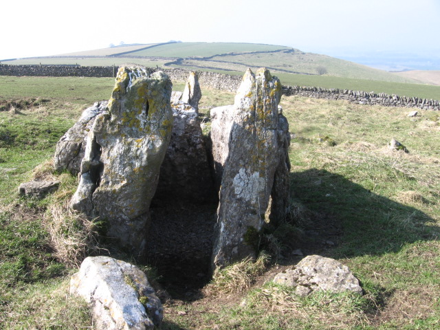
Five Wells

Five Wells is a Neolithic chambered tomb between the villages of Chelmorton and Taddington on Taddington Moor in the Derbyshire Peak District in England...

Blackwell in the Peak

Blackwell is a village in the Derbyshire Dales local government district of Derbyshire, England, on the A6 main road between Bakewell and Buxton.It is...
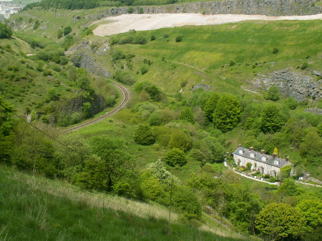
Blackwell Mill

Blackwell Mill is a location in Derbyshire, near to the village of Blackwell near Buxton, but not part of it. There was once a corn mill on the River Wye...

Chee Dale Halt railway station

Chee Dale Halt railway station was a timber-built railway halt located on the Peak Forest Junction to Buxton Junction spur of a triangle of the former...

Chelmorton

Chelmorton is a village and a civil parish in Derbyshire, England. It is in the Derbyshire Dales district and the nearest towns are Buxton to the northwest...
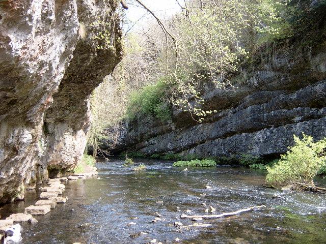
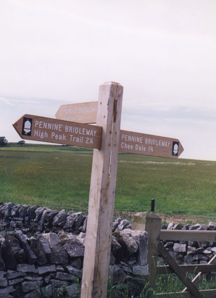
Chee Dale

Chee Dale is a steep-sided gorge on the River Wye near Buxton, Derbyshire, in the Peak District of England. The Wye valley continues upstream towards Buxton...

Deep Dale

Deep Dale is a short steep-sided gorge near Buxton, Derbyshire, in the Peak District of England. It is distinct from another Deep Dale, near Sheldon, 4...

Nearby Amenities

Located within 500m of 53.239622,-1.8285341
Calton Hill
Ele: 400
Natural: peak
Wikidata: Q5023998
Wikipedia: en:Calton Hill, Derbyshire
Lat/Long: 53.2389143/-1.8237285
Barrier: stile
Fixme: no evidence of stile anymore Oct 2014
Steps: 2
Stile: stepover
Lat/Long: 53.2385067/-1.8350725
Barrier: stile
Material: stone
Source: survey;gps
Steps: 3
Stile: stepover
Lat/Long: 53.2383239/-1.8351165
Barrier: stile
Material: stone
Source: survey;gps
Steps: 2
Stile: stepover
Lat/Long: 53.2393763/-1.8359197
Barrier: entrance
Source: survey;gps
Lat/Long: 53.2385041/-1.8350295
The data included in this document is from www.openstreetmap.org. The data is made available under ODbL.

Have you been to Calton Hill?

Leave your review of Calton Hill below (or comments, questions and feedback).