Caveshaw Hill

Hill, Mountain in Yorkshire Richmondshire

England

Caveshaw Hill

Village street and green, Newsham The quiet village in a backwater off the A66 must have once been busy as a market would have been held on this green.
Village street and green, Newsham Credit: Gordon Hatton

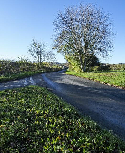
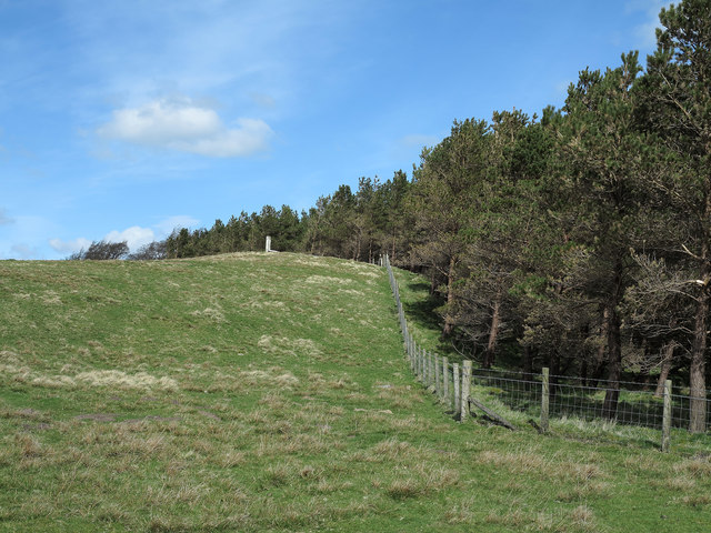
Caveshaw Hill, located in Yorkshire, England, is a prominent hill known for its scenic beauty and historical significance. Rising to a height of approximately 370 meters (1,214 feet), it is often referred to as a hill rather than a mountain due to its relatively moderate elevation. The hill is situated in the southern part of the Yorkshire Dales National Park, making it a popular destination for outdoor enthusiasts and nature lovers.

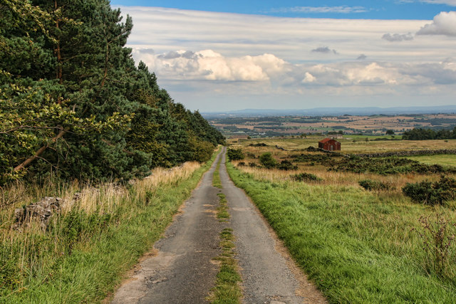
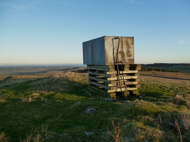
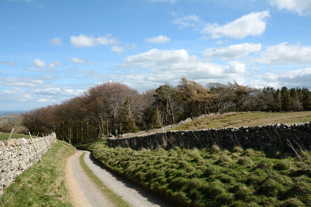
Caveshaw Hill offers breathtaking panoramic views of the surrounding countryside, with its rolling green hills and picturesque valleys. The area is renowned for its diverse wildlife, including rare bird species and various flora and fauna. The hill is covered in heather and grasslands, adding to its natural charm and appeal.

In addition to its natural beauty, Caveshaw Hill holds historical significance. It is believed to have been used as a burial site during the Iron Age, with several ancient burial mounds still visible today. The remains of an ancient settlement, dating back to the Bronze Age, have also been discovered at the foot of the hill. These archaeological findings provide valuable insights into the region's past and attract history enthusiasts.

Hikers and walkers are drawn to Caveshaw Hill for its well-maintained footpaths and trails, offering opportunities for exploration and adventure. The hill's accessibility and proximity to nearby villages make it a popular spot for locals and tourists alike, seeking a peaceful escape or a challenging outdoor activity.

If you have any feedback on the listing, please let us know in the comments section below.

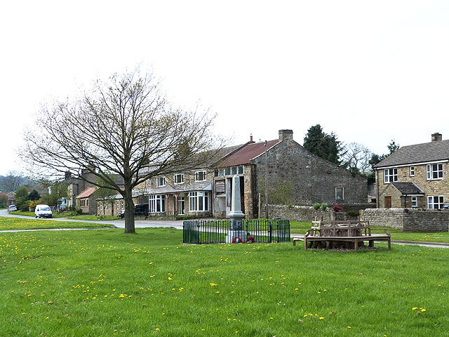
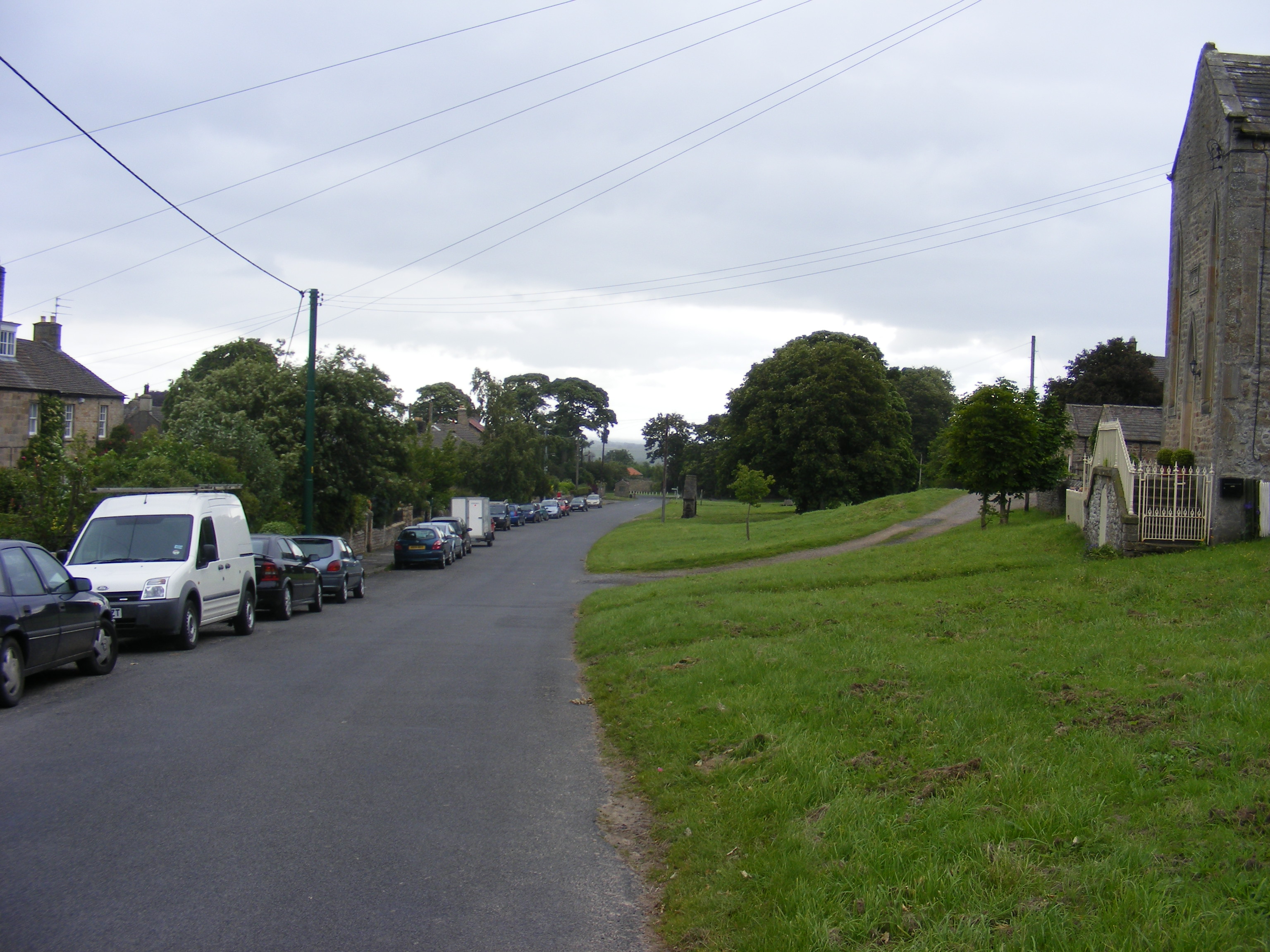
Caveshaw Hill Images

Images are sourced within 2km of 54.47008/-1.8411658 or Grid Reference NZ1008. Thanks to Geograph Open Source API. All images are credited.

Village street and green, Newsham The quiet village in a backwater off the A66 must have once been busy as a market would have been held on this green.
Village street and green, Newsham
The quiet village in a backwater off the A66 must have once been busy as a market would have been held on this green.
Market Cross, Newsham The base of the cross is most likely the 16th century original, but it was restored in 1828 and again in 1935. The bench hides the block of granite into which are fixed the iron loops of the 1828 village stocks. Across the road the bus for Richmond has just arrived.
Market Cross, Newsham
The base of the cross is most likely the 16th century original, but it was restored in 1828 and again in 1935. The bench hides the block of granite into which are fixed the iron loops of the 1828 village stocks. Across the road the bus for Richmond has just arrived.
Road entering Newsham The road connects the village of Newsham with the A66.
Road entering Newsham
The road connects the village of Newsham with the A66.
Dry stone wall, Newsham Newsham Hall over the field beyond.
Dry stone wall, Newsham
Newsham Hall over the field beyond.
Eastern entrance to Newsham
War Memorial, Newsham
A house of local stone in Newsham
Old petrol pumps : Newsham Now another five years older than in <a href="https://www.geograph.org.uk/photo/145648">NZ1010 : Old Petrol Pumps : Newsham</a>, and looking the part!
Old petrol pumps : Newsham
Now another five years older than in NZ1010 : Old Petrol Pumps : Newsham, and looking the part!
Market Cross and stocks At Dalton junction in Newsham.
Market Cross and stocks
At Dalton junction in Newsham.
Market Cross, Newsham By the Barningham Road.
Market Cross, Newsham
By the Barningham Road.
West end of Newsham
West end of Newsham
Moor Lane Moor Lane near Crumma.
Moor Lane
Moor Lane near Crumma.
Water tank. Water tank on top of unnamed hill overlooking Dalton near Richmond, North Yorks. For years I've seen this from the A66 thinking it to be a large cairn of some significance, only to find this instead. Still, the views to the North and East are excellent.
Water tank.
Water tank on top of unnamed hill overlooking Dalton near Richmond, North Yorks. For years I've seen this from the A66 thinking it to be a large cairn of some significance, only to find this instead. Still, the views to the North and East are excellent.
Gates at entry to Barningham Park A public footpath enters Barningham Park at its east side through one of the gates here - presumably the less grand one! The monument mounted in the wall commemorates the building of the wall, the creation of the deer park and the planting of trees between 1857 and 1859. Also mentioned is the erection of a model farm in 1863. All of these works were 'Designed and Executed by Augustus Sussex Milbank'... bet he had some help!
Gates at entry to Barningham Park
A public footpath enters Barningham Park at its east side through one of the gates here - presumably the less grand one! The monument mounted in the wall commemorates the building of the wall, the creation of the deer park and the planting of trees between 1857 and 1859. Also mentioned is the erection of a model farm in 1863. All of these works were 'Designed and Executed by Augustus Sussex Milbank'... bet he had some help!
Crumma Plantation The rough road in the image has that curious status of 'other route with public access'! The wall marks part of the northern limit of the MOD  Feldom Range and entry is unwelcome. The trees of Crumma Plantation are also within the range.
Crumma Plantation
The rough road in the image has that curious status of 'other route with public access'! The wall marks part of the northern limit of the MOD Feldom Range and entry is unwelcome. The trees of Crumma Plantation are also within the range.
Western Edge of Crumma Plantation A field with rough grazing bounds the western edge of the plantation. There's a military presence hereabouts - the prominent white stump on the grassy rise is the remains of a flagstaff.
Western Edge of Crumma Plantation
A field with rough grazing bounds the western edge of the plantation. There's a military presence hereabouts - the prominent white stump on the grassy rise is the remains of a flagstaff.
Newsham village green With War Memorial. One of the many attractive "Green" villages of North Yorkshire.
Newsham village green
With War Memorial. One of the many attractive "Green" villages of North Yorkshire.
Newsham village green Looking towards Low Lane, at the east end of the village. One of the many attractive "Green" villages of North Yorkshire.
Newsham village green
Looking towards Low Lane, at the east end of the village. One of the many attractive "Green" villages of North Yorkshire.
Show me another place!

Caveshaw Hill is located at Grid Ref: NZ1008 (Lat: 54.47008, Lng: -1.8411658)

Division: North Riding

Administrative County: North Yorkshire

District: Richmondshire

Police Authority: North Yorkshire

What 3 Words

///curry.wobbling.carpets. Near Barningham, Co. Durham

Related Wikis

Dalton, west North Yorkshire

Dalton is a village and civil parish in North Yorkshire in England. Dalton is situated about six miles north-west of Richmond and about five miles south...

Newsham, Richmondshire

Newsham is a village and civil parish in the Richmondshire district of North Yorkshire, England. The village is 8 miles (13 km) north west of Richmond...

Gayles, North Yorkshire

Gayles is a village and civil parish in the Richmondshire district of North Yorkshire, England. Gayles is established in the district ward of Gilling West...

Barningham Park

Barningham Park is a Grade II* listed country house and 7,000 acre estate located in the village of Barningham, County Durham (formerly the North Riding...

Milbank Arms, Barningham

The Milbank Arms is a Grade II listed public house at Barningham, County Durham. Built in the early 19th century, it spent a period as a hotel before converting...

Barningham, County Durham

Barningham is a village in County Durham, in the Pennines of England. == History == Barningham is listed in the Domesday Book under the Gilling Wapentake...

Ravensworth

Ravensworth is a village and civil parish in the Holmedale valley, within the Richmondshire district of North Yorkshire, England. It is approximately...

Ravensworth Castle (North Yorkshire)

Ravensworth Castle is a ruined 14th-century castle in the village of Ravensworth, North Yorkshire, England. It has been designated a Grade I listed building...

Nearby Amenities

Located within 500m of 54.47008,-1.8411658
High Dalton Hall
Place: farm
Lat/Long: 54.4737081/-1.8412131
Caveshaw Hill
Place: locality
Lat/Long: 54.4696157/-1.8424503
The data included in this document is from www.openstreetmap.org. The data is made available under ODbL.

Have you been to Caveshaw Hill?

Leave your review of Caveshaw Hill below (or comments, questions and feedback).