Bracken Hill

Hill, Mountain in Yorkshire Harrogate

England

Bracken Hill

Snowed heather tussocks on Great Haw The view east from Great Haw over moorland with the undulating ground of the North Yorks Moors in the distance. The stream groove to the right in the image will be of a tributary of Steel House Gill.
Snowed heather tussocks on Great Haw Credit: Trevor Littlewood

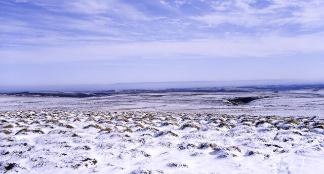
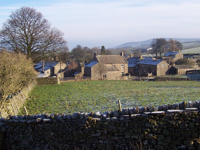
Bracken Hill, located in Yorkshire, is a prominent hill and natural landmark in the region. Situated amidst the stunning Yorkshire Dales National Park, it stands tall at an elevation of approximately 400 meters (1,300 feet). The hill is characterized by its gentle slopes and expansive bracken-covered terrain, which gives it its name.

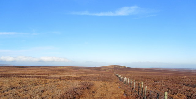
Bracken Hill offers breathtaking panoramic views of the surrounding countryside, providing visitors with a picturesque backdrop of rolling green hills, dense woodlands, and quaint villages scattered across the landscape. It is a haven for nature enthusiasts and hikers, who can explore the numerous trails that crisscross the hill, offering a variety of difficulty levels for all abilities.

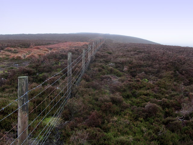
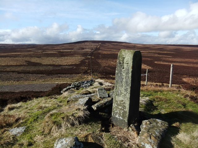
The hill is home to a diverse range of flora and fauna, with bracken ferns dominating the landscape, lending the hill its distinctive appearance. The abundance of plant life attracts a variety of bird species, making it a popular spot for birdwatching. The hillside is also dotted with ancient stone walls and remnants of historic settlements, adding an element of intrigue and history to the area.

Bracken Hill is easily accessible, with several footpaths leading to its summit. It is a favorite spot for locals and tourists alike, offering a peaceful retreat from the bustling city life. Whether one seeks a leisurely stroll or a challenging hike, Bracken Hill in Yorkshire is a natural gem that captivates visitors with its beauty and tranquility.

If you have any feedback on the listing, please let us know in the comments section below.
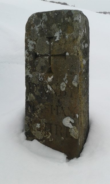
Bracken Hill Images

Images are sourced within 2km of 54.217451/-1.8627458 or Grid Reference SE0980. Thanks to Geograph Open Source API. All images are credited.

Snowed heather tussocks on Great Haw The view east from Great Haw over moorland with the undulating ground of the North Yorks Moors in the distance. The stream groove to the right in the image will be of a tributary of Steel House Gill.
Snowed heather tussocks on Great Haw
The view east from Great Haw over moorland with the undulating ground of the North Yorks Moors in the distance. The stream groove to the right in the image will be of a tributary of Steel House Gill.
Fence near Thorny Grane Head Remote stretch of moorland, with the cloud ceiling dropped to make a greater sense of isolation.  The fence and boundary wall stretches all the way from Great Whernside to above Lofthouse - at least 10 miles in length.
Fence near Thorny Grane Head
Remote stretch of moorland, with the cloud ceiling dropped to make a greater sense of isolation. The fence and boundary wall stretches all the way from Great Whernside to above Lofthouse - at least 10 miles in length.
Boundary Fence on Thorny Grane Head The convenient track beside the fence does not last for long - it becomes very difficult terrain further towards South Haw.
Boundary Fence on Thorny Grane Head
The convenient track beside the fence does not last for long - it becomes very difficult terrain further towards South Haw.
South Haw At 499 metres this small height rises out of a sea of moorland - and is visible from miles around.
South Haw
At 499 metres this small height rises out of a sea of moorland - and is visible from miles around.
Fence leading up to South Haw The summit just visible below a low cloud ceiling - an island in a sea of moor.
Fence leading up to South Haw
The summit just visible below a low cloud ceiling - an island in a sea of moor.
Bridleway approaching Steel House Gill Part of the bridleway between South Haw and the upper reaches of Steel House Gill.  This is unusual for a bridleway, or indeed public footpath crossing the extensive and tractless moors of this area - it is actually visible on the ground and easy to follow, in fact a pleasure to follow.
Bridleway approaching Steel House Gill
Part of the bridleway between South Haw and the upper reaches of Steel House Gill. This is unusual for a bridleway, or indeed public footpath crossing the extensive and tractless moors of this area - it is actually visible on the ground and easy to follow, in fact a pleasure to follow.
Bridleway between South Haw and Steel House Gill Isolated and deserted bridleway carving its way through tractless moorland - amazingly it is visible on the ground with evidence of usage.
Bridleway between South Haw and Steel House Gill
Isolated and deserted bridleway carving its way through tractless moorland - amazingly it is visible on the ground with evidence of usage.
Track above Steel House Gill heading West Substantial track engineered above Steel House Gill giving access onto the tractless moors beyond
Track above Steel House Gill heading West
Substantial track engineered above Steel House Gill giving access onto the tractless moors beyond
Track above Steel House Gill heading East Substantial track following high above the course of Steel House Gill, before joining Long Gill to come the River Burn
Track above Steel House Gill heading East
Substantial track following high above the course of Steel House Gill, before joining Long Gill to come the River Burn
Steel House Gill Rising between South Haw and Great Haw, several tributaries enter this narrow valley to form Steel House Gill.  Further down Long Gill comes in from the north combining to create the River Burn.
Steel House Gill
Rising between South Haw and Great Haw, several tributaries enter this narrow valley to form Steel House Gill. Further down Long Gill comes in from the north combining to create the River Burn.
View towards Little Haw Looking north from the base of Great Haw - towards its little brother.
View towards Little Haw
Looking north from the base of Great Haw - towards its little brother.
Beldin Gill
Beldin Gill
Steel House Gill
Steel House Gill
Little or South Haw A fine prominence although lower than Great Haw beyond
Little or South Haw
A fine prominence although lower than Great Haw beyond
Valley of the River Burn Looking downstream along the valley of the River Burn, including the fenced off site of a former mine shaft.
Valley of the River Burn
Looking downstream along the valley of the River Burn, including the fenced off site of a former mine shaft.
Boundary Stone on South Haw top Inscribed boundary stone, the other side of the stone depicted in <a href="https://www.geograph.org.uk/photo/733487">SE0878 : South Haw top North Yorkshire</a>.  This side reads "Danby Mashamshire".  The Danby Family were owners of the Swinton Estate, and included William Danby, who was responsible for building the folly near Ilton known as the Druids Temple (See <a href="https://www.geograph.org.uk/photo/5369872">SE1778 : Druid's Temple</a>, for example).
Boundary Stone on South Haw top
Inscribed boundary stone, the other side of the stone depicted in SE0878 : South Haw top North Yorkshire. This side reads "Danby Mashamshire". The Danby Family were owners of the Swinton Estate, and included William Danby, who was responsible for building the folly near Ilton known as the Druids Temple (See SE1778 : Druid's Temple, for example).
Old Boundary Marker Estate Boundary Marker in the summit ditch of Great Haw. On the former boundary of Stonebeck Up, Colsterdale and West Scrafton parishes, now Colsterdale, Healey, Stonebeck Up and West Scrafton parishes. Inscribed + / T YORKE; NETHER / DALE / FOREST and + / DANBY / MASHAM / SHIRE on three faces.

Milestone Society National ID: YW_STUP03em
Old Boundary Marker
Estate Boundary Marker in the summit ditch of Great Haw. On the former boundary of Stonebeck Up, Colsterdale and West Scrafton parishes, now Colsterdale, Healey, Stonebeck Up and West Scrafton parishes. Inscribed + / T YORKE; NETHER / DALE / FOREST and + / DANBY / MASHAM / SHIRE on three faces. Milestone Society National ID: YW_STUP03em
Old Boundary Marker Estate Boundary Marker on the highest point of South Haw. On the former boundary of Colsterdale and Stonebeck Up parishes. Now Healey and Stonebeck Up parishes. Inscribed + / T YORKE; NETHER / DALE / FOREST and + / DANBY / MASHAM / SHIRE on three faces. See also <a title="https://www.geograph.org.uk/photo/5629717" href="https://www.geograph.org.uk/photo/5629717">Link</a>.

Milestone Society National ID: YW_STUP04em
Old Boundary Marker
Estate Boundary Marker on the highest point of South Haw. On the former boundary of Colsterdale and Stonebeck Up parishes. Now Healey and Stonebeck Up parishes. Inscribed + / T YORKE; NETHER / DALE / FOREST and + / DANBY / MASHAM / SHIRE on three faces. See also Link. Milestone Society National ID: YW_STUP04em
Show me another place!

Bracken Hill is located at Grid Ref: SE0980 (Lat: 54.217451, Lng: -1.8627458)

Division: North Riding

Administrative County: North Yorkshire

District: Harrogate

Police Authority: North Yorkshire

What 3 Words

///limelight.married.shoulders. Near Leyburn, North Yorkshire

Nearby Locations

Bracken Hill

Related Wikis

West Scrafton

West Scrafton is a village and civil parish in Coverdale in the Yorkshire Dales, England. It is located 4 miles (6.4 km) south west of Leyburn. It falls...

Colsterdale

Colsterdale is the valley of the River Burn, a tributary of the River Ure, in the Yorkshire Dales in North Yorkshire, England. It gives its name to a hamlet...

Nidderdale Caves

The Nidderdale Caves are a series of caves in Upper Nidderdale in North Yorkshire, England. There are two cave systems and most of the caves are in some...

Horsehouse

Horsehouse is a village in Coverdale in the Yorkshire Dales, North Yorkshire, England. It is listed as a hamlet in many texts, but the presence of the...

Nearby Amenities

Located within 500m of 54.217451,-1.8627458
Ford: yes
Lat/Long: 54.2198003/-1.8638148
The data included in this document is from www.openstreetmap.org. The data is made available under ODbL.

Have you been to Bracken Hill?

Leave your review of Bracken Hill below (or comments, questions and feedback).