Kinder Scout

Hill, Mountain in Derbyshire High Peak

England

Kinder Scout

Crowden Tower Looking along the escarpment to Crowden Tower
Crowden Tower Credit: Shaun Ferguson

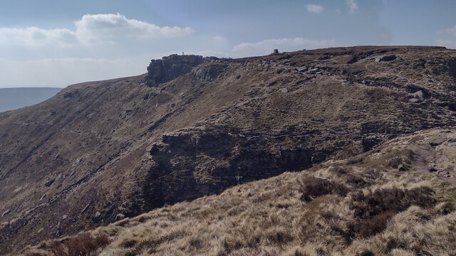
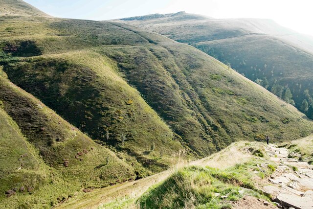
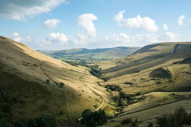
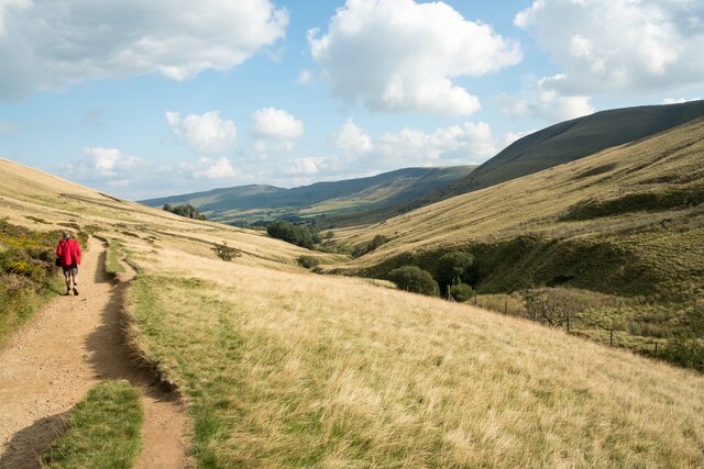
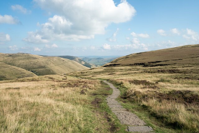
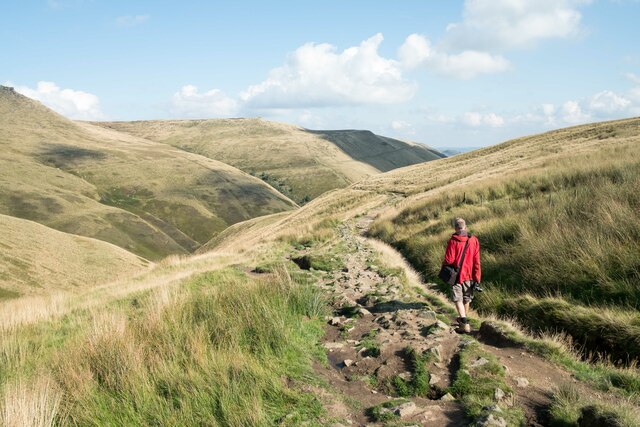
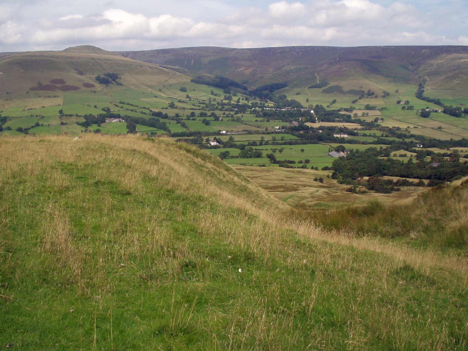
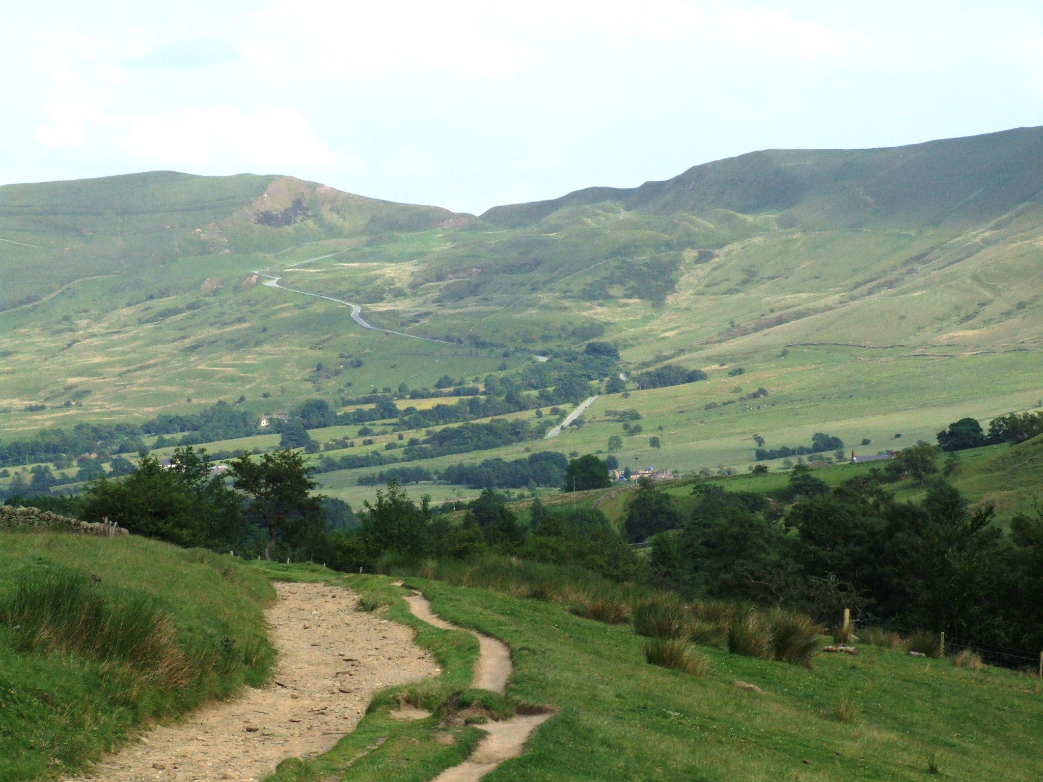
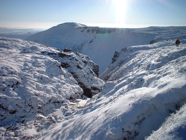
Kinder Scout, located in the county of Derbyshire, England, is a prominent hill and the highest point in the Peak District National Park. Rising to an elevation of 636 meters (2,087 feet), it is often referred to as a mountain due to its rugged terrain and commanding presence. Kinder Scout is situated within the Dark Peak area of the Peak District, known for its wild and untamed landscapes.

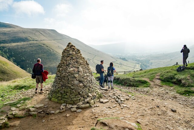
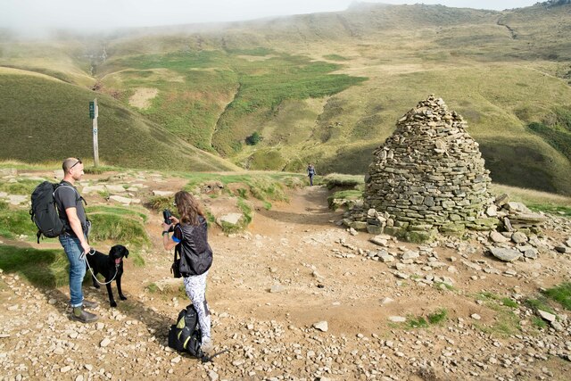
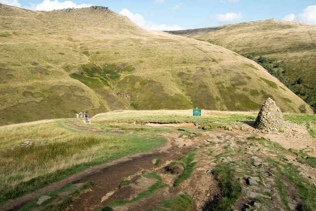
The hill is composed primarily of millstone grit, resulting in its distinctive rocky outcrops and gritstone edges. These features attract outdoor enthusiasts, including hikers and climbers, who are drawn to the challenge and beauty of the area. The summit of Kinder Scout is marked by a trig point, offering panoramic views across the surrounding countryside.

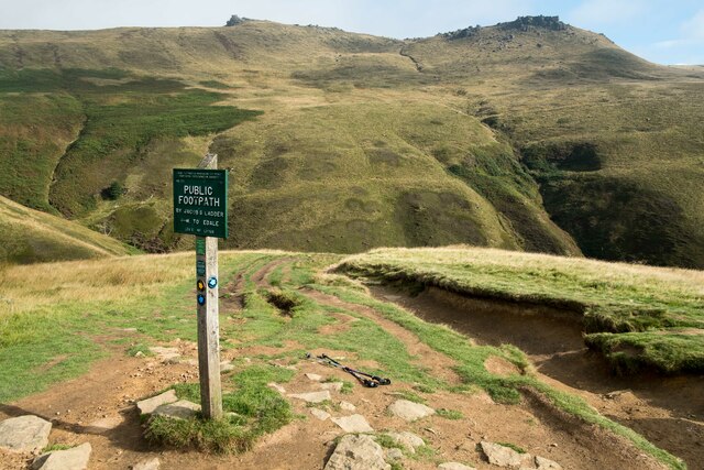
Kinder Scout has historical significance as well, particularly in relation to the access rights of British citizens to open spaces. In 1932, a mass trespass event took place when a group of ramblers protested against the lack of public access to the hill. This ultimately led to the establishment of the Countryside and Rights of Way Act 2000, granting greater access to the countryside for recreation.

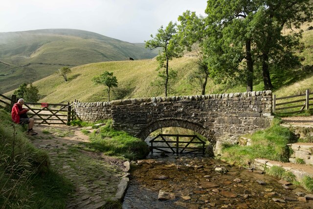
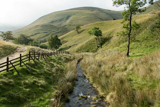
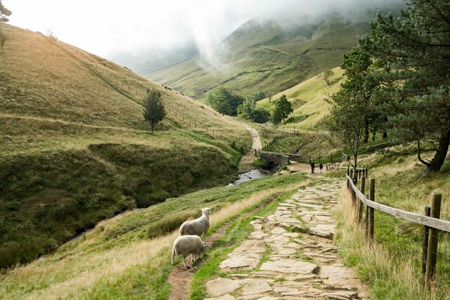
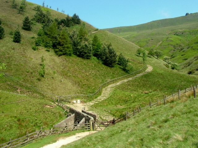
Today, Kinder Scout remains a popular destination for outdoor activities such as walking, running, and birdwatching. The hill is home to a variety of flora and fauna, including several bird species and moorland plants. Visitors can explore its extensive network of footpaths, including the Pennine Way, which passes through the area. With its rugged beauty and cultural significance, Kinder Scout continues to captivate and inspire all those who venture to its heights.

If you have any feedback on the listing, please let us know in the comments section below.

Kinder Scout Images

Images are sourced within 2km of 53.384467/-1.8734173 or Grid Reference SK0887. Thanks to Geograph Open Source API. All images are credited.

Crowden Tower Looking along the escarpment to Crowden Tower
Crowden Tower
Looking along the escarpment to Crowden Tower
Wool Packs Wool Packs rocky shapes
Wool Packs
Wool Packs rocky shapes
Noe Stool The path to Kinder Scout passing Noe Stool
Noe Stool
The path to Kinder Scout passing Noe Stool
Trig Point Kinder Scout Low Trig Point
Trig Point
Kinder Scout Low Trig Point
Edale Rocks From Swine's Back the path nearing Edale Rocks
Edale Rocks
From Swine's Back the path nearing Edale Rocks
The Pack Horse Bridge below Jacob's Ladder Walkers ascending Jacob's Ladder on the Pennine Way from Upper Booth will first of all walk across this ancient pack horse bridge which crosses the River Noe.
The Pack Horse Bridge below Jacob's Ladder
Walkers ascending Jacob's Ladder on the Pennine Way from Upper Booth will first of all walk across this ancient pack horse bridge which crosses the River Noe.
The River Noe below Jacob's Ladder Looking south along the River Noe from the old packhorse bridge below Jacob's Ladder.
The River Noe below Jacob's Ladder
Looking south along the River Noe from the old packhorse bridge below Jacob's Ladder.
On Jacob's Ladder Looking down on Jacob's Ladder towards the old packhorse bridge and the River Noe.
On Jacob's Ladder
Looking down on Jacob's Ladder towards the old packhorse bridge and the River Noe.
View from Jacob's Ladder View of the Peak District landscape from Jacob's Ladder.
View from Jacob's Ladder
View of the Peak District landscape from Jacob's Ladder.
Cairn at the top of Jacob's Ladder Walkers admire the view towards the Vale of Edale at the top of Jacob's Ladder.
Cairn at the top of Jacob's Ladder
Walkers admire the view towards the Vale of Edale at the top of Jacob's Ladder.
At the top of Jacob's Ladder The cairn at the top of Jacob's Ladder.
At the top of Jacob's Ladder
The cairn at the top of Jacob's Ladder.
The Pennine Way at the top of Jacob's Ladder The Pennine Way where it reaches the top of Jacob's Ladder.
The Pennine Way at the top of Jacob's Ladder
The Pennine Way where it reaches the top of Jacob's Ladder.
The Pennine Way The Pennine Way as it reaches the top of Jacob's Ladder.
The Pennine Way
The Pennine Way as it reaches the top of Jacob's Ladder.
The Vale of Edale The view southeast along the Vale of Edale from the top of Jacob's Ladder.
The Vale of Edale
The view southeast along the Vale of Edale from the top of Jacob's Ladder.
The Pennine Way along the Vale of Edale Walking the Pennine Way as it heads along the Vale of Edale towards Upper Booth.
The Pennine Way along the Vale of Edale
Walking the Pennine Way as it heads along the Vale of Edale towards Upper Booth.
Path near Edale Cross Not quite the Pennine Way at this point but a short cut before getting back on the path.
Path near Edale Cross
Not quite the Pennine Way at this point but a short cut before getting back on the path.
The Pennine Way near the Cloughs Heading east along the Pennine Way towards Jacobs Ladder. The area of landscape known as The Cloughs can be seen on the left.
The Pennine Way near the Cloughs
Heading east along the Pennine Way towards Jacobs Ladder. The area of landscape known as The Cloughs can be seen on the left.
View from Edale Rocks towards the Pennine Way Looking south from Edale Rocks down towards the Pennine Way in the Peak District.
View from Edale Rocks towards the Pennine Way
Looking south from Edale Rocks down towards the Pennine Way in the Peak District.
Show me another place!

Kinder Scout is located at Grid Ref: SK0887 (Lat: 53.384467, Lng: -1.8734173)

Administrative County: Derbyshire

District: High Peak

Police Authority: Derbyshire

What 3 Words

///ratty.exposes.geese. Near High Peak, Derbyshire

Nearby Locations

Kinder Scout

Related Wikis

Kinder Scout

Kinder Scout is a moorland plateau and national nature reserve in the Dark Peak of the Derbyshire Peak District in England. Part of the moor, at 636 metres...

Jacob's Ladder, Derbyshire

Jacob's Ladder is a bridleway between Kinder Scout plateau and the hamlet of Upper Booth in the Vale of Edale, in the Derbyshire Peak District of England...

Mermaid's Pool (Peak District)

Mermaid's Pool is a small pool on Kinder Scout in Derbyshire, England, which, according to legend, is inhabited by a beautiful mermaid who can be seen...

Forest of High Peak

The Forest of High Peak was, in medieval times, a moorland forest covering most of the north west of Derbyshire, England, extending as far south as Tideswell...

Vale of Edale

The Vale of Edale is the upper valley of the River Noe, in the Derbyshire Peak District of England. The village of Edale lies in the middle of the valley...

Brown Knoll

Brown Knoll is one of the highest hills in the Peak District in central England. It rises to a height of 569 metres (1,867 ft) above the head of the Edale...

Grindslow Knoll

Grindslow Knoll is a hill in the Dark Peak area of the Peak District National Park in Derbyshire, England. It is joined to Kinder Scout by a high col though...

Cowburn Tunnel

The Cowburn Tunnel is a railway tunnel at the western end of the Vale of Edale in the Derbyshire Peak District of England. The tunnel is 3,702 yards (3...

Nearby Amenities

Located within 500m of 53.384467,-1.8734173
Kinder Scout
Access: yes
Ele: 636
Natural: peak
Wikidata: Q1741750
Wikipedia: en:Kinder Scout
Lat/Long: 53.3848179/-1.8739001
The data included in this document is from www.openstreetmap.org. The data is made available under ODbL.

Have you been to Kinder Scout?

Leave your review of Kinder Scout below (or comments, questions and feedback).