Byers Hill

Hill, Mountain in Yorkshire Richmondshire

England

Byers Hill

Summit area of  How Tallon The actual summit is occupied by a trig point behind which seems to be a discarded gatepost. How Tallon is an ancient burial site and other archaeological remains are in the area. Andy Waddington gives much more information - <a title="https://www.geograph.org.uk/photo/1597315" href="https://www.geograph.org.uk/photo/1597315">Link</a> .
Summit area of How Tallon Credit: Trevor Littlewood

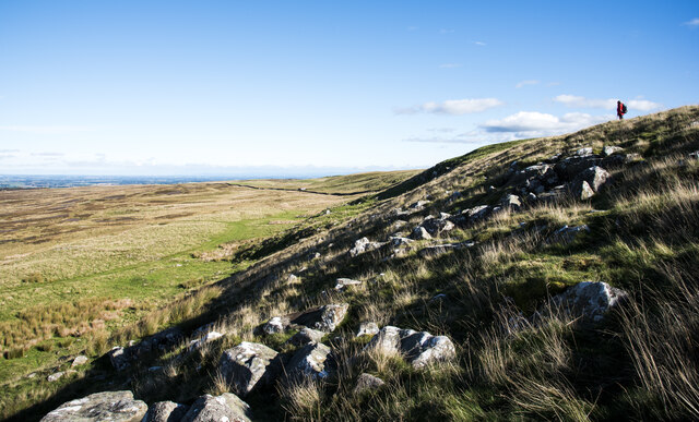
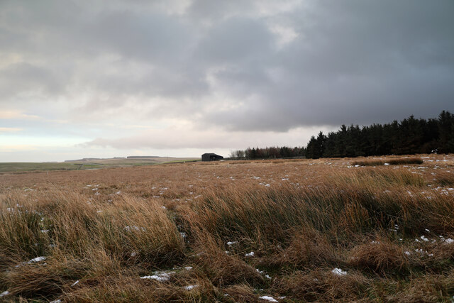
Byers Hill is a prominent geographical feature located in the county of Yorkshire, England. Rising to an elevation of approximately 434 meters (1,424 feet), it is classified as a hill rather than a mountain. Situated within the North York Moors National Park, Byers Hill offers breathtaking panoramic views of the surrounding countryside and is a popular destination for outdoor enthusiasts.

The hill is formed predominantly of sandstone and features a rugged terrain characterized by steep slopes and undulating ridges. Its distinctive shape and prominent position make it a recognizable landmark within the region. Byers Hill is part of a larger network of hills and valleys that contribute to the diverse landscape of Yorkshire.

The area surrounding Byers Hill is rich in natural beauty and biodiversity. It is home to a variety of flora and fauna, including heather moorland, grasslands, and scattered woodland. The hill serves as a habitat for several species of birds, small mammals, and insects, making it a haven for wildlife enthusiasts and nature lovers.

For those seeking outdoor activities, Byers Hill offers numerous opportunities for hiking, walking, and mountain biking. There are several well-marked trails that lead to the summit, allowing visitors to explore the hill's stunning surroundings while enjoying the fresh air and tranquility of the area.

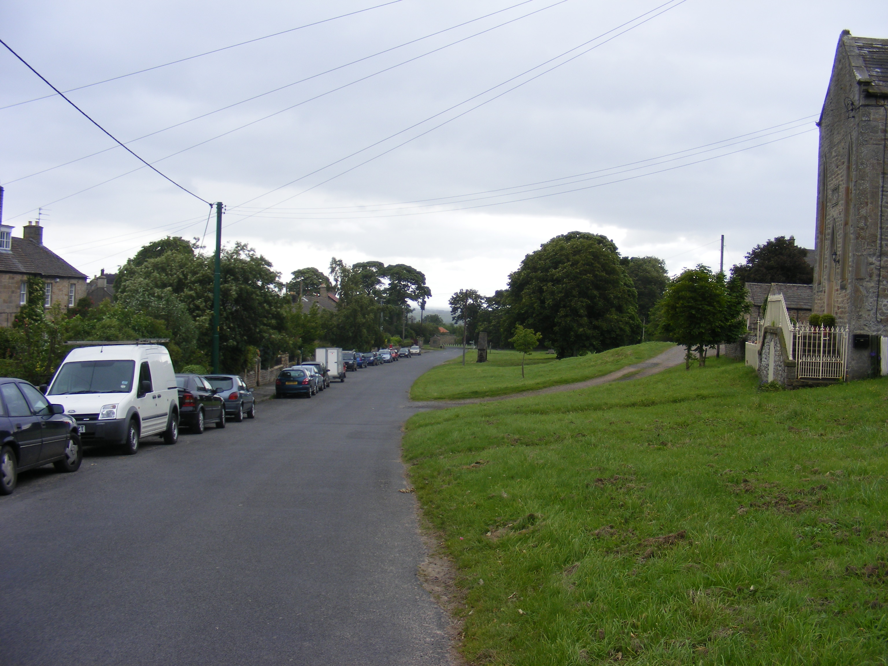
Access to Byers Hill is relatively easy, with nearby parking areas and footpaths providing convenient entry points. The hill is a popular destination for both locals and tourists alike, attracting visitors throughout the year who come to admire its natural beauty and experience the serenity of the Yorkshire countryside.

If you have any feedback on the listing, please let us know in the comments section below.

Byers Hill Images

Images are sourced within 2km of 54.463009/-1.8915465 or Grid Reference NZ0707. Thanks to Geograph Open Source API. All images are credited.

Summit area of  How Tallon The actual summit is occupied by a trig point behind which seems to be a discarded gatepost. How Tallon is an ancient burial site and other archaeological remains are in the area. Andy Waddington gives much more information - <a title="https://www.geograph.org.uk/photo/1597315" href="https://www.geograph.org.uk/photo/1597315">Link</a> .
Summit area of How Tallon
The actual summit is occupied by a trig point behind which seems to be a discarded gatepost. How Tallon is an ancient burial site and other archaeological remains are in the area. Andy Waddington gives much more information - Link .
Red flag flying The unfurled red flag indicates that there could be firing on the MOD's Feldom training area which lies to the right of the road: there was firing - it could be heard. The road is shown on OS maps as an 'other route with public access' which must refer only to unpowered use as signs tell that only farm and military vehicles can use this stretch.
Red flag flying
The unfurled red flag indicates that there could be firing on the MOD's Feldom training area which lies to the right of the road: there was firing - it could be heard. The road is shown on OS maps as an 'other route with public access' which must refer only to unpowered use as signs tell that only farm and military vehicles can use this stretch.
Boulder studded slope The slope lies to the north of How Tallon. The hill walker gives a sense of the extent of the scene.
Boulder studded slope
The slope lies to the north of How Tallon. The hill walker gives a sense of the extent of the scene.
Grassy way on north side of How Tallon The hill walker is approaching along a grassy track above which there's a steep bouldery slope which rises towards the local, minor summit at How Tallon. There's a trig point there and it's the location of a round barrow.
Grassy way on north side of How Tallon
The hill walker is approaching along a grassy track above which there's a steep bouldery slope which rises towards the local, minor summit at How Tallon. There's a trig point there and it's the location of a round barrow.
Osmaril Gill Osmaril Gill is the obvious slot with the darker rougher slope on its west side; Eel Hill is the rounded top above it.
The long, distant ridge on the right horizon is Mickle Fell.
Osmaril Gill
Osmaril Gill is the obvious slot with the darker rougher slope on its west side; Eel Hill is the rounded top above it. The long, distant ridge on the right horizon is Mickle Fell.
Moorland descending to pool The pool is on Barningham Moor and is seen looking downhill from the route of a bridleway of which there is little evidence on the ground.
The distant high ground is the moorland ridge forming the watershed between Teesdale (this side) and Weardale, beyond.
Moorland descending to pool
The pool is on Barningham Moor and is seen looking downhill from the route of a bridleway of which there is little evidence on the ground. The distant high ground is the moorland ridge forming the watershed between Teesdale (this side) and Weardale, beyond.
Simple grouse butt close to Barningham The butt is one of a line south-west of the village and is just a section of stone wall. Many, more sophisticated butts are circular so as to enclose the party within and often sunken into the ground.
Simple grouse butt close to Barningham
The butt is one of a line south-west of the village and is just a section of stone wall. Many, more sophisticated butts are circular so as to enclose the party within and often sunken into the ground.
Edge of free access At this boundary, the public bridleway leaves an area of CROW Access Land, so the sign would seem to be entirely within its rights to say "Keep to the public right of way". However, this is very much not the edge of the "Danger area" of Feldom range, as marked on the OS map, so either it is a little premature to be saying "Danger, Military Training Area" and warning of military debris that may explode and kill you, or the danger area is incorrectly depicted on the map. The MOD estates website refers to a "presumption of public access", and the Feldom byelaws specifically prohibit public access when the range is in use, in which case red flags will be flying (or red lights displayed). We haven't even got as far as where a flagpole can be seen (the nearest is still half a kilometre away over the horizon) but if this were the edge of the danger zone, then the sign restricting us to the public right of way would be in conflict with that presumption of public access. Whilst respecting the need for public safety and the freedom to prevent disruption to the operation of the range, one cannot help but feel that the MOD are being disingenuous with their signage.
Edge of free access
At this boundary, the public bridleway leaves an area of CROW Access Land, so the sign would seem to be entirely within its rights to say "Keep to the public right of way". However, this is very much not the edge of the "Danger area" of Feldom range, as marked on the OS map, so either it is a little premature to be saying "Danger, Military Training Area" and warning of military debris that may explode and kill you, or the danger area is incorrectly depicted on the map. The MOD estates website refers to a "presumption of public access", and the Feldom byelaws specifically prohibit public access when the range is in use, in which case red flags will be flying (or red lights displayed). We haven't even got as far as where a flagpole can be seen (the nearest is still half a kilometre away over the horizon) but if this were the edge of the danger zone, then the sign restricting us to the public right of way would be in conflict with that presumption of public access. Whilst respecting the need for public safety and the freedom to prevent disruption to the operation of the range, one cannot help but feel that the MOD are being disingenuous with their signage.
Right of Way into Feldom Range Behind the photographer, a bridleway leads to this point. Off to left, and straight ahead, there is an "Other route with public access" which the OS maps suggests enquiring of the local highway authority to determine the precise rights available. Some distance away, the route changes to a public footpath. The Feldom byelaws do give the Ministry of Defence the right to exclude the public when the range is in use for its intended purposes, in which case red flags would by flying (in daylight) or red lights showing. At all other times, as the MoD estates website makes clear, there is a presumption of public access to those ranges where this does not pose a significant risk. In particular, there is an absolute right to use these public rights of way when the range is not in use and a definite legal responsibility on the MoD to ensure that it is safe to do so. The signage has changed quite a bit since Trevor Littlewood's 2008 photograph <a href="https://www.geograph.org.uk/photo/2496239">NZ0806 : Entry to north end of MoD Feldom Range</a> but the message remains pretty much the same, and is just as misleading.
Right of Way into Feldom Range
Behind the photographer, a bridleway leads to this point. Off to left, and straight ahead, there is an "Other route with public access" which the OS maps suggests enquiring of the local highway authority to determine the precise rights available. Some distance away, the route changes to a public footpath. The Feldom byelaws do give the Ministry of Defence the right to exclude the public when the range is in use for its intended purposes, in which case red flags would by flying (in daylight) or red lights showing. At all other times, as the MoD estates website makes clear, there is a presumption of public access to those ranges where this does not pose a significant risk. In particular, there is an absolute right to use these public rights of way when the range is not in use and a definite legal responsibility on the MoD to ensure that it is safe to do so. The signage has changed quite a bit since Trevor Littlewood's 2008 photograph NZ0806 : Entry to north end of MoD Feldom Range but the message remains pretty much the same, and is just as misleading.
Outlying barn north of Long Green Farm There's a public footpath across the foreground field, but it looks even less used than some of the other ones in this area which criss-cross the moor with squelchy randomness. This one does at least seem to have logical destinations, linking at the farm with another path which passes the barn seen in the centre of the view. Further away, the horizon lies within the Feldom Military Training area which has rather fewer rights of way.
Outlying barn north of Long Green Farm
There's a public footpath across the foreground field, but it looks even less used than some of the other ones in this area which criss-cross the moor with squelchy randomness. This one does at least seem to have logical destinations, linking at the farm with another path which passes the barn seen in the centre of the view. Further away, the horizon lies within the Feldom Military Training area which has rather fewer rights of way.
Track on Barningham, Moor
Boardwalk To Access Grouse Butts ON Barningham Moor
Grouse Butts, Barningham Moor
Barningham Moor
Barningham Moor
How Tallon Trig Point The trig point sits atop a Bronze Age burial mound.
How Tallon Trig Point
The trig point sits atop a Bronze Age burial mound.
Osmaril Gill The dry gill or valley sits between How Tallon and Eel Hill. there is much evidence of Bronze Age habitation in close proximity, including a stone circle, burial mound and marked rocks.
Osmaril Gill
The dry gill or valley sits between How Tallon and Eel Hill. there is much evidence of Bronze Age habitation in close proximity, including a stone circle, burial mound and marked rocks.
Scale Knoll Gill Numerous small streams run off the moors into Scale Knoll Gill, the main source though comes from an unnamed tarn, created by digging out the peat to add diversity to the moorland ecosystem. The image looks up the course of the stream hidden within the moorland grasses towards the outlet from the tarn.
Scale Knoll Gill
Numerous small streams run off the moors into Scale Knoll Gill, the main source though comes from an unnamed tarn, created by digging out the peat to add diversity to the moorland ecosystem. The image looks up the course of the stream hidden within the moorland grasses towards the outlet from the tarn.
Moorland road towards Long Green Gate A remote corner of North Yorkshire with heathery moorland and some improved farmland not far off the 400m contour. The road is heading towards civilisation at Newsham, whilst just off picture to the right is Long Green Farm.
Moorland road towards Long Green Gate
A remote corner of North Yorkshire with heathery moorland and some improved farmland not far off the 400m contour. The road is heading towards civilisation at Newsham, whilst just off picture to the right is Long Green Farm.
Show me another place!

Byers Hill is located at Grid Ref: NZ0707 (Lat: 54.463009, Lng: -1.8915465)

Division: North Riding

Administrative County: North Yorkshire

District: Richmondshire

Police Authority: North Yorkshire

What 3 Words

///covenants.exhaling.drops. Near Barningham, Co. Durham

Nearby Locations

Byers Hill Badger Way

Related Wikis

New Forest, North Yorkshire

New Forest is a civil parish in the Richmondshire district of North Yorkshire, England. It lies 6 miles (10 km) west of Richmond. There is no village...

Barningham Park

Barningham Park is a Grade II* listed country house and 7,000 acre estate located in the village of Barningham, County Durham (formerly the North Riding...

Milbank Arms, Barningham

The Milbank Arms is a Grade II listed public house at Barningham, County Durham. Built in the early 19th century, it spent a period as a hotel before converting...

Barningham, County Durham

Barningham is a village in County Durham, in the Pennines of England. == History == Barningham is listed in the Domesday Book under the Gilling Wapentake...

Scargill, County Durham

Scargill is a hamlet in the Pennines of England, situated close to the River Greta. The population taken at the 2011 Census was less than 100. Details...

Brignall Banks

Brignall Banks is a Site of Special Scientific Interest in the Teesdale district of south-west County Durham, England. It consists of a narrow belt of...

Newsham, Richmondshire

Newsham is a village and civil parish in the Richmondshire district of North Yorkshire, England. The village is 8 miles (13 km) north west of Richmond...

Dalton, west North Yorkshire

Dalton is a village and civil parish in North Yorkshire in England. Dalton is situated about six miles north-west of Richmond and about five miles south...

Nearby Amenities

Located within 500m of 54.463009,-1.8915465
Byers Hill Farm
Place: farm
Lat/Long: 54.4623994/-1.8914534
The data included in this document is from www.openstreetmap.org. The data is made available under ODbL.

Have you been to Byers Hill?

Leave your review of Byers Hill below (or comments, questions and feedback).