Bieldy Pike
Hill, Mountain in Northumberland
England
Bieldy Pike

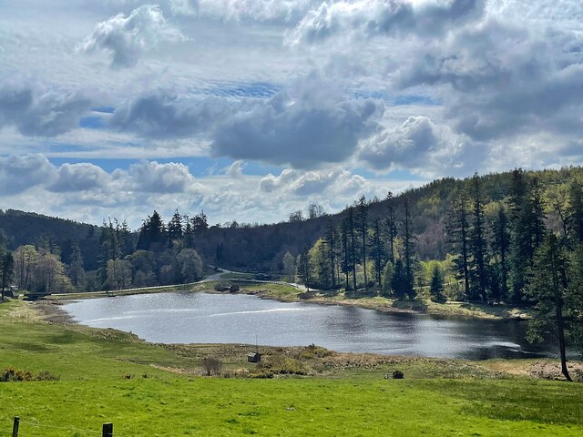
Bieldy Pike is a prominent hill situated in the county of Northumberland, England. This hill, also known as Shieldy Pike, is part of the Cheviot Hills range, which forms the border between England and Scotland. Standing at an elevation of approximately 586 meters (1,923 feet), Bieldy Pike offers breathtaking views of the surrounding countryside.
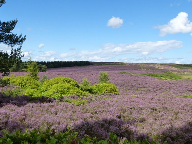
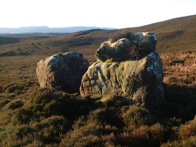
Located in the northern area of Northumberland National Park, Bieldy Pike is a popular destination for hikers and nature enthusiasts. Its distinctive shape, with a rounded summit and steep slopes, adds to its allure. The hill is characterized by its heather-clad slopes, rocky outcrops, and sparse vegetation.
To reach the summit of Bieldy Pike, there are various footpaths and trails available, offering a range of difficulty levels for hikers. One of the most popular routes starts from the nearby town of Wooler, winding through picturesque valleys and along the ridge of the Cheviot Hills. The ascent to the top is rewarded with panoramic views of the surrounding landscape, including the vast expanse of the national park and the Cheviot Hills in the distance.
Bieldy Pike is also known for its rich historical significance. The hill was once part of an ancient hillfort, with remnants of defensive earthworks still visible today. These archaeological features add a layer of intrigue to the area, attracting history enthusiasts and researchers alike.
Overall, Bieldy Pike in Northumberland offers a memorable outdoor experience, combining stunning natural beauty with a glimpse into the region's past.
If you have any feedback on the listing, please let us know in the comments section below.
Bieldy Pike Images
Images are sourced within 2km of 55.337054/-1.8918892 or Grid Reference NU0604. Thanks to Geograph Open Source API. All images are credited.


Bieldy Pike is located at Grid Ref: NU0604 (Lat: 55.337054, Lng: -1.8918892)
Unitary Authority: Northumberland
Police Authority: Northumbria
What 3 Words
///slope.windpipe.helps. Near Rothbury, Northumberland
Nearby Locations
Related Wikis
Northumberland Sandstone Hills
The Northumberland Sandstone Hills are a major natural region in the English county of Northumberland. The hills form distinctive skylines with generally...

Long Crag
Long Crag is a hill to the north of Rothbury in Northumberland, England. It lies within the Thrunton Woods, a Forestry Commission-owned area of forestry...

Cragside
Cragside is a Victorian Tudor Revival country house near the town of Rothbury in Northumberland, England. It was the home of William Armstrong, 1st Baron...

Cartington Castle
Cartington Castle is a ruinous, partly restored medieval English castle in the hamlet of Cartington, 2 miles (3.2 km) north-west of Rothbury in the county...

Thrum Mill, Rothbury, Northumberland
The Thrum Mill is a grade II-listed water mill in Rothbury, Northumberland, England. The water mill dates back to 1665. == Media == The renovation of Thrum...
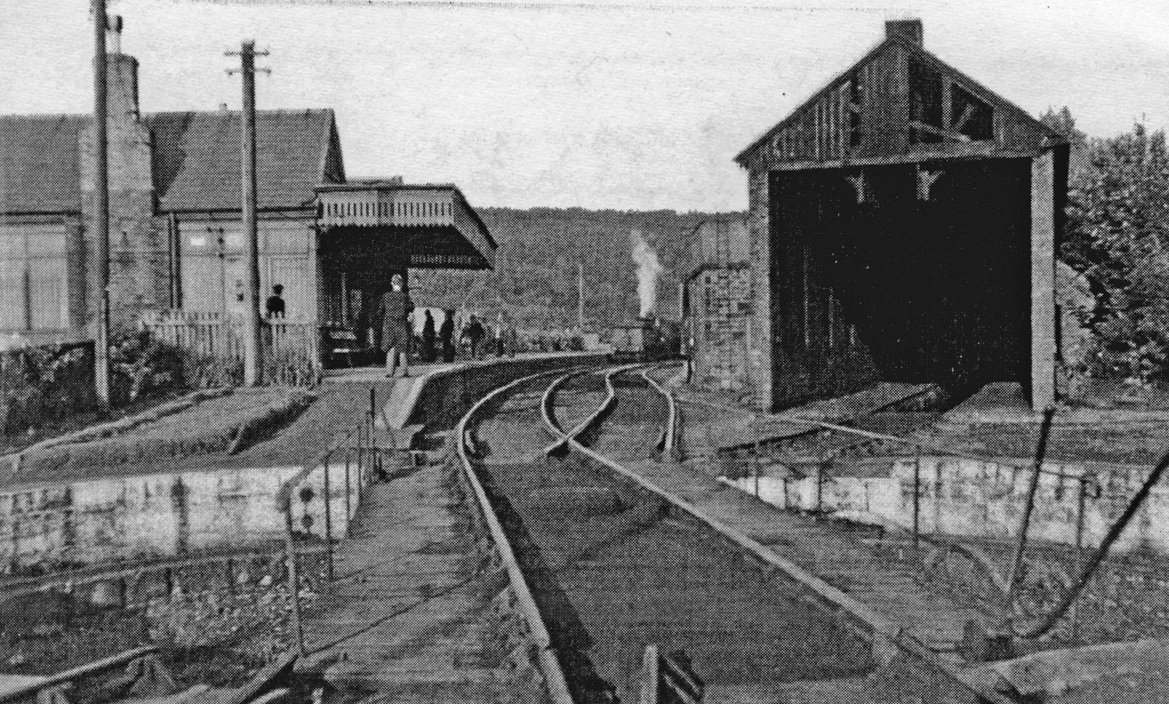
Rothbury railway station
Rothbury was a railway station in Northumberland, England at the end of the single-track Rothbury Branch that served the town of Rothbury. Rothbury was...

Rothbury
Rothbury is a market town and civil parish in Northumberland, England, on the River Coquet. It is 14 miles (22.5 km) northwest of Morpeth and 26 miles...

Cartington
Cartington is a village and former civil parish, now in the parish of Thropton, in Northumberland, England. It is about 11 miles (18 km) south west of...
Nearby Amenities
Located within 500m of 55.337054,-1.8918892Have you been to Bieldy Pike?
Leave your review of Bieldy Pike below (or comments, questions and feedback).