Scabbed Hill
Hill, Mountain in Yorkshire Craven
England
Scabbed Hill

Scabbed Hill is a prominent geographical feature located in the county of Yorkshire, England. As its name suggests, it is a hilly region that stands tall amidst the scenic landscape of Yorkshire. Rising to an elevation of approximately 500 meters (1,640 feet) above sea level, this natural formation is considered a hill rather than a mountain due to its moderate height.
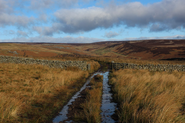
Situated in the northern part of Yorkshire, Scabbed Hill offers stunning panoramic views of the surrounding countryside. The hill is characterized by its rugged and rocky terrain, with patches of scree and loose gravel covering its slopes, hence the name "Scabbed." These rocky outcrops are a result of years of erosion and weathering.
Scabbed Hill is a popular destination for hikers, nature enthusiasts, and outdoor adventurers. Its extensive network of walking trails allows visitors to explore the hill and its surrounding areas. The hill is home to a diverse range of flora and fauna, with heather, grasses, and wildflowers dotting its slopes. Birdwatchers can also enjoy spotting various avian species, including buzzards, kestrels, and peregrine falcons soaring through the skies.
The hill is easily accessible by road, and there is ample parking available at its base. Local authorities have installed signposts and information boards to guide visitors and ensure their safety while exploring Scabbed Hill. It is advised to come prepared with appropriate footwear and clothing, as the weather conditions on the hill can change rapidly.
Overall, Scabbed Hill is a natural gem in Yorkshire, offering a captivating blend of rugged beauty, breathtaking views, and opportunities for outdoor activities.
If you have any feedback on the listing, please let us know in the comments section below.
Scabbed Hill Images
Images are sourced within 2km of 54.094549/-1.9257171 or Grid Reference SE0466. Thanks to Geograph Open Source API. All images are credited.


Scabbed Hill is located at Grid Ref: SE0466 (Lat: 54.094549, Lng: -1.9257171)
Division: West Riding
Administrative County: North Yorkshire
District: Craven
Police Authority: North Yorkshire
What 3 Words
///unless.masks.ringside. Near Grassington, North Yorkshire
Nearby Locations
Related Wikis
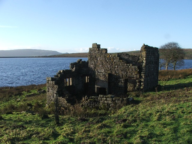
Grimwith Reservoir
Grimwith Reservoir is located in the Yorkshire Dales in North Yorkshire, England. It was originally built by the Bradford Corporation as one of eleven...
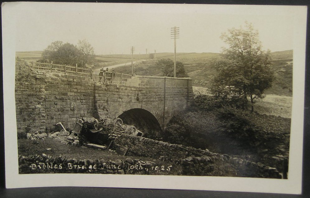
1925 Dibbles Bridge coach crash
On 10 June 1925, a coach crashed at the bottom of a steep hill at Dibbles Bridge, near Hebden in North Yorkshire, England. Seven people were killed and...

1975 Dibbles Bridge coach crash
On 27 May 1975, a coach carrying elderly passengers crashed at the bottom of a steep hill at Dibble's Bridge, near Hebden in North Yorkshire, England....

Priest's Tarn
Priest's Tarn is an upland lake on Grassington Moor, in North Yorkshire, England. The water from Priest's Tarn was historically used for hydraulic mining...

Meugher
Meugher (/ˈmuː.fər/) is a hill in the Yorkshire Dales, England. It lies in remote country between Wharfedale and Nidderdale, in the parish of Stonebeck...
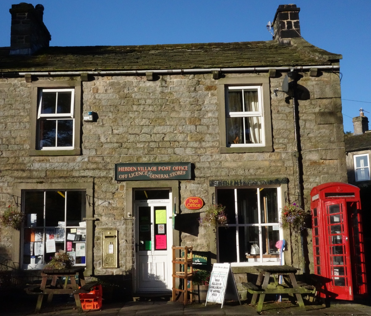
Hebden, North Yorkshire
Hebden ( HEB-dərn) is a village and civil parish in the Craven District of North Yorkshire, England, and one of four villages in the ecclesiastical parish...

Trollers Gill
Trollers Gill is a limestone gill or gorge in North Yorkshire, England, close to the village of Skyreholme and 4.7 miles (7.5 km) south-east of Grassington...

Stump Cross Caverns
Stump Cross Caverns is a limestone cave system between Wharfedale and Nidderdale in North Yorkshire, England. == Geography == The caverns at Stump Cross...
Nearby Amenities
Located within 500m of 54.094549,-1.9257171Have you been to Scabbed Hill?
Leave your review of Scabbed Hill below (or comments, questions and feedback).