Blackpool Hill

Hill, Mountain in Durham

England

Blackpool Hill

Waskerley Way
Waskerley Way Credit: Clive Nicholson

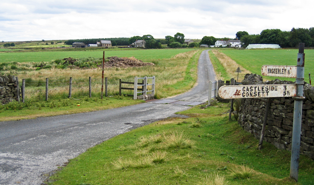
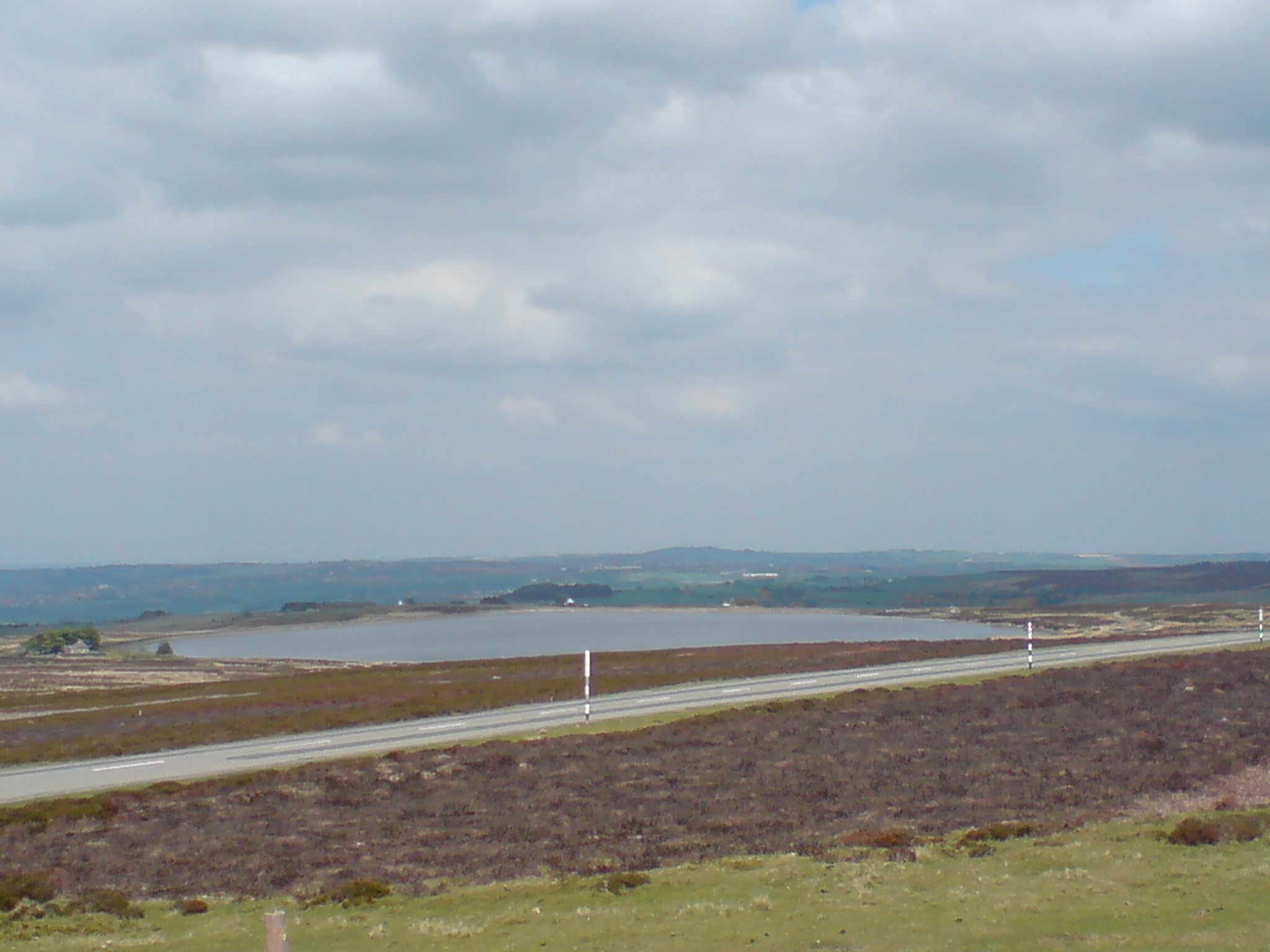
Blackpool Hill is a prominent geographical feature located in County Durham, England. Situated near the village of Blackpool, the hill is part of the larger Pennines range, renowned for its scenic beauty and diverse wildlife. Standing at an elevation of approximately 290 meters (951 feet), Blackpool Hill offers breathtaking panoramic views of the surrounding countryside.

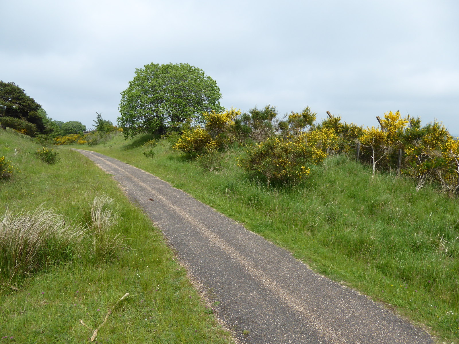
The hill is characterized by its gently sloping sides, covered in lush green grass and dotted with clusters of trees. The terrain is predominantly composed of limestone, which contributes to the unique flora and fauna found in the area. Visitors to Blackpool Hill can expect to encounter a variety of plant species, including heather, bilberry, and bracken, as well as numerous bird species such as skylarks and curlews.

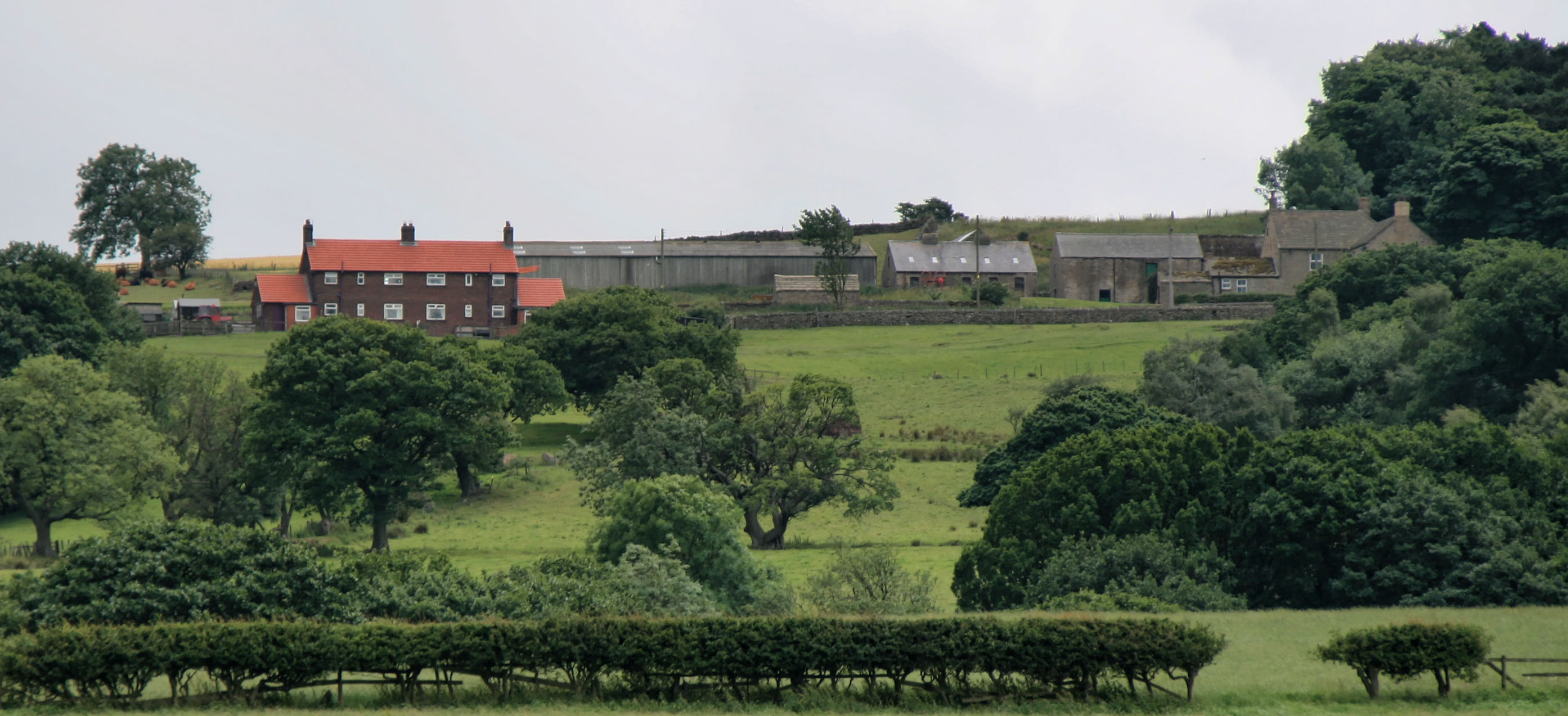
Blackpool Hill also holds historical significance, with evidence of human occupation dating back to the Bronze Age. Archaeological remains, including burial mounds and stone circles, highlight the area's rich cultural heritage. The hill has also been utilized for agricultural purposes, with sheep farming being a common activity in the surrounding fields.

The location of Blackpool Hill makes it an ideal destination for outdoor enthusiasts and nature lovers. Hiking and walking trails crisscross the area, allowing visitors to explore the hill's natural beauty at their own pace. On a clear day, the summit of Blackpool Hill provides a stunning vantage point, offering unobstructed views of the surrounding Durham landscape.

In conclusion, Blackpool Hill in Durham is a picturesque and historically significant hill, offering visitors a chance to immerse themselves in the natural beauty and cultural heritage of the region.

If you have any feedback on the listing, please let us know in the comments section below.

Blackpool Hill Images

Images are sourced within 2km of 54.81534/-1.9264126 or Grid Reference NZ0446. Thanks to Geograph Open Source API. All images are credited.

Waskerley Way
Waskerley Way
Waskerley Way Just entering the pine wood at Waskerley village.
Waskerley Way
Just entering the pine wood at Waskerley village.
Horseshoe Bridge On the original railway to Waskerley, before the deviation was built.
Horseshoe Bridge
On the original railway to Waskerley, before the deviation was built.
Smiddy Shaw Reservoir On horizon near right Pontop Pike TV mast can be seen.
Smiddy Shaw Reservoir
On horizon near right Pontop Pike TV mast can be seen.
Waskerley Village
Waskerley Village
The Moorcock Inn Near to Smiddyshaw reservoir
The Moorcock Inn
Near to Smiddyshaw reservoir
Winter sunshine over Waskerley Way
Fell Close Close to medieval lead mines the derelict house in the background was built in 1760. It was once thatched in heather and the old beams known as cruck trusses (usually wood from the same tree) can still be seen.
Fell Close
Close to medieval lead mines the derelict house in the background was built in 1760. It was once thatched in heather and the old beams known as cruck trusses (usually wood from the same tree) can still be seen.
Ancient Door The original oak studded door of Fell Close House
Ancient Door
The original oak studded door of Fell Close House
Fell Close How sad that this ancient building be left to fall into dereliction. The crucks can clearly be seen which would have supported a heather thatch. An ancient oak door is around the corner to the left of the building.
Fell Close
How sad that this ancient building be left to fall into dereliction. The crucks can clearly be seen which would have supported a heather thatch. An ancient oak door is around the corner to the left of the building.
Fell Close On a clear day you can see forever.
Fell Close
On a clear day you can see forever.
View from Fell Close A rather dull and cloudy day spoilt an otherwise magnificent view.
View from Fell Close
A rather dull and cloudy day spoilt an otherwise magnificent view.
Catchwater Channel Catchwater Channel leading form Smiddy Shaw Reservoir to Hisehope Reservoir.  In the background one of several footbridges that cross the channel.  These were constructed by about 1872.
Catchwater Channel
Catchwater Channel leading form Smiddy Shaw Reservoir to Hisehope Reservoir. In the background one of several footbridges that cross the channel. These were constructed by about 1872.
Footpath on Muggleswick Common Footpath leading from Smiddy Shaw reservoir to Lamb Shield Farm
Footpath on Muggleswick Common
Footpath leading from Smiddy Shaw reservoir to Lamb Shield Farm
Waskerley Way This disused railway - the Stanhope and Tyne Railway was built to serve the needs of the Weardale lead and iron ore mining industries in the 19th century; the section in the photo is part of the nearly level summit section at 400 metres, the highest section of standard gauge railway in Britain <span class="nowrap"><a title="http://www.durham.gov.uk/miner/projects.nsf/581cd74a9c6aa8b080256d48003758cb/bb96ba295948449580256e8a004f0ba8?OpenDocument" rel="nofollow ugc noopener" href="http://www.durham.gov.uk/miner/projects.nsf/581cd74a9c6aa8b080256d48003758cb/bb96ba295948449580256e8a004f0ba8?OpenDocument">Link</a><img style="margin-left:2px;" alt="External link" title="External link - shift click to open in new window" src="https://s1.geograph.org.uk/img/external.png" width="10" height="10"/></span> . The line is now the Waskerley Way, a component part of the C2C cycle route which crosses northern England from coast to coast <span class="nowrap"><a title="http://www.sustrans.org.uk/default.asp?sID=1094747349296" rel="nofollow ugc noopener" href="http://www.sustrans.org.uk/default.asp?sID=1094747349296">Link</a><img style="margin-left:2px;" alt="External link" title="External link - shift click to open in new window" src="https://s1.geograph.org.uk/img/external.png" width="10" height="10"/></span> <span class="nowrap"><a title="http://www.c2c-guide.co.uk/" rel="nofollow ugc noopener" href="http://www.c2c-guide.co.uk/">Link</a><img style="margin-left:2px;" alt="External link" title="External link - shift click to open in new window" src="https://s1.geograph.org.uk/img/external.png" width="10" height="10"/></span> . In the trees in the distance is Waskerley village <a href="https://www.geograph.org.uk/gridref/NZ0545">NZ0545</a>.
Waskerley Way
This disused railway - the Stanhope and Tyne Railway was built to serve the needs of the Weardale lead and iron ore mining industries in the 19th century; the section in the photo is part of the nearly level summit section at 400 metres, the highest section of standard gauge railway in Britain LinkExternal link . The line is now the Waskerley Way, a component part of the C2C cycle route which crosses northern England from coast to coast LinkExternal link LinkExternal link . In the trees in the distance is Waskerley village NZ0545.
Edge of the moor above Waskerley village
Sheep's breakfast, Waskerley village Waskerley village now consists of just a couple of houses, but at one time was an important railway settlement housing several hundred people. <span class="nowrap"><a title="http://www.durham.gov.uk/miner/projects.nsf/581cd74a9c6aa8b080256d48003758cb/bb96ba295948449580256e8a004f0ba8?OpenDocument" rel="nofollow ugc noopener" href="http://www.durham.gov.uk/miner/projects.nsf/581cd74a9c6aa8b080256d48003758cb/bb96ba295948449580256e8a004f0ba8?OpenDocument">Link</a><img style="margin-left:2px;" alt="External link" title="External link - shift click to open in new window" src="https://s1.geograph.org.uk/img/external.png" width="10" height="10"/></span>
Sheep's breakfast, Waskerley village
Waskerley village now consists of just a couple of houses, but at one time was an important railway settlement housing several hundred people. LinkExternal link
A secure building Adjoining the reservoir one can only guess at the use of this building. It once had a large opening in the side, now blocked up, so must be awfully dark inside.
A secure building
Adjoining the reservoir one can only guess at the use of this building. It once had a large opening in the side, now blocked up, so must be awfully dark inside.
Show me another place!

Blackpool Hill is located at Grid Ref: NZ0446 (Lat: 54.81534, Lng: -1.9264126)

Unitary Authority: County Durham

Police Authority: Durham

What 3 Words

///warp.quest.different. Near Muggleswick, Co. Durham

Related Wikis

Hisehope Burn Valley

Hisehope Burn Valley is a Site of Special Scientific Interest in the Derwentside district of Durham, England. It consists of two separate parcels of land...

River Browney

The River Browney is a river in County Durham, England, and the largest tributary of the River Wear. The River Browney rises from a spring in Head Plantation...

Waskerley railway station

Waskerley railway station, also known as Waskerley Park, served the village of Waskerley, County Durham, England from 1845 to 1859 on the Stanhope and...

Waskerley

Waskerley is a village in County Durham, England. It is situated six miles to the southwest of Consett and three miles southwest of Castleside and the...

Derwent Gorge and Horsleyhope Ravine

Derwent Gorge and Horsleyhope Ravine is a Site of Special Scientific Interest in the Derwentside district of north County Durham and the Tynedale district...

Horsleyhope

Horsleyhope is a village in County Durham, England. It is situated a few miles to the south-west of Consett. == References ==

Burnhill railway station

Burnhill railway station served the village of Waskerley, County Durham, England, from 1859 to 1939 on the Stanhope and Tyne Railway. == History == The...

Healeyfield

Healeyfield is a village and civil parish in County Durham, England. The population of the civil parish taken from the 2011 census was 1,544. It is situated...

Nearby Amenities

Located within 500m of 54.81534,-1.9264126
Bus Stop
Honey Hill
Naptan AtcoCode: 13001826B
Naptan Bearing: NE
Naptan CommonName: Honey Hill
Naptan Indicator: north east bound
Naptan Landmark: Landmark not known
Naptan NaptanCode: durajpwt
Naptan Notes: 2 Honey Hill Cottages- on Goldhill Lane- south of junction with Healeyfield Lane- Muggleswick.
Naptan Street: Unclassified Road
Naptan Verified: no
Source: naptan_import
Lat/Long: 54.8171214/-1.9205562
Bus Stop
Honey Hill
Naptan AtcoCode: 13001826F
Naptan Bearing: SW
Naptan CommonName: Honey Hill
Naptan Indicator: south west bound
Naptan Landmark: Landmark not known
Naptan NaptanCode: durajtad
Naptan Notes: 2 Honey Hill Cottages- on Goldhill Lane- south of junction with Healeyfield Lane- Muggleswick.
Naptan Street: Unclassified Road
Naptan Verified: no
Source: naptan_import
Lat/Long: 54.8170674/-1.9204785
The data included in this document is from www.openstreetmap.org. The data is made available under ODbL.

Have you been to Blackpool Hill?

Leave your review of Blackpool Hill below (or comments, questions and feedback).