Cuckoo Hill

Hill, Mountain in Yorkshire Richmondshire

England

Cuckoo Hill

Footpath below Fremington Edge
Footpath below Fremington Edge Credit: David Martin

Cuckoo Hill is a prominent hill located in Yorkshire, England. Situated in the scenic Yorkshire Dales National Park, it offers breathtaking views and is a popular destination for hikers and nature enthusiasts.

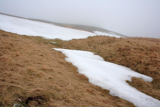
Rising to an elevation of approximately 500 meters, Cuckoo Hill boasts a distinctive shape that resembles a cuckoo's head, giving it its unique name. The hill is characterized by its gentle slopes and lush greenery, which are adorned with vibrant wildflowers during the spring and summer months.

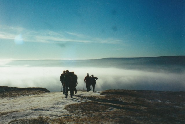
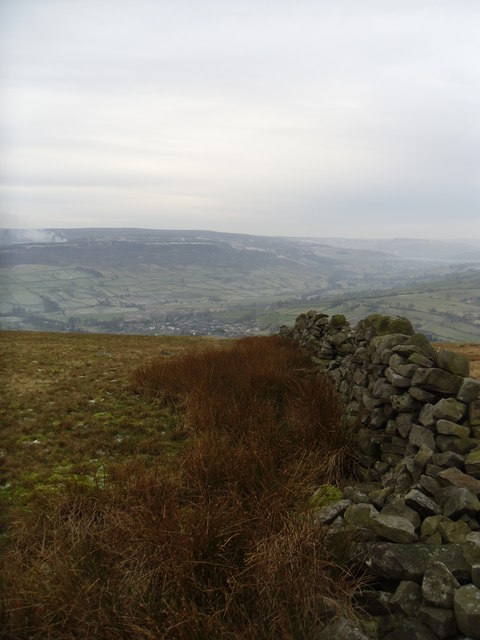
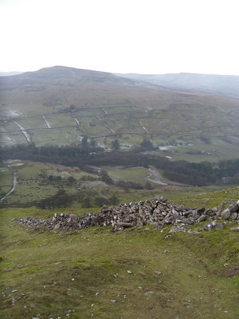
The summit of Cuckoo Hill provides panoramic vistas of the surrounding countryside, including rolling hills, picturesque valleys, and quaint villages. On clear days, it is even possible to catch a glimpse of the distant Pennine Mountains. The area is also known for its diverse wildlife, with species such as red grouse, curlews, and lapwings often spotted in the vicinity.

Access to Cuckoo Hill is relatively easy, with several well-marked trails leading to its summit. The most popular route begins from the nearby village of Grassington, taking walkers through beautiful meadows, woodlands, and past charming stone walls. It is advisable to wear appropriate footwear and carry a map when venturing onto the hill, as the terrain can be uneven and challenging in places.

Overall, Cuckoo Hill is a magnificent natural landmark in Yorkshire, offering visitors a chance to immerse themselves in the region's stunning landscapes and tranquil surroundings. Whether for a leisurely stroll or a more challenging hike, this picturesque hill is sure to captivate all who venture to its summit.

If you have any feedback on the listing, please let us know in the comments section below.
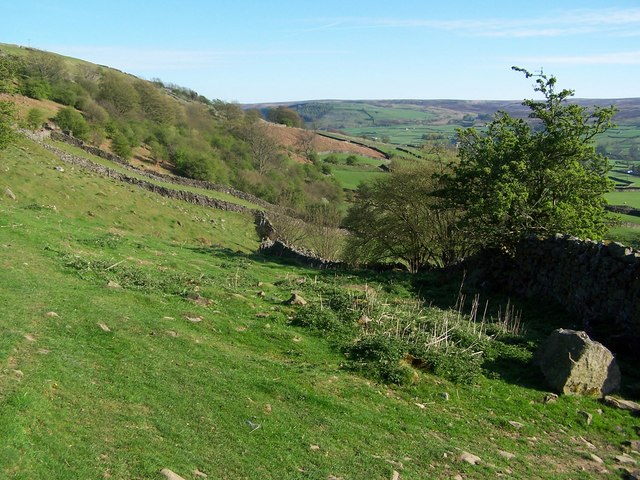
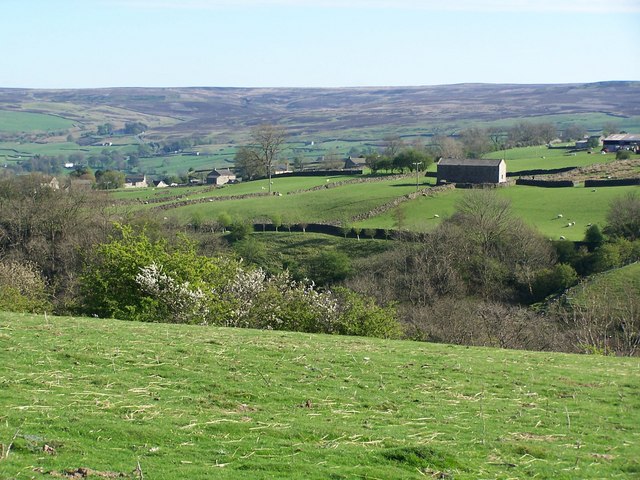
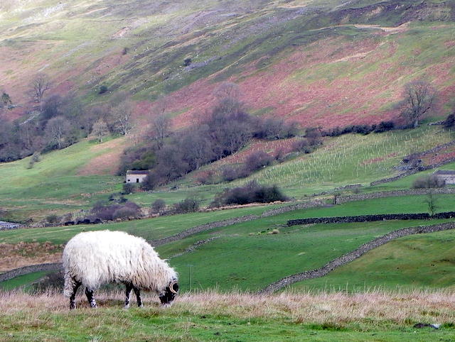
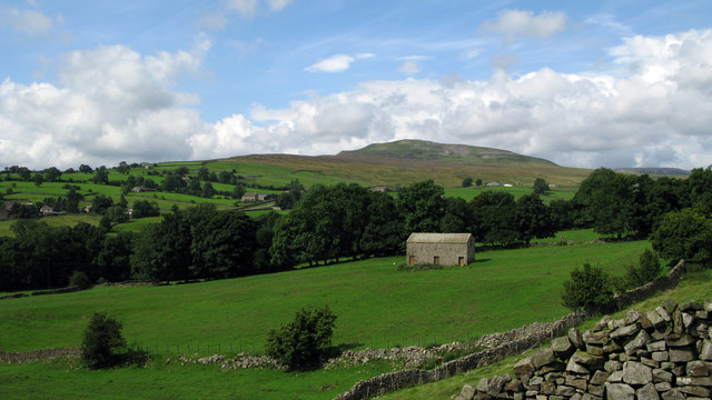
Cuckoo Hill Images

Images are sourced within 2km of 54.397318/-1.9343528 or Grid Reference NZ0400. Thanks to Geograph Open Source API. All images are credited.

Footpath below Fremington Edge
View across the Arkle Beck
View towards Fremington Edge Viewed from footpath on the southwestern side of the valley.
View towards Fremington Edge
Viewed from footpath on the southwestern side of the valley.
Grouse butts on Marrick Moor Heather moors need to be managed, as when left heather grows into a dense mass of long woody stems that support very little wildlife, has no grazing or economic value, and is a serious fire risk. When managed, the result is patchwork effect we see in this area of the moor.  The oldest heather providing cover and the new shoots providing food both for birds and sheep. 

The butts stretch across the hillside and at this time of the year they provide shelter for ewes with their lambs.
Grouse butts on Marrick Moor
Heather moors need to be managed, as when left heather grows into a dense mass of long woody stems that support very little wildlife, has no grazing or economic value, and is a serious fire risk. When managed, the result is patchwork effect we see in this area of the moor. The oldest heather providing cover and the new shoots providing food both for birds and sheep. The butts stretch across the hillside and at this time of the year they provide shelter for ewes with their lambs.
Swaledale ewe, Reeth The ewe grazes on the rough hill grasses.
Swaledale ewe, Reeth
The ewe grazes on the rough hill grasses.
Sheep grazing near Reeth Swaledale sheep graze the rough grasses above the valley.
Sheep grazing near Reeth
Swaledale sheep graze the rough grasses above the valley.
Minor road near Reeth There is an Ordnance Survey bench mark on the north east parapet of the bridge.  Watson House is in the distance.
Minor road near Reeth
There is an Ordnance Survey bench mark on the north east parapet of the bridge. Watson House is in the distance.
Bench Mark near Watson House The bench mark is to be found on the north east parapet on a small bridge near Watson House.  For a view of the bridge <a href="https://www.geograph.org.uk/photo/2398889">NZ0200 : Minor road near Reeth</a> and for further information on the bench mark and others in the area <span class="nowrap"><a title="http://www.bench-marks.org.uk/bm37860" rel="nofollow ugc noopener" href="http://www.bench-marks.org.uk/bm37860">Link</a><img style="margin-left:2px;" alt="External link" title="External link - shift click to open in new window" src="https://s1.geograph.org.uk/img/external.png" width="10" height="10"/></span>
Bench Mark near Watson House
The bench mark is to be found on the north east parapet on a small bridge near Watson House. For a view of the bridge NZ0200 : Minor road near Reeth and for further information on the bench mark and others in the area LinkExternal link
Bales and barn near Reeth There is still plenty of feed to be had at this yard although the barn has seen better days.
Bales and barn near Reeth
There is still plenty of feed to be had at this yard although the barn has seen better days.
Arkengarthdale from near Cuckoo Hill The view is across the nearby cultivated fields of the east side of Arkengarthdale; the hill rising distantly is Calver Hill.
Arkengarthdale from near Cuckoo Hill
The view is across the nearby cultivated fields of the east side of Arkengarthdale; the hill rising distantly is Calver Hill.
Footpath on track at Fremington Edge
Castle Farm House A bleak setting.
Castle Farm House
A bleak setting.
Barn in Arkengarthdale. The path off Fremington edge.
Barn in Arkengarthdale.
The path off Fremington edge.
Old wall on Fremington Rdge A stiff walk from Reeth.
Old wall on Fremington Rdge
A stiff walk from Reeth.
Cairn on Marrick Moor High above Swaledale.
Cairn on Marrick Moor
High above Swaledale.
On Fremington Edge Looking down into Arkengarthdale.
On Fremington Edge
Looking down into Arkengarthdale.
In the Mist on Fremington Edge
Snowdrift, Marrick Moor
Show me another place!

Cuckoo Hill is located at Grid Ref: NZ0400 (Lat: 54.397318, Lng: -1.9343528)

Division: North Riding

Administrative County: North Yorkshire

District: Richmondshire

Police Authority: North Yorkshire

What 3 Words

///swung.warbler.placidly. Near Barningham, Co. Durham

Nearby Locations

Cuckoo Hill

Related Wikis

Reeth, Fremington and Healaugh

Reeth, Fremington and Healaugh is a civil parish in North Yorkshire, England. It consists of the three villages of Reeth, Fremington and Healaugh. As of...

Swaledale Museum

Swaledale Museum is a local museum in the village of Reeth, near Richmond in North Yorkshire, England. It covers rural history including life and work...

Fremington Edge

Fremington Edge is a 3-mile (5 km) long wall of crags and scree slopes that is situated to the north of the village of Reeth in Swaledale in the Yorkshire...

Reeth

Reeth is a village 11 miles (18 km) west of Richmond in North Yorkshire, England, in the civil parish of Reeth, Fremington and Healaugh. Historically part...

Nearby Amenities

Located within 500m of 54.397318,-1.9343528
Man Made: cairn
Lat/Long: 54.400102/-1.933422
Barrier: stile
Foot: designated
Lat/Long: 54.3965208/-1.9386229
Source: gps survey
Lat/Long: 54.396054/-1.939263
Bench
Lat/Long: 54.39686/-1.9323282
Source: gps survey
Lat/Long: 54.3952788/-1.9407162
Barrier: stile
Foot: designated
Lat/Long: 54.3945609/-1.9402941
Barrier: stile
Foot: designated
Lat/Long: 54.3950613/-1.9398369
Bench
Lat/Long: 54.3934141/-1.9324435
Old Radio Mast
Abandoned Man Made: tower
Description: remaining frustrum of former lattice mast
Tower Type: communication
Lat/Long: 54.3981234/-1.9283471
Disused: yes
Historic: mine_shaft
Man Made: mineshaft
Lat/Long: 54.3974824/-1.9266702
Barrier: stile
Foot: designated
Lat/Long: 54.3982578/-1.9278909
Barrier: stile
Foot: designated
Lat/Long: 54.3982339/-1.9279443
Barrier: stile
Foot: designated
Lat/Long: 54.3987136/-1.9358801
David Johnson
Historic: memorial
Lat/Long: 54.4005648/-1.9337829
Access: yes
Barrier: entrance
Lat/Long: 54.4015478/-1.9332936
Ford: yes
Lat/Long: 54.3967785/-1.9388469
Power: pole
Lat/Long: 54.3969649/-1.9335414
Power: pole
Lat/Long: 54.3965558/-1.9335334
Power: pole
Lat/Long: 54.3958968/-1.9335254
Power: pole
Lat/Long: 54.3952831/-1.9335549
Power: pole
Lat/Long: 54.394721/-1.933583
Power: pole
Lat/Long: 54.3940643/-1.9328374
Power: pole
Lat/Long: 54.3936161/-1.932372
The data included in this document is from www.openstreetmap.org. The data is made available under ODbL.

Have you been to Cuckoo Hill?

Leave your review of Cuckoo Hill below (or comments, questions and feedback).