Axe Edge Moor

Hill, Mountain in Derbyshire High Peak

England

Axe Edge Moor

Berry Clough path
Berry Clough path Credit: Dani

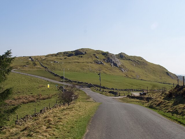
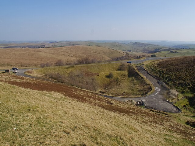
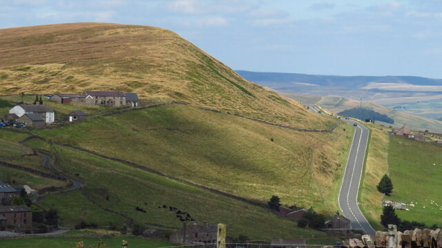
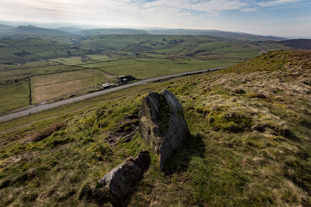
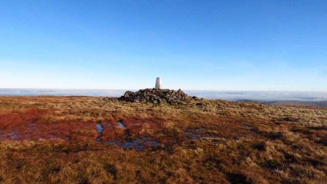
Axe Edge Moor is a prominent hill/mountain located in the county of Derbyshire, England. Situated within the Peak District National Park, it forms part of the Pennine range, a series of hills and mountains stretching across Northern England. With an elevation of 551 meters (1,808 feet), Axe Edge Moor is one of the highest points in the region.

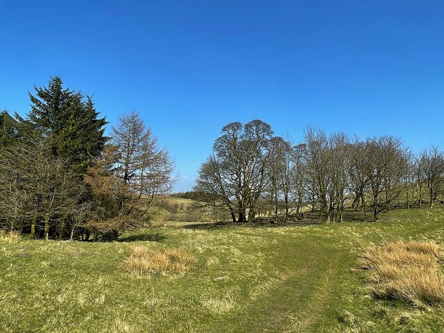
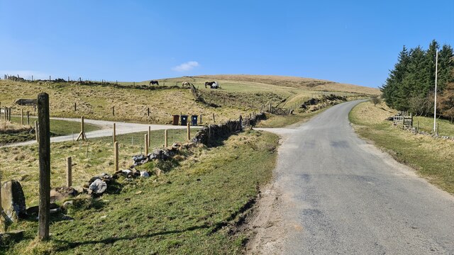
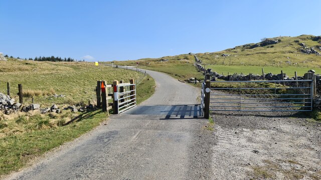
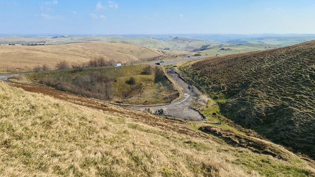
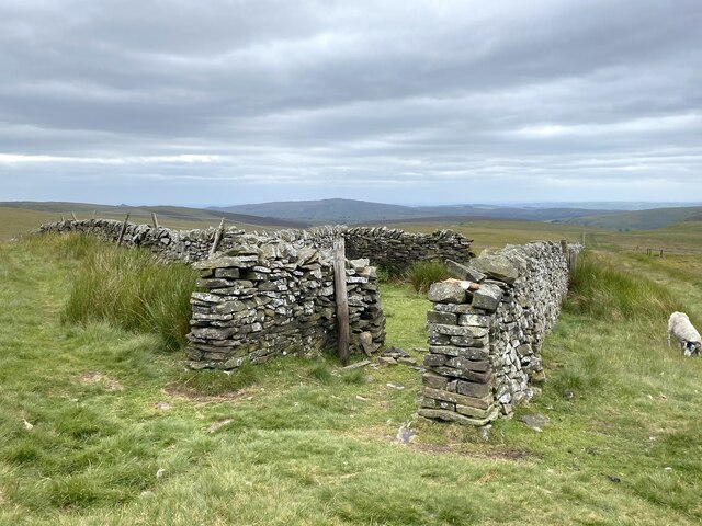
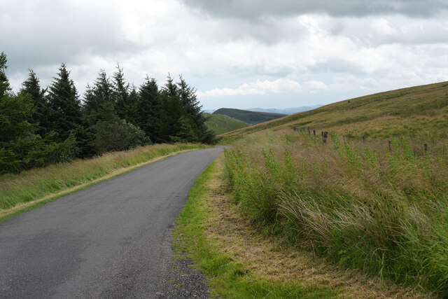
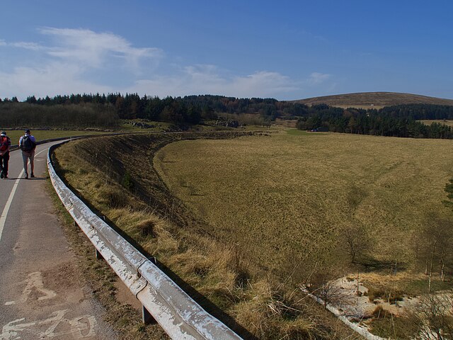
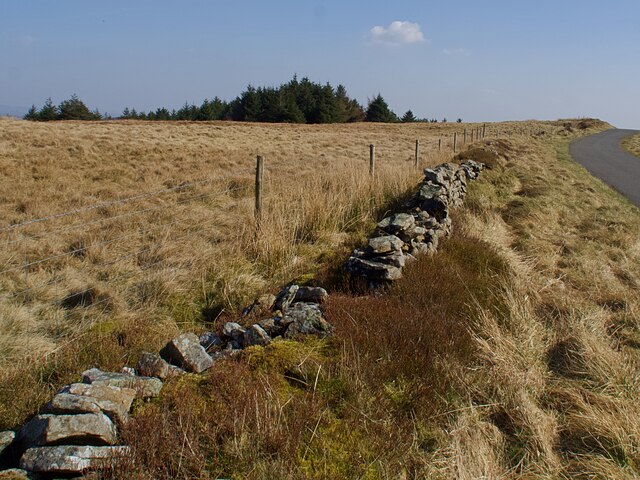
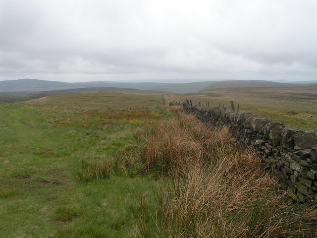
The moorland is characterized by its vast expanse of open, windswept terrain, covered in heather, grasses, and peat bogs. It offers breathtaking panoramic views of the surrounding countryside, including the nearby Roaches and Chrome Hill. The area is also intersected by several walking trails and footpaths, making it a popular destination for hikers and nature enthusiasts.

Axe Edge Moor has a rich history, with evidence of human activity dating back thousands of years. The moor contains several archaeological sites, including Bronze Age burial mounds and remnants of ancient settlements. It has also been used for centuries as common grazing land for local farmers.

The moor is home to a diverse range of wildlife, including various bird species such as curlews, lapwings, and red grouse. Mammals such as hares, rabbits, and foxes can also be spotted in the area.

Despite its natural beauty, Axe Edge Moor is also known for its harsh weather conditions. It experiences strong winds and heavy rainfall throughout the year, adding to the challenging but rewarding experience for those who venture to its summit.

If you have any feedback on the listing, please let us know in the comments section below.

Axe Edge Moor Images

Images are sourced within 2km of 53.232543/-1.9489947 or Grid Reference SK0370. Thanks to Geograph Open Source API. All images are credited.

Berry Clough path
Berry Clough path
Minor road passing Thirkelow Rocks
Overlooking the A53 Leek - Buxton Road Evidence of the road having been straightened here.
Overlooking the A53 Leek - Buxton Road
Evidence of the road having been straightened here.
Footpath through trees On moorland near Turncliffe Common
Footpath through trees
On moorland near Turncliffe Common
Road below Thirkelow Rocks
A53 below Axe Edge
A53 below Axe Edge
Boundary sheepfold Situated on the boundary of Derbyshire and Staffordshire.
Boundary sheepfold
Situated on the boundary of Derbyshire and Staffordshire.
A53 below Axe Edge from Oliver Hill
Axe Edge Summit Looking Down On The A53
Staffordshire County Top Cheeks Hill, Boundary wall Staffordshire on the right Derbyshire on the left of the wall ..

At 520m / 1706ft Cheeks Hill is the highest point in Staffordshire. 

<span class="nowrap"><a title="http://www.hill-bagging.co.uk/mountaindetails.php?qu=S&rf=5472" rel="nofollow ugc noopener" href="http://www.hill-bagging.co.uk/mountaindetails.php?qu=S&rf=5472">Link</a><img style="margin-left:2px;" alt="External link" title="External link - shift click to open in new window" src="https://s1.geograph.org.uk/img/external.png" width="10" height="10"/></span>
Staffordshire County Top Cheeks Hill, Boundary wall
Staffordshire on the right Derbyshire on the left of the wall .. At 520m / 1706ft Cheeks Hill is the highest point in Staffordshire. LinkExternal link
The road on Axe Edge Generally the surface of the road is good but the few places where you can pull off the road are quite bad with potholes and lumps of tarmac.
The road on Axe Edge
Generally the surface of the road is good but the few places where you can pull off the road are quite bad with potholes and lumps of tarmac.
Near Leap Edge Not really very far from Buxton, but the area looks quite bleak.
Near Leap Edge
Not really very far from Buxton, but the area looks quite bleak.
Track to Cheeks Hill Heading up to the highest point in Staffordshire.
Track to Cheeks Hill
Heading up to the highest point in Staffordshire.
Axe Edge Trig Point Even on this December day, the summit was warm enough for a leisurely lunch stop. A cold air inversion covers much of the Peak District.
Axe Edge Trig Point
Even on this December day, the summit was warm enough for a leisurely lunch stop. A cold air inversion covers much of the Peak District.
Road on a former railway alignment Originally part of the Cromford and High Peak Railway it is now a link road between sites in the Health and Safety Executive testing area.
Road on a former railway alignment
Originally part of the Cromford and High Peak Railway it is now a link road between sites in the Health and Safety Executive testing area.
Broken drystone wall  On Moorland to the south of Buxton. Unlikely to be repaired given that a post and wire replacement fence has been erected.
Broken drystone wall
On Moorland to the south of Buxton. Unlikely to be repaired given that a post and wire replacement fence has been erected.
Small stream on Axe Edge Moor
Show me another place!

Axe Edge Moor is located at Grid Ref: SK0370 (Lat: 53.232543, Lng: -1.9489947)

Administrative County: Derbyshire

District: High Peak

Police Authority: Derbyshire

What 3 Words

///drummers.orchestra.agree. Near Buxton, Derbyshire

Related Wikis

Axe Edge Moor

Axe Edge Moor is the major moorland southwest of Buxton in the Peak District, England. It is mainly gritstone (Namurian shale and sandstone). Its highest...

Cheeks Hill

Cheeks Hill is a hill on Axe Edge Moor in the Peak District, England. It lies just south of the Cat and Fiddle Road near Buxton, and forms part of the...

Grin Low

Grin Low is a hill overlooking Buxton in Derbyshire, in the Peak District. The summit is 434 metres (1,424 ft) above sea level.Grin Low was the main location...

Ann Croft

Ann Croft is a place in the parish of Hartington Upper Quarter in the Hundred of Wirksworth. A croft is a small enclosed field or pasture near a house...

RAF Harpur Hill

RAF Harpur Hill is a former Royal Air Force station, situated at Harpur Hill near Buxton, Derbyshire in England. The site was operational from 1938 to...

Health and Safety Laboratory

The Health and Safety Laboratory (HSE Laboratory or HSL Buxton) is a large 550-acre research site in rural High Peak, Derbyshire, south of Buxton. It researches...

Buxton Pavilion Gardens

Buxton Pavilion Gardens is a Victorian landscaped public park in the spa town of Buxton in Derbyshire. The River Wye flows through the gardens, which are...

Solomon's Temple, Buxton

Solomon's Temple, also known as Grinlow Tower, is a Victorian folly on the summit of Grin Low hill, near the spa town of Buxton in the Derbyshire Peak...

Nearby Amenities

Located within 500m of 53.232543,-1.9489947
Axe Edge Moor
Man Made: survey_point
Ref: S2766
Tpuk Ref: TP0942
Lat/Long: 53.2325523/-1.949019
Axe Edge Moor
Ele: 551
Natural: peak
Source: https://www.hill-bagging.co.uk/mountaindetails.php?qu=S&rf=3629
Source Ele: NPE (1,807ft)
Wikidata: Q3425629
Lat/Long: 53.2325776/-1.9489783
The data included in this document is from www.openstreetmap.org. The data is made available under ODbL.

Have you been to Axe Edge Moor?

Leave your review of Axe Edge Moor below (or comments, questions and feedback).