Kettlebaston

Settlement in Suffolk Babergh

England

Kettlebaston

Kettlebaston: Farmland
Kettlebaston: Farmland Credit: Michael Garlick

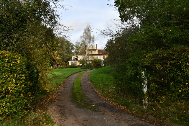
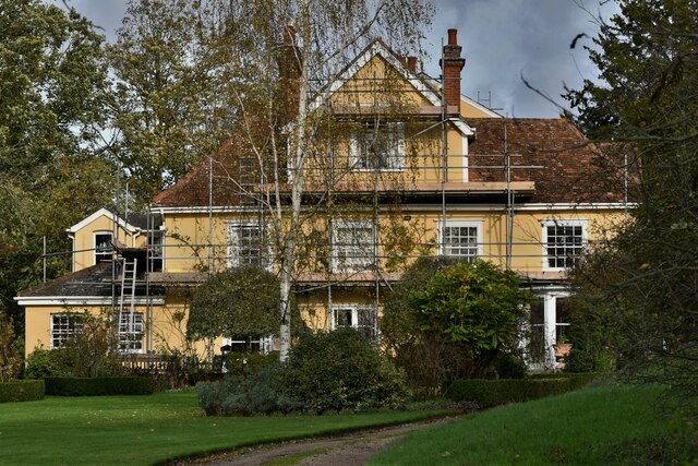
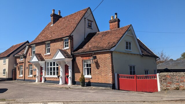
Kettlebaston is a small village located in the county of Suffolk, England. It is situated approximately 10 miles south of the town of Stowmarket and 2 miles east of Bildeston. With a population of around 200 people, it is a tight-knit and close community.

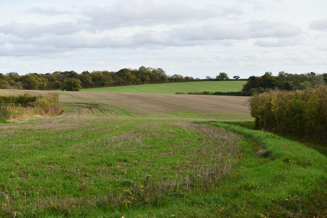
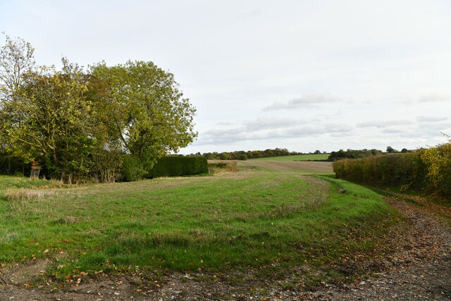
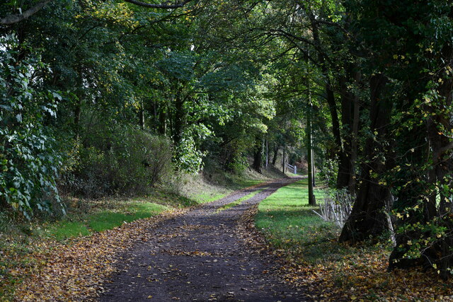
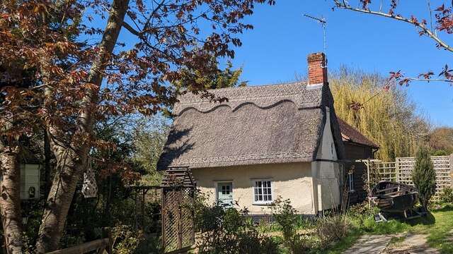
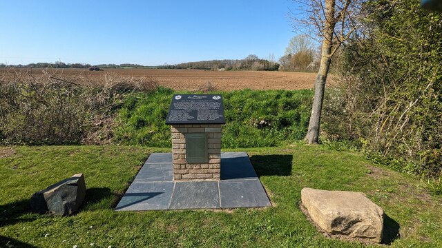
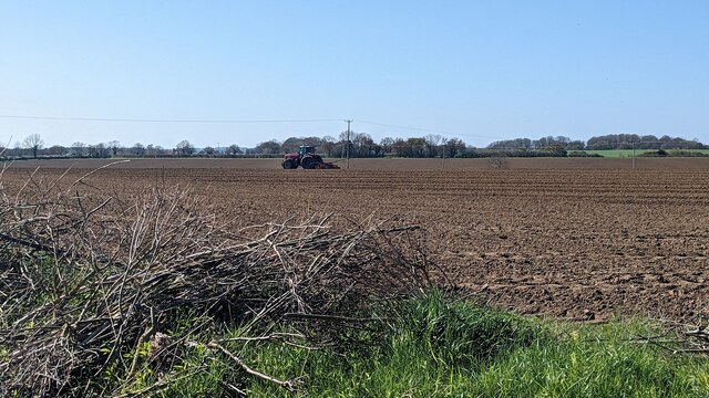
The village of Kettlebaston is known for its picturesque countryside, characterized by rolling hills, meadows, and farmland. It offers a tranquil and idyllic setting, making it a popular choice for those seeking a peaceful rural lifestyle.

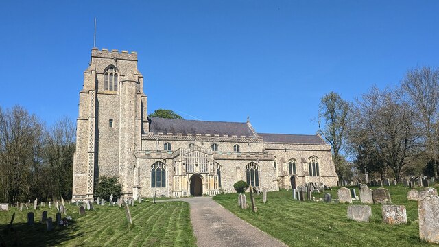
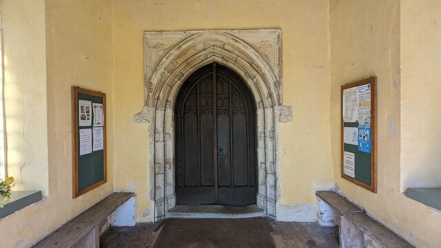
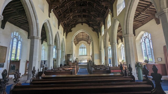
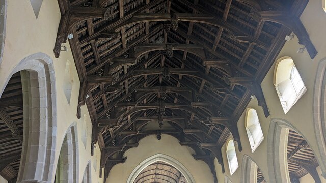
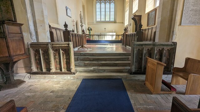
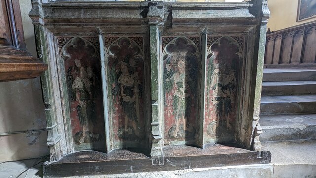
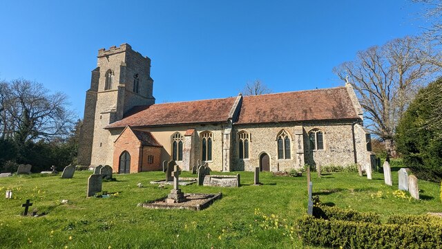
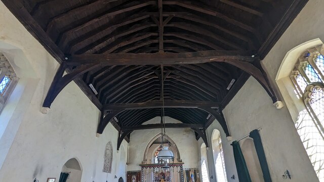
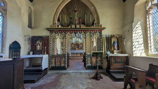
The village is home to a notable 14th-century church, St. Mary's Church, which stands at the heart of the community. This historic building is a prominent landmark and a place of worship for the locals.

Although Kettlebaston is a small village, it is well-connected to neighboring towns and cities. The A1141 road runs through the village, linking it to nearby settlements such as Stowmarket and Sudbury. This makes it easily accessible for both residents and visitors, providing convenient transport links.

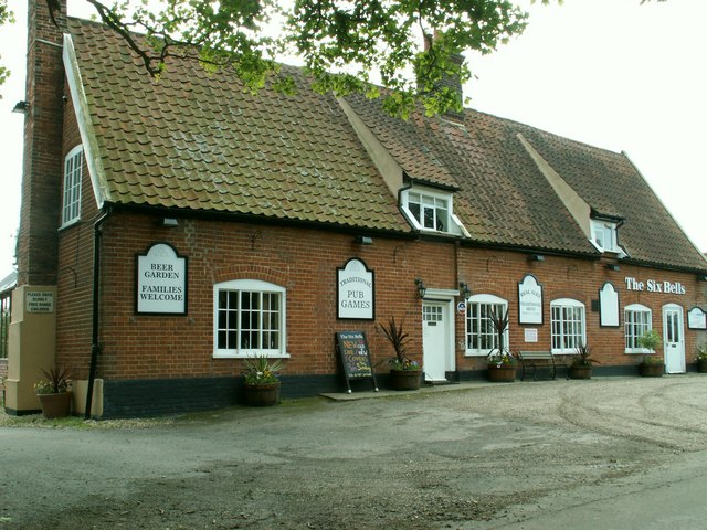
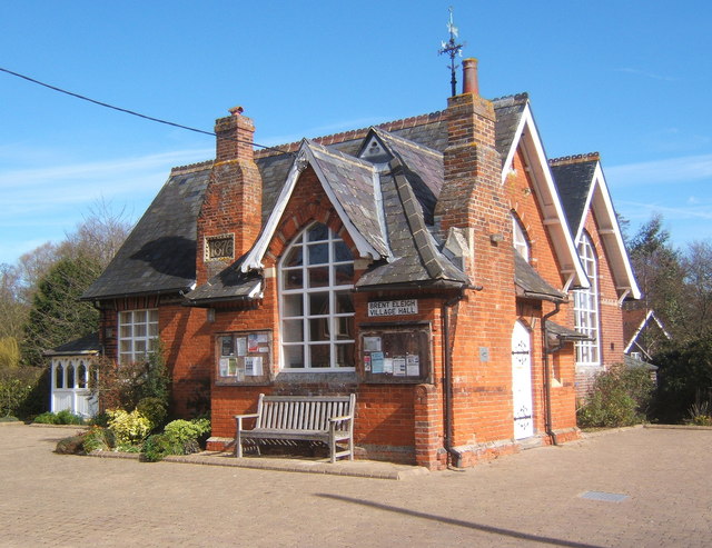
In terms of amenities, Kettlebaston has a village hall that serves as a community hub for various events and gatherings. The village also benefits from a local pub, offering a cozy environment for socializing and enjoying traditional pub food.

Overall, Kettlebaston is a charming and peaceful village, perfect for those seeking a tranquil countryside lifestyle, while still having access to nearby amenities and transport links.

If you have any feedback on the listing, please let us know in the comments section below.

Kettlebaston Images

Images are sourced within 2km of 52.116276/0.87062 or Grid Reference TL9650. Thanks to Geograph Open Source API. All images are credited.

Kettlebaston: Farmland
Kettlebaston, Rectory Lane: The Old Rectory
Kettlebaston: Rectory Lane
Church of All Saints, Hitcham <span class="nowrap"><a title="https://historicengland.org.uk/listing/the-list/list-entry/1285593?section=official-list-entry" rel="nofollow ugc noopener" href="https://historicengland.org.uk/listing/the-list/list-entry/1285593?section=official-list-entry">Link</a><img style="margin-left:2px;" alt="External link" title="External link - shift click to open in new window" src="https://s1.geograph.org.uk/img/external.png" width="10" height="10"/></span>
Church of All Saints, Hitcham
Doorway at Church of All Saints, Hitcham <span class="nowrap"><a title="https://historicengland.org.uk/listing/the-list/list-entry/1285593?section=official-list-entry" rel="nofollow ugc noopener" href="https://historicengland.org.uk/listing/the-list/list-entry/1285593?section=official-list-entry">Link</a><img style="margin-left:2px;" alt="External link" title="External link - shift click to open in new window" src="https://s1.geograph.org.uk/img/external.png" width="10" height="10"/></span>
Doorway at Church of All Saints, Hitcham
Interior of Church of All Saints, Hitcham <span class="nowrap"><a title="https://historicengland.org.uk/listing/the-list/list-entry/1285593?section=official-list-entry" rel="nofollow ugc noopener" href="https://historicengland.org.uk/listing/the-list/list-entry/1285593?section=official-list-entry">Link</a><img style="margin-left:2px;" alt="External link" title="External link - shift click to open in new window" src="https://s1.geograph.org.uk/img/external.png" width="10" height="10"/></span>
Interior of Church of All Saints, Hitcham
Double-hammer beam roof at Church of All Saints, Hitcham <span class="nowrap"><a title="https://historicengland.org.uk/listing/the-list/list-entry/1285593?section=official-list-entry" rel="nofollow ugc noopener" href="https://historicengland.org.uk/listing/the-list/list-entry/1285593?section=official-list-entry">Link</a><img style="margin-left:2px;" alt="External link" title="External link - shift click to open in new window" src="https://s1.geograph.org.uk/img/external.png" width="10" height="10"/></span>
Double-hammer beam roof at Church of All Saints, Hitcham
Rood Screen Dado at Church of All Saints, Hitcham <span class="nowrap"><a title="http://www.suffolkchurches.co.uk/hitcham.htm" rel="nofollow ugc noopener" href="http://www.suffolkchurches.co.uk/hitcham.htm">Link</a><img style="margin-left:2px;" alt="External link" title="External link - shift click to open in new window" src="https://s1.geograph.org.uk/img/external.png" width="10" height="10"/></span>
Rood Screen Dado at Church of All Saints, Hitcham
Closer Look at Rood Screen Dado at Church of All Saints, Hitcham <span class="nowrap"><a title="http://www.suffolkchurches.co.uk/hitcham.htm" rel="nofollow ugc noopener" href="http://www.suffolkchurches.co.uk/hitcham.htm">Link</a><img style="margin-left:2px;" alt="External link" title="External link - shift click to open in new window" src="https://s1.geograph.org.uk/img/external.png" width="10" height="10"/></span>
Closer Look at Rood Screen Dado at Church of All Saints, Hitcham
The White Horse <span class="nowrap"><a title="https://historicengland.org.uk/listing/the-list/list-entry/1194824?section=official-list-entry" rel="nofollow ugc noopener" href="https://historicengland.org.uk/listing/the-list/list-entry/1194824?section=official-list-entry">Link</a><img style="margin-left:2px;" alt="External link" title="External link - shift click to open in new window" src="https://s1.geograph.org.uk/img/external.png" width="10" height="10"/></span>
The White Horse
Brook Cottage, Hitcham <span class="nowrap"><a title="https://historicengland.org.uk/listing/the-list/list-entry/1037269?section=official-list-entry" rel="nofollow ugc noopener" href="https://historicengland.org.uk/listing/the-list/list-entry/1037269?section=official-list-entry">Link</a><img style="margin-left:2px;" alt="External link" title="External link - shift click to open in new window" src="https://s1.geograph.org.uk/img/external.png" width="10" height="10"/></span>
Brook Cottage, Hitcham
Memorial to Mid-Air Tragedy - 2nd October 1944 <span class="nowrap"><a title="https://www.iwm.org.uk/memorials/item/memorial/86682" rel="nofollow ugc noopener" href="https://www.iwm.org.uk/memorials/item/memorial/86682">Link</a><img style="margin-left:2px;" alt="External link" title="External link - shift click to open in new window" src="https://s1.geograph.org.uk/img/external.png" width="10" height="10"/></span>
Memorial to Mid-Air Tragedy - 2nd October 1944
Tractor Working in a Field
Church of St Mary, Kettlebaston <span class="nowrap"><a title="https://historicengland.org.uk/listing/the-list/list-entry/1037253?section=official-list-entry" rel="nofollow ugc noopener" href="https://historicengland.org.uk/listing/the-list/list-entry/1037253?section=official-list-entry">Link</a><img style="margin-left:2px;" alt="External link" title="External link - shift click to open in new window" src="https://s1.geograph.org.uk/img/external.png" width="10" height="10"/></span>
Church of St Mary, Kettlebaston
Detail of Roof at Church of St Mary, Kettlebaston The nave roof consists of tie-beams with king posts supported by carved stone corbels.
Detail of Roof at Church of St Mary, Kettlebaston
The nave roof consists of tie-beams with king posts supported by carved stone corbels.
Rood Screen at Church of St Mary, Kettlebaston <span class="nowrap"><a title="https://heritage.suffolk.gov.uk/Monument/MSF2647" rel="nofollow ugc noopener" href="https://heritage.suffolk.gov.uk/Monument/MSF2647">Link</a><img style="margin-left:2px;" alt="External link" title="External link - shift click to open in new window" src="https://s1.geograph.org.uk/img/external.png" width="10" height="10"/></span>
Rood Screen at Church of St Mary, Kettlebaston
Show me another place!

Kettlebaston is located at Grid Ref: TL9650 (Lat: 52.116276, Lng: 0.87062)

Administrative County: Suffolk

District: Babergh

Police Authority: Suffolk

What 3 Words

///vertical.inch.captions. Near Bildeston, Suffolk

Nearby Locations

Kettlebaston Kettlebaston

Related Wikis

Kettlebaston

Kettlebaston is a village and a civil parish with just over 30 inhabitants in the Babergh district of Suffolk, England, located around 3 miles (5 km) east...

Hitcham, Suffolk

Hitcham is a village and civil parish in Suffolk, England. Located on the B1115 road, between Hadleigh and Stowmarket, it is part of Babergh district....

Preston St Mary

Preston St Mary is a village and civil parish in Suffolk, England. Located to the north-east of Lavenham, it is part of the Babergh district. The parish...

Cosford Hundred

Cosford was a hundred of Suffolk, consisting of 30,712 acres (124.29 km2).The hundred consisted of Hadleigh, the only town of any size, and seventeen other...

Chelsworth

Chelsworth is a village and civil parish in Suffolk, England. It lies on the B1115 road, 10 miles in either direction from Sudbury and Stowmarket. It is...

Old Buckenham Hall School

Old Buckenham Hall School (commonly known as OBH) is a day and boarding preparatory school with pre-prep for boys and girls in the village of Brettenham...

Bildeston

Bildeston is a village and civil parish in the Babergh district of Suffolk, England. Located around 5 miles (8 km) north of Hadleigh, in 2005 it had a...

Brent Eleigh

Brent Eleigh is a village and civil parish in the Babergh district of Suffolk, England. Located between Hadleigh and Lavenham, in 2005 it had a population...

Related Videos

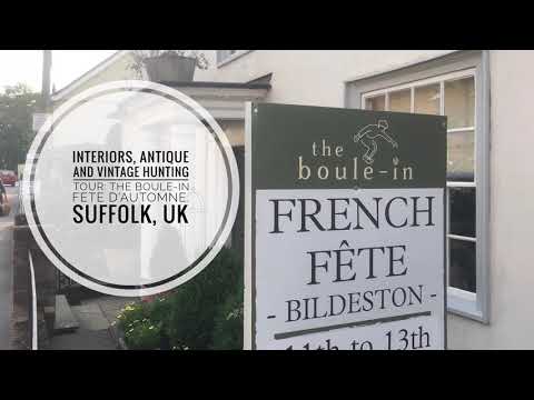
Interiors, Antique and Vintage Hunting Tour: The Boule-in Fete D’Automne Suffolk UK

Four times a year Bildeston, a pretty little village in Suffolk comes alive with a seasonal fete hosted by The Boule-in. The Boule-In ...

Nearby Amenities

Located within 500m of 52.116276,0.87062
Kettlebaston
Created By: POI Editor
Place: hamlet
Source: npe
Wikidata: Q2348607
Lat/Long: 52.1156791/0.8707189
Village Sign
Naptan AtcoCode: 390010485
Naptan Bearing: S
Naptan BusStopType: CUS
Naptan CommonName: Village Sign
Naptan Indicator: adj
Naptan Landmark: Village Sign
Naptan NaptanCode: sufagjwd
Naptan Street: Unclassified
Naptan Verified: no
Source: naptan_import
Lat/Long: 52.1159033/0.8704834
Village Sign
Naptan AtcoCode: 390010486
Naptan Bearing: N
Naptan BusStopType: CUS
Naptan CommonName: Village Sign
Naptan Indicator: opp
Naptan Landmark: Village Sign
Naptan NaptanCode: sufagjwg
Naptan Street: Unclassified
Naptan Verified: no
Source: naptan_import
Lat/Long: 52.1158519/0.8703778
Turning Loop
Lat/Long: 52.1157187/0.8713475
Telephone
Booth: K6
Covered: booth
Listed Status: Grade II
Phone: +44 1449 740420
Lat/Long: 52.1162291/0.8706428
Advertising: board
Lat/Long: 52.1158535/0.8703513
Bench
Lat/Long: 52.1158431/0.8703263
The data included in this document is from www.openstreetmap.org. The data is made available under ODbL.

Have you been to Kettlebaston?

Leave your review of Kettlebaston below (or comments, questions and feedback).