Barking

Settlement in Essex

England

Barking

Eastbury Manor Barking This is a photograph of Eastbury Manor Barking. The kind of building that is far from typical in the area. Built in the mid 17th Century by a wealthy merchant; Clement Sysley on land once owned by Barking Abbey. Over the centuries the building passed through many hands falling into decay in the early part of the 20th century. The manor was saved for the nation by the National Trust in 1918.
Eastbury Manor Barking Credit: Glyn Baker

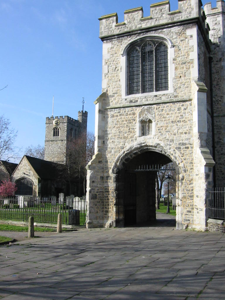
Barking is a suburban town located in the London Borough of Barking and Dagenham, in the county of Essex, England. Situated approximately 9 miles east of central London, it is part of the Greater London area and falls within the London Riverside regeneration zone. Barking has a rich history dating back to the seventh century when it was a fishing settlement along the River Thames.

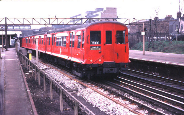
Today, Barking is a bustling town with a diverse population of around 60,000 residents. It benefits from excellent transportation links, with two London Underground stations (Barking and Upney) and several bus routes connecting it to the city. The town is also adjacent to major roads, including the A13, providing easy access to the rest of Essex and beyond.

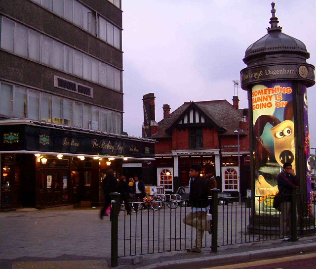
Barking offers various amenities and facilities to cater to its residents' needs. The town center features a range of shops, supermarkets, and a bustling market dating back to the twelfth century. Additionally, there are several parks and green spaces, such as Barking Park, providing recreational areas for locals to enjoy.

The town has a vibrant cultural scene, with the Broadway Theatre hosting a diverse range of performances, from plays and musicals to comedy shows and concerts. Barking is also home to a number of community centers, sports clubs, and leisure facilities, offering activities for all ages.

With ongoing regeneration efforts, Barking has seen significant development in recent years, including new housing, business parks, and improved infrastructure. This has attracted investment and contributed to the town's overall growth and prosperity.

In conclusion, Barking, Essex, is a vibrant suburban town that combines its rich history with modern amenities, benefiting from excellent transport links and ongoing regeneration efforts.

If you have any feedback on the listing, please let us know in the comments section below.

Barking Images

Images are sourced within 2km of 51.538117/0.078948 or Grid Reference TQ4484. Thanks to Geograph Open Source API. All images are credited.

Eastbury Manor Barking This is a photograph of Eastbury Manor Barking. The kind of building that is far from typical in the area. Built in the mid 17th Century by a wealthy merchant; Clement Sysley on land once owned by Barking Abbey. Over the centuries the building passed through many hands falling into decay in the early part of the 20th century. The manor was saved for the nation by the National Trust in 1918.
Eastbury Manor Barking
This is a photograph of Eastbury Manor Barking. The kind of building that is far from typical in the area. Built in the mid 17th Century by a wealthy merchant; Clement Sysley on land once owned by Barking Abbey. Over the centuries the building passed through many hands falling into decay in the early part of the 20th century. The manor was saved for the nation by the National Trust in 1918.
East Ham High St This is a photo of High St North East Ham, taken looking south towards the station. Sibley Grove is on the left. The pub on the corner is amusingly named the Overdraft Tavern
East Ham High St
This is a photo of High St North East Ham, taken looking south towards the station. Sibley Grove is on the left. The pub on the corner is amusingly named the Overdraft Tavern
A Pair of Dogs The picture is of Station Parade Longbridge Rd Barking. A dozen or so years ago everyone knew where you meant when you said "I'll meet you in the Barking Dog".
There was only one dog and that was the spotted one in the background with the half timbered gable end. When Wetherspoons opened their new drinking emporium in the retail unit below the office block Tim Martin cheekily named it "The Barking Dog" causing confusion for a while. However the two hounds seem to get on fairly well these days.
A Pair of Dogs
The picture is of Station Parade Longbridge Rd Barking. A dozen or so years ago everyone knew where you meant when you said "I'll meet you in the Barking Dog". There was only one dog and that was the spotted one in the background with the half timbered gable end. When Wetherspoons opened their new drinking emporium in the retail unit below the office block Tim Martin cheekily named it "The Barking Dog" causing confusion for a while. However the two hounds seem to get on fairly well these days.
Faircross Parade, Barking and in 2008 <a href="https://www.geograph.org.uk/photo/998310">TQ4585 : Faircross Parade</a>
Faircross Parade, Barking
Up Barking Creek Footbridge over the River Roding near where it becomes known as Barking Creek.
Up Barking Creek
Footbridge over the River Roding near where it becomes known as Barking Creek.
Keppel and Kempton Rds East Ham This is the Junction of Keppel and Kempton Roads in East Ham. The terraced houses are typical of the area.
Keppel and Kempton Rds East Ham
This is the Junction of Keppel and Kempton Roads in East Ham. The terraced houses are typical of the area.
River Roding This is the River Roding before it becomes Barking Creek. Effectively the River is the boundary between East Ham & Barking.
River Roding
This is the River Roding before it becomes Barking Creek. Effectively the River is the boundary between East Ham & Barking.
St Marys Estate, Barking This is the St Mary’s Community Housing Project in Barking.
St Marys Estate, Barking
This is the St Mary’s Community Housing Project in Barking.
Gallions Reach Entertainment Centre This is the Gallions Reach entertainment complex, it actually stands on Barking Creek which runs into the Thames at Gallions Reach.
Gallions Reach Entertainment Centre
This is the Gallions Reach entertainment complex, it actually stands on Barking Creek which runs into the Thames at Gallions Reach.
Eastbury School This Modern Looking School is in Rosslyn Rd Upney
Eastbury School
This Modern Looking School is in Rosslyn Rd Upney
Alfred Pryor House This tower block is in at the junction of Jack Cornwall Rd and Grantham Rd Ilford.
Alfred Pryor House
This tower block is in at the junction of Jack Cornwall Rd and Grantham Rd Ilford.
Loxford Park, Ilford This park in Ilford is bounded by Stanes Rd and Loxford Lane
Loxford Park, Ilford
This park in Ilford is bounded by Stanes Rd and Loxford Lane
The Westbury Centre this Victorian school building was attended by Bobby Moore. It is now a teacher's centre, and cars park where Bobby once played football ...
The Westbury Centre
this Victorian school building was attended by Bobby Moore. It is now a teacher's centre, and cars park where Bobby once played football ...
Carrying Coals to Newcastle? 47278 heads an eastbound train of cars into Barking station, towards Dagenham (home of Ford). Under the bridge the nearest set of rails can be seen climbing a flyover that carries London Transport's line over British Rail's
Carrying Coals to Newcastle?
47278 heads an eastbound train of cars into Barking station, towards Dagenham (home of Ford). Under the bridge the nearest set of rails can be seen climbing a flyover that carries London Transport's line over British Rail's
CO Stock at Barking A District Line train made up of CO stock departs Barking for Ealing.  The design is 1935 vintage.  All were withdrawn in the early 1980's as new trains were delivered for the District Line.
CO Stock at Barking
A District Line train made up of CO stock departs Barking for Ealing. The design is 1935 vintage. All were withdrawn in the early 1980's as new trains were delivered for the District Line.
Slam Door Stock Services on the London Tilbury and Southend Railway from the 1960's to the early 1990's were handled mainly by class 302 Electric Multiple Units.  I believe that 244 was unique in having this type of cab - picking up a spare car from another class of EMU following an accident.  The others had flat fronts.  Behind the unit can be seen a train of Hammersmith and City stock waiting in the bay platform.
Slam Door Stock
Services on the London Tilbury and Southend Railway from the 1960's to the early 1990's were handled mainly by class 302 Electric Multiple Units. I believe that 244 was unique in having this type of cab - picking up a spare car from another class of EMU following an accident. The others had flat fronts. Behind the unit can be seen a train of Hammersmith and City stock waiting in the bay platform.
Children's Train in Barking Park Opened in the early 1950s, in a gauge of 9½ inches and originally consisted of three coaches hauled by a steam locomotive named ‘The Empress’. This was replaced by a sit-in diesel locomotive named ‘Little Nan', trains running between the main park entrance at Longbridge Road, up to a turntable at the boating lake.
Children's Train in Barking Park
Opened in the early 1950s, in a gauge of 9½ inches and originally consisted of three coaches hauled by a steam locomotive named ‘The Empress’. This was replaced by a sit-in diesel locomotive named ‘Little Nan', trains running between the main park entrance at Longbridge Road, up to a turntable at the boating lake.
Barking Park <span class="nowrap"><a title="http://www.barking-dagenham.gov.uk/barking-park/" rel="nofollow ugc noopener" href="http://www.barking-dagenham.gov.uk/barking-park/">Link</a><img style="margin-left:2px;" alt="External link" title="External link - shift click to open in new window" src="https://s1.geograph.org.uk/img/external.png" width="10" height="10"/></span>
Barking Park
Show me another place!

Barking is located at Grid Ref: TQ4484 (Lat: 51.538117, Lng: 0.078948)

Unitary Authority: Barking and Dagenham

Police Authority: Metropolitan

What 3 Words

///rotate.rests.twigs. Near Barking, London

Nearby Locations

Barking

Related Wikis

Abbey (Barking and Dagenham ward)

Abbey is an electoral ward in the London Borough of Barking and Dagenham, returning councillors to Barking and Dagenham London Borough Council. The population...
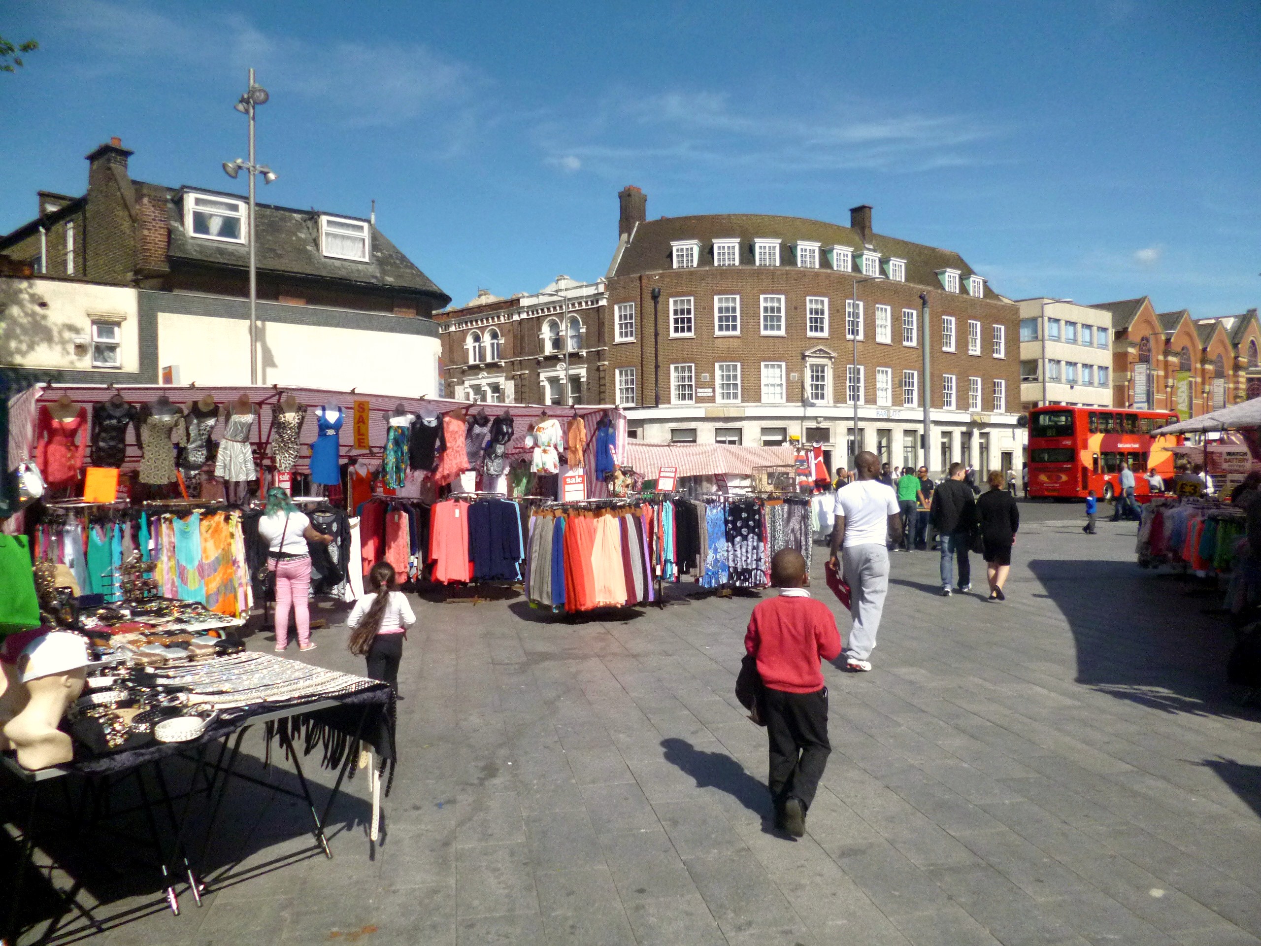
Barking Market

Barking Market (also called Barking Town Centre Market) is a market located in Barking in the London Borough of Barking and Dagenham in East London, England...

Barking Learning Centre

The Barking Learning Centre, in the London Borough of Barking and Dagenham, is a community-based learning facility. The centre is located in Barking Town...

Barking, London

Barking is a town in East London, England, within the London Borough of Barking and Dagenham. It is 9.3 miles (15 km) east of Charing Cross. The total...

Nearby Amenities

Located within 500m of 51.538117,0.078948
Barking
Name Fa: بارکینگ
Place: town
Wikidata: Q377720
Wikipedia: en:Barking, London
Lat/Long: 51.5389922/0.0804245
Crossing
Crossing: traffic_signals
Crossing Island: separate
Crossing Markings: dots
Crossing Signals: yes
Crossing Ref: pelican
Lat/Long: 51.541053/0.0835554
Crossing
Crossing: traffic_signals
Crossing Island: separate
Crossing Markings: dots
Crossing Signals: yes
Crossing Ref: pelican
Lat/Long: 51.5409863/0.0835333
Traffic Signals
Crossing: no
Traffic Signals: traffic_lights
Traffic Signals Direction: backward
Lat/Long: 51.5406734/0.0836911
Crossing
Crossing: traffic_signals
Crossing Island: separate
Crossing Markings: dots
Crossing Signals: yes
Crossing Ref: pelican
Lat/Long: 51.5407694/0.0823127
Cycleway: asl
Direction: forward
Lat/Long: 51.5408364/0.0822462
Crossing
Crossing: traffic_signals
Crossing Island: no
Crossing Ref: pelican
Lat/Long: 51.540447/0.0750289
Traffic Signals
Traffic Signals Direction: forward
Lat/Long: 51.5376545/0.0734381
Traffic Signals
Traffic Signals Direction: forward
Lat/Long: 51.5374125/0.0735918
Crossing
Bicycle: yes
Crossing: traffic_signals
Crossing Island: no
Crossing Ref: toucan
Lat/Long: 51.5354063/0.0823293
Barking
Operator: London Underground
Operator Wikidata: Q20075
Public Transport: stop_position
Railway: stop
Ref: 2
Subway: yes
Lat/Long: 51.5396162/0.0810967
Crossing
Crossing: traffic_signals
Crossing Ref: pelican
Lat/Long: 51.5392699/0.0779603
Crossing
Crossing: uncontrolled
Crossing Island: yes
Crossing Ref: zebra
Lat/Long: 51.5365152/0.0765918
Ref GB Tflcid: RWG170055
Traffic Calming: hump
Lat/Long: 51.5363973/0.0788721
Crossing
Crossing: uncontrolled
Crossing Island: no
Crossing Ref: zebra
Lat/Long: 51.53823/0.07906
Post Box
Collection Times: Mo-Fr 09:00, Sa 07:00
Post Box Type: pillar
Ref: IG11 4D
Royal Cypher: EVIIIR
Royal Cypher Wikidata: Q33102195
Lat/Long: 51.5408412/0.0742557
Bus Stop
Barking Station
Bus: yes
Local Ref: G
Naptan AtcoCode: 490000015G
Naptan Bearing: SW
Naptan CommonName: Barking
Naptan Indicator: Stop G
Naptan Verified: yes
Note: Bus stand
Public Transport: platform
Ref: 53272
Source Ref: naptan
Lat/Long: 51.5399946/0.0823269
Bus Stop
Barking Station
Bus: yes
Local Ref: H
Naptan AtcoCode: 490000015H
Naptan Bearing: SW
Naptan CommonName: Barking
Naptan Indicator: Stop H
Naptan Verified: no
Public Transport: platform
Ref: 72621
Lat/Long: 51.5393879/0.0815614
Barking Station
Local Ref: J
Naptan AtcoCode: 490000015J
Naptan Bearing: NE
Naptan CommonName: Barking
Naptan Indicator: Stop J
Naptan Verified: no
Lat/Long: 51.5392501/0.0811639
Bus Stop
Barking Station
Bus: yes
Local Ref: K
Naptan AtcoCode: 490000015K
Naptan Bearing: NE
Naptan CommonName: Barking
Naptan Indicator: Stop K
Naptan Verified: yes
Public Transport: platform
Ref: 47665
Shelter: yes
Lat/Long: 51.539394/0.0813237
Bus Stop
Barking Station
Bus: yes
Local Ref: L
Naptan AtcoCode: 490000015L
Naptan Bearing: NE
Naptan CommonName: Barking
Naptan Indicator: Stop L
Naptan Verified: yes
Public Transport: platform
Ref: 50989
Shelter: yes
Lat/Long: 51.5400498/0.0821453
Barking Station
Local Ref: N
Naptan AtcoCode: 490000015N
Naptan Bearing: SW
Naptan CommonName: Barking
Naptan Indicator: Stop N
Naptan Verified: no
Public Transport: platform
Lat/Long: 51.5392544/0.0813938
Bus Stop
Abbey Sports Centre
Bench: yes
Bin: yes
Bus: yes
Lit: yes
Local Ref: Y
Naptan AtcoCode: 490003033W
Naptan Bearing: W
Naptan CommonName: Abbey Sports Centre
Naptan Indicator: Stop Y
Naptan Street: ST PAUL'S ROAD
Naptan Verified: no
Public Transport: platform
Ref: 77475
Shelter: yes
Source Ref: naptan
Tactile Paving: no
Lat/Long: 51.5347727/0.0797555
Bus Stop
Barking Abbey
Bench: yes
Bin: yes
Bus: yes
Lit: yes
Local Ref: A
Naptan AtcoCode: 490003603A
Naptan Bearing: N
Naptan CommonName: Barking AbbeyBroadway Theatre
Naptan Indicator: A
Naptan Street: NORTH STREET
Naptan Verified: no
Public Transport: platform
Ref: 49617
Shelter: yes
Source Ref: naptan
Tactile Paving: no
Lat/Long: 51.5370255/0.0762521
Bus Stop
Broadway Theatre
Bus: yes
Local Ref: B
Naptan AtcoCode: 490003603B
Naptan Bearing: S
Naptan CommonName: Barking AbbeyBroadway Theatre
Naptan Indicator: Stop B
Naptan Street: NORTH STREET
Naptan Verified: no
Public Transport: platform
Ref: 77519
Source Ref: naptan
Lat/Long: 51.5360192/0.0770102
Bus Stop
Barking Town Centre
Bench: yes
Bin: yes
Bus: yes
Lit: yes
Local Ref: C
Naptan AtcoCode: 490003616C
Naptan Bearing: W
Naptan CommonName: Barking Town Centre
Naptan Indicator: Stop C
Naptan Verified: no
Public Transport: platform
Ref: 56790
Shelter: yes
Tactile Paving: no
Lat/Long: 51.5380382/0.0784013
Bus Stop
Barking Town Centre
Bench: yes
Bin: no
Bus: yes
Lit: yes
Local Ref: D
Naptan AtcoCode: 490003616D
Naptan Bearing: E
Naptan CommonName: Barking Town Centre
Naptan Indicator: Stop D
Naptan Street: LONDON ROAD
Naptan Verified: no
Public Transport: platform
Ref: 73363
Shelter: yes
Tactile Paving: no
Lat/Long: 51.5380953/0.0780252
Bus Stop
Barking Town Centre
Bench: yes
Bin: yes
Bus: yes
Lit: yes
Local Ref: E
Naptan AtcoCode: 490003616E
Naptan Bearing: E
Naptan CommonName: Barking Town Centre
Naptan Indicator: Stop E
Naptan Street: LONDON ROAD
Naptan Verified: no
Public Transport: platform
Ref: 48966
Shelter: yes
Tactile Paving: no
Lat/Long: 51.5381734/0.0785287
Bus Stop
Barking Town Centre
Bench: yes
Bin: no
Bus: yes
Lit: yes
Local Ref: M
Naptan AtcoCode: 490003616M
Naptan Bearing: W
Naptan CommonName: Barking Town Centre
Naptan Indicator: Stop M
Naptan Street: LONDON ROAD
Naptan Verified: yes
Note: Alighting point only
Public Transport: platform
Ref: 57724
Shelter: yes
Tactile Paving: no
Lat/Long: 51.5379884/0.0780698
Bus Stop
Cowbridge Lane
Bus: yes
Naptan AtcoCode: 490005686N
Naptan Bearing: N
Naptan CommonName: Cowbridge Lane
Naptan Street: NORTH STREET
Naptan Verified: no
Public Transport: platform
Ref: 55794
Source Ref: naptan
Lat/Long: 51.5409239/0.0741886
Bus Stop
Cowbridge Lane
Bus: yes
Local Ref: SB
Naptan AtcoCode: 490005686S
Naptan Bearing: S
Naptan CommonName: Cowbridge Lane
Naptan Indicator: Stop SB
Naptan Street: NORTH STREET
Naptan Verified: no
Public Transport: platform
Ref: 73968
Source Ref: naptan
Lat/Long: 51.5411009/0.0742638
Bus Stop
Longbridge Road
Bus: yes
Local Ref: Q
Naptan AtcoCode: 490009294N
Naptan Bearing: N
Naptan CommonName: Longbridge RdFanshawe Avenue
Naptan Indicator: Stop Q
Naptan Street: FANSHAWE AVENUE
Naptan Verified: no
Public Transport: platform
Ref: 55374
Lat/Long: 51.5420368/0.0813097
Bus Stop
Longbridge Road
Bus: yes
Local Ref: R
Naptan AtcoCode: 490009294S
Naptan Bearing: S
Naptan CommonName: Longbridge RdFanshawe Avenue
Naptan Indicator: Stop R
Naptan Street: FANSHAWE AVENUE
Naptan Verified: no
Public Transport: platform
Ref: 55167
Lat/Long: 51.5416634/0.082402
Bus Stop
North Street
Bus: yes
Local Ref: F
Naptan AtcoCode: 490010408F
Naptan Bearing: W
Naptan CommonName: North Street London Road
Naptan Indicator: Stop F
Naptan Street: LONDON ROAD
Naptan Verified: no
Public Transport: platform
Ref: 53879
Source Ref: naptan
Lat/Long: 51.5376295/0.0756194
Bus Stop
North Street
Bus: yes
Local Ref: P
Naptan AtcoCode: 490010408P
Naptan Bearing: E
Naptan CommonName: North Street London Road
Naptan Indicator: Stop P
Naptan Street: LONDON ROAD
Naptan Verified: no
Public Transport: platform
Ref: 55317
Source Ref: naptan
Lat/Long: 51.5377225/0.0753106
Bus Stop
Westbury Road
Bus: yes
Local Ref: T
Naptan AtcoCode: 490018827N
Naptan Bearing: N
Naptan CommonName: Westbury Road Ripple Road
Naptan Indicator: Stop
Naptan Verified: no
Public Transport: platform
Ref: 49010
Source Ref: naptan
Lat/Long: 51.5346544/0.0833145
Place Of Worship
Catholic Church of St Mary & St Ethelburga, Barking
Denomination: catholic
Religion: christian
Lat/Long: 51.539412/0.0776784
Theatre
The Broadway Theatre, Barking
Addr City: Barking
Addr Housename: Broadway Theatre
Addr Street: Broadway
Lat/Long: 51.5359833/0.0772176
Parking
Lat/Long: 51.5352492/0.0798569
Pub
The Victoria
Addr City: Barking
Addr Housename: The Victoria Ph
Addr Postcode: IG11 7LZ
Addr Street: Axe Street
Fhrs Id: 102229
Toilets: yes
Toilets Access: customers
Lat/Long: 51.535343/0.0796786
Restaurant
The Barge Aground
Toilets: yes
Toilets Access: customers
Lat/Long: 51.5358098/0.0773786
Crossing
Crossing: traffic_signals
Crossing Island: no
Crossing Ref: pelican
Lat/Long: 51.5403187/0.0744769
Barking Tilbury Line Junction West
Railway: switch
Lat/Long: 51.5412652/0.077122
Ref GB Tflcid: RWG169148
Traffic Calming: hump
Lat/Long: 51.5386484/0.0781407
Traffic Calming: table
Lat/Long: 51.5423937/0.0771159
Crossing
Crossing: unmarked
Crossing Island: no
Crossing Markings: no
Lat/Long: 51.5418075/0.0781036
Ref GB Tflcid: RWG169356
Traffic Calming: table
Lat/Long: 51.5397544/0.0775129
Source: OS
Lat/Long: 51.5379024/0.0756694
Place Of Worship
Gurdwara Singh Sabha
Religion: sikh
Source: os_street_view
Lat/Long: 51.5399973/0.0753296
Place Of Worship
Barking Methodist Church
Addr City: Barking
Addr Housenumber: 31-35
Addr Postcode: IG11 8AA
Addr Street: London Road
Denomination: methodist
Fhrs Id: 553033
Fhrs Local Authority Id: 3797
Note: Partly in same building as Technical Skills Academy
Religion: christian
Lat/Long: 51.5377734/0.0776872
Place Of Worship
Barking Baptist Church (Biserica Baptista Genesis)
Addr City: Barking
Addr Country: GB
Addr Housenumber: 15
Addr Postcode: IG11 8HE
Addr Street: Linton Road
Alt Name: Barking Baptist Tabernacle
Denomination: baptist
Node Id: 724398577
Religion: christian
Source: os_street_view
Website: https://www.barkingbaptist.org.uk/
Lat/Long: 51.5391063/0.078738
Jobcentre Plus
Brand: Jobcentre Plus
Brand Wikidata: Q6206793
Office: employment_agency
Source: os_street_view
Lat/Long: 51.54041/0.081325
Ref GB Tflcid: RWG170064
Traffic Calming: hump
Lat/Long: 51.5371731/0.0818397
Railway: switch
Lat/Long: 51.5380037/0.0836045
Cafe
The Best Cafe in Town
Lat/Long: 51.5403609/0.0827667
Give Way
Direction: forward
Lat/Long: 51.5374256/0.0720995
Crossing
Crossing: uncontrolled
Crossing Island: no
Crossing Ref: zebra
Lat/Long: 51.5355837/0.0820507
Give Way
Direction: forward
Lat/Long: 51.5362418/0.0815902
Crossing
Bicycle: yes
Crossing: uncontrolled
Crossing Island: no
Crossing Ref: parallel
Lat/Long: 51.5362605/0.0814672
Railway: switch
Lat/Long: 51.5371564/0.0851701
Railway: switch
Lat/Long: 51.5376283/0.0841866
Railway: buffer_stop
Lat/Long: 51.5377025/0.0841193
Railway: switch
Lat/Long: 51.5381169/0.0833709
Railway: switch
Lat/Long: 51.5384893/0.0825069
Railway: switch
Lat/Long: 51.538556/0.0824527
Railway: signal
Railway Signal Direction: forward
Railway Signal Distant: GB-NR:banner
Railway Signal Distant Form: light
Railway Signal Distant States: on;off;green
Railway Signal Operator: Network Rail
Railway Signal Position: left
Ref: UR 169 BR
Lat/Long: 51.5383236/0.0835725
Barking
Public Transport: stop_position
Railway: stop
Ref: 5
Train: yes
Lat/Long: 51.5401983/0.0795547
Electrified: contact_line
Frequency: 50
Railway: switch
Voltage: 25000
Lat/Long: 51.5410938/0.078208
Barking Tilbury Line Junction West
Railway: switch
Lat/Long: 51.5412427/0.0770914
Railway: signal
Railway Signal Direction: backward
Railway Signal Main: GB-NR:main
Railway Signal Main Design: individual
Railway Signal Main Form: light
Railway Signal Main States: red;green;yellow;double_yellow
Railway Signal Operator: Network Rail
Railway Signal Position: bridge
Railway Signal Route: GB-NR:junction
Railway Signal Route Design: feather
Railway Signal Route Form: light
Railway Signal Route States: position_1;off
Ref: UR 521
Lat/Long: 51.5419926/0.0758909
Railway: signal
Railway Signal Direction: forward
Railway Signal Main: GB-NR:main
Railway Signal Main Design: individual
Railway Signal Main Form: light
Railway Signal Main States: red;green;yellow;double_yellow
Railway Signal Operator: Network Rail
Railway Signal Position: bridge
Ref: UR 159
Lat/Long: 51.5420167/0.0759194
Give Way
Direction: forward
Lat/Long: 51.5347428/0.078128
Crossing
Crossing: uncontrolled
Crossing Island: no
Crossing Ref: zebra
Supervised: no
Tactile Paving: yes
Lat/Long: 51.5349894/0.0777136
Barrier: bollard
Lat/Long: 51.5423971/0.0770378
Crossing
Crossing: unmarked
Crossing Island: no
Crossing Markings: no
Tactile Paving: yes
Lat/Long: 51.5415511/0.0780993
Give Way
Direction: forward
Lat/Long: 51.5416143/0.077788
Barrier: bollard
Lat/Long: 51.5418048/0.078163
Railway: switch
Lat/Long: 51.5387967/0.0826189
Railway: buffer_stop
Lat/Long: 51.5391213/0.0819611
Entrance: yes
Lat/Long: 51.5388717/0.0809804
Crossing
Bicycle: yes
Crossing: traffic_signals
Crossing Island: no
Crossing Ref: toucan
Lat/Long: 51.5355171/0.0824032
Crossing
Crossing: traffic_signals
Crossing Ref: puffin
Lat/Long: 51.5350917/0.0802806
Crossing
Check Date Crossing: 2022-06-26
Crossing: traffic_signals
Crossing Ref: puffin
Lat/Long: 51.5351528/0.0802102
Crossing
Crossing: traffic_signals
Crossing Island: no
Crossing Markings: dots
Crossing Signals: yes
Crossing Ref: puffin
Lat/Long: 51.5365185/0.0814095
Crossing
Crossing: marked
Lat/Long: 51.5375107/0.071853
Crossing
Crossing: traffic_signals
Crossing Island: no
Crossing Markings: dots
Crossing Signals: yes
Lat/Long: 51.5378518/0.0761022
Crossing
Crossing: unmarked
Lat/Long: 51.5374367/0.0721838
Barrier: bollard
Lat/Long: 51.5417632/0.0802879
Barrier: bollard
Lat/Long: 51.5422102/0.080919
Entrance: main
Lat/Long: 51.5366501/0.0780404
Traffic Signals
Crossing: no
Traffic Signals: traffic_lights
Traffic Signals Direction: forward
Lat/Long: 51.5377024/0.0758
Crossing
Crossing: traffic_signals
Crossing Island: no
Crossing Markings: dots
Crossing Signals: yes
Lat/Long: 51.5377133/0.0759242
Crossing
Crossing: uncontrolled
Crossing Island: no
Crossing Ref: zebra
Traffic Calming: table
Lat/Long: 51.5387916/0.0804702
Crossing
Crossing: uncontrolled
Crossing Island: no
Crossing Ref: zebra
Traffic Calming: table
Lat/Long: 51.538842/0.0807787
Crossing
Bicycle: yes
Crossing: traffic_signals
Crossing Ref: toucan
Lat/Long: 51.5395807/0.0816971
Give Way
Direction: forward
Lat/Long: 51.5396307/0.0818411
Traffic Signals
Crossing: no
Traffic Signals: traffic_lights
Traffic Signals Direction: forward
Lat/Long: 51.5404103/0.0826823
Cycleway: asl
Direction: forward
Lat/Long: 51.5404488/0.0826838
Crossing
Crossing: traffic_signals
Crossing Island: separate
Crossing Markings: dots
Crossing Signals: yes
Crossing Ref: pelican
Lat/Long: 51.540483/0.0826767
Crossing
Crossing: traffic_signals
Crossing Island: separate
Crossing Markings: dots
Crossing Signals: yes
Crossing Ref: pelican
Lat/Long: 51.5404772/0.0828363
Traffic Signals
Crossing: no
Traffic Signals: pedestrian_crossing
Traffic Signals Direction: forward
Lat/Long: 51.5405097/0.0828794
Ref GB Tflcid: RWG169446
Traffic Calming: hump
Lat/Long: 51.5405256/0.0839826
Traffic Signals
Crossing: no
Traffic Signals: traffic_lights
Traffic Signals Direction: forward
Lat/Long: 51.5406343/0.0827421
Cycleway: asl
Direction: backward
Lat/Long: 51.5407008/0.083636
Crossing
Crossing: traffic_signals
Crossing Island: no
Crossing Markings: dots
Crossing Signals: yes
Crossing Ref: pelican
Lat/Long: 51.5407256/0.0835843
Traffic Signals
Crossing: no
Traffic Signals: pedestrian_crossing
Traffic Signals Direction: forward
Lat/Long: 51.5407504/0.0823669
Traffic Signals
Crossing: no
Traffic Signals: traffic_lights
Traffic Signals Direction: forward
Lat/Long: 51.5408088/0.0824548
Traffic Signals
Crossing: no
Traffic Signals: traffic_lights
Traffic Signals Direction: forward
Lat/Long: 51.5408273/0.0821949
Crossing
Crossing: traffic_signals
Crossing Island: separate
Crossing Markings: dots
Crossing Signals: yes
Crossing Ref: pelican
Lat/Long: 51.5408483/0.0822941
Traffic Signals
Traffic Signals Direction: forward
Lat/Long: 51.5409799/0.0833624
Cycleway: asl
Direction: forward
Lat/Long: 51.5410165/0.0835829
Traffic Signals
Traffic Signals Direction: forward
Lat/Long: 51.5410458/0.0836358
Crossing
Crossing: unmarked
Crossing Markings: no
Lat/Long: 51.5410489/0.0804307
Traffic Signals
Crossing: no
Traffic Signals: pedestrian_crossing
Traffic Signals Direction: forward
Lat/Long: 51.5410555/0.0834843
Traffic Signals
Crossing: no
Traffic Signals: traffic_lights
Traffic Signals Direction: forward
Lat/Long: 51.5411562/0.0829774
Crossing
Crossing: unmarked
Crossing Island: no
Crossing Markings: no
Lat/Long: 51.5411666/0.0807885
Traffic Signals
Crossing: no
Traffic Signals: pedestrian_crossing
Traffic Signals Direction: forward
Lat/Long: 51.5412073/0.0827737
Crossing
Crossing: traffic_signals
Crossing Island: separate
Crossing Markings: dots
Crossing Signals: yes
Crossing Ref: pelican
Lat/Long: 51.5412381/0.0830302
Crossing
Crossing: traffic_signals
Crossing Island: separate
Crossing Markings: dots
Crossing Signals: yes
Crossing Ref: pelican
Lat/Long: 51.5412519/0.0827747
Cycleway: asl
Direction: forward
Lat/Long: 51.5412668/0.082981
Barrier: bollard
Lat/Long: 51.5412964/0.07839
Traffic Signals
Crossing: no
Traffic Signals: traffic_lights
Traffic Signals Direction: forward
Lat/Long: 51.5412961/0.0829295
Barrier: fence
Lat/Long: 51.5408551/0.076579
Traffic Calming: choker
Lat/Long: 51.540868/0.0765188
Crossing
Crossing: unmarked
Crossing Markings: no
Layer: 1
Lat/Long: 51.5408976/0.0766454
Barrier: bollard
Lat/Long: 51.5414942/0.0793734
Crossing
Crossing: unmarked
Crossing Markings: no
Lat/Long: 51.5415507/0.0777959
Tactile Paving: yes
Lat/Long: 51.5415751/0.0781449
Crossing
Crossing: unmarked
Crossing Markings: no
Lat/Long: 51.5416164/0.0778394
Give Way
Direction: forward
Lat/Long: 51.5416723/0.0780567
Crossing
Crossing: unmarked
Crossing Markings: no
Lat/Long: 51.5419213/0.0771264
Give Way
Direction: forward
Lat/Long: 51.5420275/0.0770027
Railway: signal
Railway Signal Direction: forward
Railway Signal Main: GB-NR:main
Railway Signal Main Design: individual
Railway Signal Main Form: light
Railway Signal Main States: red;green;yellow
Railway Signal Operator: Network Rail
Railway Signal Position: bridge
Ref: UR 527
Lat/Long: 51.5377155/0.085663
Railway: signal
Railway Signal Direction: forward
Railway Signal Main: GB-NR:main
Railway Signal Main Design: individual
Railway Signal Main Form: light
Railway Signal Main States: red;green;yellow
Railway Signal Operator: Network Rail
Railway Signal Position: bridge
Ref: UR 169
Lat/Long: 51.5377458/0.0856776
Man Made: tower
Tower Type: communication
Lat/Long: 51.5377968/0.0845056
Give Way
Lat/Long: 51.5389195/0.0784991
Traffic Signals
Traffic Signals Direction: forward
Lat/Long: 51.5393081/0.0782421
Crossing
Crossing: traffic_signals
Crossing Island: yes
Crossing Ref: pelican
Lat/Long: 51.5393712/0.0781382
Crossing
Crossing: traffic_signals
Lat/Long: 51.5393929/0.0779776
Cycleway: asl
Direction: backward
Lat/Long: 51.539423/0.0779397
Traffic Signals
Traffic Signals Direction: backward
Lat/Long: 51.5394527/0.0779022
Advertising: column
Operator: JCDecaux
Operator Wikidata: Q74877
Lat/Long: 51.538534/0.0805047
Telephone
Booth: KXPlus
Operator: BT
Operator Wikidata: Q593786
Lat/Long: 51.5386411/0.0806521
Telephone
Booth: KXPlus
Operator: BT
Operator Wikidata: Q593786
Lat/Long: 51.5386543/0.0806675
Bicycle Parking
Bicycle Parking: stands
Capacity: 10
Lat/Long: 51.5389202/0.0807493
Barking Stn
Lcn: yes
Lcn Name: Barking station
Lat/Long: 51.5390292/0.0810107
Post Box
Collection Times: Mo-Fr 17:30; Sa 12:45
Note: double aperture, ref on left side isn't visible
Operator: Royal Mail
Operator Wikidata: Q638098
Post Box Type: pillar
Ref: IG11 400
Royal Cypher: EIIR
Royal Cypher Wikidata: Q33102113
Lat/Long: 51.538698/0.0807003
Advertising: column
Lat/Long: 51.5377443/0.0793794
Bicycle Parking
Bicycle Parking: stands
Lat/Long: 51.53775/0.0798562
Telephone
Booth: KXPlus
Operator: BT
Operator Wikidata: Q593786
Lat/Long: 51.5377852/0.0798161
Telephone
Booth: KXPlus
Operator: BT
Operator Wikidata: Q593786
Lat/Long: 51.5377948/0.0798032
Bench
Backrest: yes
Lat/Long: 51.5381437/0.0791471
Telephone
Booth: KXPlus
Operator: BT
Operator Wikidata: Q593786
Lat/Long: 51.5382477/0.0798954
Clock
Display: analog
Lat/Long: 51.5370378/0.0787596
Camera Mount: pole
Camera Type: panning
Check Date: 2022-07-05
Man Made: surveillance
Surveillance: public
Surveillance Type: camera
Lat/Long: 51.5362208/0.0766808
Barrier: swing_gate
Bicycle: yes
Foot: yes
Lat/Long: 51.5363508/0.0785619
Bench
Backrest: yes
Lat/Long: 51.5376127/0.0790394
Bench
Backrest: yes
Lat/Long: 51.5377564/0.0792285
Barrier: bollard
Bicycle: yes
Foot: yes
Lat/Long: 51.5366666/0.0780765
Post Box
Brand: Royal Mail
Brand Wikidata: Q638098
Collection Times: Mo-Fr 17:30; Sa 12:00
Operator: Royal Mail
Operator Wikidata: Q638098
Post Box Type: pillar
Ref: IG11 13
Royal Cypher: GVIR
Royal Cypher Wikidata: Q33102169
Lat/Long: 51.5369837/0.0785607
Clock
Display: analog
Support: wall_mounted
Lat/Long: 51.5373161/0.0789298
Bench
Backrest: yes
Check Date: 2022-07-05
Lat/Long: 51.5373328/0.0783696
Place Of Worship
Rehoboth Temple
Level: 1;2
Operator: Fountain of Life Int. Church of Miracles
Religion: christian
Lat/Long: 51.5366682/0.0782594
Barrier: swing_gate
Bicycle: yes
Foot: yes
Lat/Long: 51.5363851/0.0773031
Parking Entrance
Parking: multi-storey
Lat/Long: 51.5383032/0.0771646
Crossing
Button Operated: yes
Crossing: traffic_signals
Crossing Island: no
Crossing Ref: pelican
Tactile Paving: yes
Traffic Signals Sound: yes
Traffic Signals Vibration: yes
Lat/Long: 51.5380479/0.0778384
Aid for All
Level: 1;8;12
Lat/Long: 51.5388669/0.0790631
Aquanet Services
Level: 4
Office: company
Lat/Long: 51.538876/0.0791088
Barking Valuation Office
Level: 9;10
Office: government
Operator: Valuation Office Agency
Website: http://www.voa.gov.uk/corporate/contact/Offices/barkingOffice.html
Lat/Long: 51.5388385/0.0790712
Barts & the London NHS Trust
Level: 13;14
Office: government
Lat/Long: 51.5388757/0.079037
Careers Development Group
Level: 11
Office: company
Lat/Long: 51.5388486/0.079057
Credit Claim Helpline Ltd
Level: 5
Office: company
Lat/Long: 51.5388645/0.0791159
Extra Management Services Ltd
Level: 8
Office: company
Lat/Long: 51.5388373/0.0790959
Global College London Limited
Level: 7
Lat/Long: 51.5388438/0.0791244
Lewis Day Transport Plc
Level: 12
Office: company
Lat/Long: 51.538858/0.079037
London Borough of Barking and Dagenham Marketing and Communications Department
Level: 3
Office: government
Lat/Long: 51.5388811/0.0790738
Sternberg, Reed
Level: 2
Office: company
Lat/Long: 51.5388543/0.0790819
Crossing
Crossing: unmarked
Crossing Markings: no
Lat/Long: 51.5362704/0.076902
Camera Mount: pole
Man Made: surveillance
Surveillance: public
Surveillance Type: camera
Lat/Long: 51.5381693/0.0791691
Toilets
Access: yes
Note: Small toilet in a circular structure, almost certainly automated
Lat/Long: 51.5381989/0.0792764
Telephone
Booth: KXPlus
Operator: BT
Operator Wikidata: Q593786
Lat/Long: 51.538364/0.0792415
Level: 6
Office: vacant
Lat/Long: 51.5388556/0.0791263
Bus Stop
Vicarage Field Shopping Centre
Bus: yes
Local Ref: EL
Naptan AtcoCode: 490018828S
Operator: Transport for London
Public Transport: platform
Ref: 48047
Shelter: yes
Source Ref: naptan
Lat/Long: 51.5373871/0.0805809
Entrance: main
Wheelchair: yes
Lat/Long: 51.537536/0.0804235
Advertising: column
Lat/Long: 51.5376907/0.0801888
Fixme: continues
Lat/Long: 51.5377311/0.080857
Fixme: continues
Lat/Long: 51.5387249/0.0812588
Traffic Calming: choker
Lat/Long: 51.5369883/0.0809663
Telephone
Booth: NWKiosk
Covered: booth
Operator: Arqiva
Operator Wikidata: Q4795774
Lat/Long: 51.5369984/0.0808556
Bus Stop
Sunningdale Avenue
Bus: yes
Local Ref: U
Naptan AtcoCode: 490013015U
Public Transport: platform
Shelter: yes
Lat/Long: 51.5361185/0.0818792
Telephone
Booth: KXPlus
Operator: BT
Operator Wikidata: Q593786
Lat/Long: 51.5360678/0.0820722
Telephone
Booth: KXPlus
Operator: BT
Operator Wikidata: Q593786
Lat/Long: 51.5360756/0.0820879
Camera Mount: pole
Man Made: surveillance
Surveillance: public
Surveillance Type: camera
Lat/Long: 51.5362687/0.0816994
Advertising: column
Operator: JCDecaux
Operator Wikidata: Q74877
Lat/Long: 51.5363985/0.0815951
Traffic Calming: table
Lat/Long: 51.5369155/0.0812051
Entrance: main
Lat/Long: 51.5358006/0.081773
Ref GB Tflcid: RWG170063
Traffic Calming: hump
Lat/Long: 51.5370339/0.0816254
Entrance: main
Lat/Long: 51.537281/0.0815681
Bicycle Parking
Bicycle Parking: stands
Lat/Long: 51.5369717/0.080891
Access: private
Barrier: lift_gate
Lat/Long: 51.5369729/0.0816781
Bus Stop
Vicarage Field Shopping Centre
Bus: yes
Local Ref: EN
Naptan AtcoCode: 490018828N
Public Transport: platform
Ref: 53933
Shelter: yes
Source Ref: naptan
Lat/Long: 51.5376233/0.0800741
Barrier: bollard
Bicycle: yes
Foot: yes
Lat/Long: 51.5370224/0.0807087
Grit Bin
Lat/Long: 51.5372032/0.0804271
Advertising: column
Lat/Long: 51.5372592/0.0804959
Information: map
Map Type: street
Note: Legible London map signpost
Tourism: information
Lat/Long: 51.5373071/0.080385
Hungerburger Limited
Addr City: Barking
Addr Country: GB
Addr Housename: Asghar House
Addr Housenumber: 24A
Addr Postcode: IG11 8ED
Addr Street: Station Parade
Office: company
Source Addr Postcode: code-point_open
Lat/Long: 51.5384245/0.0806587
Advertising: column
Lat/Long: 51.5383503/0.0800379
Bicycle Parking
Bicycle Parking: stands
Lat/Long: 51.5383943/0.0800829
Telephone
Booth: NWKiosk
Covered: booth
Operator: Arqiva
Operator Wikidata: Q4795774
Lat/Long: 51.5384559/0.0801907
Grit Bin
Lat/Long: 51.5386251/0.0804146
Bicycle Parking
Bicycle Parking: stands
Lat/Long: 51.5386861/0.0804814
Taxi
Barking Station
Shelter: yes
Lat/Long: 51.539537/0.0815135
Entrance: main
Note: Entrance to Roding House
Lat/Long: 51.5389387/0.0802776
Advertising: column
Lat/Long: 51.5389446/0.0807054
Telephone
Operator: Arqiva
Operator Wikidata: Q4795774
Lat/Long: 51.5389973/0.0807938
Telephone
Booth: KXPlus
Operator: BT
Operator Wikidata: Q593786
Lat/Long: 51.5390309/0.0808387
Telephone
Booth: KXPlus
Operator: BT
Operator Wikidata: Q593786
Lat/Long: 51.5390385/0.0808517
Description: Legible London map (wider type)
Information: map
Map Type: street
Tourism: information
Lat/Long: 51.5391788/0.0809988
Bench
Backrest: yes
Lat/Long: 51.5392117/0.0810384
Bench
Backrest: yes
Lat/Long: 51.5392477/0.0810866
Entrance: main
Wheelchair: yes
Lat/Long: 51.5392556/0.0809171
Atm
Lat/Long: 51.5394599/0.0811896
Bench
Backrest: yes
Lat/Long: 51.5394666/0.0813557
Atm
Lat/Long: 51.539468/0.0812004
Barking
Brand: Legible London
Brand Wikidata: Q6518074
Description: Legible London map (wider type)
Information: map
Map Size: local
Map Type: street
Network: legible_london
Operator: Transport for London
Operator Type: government
Operator Wikidata: Q682520
Owner: Barking and Dagenham
Ref: 16001
Tourism: information
Lat/Long: 51.5394838/0.0813821
Bench
Backrest: yes
Lat/Long: 51.5395109/0.0814154
Entrance: main
Wheelchair: yes
Lat/Long: 51.5395157/0.0812641
Grit Bin
Lat/Long: 51.53958/0.0815966
Bicycle Parking
Bicycle Parking: stands
Lat/Long: 51.539655/0.0816747
Telephone
Booth: ST6
Operator: BT
Operator Wikidata: Q593786
Lat/Long: 51.5403023/0.0824582
Bus Stop
Barking Station
Bus: yes
Local Ref: N
Naptan AtcoCode: 490000015X
Naptan Bearing: SW
Public Transport: platform
Ref: 91335
Shelter: yes
Lat/Long: 51.5398045/0.0820935
TolTops Solicitors
Office: lawyer
Lat/Long: 51.5403546/0.0829434
New Heights Immigration Services
Office: immigration_consultant
Phone: +44 20 8252 8458
Lat/Long: 51.5405085/0.0831501
Sunny's
Shop: convenience
Lat/Long: 51.5411891/0.0835331
Place Of Worship
The Sacraments Church
Note: Same entrance as Sam's Leather Shoes
Religion: christian
Lat/Long: 51.5404774/0.0831184
Advertising: column
Operator: JCDecaux
Operator Wikidata: Q74877
Lat/Long: 51.5397262/0.0820019
Post Box
Collection Times: Mo-Fr 09:00; Sa 07:00
Operator: Royal Mail
Operator Wikidata: Q638098
Post Box Type: pillar
Ref: IG11 5D
Royal Cypher: EIIR
Royal Cypher Wikidata: Q33102113
Lat/Long: 51.5402854/0.0826612
Telephone
Booth: KXPlus
Operator: BT
Operator Wikidata: Q593786
Lat/Long: 51.5405747/0.0830755
Atm
Lat/Long: 51.5412136/0.0837484
Restaurant
Nando's
Addr City: Barking
Addr Housename: The Odeon
Addr Housenumber: 22-30
Addr Postcode: IG11 8RR
Addr Street: Longbridge Road
Addr Unit: 1
Brand: Nando's
Brand Wikidata: Q3472954
Brand Wikipedia: en:Nando's
Cuisine: chicken;portuguese
Diet Vegetarian: yes
Fhrs Id: 122886
Fhrs Local Authority Id: 51343
Operator: Nando's Chickenland Ltd
Website: https://www.nandos.co.uk/restaurants/barking
Lat/Long: 51.5396722/0.0821351
Crossing
Button Operated: yes
Crossing: traffic_signals
Crossing Island: no
Crossing Ref: pelican
Tactile Paving: yes
Traffic Signals Sound: no
Traffic Signals Vibration: yes
Lat/Long: 51.5374693/0.0736776
Crossing
Button Operated: yes
Crossing: traffic_signals
Crossing Island: no
Crossing Ref: pelican
Tactile Paving: yes
Traffic Signals Sound: no
Traffic Signals Vibration: yes
Lat/Long: 51.5374486/0.0735665
Crossing
Crossing: unmarked
Lat/Long: 51.5376945/0.0729236
Ref GB Tflcid: RWG169150
Traffic Calming: hump
Lat/Long: 51.5382423/0.0773335
Crossing
Crossing: unmarked
Lat/Long: 51.5377734/0.0729284
Crossing
Bicycle: yes
Crossing: uncontrolled
Crossing Island: no
Crossing Ref: parallel
Lat/Long: 51.5357041/0.0771286
Barking
Public Transport: stop_position
Railway: stop
Ref: 1
Train: yes
Lat/Long: 51.539809/0.080969
Barking
Operator: London Underground
Operator Wikidata: Q20075
Public Transport: stop_position
Railway: stop
Ref: 3
Subway: yes
Lat/Long: 51.5403813/0.0795246
Barking
Public Transport: stop_position
Railway: stop
Ref: 4
Train: yes
Lat/Long: 51.5396574/0.0806838
Barking
Operator: London Underground
Operator Wikidata: Q20075
Public Transport: stop_position
Railway: stop
Ref: 6
Subway: yes
Lat/Long: 51.5401805/0.079327
Barking
Public Transport: stop_position
Railway: stop
Ref: 7
Train: yes
Lat/Long: 51.5395316/0.0805214
Barking
Public Transport: stop_position
Railway: stop
Ref: 8
Train: yes
Lat/Long: 51.5400802/0.0791951
Electrified: contact_line
Frequency: 50
Railway: buffer_stop
Voltage: 25000
Lat/Long: 51.5396931/0.0811978
Railway: buffer_stop
Lat/Long: 51.54034/0.0796073
Railway: switch
Lat/Long: 51.5406645/0.0790292
Entrance: main
Lat/Long: 51.5411805/0.0784855
Crossing
Crossing: unmarked
Crossing Markings: no
Lat/Long: 51.5362531/0.0766544
Ref GB Tflcid: RWG170050
Traffic Calming: table
Lat/Long: 51.5362808/0.076769
Asda
Addr City: Barking
Addr Country: GB
Addr Housename: Genoa Building
Addr Housenumber: 2
Addr Postcode: IG11 8FJ
Addr Street: Short Blue Place
Brand: Asda
Brand Wikidata: Q297410
Brand Wikipedia: en:Asda
Contact Facebook: https://www.facebook.com/asda/
Contact Twitter: asda
Contact Website: https://storelocator.asda.com/london/barking/genoa-building-2-short-blue-place
Fhrs Id: 847353
Fhrs Local Authority Id: 66434
Opening Hours: Mo-Sa 07:00-23:00; Su 11:00-17:00
Operator: Asda Stores Ltd
Shop: supermarket
Lat/Long: 51.5372955/0.0772175
Ruins of Barking Abbey
Historic: ruins
Lat/Long: 51.536022/0.0748878
Lituanica
Shop: supermarket
Lat/Long: 51.5372714/0.0791098
Ref GB Tflcid: RWG169349
Traffic Calming: hump
Lat/Long: 51.5402865/0.0768177
Lighted Lady of Barking
Tourism: artwork
Lat/Long: 51.5377364/0.0723677
Doctors
Abbey Medical Centre
Healthcare: doctor
Lat/Long: 51.5412987/0.0791663
Lighted Lady of Barking
Historic: memorial
Lat/Long: 51.5377364/0.0723677
Theatre
The Broadway
Wheelchair: yes
Wikidata: Q7720225
Wikipedia: en:The Broadway (theatre)
Lat/Long: 51.5355012/0.0777824
BE
Office: yes
Lat/Long: 51.5369194/0.0787916
The Catch
Historic: memorial
Lat/Long: 51.5409401/0.0829615
Ref GB Tflcid: RWG170043
Traffic Calming: hump
Lat/Long: 51.5355081/0.0797606
Library
Barking Learning Centre
Internet Access: wlan
Opening Hours: Mo-Th 09:00-19:00; Fr,Sa 09:00-17:00; Su 10:00-16:00
Wheelchair: yes
Wikidata: Q4861037
Wikipedia: en:Barking Learning Centre
Lat/Long: 51.5359687/0.0794438
Job Henry Charles Drain VC
Historic: memorial
Subject Wikidata: Q6206665
Subject Wikipedia: en:Job Henry Charles Drain
Lat/Long: 51.5353876/0.0776615
Doctors
The Child & Family Centre
Addr City: Barking
Addr Country: GB
Addr Housename: Child and Family Doctors' Surgery
Addr Housenumber: 79
Addr Postcode: IG11 7LZ
Addr Street: Axe Street
Contact Fax: +44 20 8911 3759
Contact Phone: +44 20 8911 3740
Contact Twitter: @ChildFamilyDoc
Contact Website: http://www.childandfamilydoctors-barking.nhs.uk/
Healthcare: doctor
Opening Hours: Mo-Fr 08:00-20:00; Sa 09:00-12:00
Operator: Concordia Health
Wheelchair: yes
Lat/Long: 51.5356198/0.079361
Folly Wall
Tourism: attraction
Wheelchair: yes
Lat/Long: 51.5365684/0.0788291
Fountain
Foot: yes
Layer: 1
Lat/Long: 51.5396866/0.0754222
Fountain
Foot: yes
Layer: 1
Lat/Long: 51.5397/0.0754813
Fountain
Foot: yes
Layer: 1
Lat/Long: 51.5397116/0.0755456
Ref GB Tflcid: RWG170050
Traffic Calming: table
Lat/Long: 51.5362427/0.0767977
Bus Stop
Broadway Theatre
Bench: yes
Bin: no
Bus: yes
Lit: yes
Local Ref: S
Naptan AtcoCode: 490004383S
Naptan Bearing: N
Naptan CommonName: Broadway Theatre
Naptan Indicator: Stop S
Naptan Street: BROADWAY
Naptan Verified: no
Public Transport: platform
Ref: 71346
Shelter: yes
Source Ref: naptan
Tactile Paving: no
Lat/Long: 51.5352366/0.077396
Crossing
Crossing: uncontrolled
Crossing Island: no
Crossing Ref: zebra
Lat/Long: 51.536238/0.0814011
Barrier: bollard
Lat/Long: 51.5407504/0.0774499
Crossing
Crossing: unmarked
Crossing Markings: no
Lat/Long: 51.5356212/0.0773168
Crossing
Crossing: traffic_signals
Crossing Ref: puffin
Lat/Long: 51.5423621/0.0808191
Crossing
Crossing: unmarked
Crossing Markings: no
Lat/Long: 51.5417631/0.0801749
Crossing
Crossing: unmarked
Crossing Markings: no
Lat/Long: 51.5423532/0.0771885
Tactile Paving: yes
Lat/Long: 51.5423487/0.0772589
Crossing
Crossing: unmarked
Crossing Markings: no
Lat/Long: 51.5423396/0.0770918
Traffic Signals
Traffic Signals Direction: backward
Lat/Long: 51.5393985/0.0782015
Crossing
Crossing: traffic_signals
Crossing Ref: pelican
Lat/Long: 51.53929/0.0781078
Crossing
Crossing: unmarked
Lat/Long: 51.5375168/0.0734136
Barrier: bollard
Lat/Long: 51.5374825/0.0733135
Crossing
Crossing: marked
Lat/Long: 51.5374204/0.0719667
Crossing
Button Operated: yes
Crossing: traffic_signals
Crossing Island: yes
Crossing Ref: pelican
Tactile Paving: yes
Traffic Signals Sound: no
Traffic Signals Vibration: yes
Lat/Long: 51.5375735/0.0737294
Crossing
Bicycle: yes
Crossing: unmarked
Lat/Long: 51.5378338/0.0718929
Crossing
Crossing: unmarked
Lat/Long: 51.5380119/0.0723084
Crossing
Crossing: unmarked
Lat/Long: 51.5379707/0.0721415
Barking
Addr City: Barking
Addr Country: GB
Addr Postcode: IG11 8TU
Addr Street: Station Parade
Fare Zone: 4
Line: District;Hammersmith & City
Naptan AtcoCode: 9100BARKING
Network: National Rail;London Underground;London Overground
Network Website: https://www.nationalrail.co.uk/stations/bkg/
Network Wikidata: Q26334
Operator: c2c
Platforms: 8
Public Transport: station
Railway: station
Ref Crs: BKG
Source: Survey of 2014-08-08
Station: subway
Subway: yes
Train: yes
Wheelchair: yes
Wikidata: Q800451
Wikipedia: en:Barking station
Lat/Long: 51.5402677/0.0793235
Traffic Signals
Traffic Signals Direction: forward
Lat/Long: 51.5351275/0.080153
Police
Barking Police
Lat/Long: 51.5365116/0.0799034
Cafe
Storky Coffee & Juice Bar
Addr City: Barking
Addr Housename: Barking Station
Addr Postcode: IG11 8TU
Addr Street: Station Parade
Addr Unit: Unit 1
Diet Vegan: yes
Diet Vegetarian: yes
Fhrs Id: 1107145
Fhrs Local Authority Id: 73678
Level: 0
Lat/Long: 51.5394123/0.0806708
Grab A Bite
Addr City: Barking
Addr Housename: Barking Station
Addr Postcode: IG11 8TU
Addr Street: Station Parade
Addr Unit: Platform 5-6
Fhrs Id: 415780
Fhrs Local Authority Id: 62106
Level: -1
Shop: kiosk
Lat/Long: 51.5395762/0.0806292
Grab A Bite
Addr City: Barking
Addr Housename: Barking Station
Addr Postcode: IG11 8TU
Addr Street: Station Parade
Addr Unit: Platform 2-4
Fhrs Id: 415779
Fhrs Local Authority Id: 62092
Level: -1
Shop: kiosk
Lat/Long: 51.5397071/0.0807922
Fast Food
Domino's
Addr City: Barking
Addr Country: GB
Addr Housenumber: 1a
Addr Postcode: IG11 8RU
Addr Street: Longbridge Road
Brand: Domino's
Brand Wikidata: Q839466
Brand Wikipedia: en:Domino's Pizza
Contact Website: https://www.dominos.co.uk/pizza-near-me/barking/unit-1a-longbridge-road
Cuisine: pizza
Fhrs Id: 123195
Level: 0
Takeaway: yes
Lat/Long: 51.5397513/0.082154
MiXas
Addr City: Barking
Addr Housenumber: 32
Addr Postcode: IG11 8RY
Addr Street: Longbridge Road
Fhrs Id: 465943
Fhrs Local Authority Id: 62338
Level: 0
Shop: convenience
Lat/Long: 51.5399628/0.0824189
Fast Food
Chick 'n' Rice
Addr City: Barking
Addr Housenumber: 33
Addr Postcode: IG11 8TN
Addr Street: Longbridge Road
Cuisine: indian
Fhrs Id: 128478
Fhrs Local Authority Id: 58462
Level: 0
Phone: +44 20 8594 8444
Lat/Long: 51.5403202/0.0823069
Barrier: bollard
Bollard: fixed
Lat/Long: 51.5344948/0.0747651
Railway: signal
Railway Signal Direction: forward
Railway Signal Main: GB-NR:main
Railway Signal Main Design: individual
Railway Signal Main Form: light
Railway Signal Main States: red;green;yellow;double_yellow
Railway Signal Operator: Network Rail
Railway Signal Position: bridge
Ref: UR 523
Lat/Long: 51.5395024/0.0809166
Railway: signal
Railway Signal Direction: forward
Railway Signal Main: GB-NR:main
Railway Signal Main Design: individual
Railway Signal Main Form: light
Railway Signal Main States: red;green;yellow;double_yellow
Railway Signal Operator: Network Rail
Railway Signal Position: bridge
Railway Signal Route: GB-NR:junction
Railway Signal Route Design: feather
Railway Signal Route Form: light
Railway Signal Route States: position_4;off
Ref: UR 167
Lat/Long: 51.5395264/0.0809416
Railway: signal
Railway Signal Direction: forward
Railway Signal Main: GB-NR:main
Railway Signal Main Design: individual
Railway Signal Main Form: light
Railway Signal Main States: red;green;yellow;double_yellow
Railway Signal Operator: Network Rail
Railway Signal Position: left
Ref: UR 161
Lat/Long: 51.5413604/0.0773124
Railway: signal
Railway Signal Direction: backward
Railway Signal Main: GB-NR:main
Railway Signal Main Design: individual
Railway Signal Main Form: light
Railway Signal Main States: red;green;yellow;double_yellow
Railway Signal Operator: Network Rail
Railway Signal Position: left
Ref: UR 523
Lat/Long: 51.5414199/0.0771074
Railway: switch
Lat/Long: 51.5414449/0.0771372
Railway: switch
Lat/Long: 51.5416394/0.0766463
Cafe
Asda Café
Brand: Asda
Brand Wikidata: Q297410
Brand Wikipedia: en:Asda
Contact Phone: +44 20 3794 2456
Contact Website: https://storelocator.asda.com/london/barking/genoa-building-2-short-blue-place/cafe
Cuisine: coffee_shop
Drinking Water Refill: yes
Drinking Water Refill Network: Refill
Fixme: Location not accurate
Internet Access: wlan
Internet Access Fee: no
Opening Hours Covid19: Mo-Su off
Operator: Asda Stores Ltd
Takeaway: yes
Lat/Long: 51.5374687/0.0774541
Crossing
Crossing: traffic_signals
Lat/Long: 51.539265/0.078239
Barrier: lift_gate
Lat/Long: 51.5385239/0.0782525
Traffic Signals
Traffic Signals: signal
Traffic Signals Direction: forward
Lat/Long: 51.5392397/0.0781751
Bicycle Parking
Bicycle Parking: hoop
Capacity: 2
Lat/Long: 51.5357022/0.0822461
Bicycle Parking
Bicycle Parking: stands
Capacity: 12
Covered: no
Lat/Long: 51.5353551/0.0772354
Bicycle Parking
Bicycle Parking: hoop
Capacity: 2
Lat/Long: 51.5358937/0.0820418
Bicycle Parking
Bicycle Parking: stands
Capacity: 10
Covered: no
Lat/Long: 51.5362375/0.0769987
Bicycle Parking
Bicycle Parking: stands
Capacity: 4
Lat/Long: 51.535569/0.0825052
Bicycle Parking
Bicycle Parking: stands
Capacity: 6
Covered: no
Lat/Long: 51.5359685/0.0767755
Bicycle Parking
Bicycle Parking: stands
Capacity: 8
Lat/Long: 51.538364/0.079201
Bicycle Parking
Bicycle Parking: stands
Capacity: 20
Lat/Long: 51.5385568/0.0787647
Bicycle Parking
Bicycle Parking: stands
Capacity: 6
Covered: no
Lat/Long: 51.5373533/0.0780693
Bicycle Parking
Bicycle Parking: stands
Capacity: 6
Covered: no
Lat/Long: 51.537004/0.0785752
Bicycle Parking
Bicycle Parking: lockers
Capacity: 6
Lat/Long: 51.5384431/0.0783973
Bicycle Parking
Bicycle Parking: stands
Capacity: 4
Covered: no
Lat/Long: 51.5381079/0.0779384
Bicycle Parking
Bicycle Parking: stands
Capacity: 6
Lat/Long: 51.5372192/0.0788692
Bicycle Parking
Bicycle Parking: hoop
Capacity: 1
Lat/Long: 51.5411686/0.083717
Bicycle Parking
Bicycle Parking: hoop
Capacity: 1
Lat/Long: 51.5411445/0.0836718
Bicycle Parking
Bicycle Parking: hoop
Capacity: 1
Lat/Long: 51.5410708/0.0838413
Bicycle Parking
Bicycle Parking: stands
Capacity: 2
Lat/Long: 51.5409983/0.0808184
Bicycle Parking
Bicycle Parking: hoop
Capacity: 1
Lat/Long: 51.5411921/0.08376
Bicycle Parking
Bicycle Parking: hoop
Capacity: 1
Lat/Long: 51.5410143/0.0837394
Barrier: lift_gate
Lat/Long: 51.5403573/0.0802772
Barrier: lift_gate
Lat/Long: 51.5400233/0.0809345
Barking Tilbury Line Junction East
Railway: junction
Lat/Long: 51.5377476/0.0842092
Barking Tilbury Line Junction West
Railway: junction
Lat/Long: 51.5412587/0.0770828
Conference Centre
The Ripple Centre
Addr City: Barking
Addr Housenumber: 121-125
Addr Postcode: IG11 7FN
Addr Street: Ripple Road
Website: http://www.ripplecentre.org.uk/
Lat/Long: 51.5355871/0.0825211
Crossing
Crossing: unmarked
Crossing Markings: no
Traffic Calming: table
Lat/Long: 51.5397354/0.0817356
Traffic Signals
Traffic Signals Direction: forward
Lat/Long: 51.5396142/0.0817405
Give Way
Direction: forward
Lat/Long: 51.5397118/0.0817826
Crossing
Crossing: unmarked
Crossing Island: no
Crossing Markings: no
Traffic Calming: table
Lat/Long: 51.5396056/0.0818925
Give Way
Direction: backward
Lat/Long: 51.5383299/0.0801052
Barrier: block
Bicycle: yes
Foot: yes
Lat/Long: 51.5380749/0.0796446
Barrier: bollard
Lat/Long: 51.5381923/0.0791527
Disused Highway: traffic_signals
Traffic Signals Direction: forward
Lat/Long: 51.5345219/0.0746506
Kerb: lowered
Lat/Long: 51.538282/0.0720392
Kerb: lowered
Lat/Long: 51.5383172/0.0721639
Barrier: bollard
Bollard: removable
Lat/Long: 51.5373249/0.0720611
Traffic Signals
Traffic Signals Direction: backward
Lat/Long: 51.537577/0.0737985
Kerb: lowered
Lat/Long: 51.5376258/0.0737743
Entrance: staircase
Lat/Long: 51.53553/0.0735936
Entrance: staircase
Lat/Long: 51.5354708/0.0733692
Entrance: staircase
Lat/Long: 51.5353447/0.0738745
Entrance: staircase
Lat/Long: 51.5349543/0.0742924
Crossing
Crossing: unmarked
Crossing Island: no
Crossing Markings: no
Lat/Long: 51.5420327/0.0769485
Taxi
Lat/Long: 51.53976/0.081603
Crossing
Crossing: unmarked
Crossing Island: no
Crossing Markings: no
Lat/Long: 51.5389837/0.0811073
Give Way
Direction: backward
Lat/Long: 51.5390011/0.0810724
Tactile Paving: yes
Lat/Long: 51.539014/0.0811462
Stop
Direction: backward
Lat/Long: 51.5389746/0.0811255
Waste Basket
Lat/Long: 51.5358464/0.0736946
Bench
Backrest: yes
Material: wood
Lat/Long: 51.536965/0.07626
Fixme: Path is unmarked
Lat/Long: 51.5368819/0.0754761
Waste Basket
Lat/Long: 51.537263/0.0747703
Bicycle Parking
Bicycle Parking: stands
Capacity: 6
Covered: yes
Lat/Long: 51.5357141/0.0735574
Waste Basket
Lat/Long: 51.5370654/0.0757249
Waste Basket
Lat/Long: 51.5359752/0.0737178
Bench
Backrest: yes
Lat/Long: 51.5356503/0.0735954
Waste Basket
Lat/Long: 51.5366233/0.0745357
Bench
Backrest: yes
Material: wood
Lat/Long: 51.5369976/0.0762138
Waste Basket
Lat/Long: 51.5360709/0.0744187
Bench
Backrest: no
Material: wood
Lat/Long: 51.5366353/0.0745623
Waste Basket
Lat/Long: 51.5374133/0.0756534
Waste Basket
Lat/Long: 51.5363034/0.075256
Bench
Backrest: no
Material: wood
Lat/Long: 51.5374513/0.076161
Waste Basket
Lat/Long: 51.5358901/0.0738497
Waste Basket
Lat/Long: 51.5356018/0.0732164
Bench
Backrest: yes
Lat/Long: 51.5355318/0.0738297
Bench
Backrest: yes
Lat/Long: 51.5358479/0.0740981
Bench
Backrest: yes
Lat/Long: 51.5355273/0.0737913
Waste Basket
Lat/Long: 51.5354451/0.0738527
Bench
Backrest: yes
Lat/Long: 51.5357346/0.0741402
Bench
Backrest: yes
Lat/Long: 51.5355654/0.0738238
Bicycle Parking
Bicycle Parking: stands
Capacity: 6
Covered: no
Lat/Long: 51.5354226/0.0738869
Bench
Backrest: no
Lat/Long: 51.5358835/0.0740956
Bench
Backrest: yes
Lat/Long: 51.5353789/0.0771927
Bench
Backrest: yes
Lat/Long: 51.5345365/0.0748375
Waste Basket
Lat/Long: 51.5358164/0.0766555
Bench
Backrest: yes
Lat/Long: 51.5352745/0.0772861
Bench
Backrest: yes
Lat/Long: 51.5350739/0.0774865
Waste Basket
Lat/Long: 51.5346729/0.0757232
Waste Basket
Lat/Long: 51.5344202/0.0751516
Waste Basket
Lat/Long: 51.534899/0.0770532
Bench
Backrest: yes
Lat/Long: 51.5351205/0.0774342
Waste Basket
Lat/Long: 51.5354462/0.0768897
Covered: no
Leisure: picnic_table
Lat/Long: 51.535289/0.0764815
Covered: no
Leisure: picnic_table
Lat/Long: 51.5343665/0.0759856
Covered: no
Leisure: picnic_table
Lat/Long: 51.5347919/0.0771439
Waste Basket
Lat/Long: 51.5349867/0.0750654
Bench
Backrest: yes
Lat/Long: 51.5344062/0.0749243
Covered: no
Leisure: picnic_table
Lat/Long: 51.5345665/0.0763072
Post Office
Barking Post Office
Addr City: Barking
Addr Housename: Vicarage Field Shopping Centre
Addr Postcode: IG11 8DH
Addr Street: Ripple Road
Addr Unit: 40
Brand: Post Office
Brand Wikidata: Q1783168
Check Date: 2022‑05‑27
Check Date Opening Hours: 2022‑05‑27
Opening Hours: Mo-Fr 09:00-17:30; Sa 09:00-17:00
Ref Pol Id: 124849
Website: https://www.postoffice.co.uk/branch-finder/2100266/barking
Lat/Long: 51.538/0.0813
Restaurant
Pablo's Pizza
Addr Housenumber: 35
Addr Street: London Road
Description: Pizza restaurant
Opening Hours: Mo-Su 12:00-23:45
Phone: +44 20 8507 3555
Website: https://pablospizzabarking.co.uk/
Lat/Long: 51.5377666/0.0769093
Restaurant
Burger Trap
Addr Housenumber: 16
Addr Street: North Street
Phone: +44 20 8594 2204
Lat/Long: 51.5371523/0.0765039
Parking Entrance
ASDA Car park
Opening Hours: Mo-Sa 06:30-23:30; Su 10:30-17:30
Lat/Long: 51.5367445/0.0766971
Taxi
Sams Cars
Addr Street: North Street
Lat/Long: 51.5364113/0.0768261
Furniture Zone
Addr Housenumber: 16
Addr Street: North Street
Description: New & used furniture retailer.
Email: furniturezonebarking@hotmail.com
Phone: +44 7809 597882
Shop: furniture
Website: https://furniturezonebarking.com/
Lat/Long: 51.5366886/0.0767053
Gadget Xperts
Addr Street: North Street
Craft: electronics_repair
Description: Mobile phones, PC, Game Consoles, Data Recovery repair services and Accessories
Email: gadgetxperts@outlook.com
Phone: +44 20 3689 4723
Lat/Long: 51.5364566/0.0767914
Tactile Paving: yes
Lat/Long: 51.5357394/0.077027
Crossing
Crossing: uncontrolled
Crossing Island: no
Crossing Ref: zebra
Supervised: no
Lat/Long: 51.5357546/0.0770959
Tactile Paving: yes
Lat/Long: 51.5357638/0.0771285
Traffic Signals
Traffic Signals Direction: backward
Lat/Long: 51.5380584/0.0779126
Traffic Signals
Traffic Signals Direction: forward
Lat/Long: 51.5380401/0.0777827
Crossing
Crossing: traffic_signals
Lat/Long: 51.5345654/0.0791587
Crossing
Crossing: traffic_signals
Lat/Long: 51.5346057/0.0789995
Traffic Signals
Traffic Signals Direction: forward
Lat/Long: 51.5345825/0.0789475
Traffic Signals
Traffic Signals Direction: forward
Lat/Long: 51.5345875/0.0792058
Traffic Signals
Traffic Signals Direction: forward
Lat/Long: 51.5351145/0.0803282
Traffic Signals
Traffic Signals Direction: forward
Lat/Long: 51.535399/0.0823931
Traffic Signals
Traffic Signals Direction: forward
Lat/Long: 51.5355487/0.0823637
Ref GB Tflcid: RWG169519
Traffic Calming: hump
Lat/Long: 51.538272/0.0846381
Ref GB Tflcid: RWG169530
Traffic Calming: hump
Lat/Long: 51.5383935/0.0853605
Ref GB Tflcid: RWG169467
Traffic Calming: hump
Lat/Long: 51.5397546/0.0853738
Ref GB Tflcid: RWG169470
Traffic Calming: hump
Lat/Long: 51.5401343/0.084688
Ref GB Tflcid: RWG169106
Traffic Calming: hump
Lat/Long: 51.5423489/0.0783714
Ref GB Tflcid: RWG169102
Traffic Calming: hump
Lat/Long: 51.5414321/0.0808078
Ref GB Tflcid: RWG169109
Traffic Calming: hump
Lat/Long: 51.5425042/0.0791596
Ref GB Tflcid: RWG169490
Traffic Calming: hump
Lat/Long: 51.5389879/0.0831211
Ref GB Tflcid: RWG169104
Traffic Calming: hump
Lat/Long: 51.5415365/0.0799969
Ref GB Tflcid: RWG169514
Traffic Calming: hump
Lat/Long: 51.5386174/0.0837593
Ref GB Tflcid: RWG169486
Traffic Calming: hump
Lat/Long: 51.5392621/0.0825973
Ref GB Tflcid: RWG169142
Traffic Calming: yes
Lat/Long: 51.5381703/0.0798823
Ref GB Tflcid: RWG169105
Traffic Calming: hump
Lat/Long: 51.5418441/0.0790211
Ref GB Tflcid: RWG169101
Traffic Calming: hump
Lat/Long: 51.5411617/0.081345
Ref GB Tflcid: RWG169110
Traffic Calming: hump
Lat/Long: 51.5421645/0.079625
Bicycle Parking
Bicycle Parking: stands
Capacity: 12
Ref GB Tflcid: RWG156894
Lat/Long: 51.5391111/0.0809464
Post Box
Brand: Royal Mail
Brand Wikidata: Q638098
Collection Times: Mo-Fr 09:00; Sa 07:00
Image: https://www.geograph.org.uk/photo/6150308
Operator: Royal Mail
Operator Wikidata: Q638098
Post Box Type: pillar
Ref: IG11 1
Source: bing;geograph
Lat/Long: 51.5383526/0.0756681
Addr City: Barking
Addr Housenumber: 1-9
Addr Street: Cooke Street
Lat/Long: 51.5341492/0.0789281
Addr City: Barking
Addr Housenumber: 10-21
Addr Street: Cooke Street
Lat/Long: 51.5343699/0.0790926
Addr City: Barking
Addr Housenumber: 22-30
Addr Street: Cooke Street
Lat/Long: 51.5345264/0.0794634
Crossing
Crossing: traffic_signals
Crossing Island: no
Crossing Ref: pelican
Lat/Long: 51.5402598/0.0745908
Crossing
Crossing: traffic_signals
Crossing Island: yes
Crossing Ref: pelican
Tactile Paving: yes
Lat/Long: 51.5404935/0.0746317
Barrier: bollard
Lat/Long: 51.5388751/0.0724222
Crossing
Crossing: traffic_signals
Crossing Island: no
Crossing Ref: pelican
Lat/Long: 51.5403816/0.0751548
Crossing
Crossing: traffic_signals
Crossing Island: yes
Crossing Ref: pelican
Tactile Paving: yes
Lat/Long: 51.5402184/0.0749008
Bicycle Parking
Bicycle Parking: stands
Capacity: 18
Lat/Long: 51.538823/0.0806161
Crossing
Crossing: unmarked
Crossing Island: no
Crossing Markings: no
Lat/Long: 51.537278/0.0807748
Tactile Paving: yes
Lat/Long: 51.5362104/0.0814307
Crossing
Crossing: unmarked
Crossing Island: no
Crossing Markings: no
Lat/Long: 51.5357889/0.0819017
Crossing
Lat/Long: 51.5360193/0.0808624
Crossing
Crossing: unmarked
Crossing Markings: no
Lat/Long: 51.5349783/0.0797028
Crossing
Crossing: traffic_signals
Crossing Island: yes
Tactile Paving: yes
Lat/Long: 51.534163/0.0777576
Crossing
Crossing: traffic_signals
Crossing Island: yes
Tactile Paving: yes
Lat/Long: 51.5340379/0.077687
Crossing
Crossing: unmarked
Crossing Island: yes
Crossing Markings: no
Tactile Paving: yes
Traffic Calming: table
Lat/Long: 51.533851/0.0769709
Crossing
Crossing: unmarked
Crossing Island: yes
Crossing Markings: no
Tactile Paving: yes
Traffic Calming: table
Lat/Long: 51.5338122/0.077007
Cycleway: asl
Direction: backward
Lat/Long: 51.5393783/0.0781546
Amirah Cakes And Bakes
Opening Hours: Mo-Fr 10:00-20:00; PH closed
Shop: pastry
Wheelchair: limited
Lat/Long: 51.5380031/0.078561
Addr City: Barking
Addr Housenumber: 1-18
Addr Street: Cape Close
Source Addr: survey
Lat/Long: 51.5408655/0.0738127
Addr City: Barking
Addr Housenumber: 19-27
Addr Street: Cape Close
Source Addr: survey
Lat/Long: 51.5407841/0.0731566
Addr City: Barking
Addr Housenumber: 206-214
Addr Street: Cowbridge Lane
Source Addr: survey
Lat/Long: 51.5406417/0.0737902
Addr City: Barking
Addr Housenumber: 182-205
Addr Street: Cowbridge Lane
Source Addr: survey
Lat/Long: 51.5405121/0.0732915
Addr City: Barking
Addr Housenumber: 114-122
Addr Street: North Street
Source Addr: streetside
Lat/Long: 51.5412217/0.0743674
Addr City: Barking
Addr Housenumber: 110
Addr Street: North Street
Source Addr: streetside
Lat/Long: 51.5409624/0.0744782
Telephone
Booth: KXPlus
Covered: booth
Lat/Long: 51.5378735/0.0758886
Traffic Signals
Crossing: no
Traffic Signals: traffic_lights
Traffic Signals Direction: backward
Lat/Long: 51.5379003/0.0760911
Crossing
Crossing: traffic_signals
Crossing Island: no
Crossing Markings: dots
Crossing Signals: yes
Lat/Long: 51.5376185/0.07616
Crossing
Crossing: traffic_signals
Crossing Island: no
Crossing Markings: dots
Crossing Signals: yes
Lat/Long: 51.5377682/0.0762988
Addr City: Barking
Addr Housenumber: 77
Addr Street: Fanshawe Avenue
Source Addr: nls
Lat/Long: 51.542204/0.0808395
Addr City: Barking
Addr Housenumber: 87
Addr Street: Fanshawe Avenue
Source Addr: nls
Lat/Long: 51.5423648/0.0805284
Addr City: Barking
Addr Housenumber: 95
Addr Street: Fanshawe Avenue
Source Addr: nls
Lat/Long: 51.5424766/0.0803001
Addr City: Barking
Addr Housenumber: 93
Addr Street: Fanshawe Avenue
Source Addr Housenumber: interpolation
Lat/Long: 51.5424491/0.080355
Addr City: Barking
Addr Housenumber: 91
Addr Street: Fanshawe Avenue
Source Addr Housenumber: interpolation
Lat/Long: 51.5424174/0.0804221
Addr City: Barking
Addr Housenumber: 1
Addr Street: Monteagle Avenue
Source Addr Housenumber: nls
Lat/Long: 51.5423753/0.0810272
Recycling
Recycling Type: container
Lat/Long: 51.5383059/0.0751141
Give Way
Direction: forward
Lat/Long: 51.5384436/0.0755222
Barrier: bollard
Lat/Long: 51.5388346/0.0720921
Entrance: yes
Lat/Long: 51.5395066/0.078118
Bicycle Parking
Capacity: 40
Lat/Long: 51.539131/0.0781313
Events Venue
FACTORY 15
Website: https://www.makeitlondon.co.uk/category/event-studio
Lat/Long: 51.5390643/0.0779806
Entrance: yes
Lat/Long: 51.5390481/0.0782061
Entrance: yes
Lat/Long: 51.5385287/0.0753167
Saints Liquor Store
Shop: beverages
Lat/Long: 51.5422488/0.0813305
Noexit: yes
Lat/Long: 51.5409289/0.0821854
Crossing
Crossing: unmarked
Crossing Markings: no
Lat/Long: 51.5412729/0.0810158
Crossing
Crossing: unmarked
Crossing Markings: no
Lat/Long: 51.5412546/0.0811569
Addr City: Barking
Addr Housenumber: 2
Addr Street: Fanshawe Avenue
Source Addr Housenumber: nls
Lat/Long: 51.5413229/0.0831856
Addr City: Barking
Addr Housenumber: 12
Addr Street: Fanshawe Avenue
Source Addr Housenumber: nls
Lat/Long: 51.5414545/0.0829134
Addr City: Barking
Addr Housenumber: 26
Addr Street: Fanshawe Avenue
Source Addr Housenumber: interpolation
Lat/Long: 51.5416383/0.0825336
Addr City: Barking
Addr Housenumber: 24
Addr Street: Fanshawe Avenue
Source Addr Housenumber: streetside
Lat/Long: 51.5416123/0.0825873
Addr Housename: Dunstan Place
Source: marketing
Lat/Long: 51.5369914/0.0733551
Addr Housename: Erkan Plaza
Source: marketing
Lat/Long: 51.5372944/0.0732344
Adecco
Addr City: Barking
Addr Housename: Weller House
Addr Housenumber: 58/60
Addr Street: Longbridge Road
Brand: Adecco
Brand Wikidata: Q353494
Office: employment_agency
Lat/Long: 51.5405953/0.0832476
Sweet London
Addr City: Barking
Addr Housenumber: 62A
Addr Street: Longbridge Road
Shop: confectionery
Lat/Long: 51.5406834/0.0833089
Gjana Barber
Addr City: Barking
Addr Housenumber: 62
Addr Street: Longbridge Road
Shop: hairdresser
Lat/Long: 51.5407162/0.0833577
Street Lamp
Lat/Long: 51.5402983/0.0826785
Street Lamp
Lat/Long: 51.5405602/0.0830271
Crossing
Crossing: unmarked
Crossing Markings: no
Lat/Long: 51.5350078/0.0829005
Crossing
Crossing: unmarked
Crossing Markings: no
Lat/Long: 51.5368883/0.0763134
Crossing
Crossing: unmarked
Crossing Markings: no
Lat/Long: 51.5367309/0.0766001
Crossing
Crossing: unmarked
Crossing Markings: no
Lat/Long: 51.5369714/0.0765107
Crossing
Crossing: unmarked
Crossing Markings: no
Lat/Long: 51.5352109/0.0776434
Crossing
Crossing: unmarked
Crossing Markings: no
Lat/Long: 51.5347681/0.0781311
Give Way
Direction: forward
Lat/Long: 51.5343923/0.0787683
Crossing
Crossing: unmarked
Crossing Markings: no
Lat/Long: 51.5348286/0.0777665
Defibrillator
Defibrillator Location: On back of advertising board/telephone outside Superdrug on Station Parade
Emergency: defibrillator
Indoor: no
Operator: Community Heartbeat
Lat/Long: 51.5383648/0.0802524
Kerb: lowered
Lat/Long: 51.5356366/0.0824882
Give Way
Direction: backward
Lat/Long: 51.5356174/0.0823461
Bicycle: yes
Information: guidepost
Tourism: information
Lat/Long: 51.5354816/0.0822927
Tactile Paving: yes
Lat/Long: 51.5362605/0.0813769
Kerb: lowered
Lat/Long: 51.5365741/0.0812957
Give Way
Direction: forward
Lat/Long: 51.5366992/0.0848489
Bicycle: yes
Information: guidepost
Tourism: information
Lat/Long: 51.5367858/0.0848976
Crossing
Crossing: unmarked
Crossing Island: yes
Crossing Markings: no
Tactile Paving: yes
Lat/Long: 51.5356268/0.0823692
Kerb: lowered
Lat/Long: 51.5353225/0.082525
Crossing
Bicycle: yes
Crossing: uncontrolled
Crossing Island: no
Crossing Ref: parallel
Lat/Long: 51.53562/0.0820721
Crossing
Bicycle: yes
Crossing: marked
Crossing Island: no
Lat/Long: 51.5358038/0.0819427
Barrier: bollard
Lat/Long: 51.5361671/0.0816296
Kerb: lowered
Lat/Long: 51.5362175/0.0815066
Kerb: lowered
Lat/Long: 51.5362912/0.0814338
Tactile Paving: yes
Lat/Long: 51.5362632/0.0813429
Traffic Signals
Crossing: no
Traffic Signals: pedestrian_crossing
Traffic Signals Direction: backward
Lat/Long: 51.5365534/0.0813817
Traffic Signals
Crossing: no
Traffic Signals: pedestrian_crossing
Traffic Signals Direction: forward
Lat/Long: 51.5364807/0.0814414
Crossing
Crossing: traffic_signals
Crossing Island: no
Crossing Ref: pelican
Note: Temporary crossing
Lat/Long: 51.5346374/0.0745813
Tactile Paving: yes
Lat/Long: 51.5404168/0.0751315
Tactile Paving: yes
Lat/Long: 51.5404201/0.0750453
Tactile Paving: yes
Lat/Long: 51.540341/0.0751833
Tactile Paving: yes
Lat/Long: 51.5404925/0.0750035
Traffic Signals
Traffic Signals Direction: forward
Lat/Long: 51.5404099/0.0752696
Cycleway: asl
Direction: forward
Lat/Long: 51.540393/0.075201
Tactile Paving: yes
Lat/Long: 51.5403759/0.0744338
Tactile Paving: yes
Lat/Long: 51.5402932/0.0745737
Tactile Paving: yes
Lat/Long: 51.5402244/0.0746074
Traffic Signals
Traffic Signals Direction: forward
Lat/Long: 51.5402858/0.0743496
Cycleway: asl
Direction: forward
Lat/Long: 51.5403043/0.0744214
Traffic Signals
Traffic Signals Direction: forward
Lat/Long: 51.5401861/0.0749165
Traffic Signals
Traffic Signals Direction: backward
Lat/Long: 51.5405148/0.0746106
Give Way
Direction: backward
Lat/Long: 51.5406373/0.0744356
Crossing
Crossing: unmarked
Crossing Island: no
Crossing Markings: no
Traffic Calming: table
Lat/Long: 51.5359676/0.0820075
Crossing
Crossing: unmarked
Crossing Markings: no
Lat/Long: 51.5351896/0.0806009
Addr Housenumber: 1
Addr Street: Tide Street
Lat/Long: 51.5341991/0.0809906
Addr Housenumber: 3
Addr Street: Tide Street
Lat/Long: 51.5342455/0.0811025
Addr Housenumber: 7
Addr Street: Tide Street
Lat/Long: 51.5347399/0.0824118
Addr Housenumber: 9
Addr Street: Tide Street
Lat/Long: 51.5348497/0.0827054
Addr Housenumber: 5
Addr Street: Tide Street
Lat/Long: 51.5342876/0.081216
Crossing
Crossing: unmarked
Crossing Markings: no
Lat/Long: 51.535313/0.0791961
Give Way
Direction: forward
Lat/Long: 51.5352963/0.0792156
Crossing
Crossing: unmarked
Crossing Markings: no
Lat/Long: 51.5354761/0.0739691
Crossing
Crossing: unmarked
Crossing Markings: no
Lat/Long: 51.5349993/0.083136
Crossing
Crossing: unmarked
Crossing Island: no
Crossing Markings: no
Lat/Long: 51.5411513/0.0809918
Give Way
Direction: backward
Lat/Long: 51.537089/0.0808377
Noexit: yes
Lat/Long: 51.5377967/0.0819369
Noexit: yes
Lat/Long: 51.5375991/0.0818502
Give Way
Direction: forward
Lat/Long: 51.5411279/0.0810083
Soud Buchery
Shop: bakery
Lat/Long: 51.5362727/0.0770983
Cycleway: asl
Direction: forward
Lat/Long: 51.5375756/0.0761749
Cycleway: asl
Direction: forward
Lat/Long: 51.5377078/0.0758612
Traffic Signals
Crossing: no
Traffic Signals: traffic_lights
Traffic Signals Direction: forward
Lat/Long: 51.5375402/0.0761872
Barrier: bollard
Lat/Long: 51.5347672/0.0821531
The Gym
Addr City: Barking
Addr Housename: The Clock House
Addr Postcode: IG11 8EQ
Addr Street: East Street
Brand: The Gym
Brand Wikidata: Q48815022
Leisure: fitness_centre
Opening Hours: 24/7
Website: https://www.thegymgroup.com/find-a-gym/east-london-gyms/barking/
Lat/Long: 51.5373316/0.0789928
Entrance: yes
Lat/Long: 51.5372712/0.0790161
Addr City: Barking
Addr Housenumber: 25
Addr Street: Mast Street
Lat/Long: 51.535126/0.0816764
Addr City: Barking
Addr Housenumber: 23
Addr Street: Mast Street
Lat/Long: 51.5349224/0.0818615
Addr City: Barking
Addr Housenumber: 21
Addr Street: Mast Street
Lat/Long: 51.5348607/0.0819205
Addr City: Barking
Addr Housenumber: 19
Addr Street: Mast Street
Lat/Long: 51.5348023/0.0819768
Entrance: main
Lat/Long: 51.5414603/0.0811905
Entrance: main
Lat/Long: 51.541044/0.0822735
Entrance: main
Lat/Long: 51.5412891/0.0825097
Entrance: main
Lat/Long: 51.5414806/0.0821192
Entrance: main
Lat/Long: 51.5416877/0.0814563
Entrance: main
Lat/Long: 51.5420374/0.0809935
Entrance: main
Lat/Long: 51.5412779/0.0815554
Entrance: main
Lat/Long: 51.5413526/0.0813688
Entrance: main
Lat/Long: 51.5411506/0.0816873
Entrance: main
Lat/Long: 51.541188/0.081759
The data included in this document is from www.openstreetmap.org. The data is made available under ODbL.

Have you been to Barking?

Leave your review of Barking below (or comments, questions and feedback).