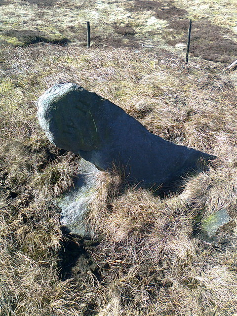
Blake Hill

Hill, Mountain in Yorkshire Harrogate

England

Blake Hill

Vickers Wellington DV718 Vickers Wellington Mk.IC DV718 of No.11 OTU, crashed on Riggs Moor, Blake Hill near Kettlewell on the 2nd / 3rd September 1942.
Vickers Wellington DV718 Credit: John Ryles

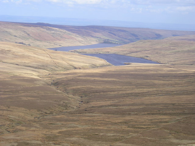
Blake Hill is a prominent hill located in the county of Yorkshire, England. Situated in the northern part of the county, it forms part of the stunning landscape of the Yorkshire Dales National Park. With an elevation of approximately 482 meters (1,581 feet), it offers breathtaking views of the surrounding countryside.

The hill is characterized by its gently sloping sides, covered in lush green vegetation, making it an ideal destination for hikers and nature enthusiasts. The terrain is rich in diverse flora and fauna, with a variety of wildflowers, grasses, and ferns dotting the landscape. It is also home to various species of birds, including the elusive red grouse, making it a popular spot for birdwatching.

Blake Hill is renowned for its tranquility and peaceful ambiance, attracting visitors looking to escape the hustle and bustle of city life. The hill offers several well-maintained footpaths, allowing walkers to explore its picturesque surroundings at their own pace. The paths wind through rolling meadows, ancient woodlands, and babbling streams, providing a truly immersive experience in nature.

The summit of Blake Hill boasts panoramic views that stretch across the vast expanse of the Yorkshire Dales. On clear days, visitors are treated to breathtaking vistas of verdant valleys, craggy peaks, and charming villages nestled in the distance. It is a perfect spot to enjoy a picnic while taking in the awe-inspiring natural beauty of the region.

Overall, Blake Hill in Yorkshire is a captivating destination that offers a serene escape into the heart of nature. Its tranquil atmosphere, diverse wildlife, and stunning vistas make it a must-visit for anyone exploring the Yorkshire Dales.

If you have any feedback on the listing, please let us know in the comments section below.
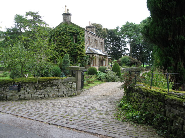
Blake Hill Images

Images are sourced within 2km of 54.152975/-1.9622837 or Grid Reference SE0273. Thanks to Geograph Open Source API. All images are credited.

Vickers Wellington DV718 Vickers Wellington Mk.IC DV718 of No.11 OTU, crashed on Riggs Moor, Blake Hill near Kettlewell on the 2nd / 3rd September 1942.
Vickers Wellington DV718
Vickers Wellington Mk.IC DV718 of No.11 OTU, crashed on Riggs Moor, Blake Hill near Kettlewell on the 2nd / 3rd September 1942.
Vickers Wellington DV718 SE021733 Vickers Wellington Mk.IC DV718 of No.11 OTU, crashed on Riggs Moor, Blake Hill near Kettlewell on the 2nd / 3rd September 1942.
Above is the area where DV718 burned out.
Vickers Wellington DV718 SE021733
Vickers Wellington Mk.IC DV718 of No.11 OTU, crashed on Riggs Moor, Blake Hill near Kettlewell on the 2nd / 3rd September 1942. Above is the area where DV718 burned out.
Angram and Scar Reservoirs from Great Whernside Cold but calm day with superb visibility
Angram and Scar Reservoirs from Great Whernside
Cold but calm day with superb visibility
Old Boundary Marker Parish Boundary Marker 700 metres north of Sandy Gate on Conistone Moor. On the boundary of Conistone with Kilnsey and Stonebeck Up parishes. Inscribed WH.

Milestone Society National ID: YW_CONSTU01pb
Old Boundary Marker
Parish Boundary Marker 700 metres north of Sandy Gate on Conistone Moor. On the boundary of Conistone with Kilnsey and Stonebeck Up parishes. Inscribed WH. Milestone Society National ID: YW_CONSTU01pb
Old Boundary Marker Parish Boundary Marker 2100 metres north of Sandy Gate on Conistone Moor. On the boundary of Conistone with Kilnsey and Stonebeck Up parishes. Inscribed WH.

Milestone Society National ID: YW_CONSTU02pb
Old Boundary Marker
Parish Boundary Marker 2100 metres north of Sandy Gate on Conistone Moor. On the boundary of Conistone with Kilnsey and Stonebeck Up parishes. Inscribed WH. Milestone Society National ID: YW_CONSTU02pb
Old Boundary Marker Parish Boundary Marker 2130 metres north of Sandy Gate on Conistone Moor. On the boundary of Conistone with Kilnsey and Stonebeck Up parishes. Inscribed WH / 1863.

Milestone Society National ID: YW_CONSTU03pb
Old Boundary Marker
Parish Boundary Marker 2130 metres north of Sandy Gate on Conistone Moor. On the boundary of Conistone with Kilnsey and Stonebeck Up parishes. Inscribed WH / 1863. Milestone Society National ID: YW_CONSTU03pb
Old Boundary Marker Parish Boundary Marker 730 metres north of Sandy Gate on Conistone Moor. On the boundary of Conistone with Kilnsey and Stonebeck Up parishes. Inscribed WH.

Milestone Society National ID: YW_CONSTU04pb
Old Boundary Marker
Parish Boundary Marker 730 metres north of Sandy Gate on Conistone Moor. On the boundary of Conistone with Kilnsey and Stonebeck Up parishes. Inscribed WH. Milestone Society National ID: YW_CONSTU04pb
Old Boundary Marker Parish Boundary Marker 1030 metres north of Sandy Gate on Conistone Moor. On the boundary of Conistone with Kilnsey and Stonebeck Up parishes. Inscribed WH.

Milestone Society National ID: YW_CONSTU05pb
Old Boundary Marker
Parish Boundary Marker 1030 metres north of Sandy Gate on Conistone Moor. On the boundary of Conistone with Kilnsey and Stonebeck Up parishes. Inscribed WH. Milestone Society National ID: YW_CONSTU05pb
Old Boundary Marker Parish Boundary Marker 1240 metres north of Sandy Gate on Conistone Moor. On the boundary of Conistone with Kilnsey and Stonebeck Up parishes. Inscribed WH / 1863.

Milestone Society National ID: YW_CONSTU06pb
Old Boundary Marker
Parish Boundary Marker 1240 metres north of Sandy Gate on Conistone Moor. On the boundary of Conistone with Kilnsey and Stonebeck Up parishes. Inscribed WH / 1863. Milestone Society National ID: YW_CONSTU06pb
Old Boundary Marker Parish Boundary Marker 1440 metres north of Sandy Gate on Conistone Moor. On the boundary of Conistone with Kilnsey and Stonebeck Up parishes. Inscribed WH / 1863.

Milestone Society National ID: YW_CONSTU07pb
Old Boundary Marker
Parish Boundary Marker 1440 metres north of Sandy Gate on Conistone Moor. On the boundary of Conistone with Kilnsey and Stonebeck Up parishes. Inscribed WH / 1863. Milestone Society National ID: YW_CONSTU07pb
Old Boundary Marker Fallen Parish Boundary Marker 1530 metres north of Sandy Gate on Conistone Moor. On the boundary of Conistone with Kilnsey and Stonebeck Up parishes. Inscribed WH.

Milestone Society National ID: YW_CONSTU08pb
Old Boundary Marker
Fallen Parish Boundary Marker 1530 metres north of Sandy Gate on Conistone Moor. On the boundary of Conistone with Kilnsey and Stonebeck Up parishes. Inscribed WH. Milestone Society National ID: YW_CONSTU08pb
Old Boundary Marker Parish Boundary Marker 1610 metres north of Sandy Gate on Conistone Moor. On the boundary of Conistone with Kilnsey and Stonebeck Up parishes. Inscribed WH.

Milestone Society National ID: YW_CONSTU09pb
Old Boundary Marker
Parish Boundary Marker 1610 metres north of Sandy Gate on Conistone Moor. On the boundary of Conistone with Kilnsey and Stonebeck Up parishes. Inscribed WH. Milestone Society National ID: YW_CONSTU09pb
Old Boundary Marker Fallen Parish Boundary Marker 1730 metres north of Sandy Gate on Conistone Moor. On the boundary of Conistone with Kilnsey and Stonebeck Up parishes. Inscribed WH.

Milestone Society National ID: YW_CONSTU10pb
Old Boundary Marker
Fallen Parish Boundary Marker 1730 metres north of Sandy Gate on Conistone Moor. On the boundary of Conistone with Kilnsey and Stonebeck Up parishes. Inscribed WH. Milestone Society National ID: YW_CONSTU10pb
Old Boundary Marker Parish Boundary Marker 1910 metres north of Sandy Gate on Conistone Moor. On the boundary of Conistone with Kilnsey and Stonebeck Up parishes. Inscribed WH / 1863.

Milestone Society National ID: YW_CONSTU11pb
Old Boundary Marker
Parish Boundary Marker 1910 metres north of Sandy Gate on Conistone Moor. On the boundary of Conistone with Kilnsey and Stonebeck Up parishes. Inscribed WH / 1863. Milestone Society National ID: YW_CONSTU11pb
Old Boundary Marker Parish Boundary Marker 250 metres north of Sandy Gate on Conistone Moor. On the boundary of Conistone with Kilnsey and Stonebeck Up parishes. Inscribed WH.

Milestone Society National ID: YW_CONSTU12pb
Old Boundary Marker
Parish Boundary Marker 250 metres north of Sandy Gate on Conistone Moor. On the boundary of Conistone with Kilnsey and Stonebeck Up parishes. Inscribed WH. Milestone Society National ID: YW_CONSTU12pb
Stone Beck at Nab End Section of the beck that rises on the upper eastern flanks of Great Whernside, rushing down to contribute to the waters of Angram Reservoir.
Stone Beck at Nab End
Section of the beck that rises on the upper eastern flanks of Great Whernside, rushing down to contribute to the waters of Angram Reservoir.
Stone Beck on Lodge Moor looking Downstream Stone Beck rises high on the eastern flanks of Great Whernside, before tumbling down over Lodge Moor to reach Angram Reservoir.
Stone Beck on Lodge Moor looking Downstream
Stone Beck rises high on the eastern flanks of Great Whernside, before tumbling down over Lodge Moor to reach Angram Reservoir.
Stone Beck on Lodge Moor looking Upstream Looking towards the source high up on the eastern flanks of Great Whernside - unfortunately on this occasion shrouded by a low cloud ceiling.
Stone Beck on Lodge Moor looking Upstream
Looking towards the source high up on the eastern flanks of Great Whernside - unfortunately on this occasion shrouded by a low cloud ceiling.
Show me another place!

Blake Hill is located at Grid Ref: SE0273 (Lat: 54.152975, Lng: -1.9622837)

Division: West Riding

Administrative County: North Yorkshire

District: Harrogate

Police Authority: North Yorkshire

What 3 Words

///booklet.waxes.hamsters. Near Grassington, North Yorkshire

Nearby Locations

Blake Hill

Related Wikis

Great Whernside

Great Whernside is a fell in the Yorkshire Dales, England, not to be confused with Whernside, some 17 miles (27 km) to the west. Its summit is the highest...

Meugher

Meugher (/ˈmuː.fər/) is a hill in the Yorkshire Dales, England. It lies in remote country between Wharfedale and Nidderdale, in the parish of Stonebeck...

Stonebeck Up

Stonebeck Up is a civil parish in Harrogate district, North Yorkshire, England. The only village in the parish is Middlesmoor. The population of the...
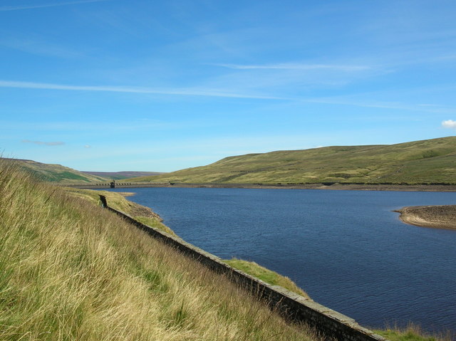
Angram Reservoir

Angram Reservoir is the first of three reservoirs on the River Nidd in Upper Nidderdale, North Yorkshire, England, the others being Scar House Reservoir...

Nidd Valley Light Railway

Nidd Valley Light Railway was a light railway in upper Nidderdale in the West Riding of Yorkshire, England. It was owned by Bradford Corporation Waterworks...

Langcliffe Pot

Langcliffe Pot is a cave system on the slopes of Great Whernside in Upper Wharfedale, about 3 kilometres (1.9 mi) SSE of Kettlewell in North Yorkshire...

Priest's Tarn

Priest's Tarn is an upland lake on Grassington Moor, in North Yorkshire, England. The water from Priest's Tarn was historically used for hydraulic mining...

Little Whernside

Little Whernside is a hill in the Yorkshire Dales, North Yorkshire, England, 2.82 miles (4.54 km) north east of Great Whernside. It is on the boundary...

Nearby Amenities

Located within 500m of 54.152975,-1.9622837
Blake Hill
Natural: peak
Source: OS 1853
Lat/Long: 54.1527122/-1.9613023
The data included in this document is from www.openstreetmap.org. The data is made available under ODbL.

Have you been to Blake Hill?

Leave your review of Blake Hill below (or comments, questions and feedback).