Alderman's Hill

Hill, Mountain in Yorkshire

England

Alderman's Hill

View of St Chad Church, Saddleworth Link to Church Website <span class="nowrap"><a title="https://www.cofeinsaddleworth.org.uk/st-chad-saddleworth-parish-church" rel="nofollow ugc noopener" href="https://www.cofeinsaddleworth.org.uk/st-chad-saddleworth-parish-church">Link</a><img style="margin-left:2px;" alt="External link" title="External link - shift click to open in new window" src="https://s1.geograph.org.uk/img/external.png" width="10" height="10"/></span>
View of St Chad Church, Saddleworth Credit: Philip Cornwall

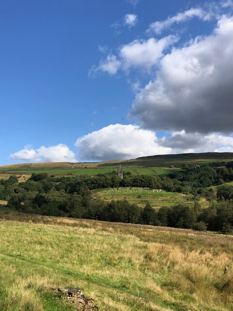
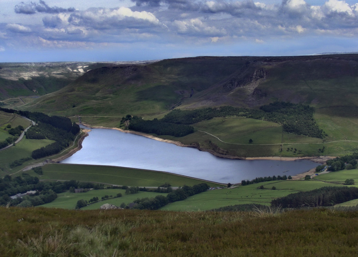
Alderman's Hill is a prominent hill located in the stunning county of Yorkshire, England. With an elevation of approximately 450 meters, it stands as a notable feature in the region. Situated in the heart of the Yorkshire Dales National Park, Alderman's Hill offers breathtaking panoramic views of the surrounding countryside.

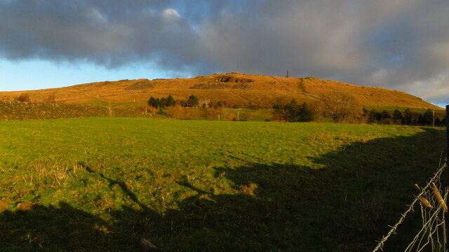
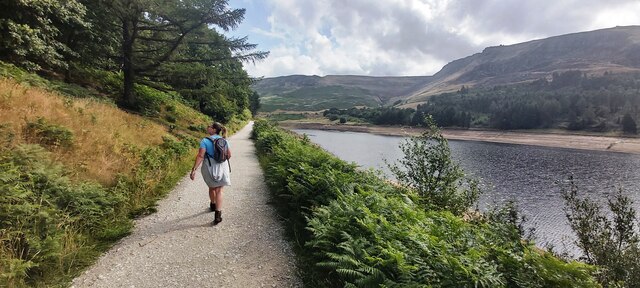
The hill is characterized by its rugged terrain, covered in a patchwork of vibrant green fields, interspersed with rocky outcrops and clusters of ancient trees. Its slopes are home to a diverse range of flora and fauna, creating a haven for nature enthusiasts and hikers alike.

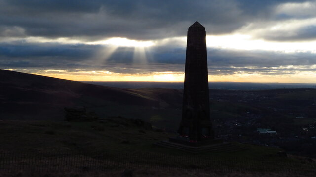
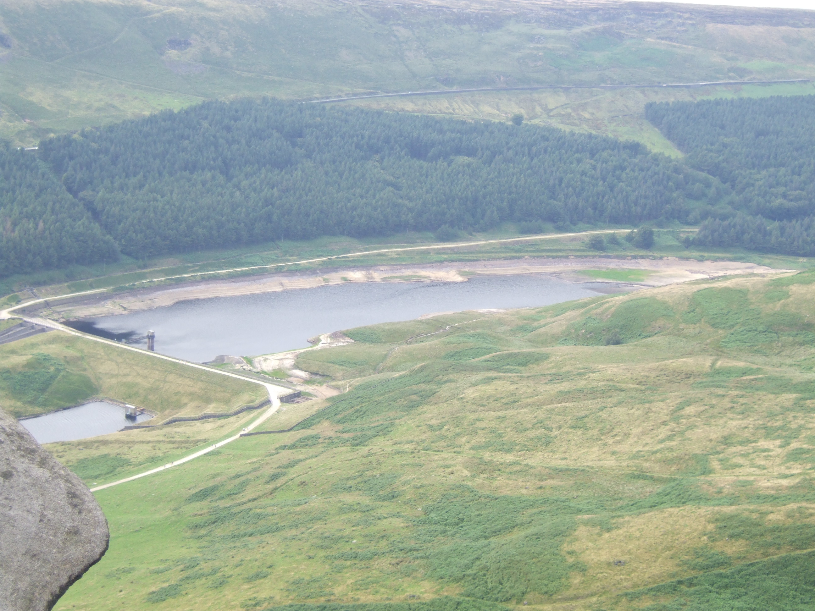
The summit of Alderman's Hill is marked by a trig point, providing a reference point for navigational purposes. From this vantage point, visitors can marvel at the picturesque landscapes that stretch as far as the eye can see, encompassing rolling hills, quaint villages, and meandering rivers.

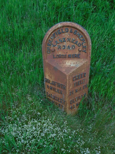
Access to Alderman's Hill is primarily via well-maintained footpaths and trails that wind their way through the surrounding countryside. These routes provide a variety of options for walkers of all abilities, from gentle strolls to more challenging hikes.

Throughout the year, Alderman's Hill attracts visitors from far and wide, who come to immerse themselves in the beauty of Yorkshire's natural landscapes. The hill offers a peaceful retreat from the hustle and bustle of everyday life, providing an opportunity to connect with nature and enjoy the tranquility of the countryside.

In conclusion, Alderman's Hill is a captivating natural landmark in Yorkshire, offering stunning views, diverse wildlife, and a gateway to the scenic wonders of the Yorkshire Dales National Park.

If you have any feedback on the listing, please let us know in the comments section below.

Alderman's Hill Images

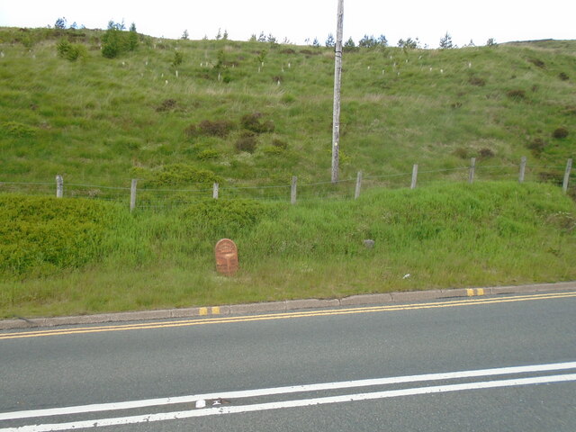
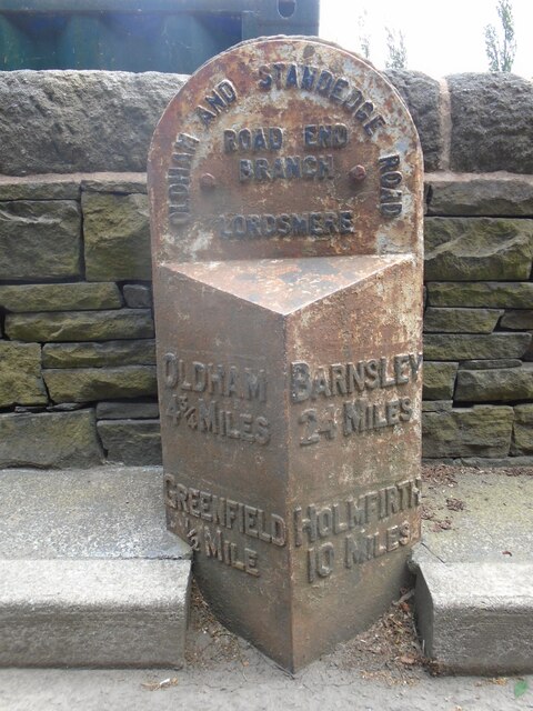
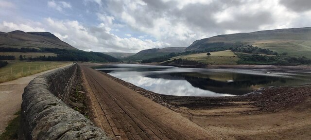
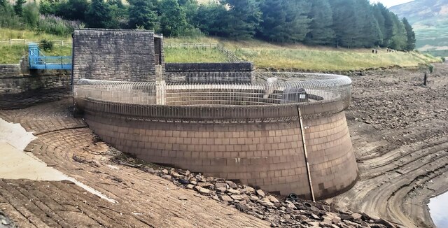
Images are sourced within 2km of 53.538037/-1.9782793 or Grid Reference SE0104. Thanks to Geograph Open Source API. All images are credited.

View of St Chad Church, Saddleworth Link to Church Website <span class="nowrap"><a title="https://www.cofeinsaddleworth.org.uk/st-chad-saddleworth-parish-church" rel="nofollow ugc noopener" href="https://www.cofeinsaddleworth.org.uk/st-chad-saddleworth-parish-church">Link</a><img style="margin-left:2px;" alt="External link" title="External link - shift click to open in new window" src="https://s1.geograph.org.uk/img/external.png" width="10" height="10"/></span>
View of St Chad Church, Saddleworth
Link to Church Website LinkExternal link
Pots & Pans Monument & Greenfield This war memorial was erected in 1923 to honour the 259 people from the villages of Saddleworth who died during the first world war and was located here specifically to be visible from the villages in the area. When plans were submitted for the war memorial there was much opposition from local people who wanted a memorial in the village rather than on top of a bleak hill.
Pots & Pans Monument & Greenfield
This war memorial was erected in 1923 to honour the 259 people from the villages of Saddleworth who died during the first world war and was located here specifically to be visible from the villages in the area. When plans were submitted for the war memorial there was much opposition from local people who wanted a memorial in the village rather than on top of a bleak hill.
Late afternoon sunlight on Pots & Pans Monument near Greenfield
Old milestone The 2 miles from Greenfield West Riding CC milestone, now in Greater Manchester, is on the west side of the A635.  The 3 mile stone minus its attachment was seen in 2002 but has since disappeared altogether.  Many of the milestones in this area known as Saddleworth were painted several years ago.   Now ready for a repaint although the legends can be read.  Neither the 2 or 3 mile stones were 'listed'.
Old milestone
The 2 miles from Greenfield West Riding CC milestone, now in Greater Manchester, is on the west side of the A635. The 3 mile stone minus its attachment was seen in 2002 but has since disappeared altogether. Many of the milestones in this area known as Saddleworth were painted several years ago. Now ready for a repaint although the legends can be read. Neither the 2 or 3 mile stones were 'listed'.
Old milestone The Greenfield and Shepley Lane Head tollroad existed from 1823 to the early 1880s.   About 2 metres to the right of the West Riding CC milestone can just be made out an old stone at the edge of the uncut longer grass.   It is thought that this is a milestone from the turnpike era although no inscription can be made out.
Old milestone
The Greenfield and Shepley Lane Head tollroad existed from 1823 to the early 1880s. About 2 metres to the right of the West Riding CC milestone can just be made out an old stone at the edge of the uncut longer grass. It is thought that this is a milestone from the turnpike era although no inscription can be made out.
Old milestone This milestone is not quite like any of the other late 19C West Riding CC milestones so may be an early replacement.  There is no raised edge to the top section and the lettering is a different style.   It is on the A669 Chew Valley Road near St Mary's CE school.   This area was once in the West Riding but now Greater Manchester.
Old milestone
This milestone is not quite like any of the other late 19C West Riding CC milestones so may be an early replacement. There is no raised edge to the top section and the lettering is a different style. It is on the A669 Chew Valley Road near St Mary's CE school. This area was once in the West Riding but now Greater Manchester.
Dove Stone Reservoir in drought The first six months of 2022 are the driest in the UK since 1976
Dove Stone Reservoir in drought
The first six months of 2022 are the driest in the UK since 1976
Redundant Reservoir Overflow Drain at Dove Stone Reservoir The first six months of 2022 are the driest since 1976
Redundant Reservoir Overflow Drain at Dove Stone Reservoir
The first six months of 2022 are the driest since 1976
Footpath by Dove Stone Reservoir
Greenfield Reservoir Dam
Dam Wall at Greenfield Reservoir
Ashway Edge Reflected in Greenfield Reservoir
Footpath by Greenfield Brook
Ashway Rocks with Dove Stone Reservoir beyond
Ashway Rocks
Ashway Rocks
The path up to Little Flat
Memorial to a local MP who died on this spot Died by the "accidental discharge of a gun"
Memorial to a local MP who died on this spot
Died by the "accidental discharge of a gun"
Wimberry and Heather cover the top end of Ashway Gap
Show me another place!

Alderman's Hill is located at Grid Ref: SE0104 (Lat: 53.538037, Lng: -1.9782793)

Division: West Riding

Unitary Authority: Oldham

Police Authority: Greater Manchester

What 3 Words

///image.snaps.backyards. Near Diggle, Manchester

Related Wikis

Yeoman Hey Reservoir

Yeoman Hey Reservoir is a reservoir in the English Peak District. On its margin is a commemorative stone laid by the King of Tonga in 1981. The reservoir...

Dovestone Reservoir

Dove Stone Reservoir lies at the convergence of the valleys of the Greenfield and Chew Brooks above the village of Greenfield, on Saddleworth Moor in Greater...

Greenfield Valley

Greenfield Valley is a river valley through Saddleworth Moor in England's Peak District National Park. Historically this area of the South Pennines was...

Greenfield Reservoir

Greenfield Reservoir is a reservoir in the Saddleworth parish of the Metropolitan Borough of Oldham in Greater Manchester, in the English Peak District...

Nearby Amenities

Located within 500m of 53.538037,-1.9782793
Barrier: stile
Material: steel
Steps: 3
Stile: squeezer
Lat/Long: 53.5353513/-1.974883
Parking
Access: yes
Capacity: 13
Fee: no
Parking: layby
Supervised: no
Surface: asphalt
Lat/Long: 53.5360304/-1.9751493
Alderman's Hill
Natural: peak
Source: OS 1:25k
Lat/Long: 53.5382417/-1.978484
Brockley Moor
Natural: moor
Source: OS 1:25k
Lat/Long: 53.5368868/-1.9826275
Barrier: stile
Material: wood
Source: survey;gps
Stile: stepover
Lat/Long: 53.5403335/-1.9836418
Material: wood
Power: pole
Lat/Long: 53.5374433/-1.9711817
Barrier: kissing_gate
Lat/Long: 53.5374344/-1.971216
Material: wood
Power: pole
Lat/Long: 53.5341245/-1.9753109
Material: wood
Power: pole
Lat/Long: 53.5347524/-1.973743
Material: wood
Power: pole
Lat/Long: 53.5353926/-1.9724952
Material: wood
Power: pole
Lat/Long: 53.535999/-1.9715622
Material: wood
Power: pole
Lat/Long: 53.5380823/-1.971921
Material: wood
Power: pole
Lat/Long: 53.538888/-1.9717503
Material: wood
Power: pole
Lat/Long: 53.5397057/-1.971584
Parking Space
Parking Space: disabled
Lat/Long: 53.5365886/-1.9746517
Parking Space
Parking Space: disabled
Lat/Long: 53.536595/-1.9747107
Parking Space
Parking Space: disabled
Lat/Long: 53.5366022/-1.9747576
The data included in this document is from www.openstreetmap.org. The data is made available under ODbL.

Have you been to Alderman's Hill?

Leave your review of Alderman's Hill below (or comments, questions and feedback).