Gradbach Hill

Hill, Mountain in Staffordshire Staffordshire Moorlands

England

Gradbach Hill

Guide post and water trough Presumably, originally intended for watering horses but just as good for the many dogs that accompany their owners on walks around The Roaches.
Guide post and water trough Credit: Ian Calderwood

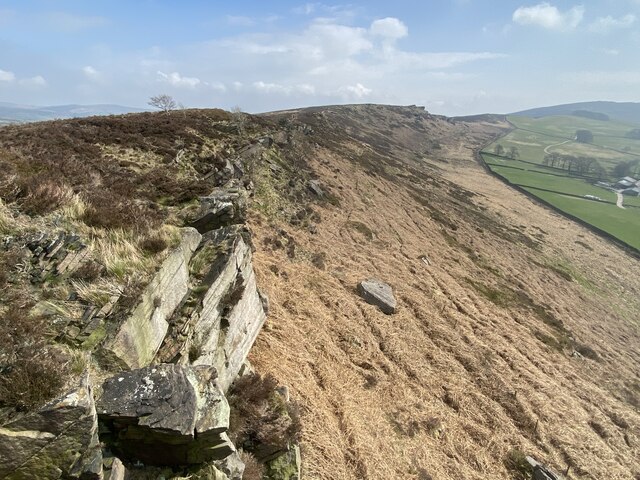
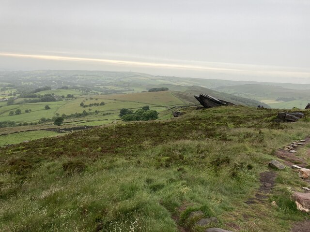
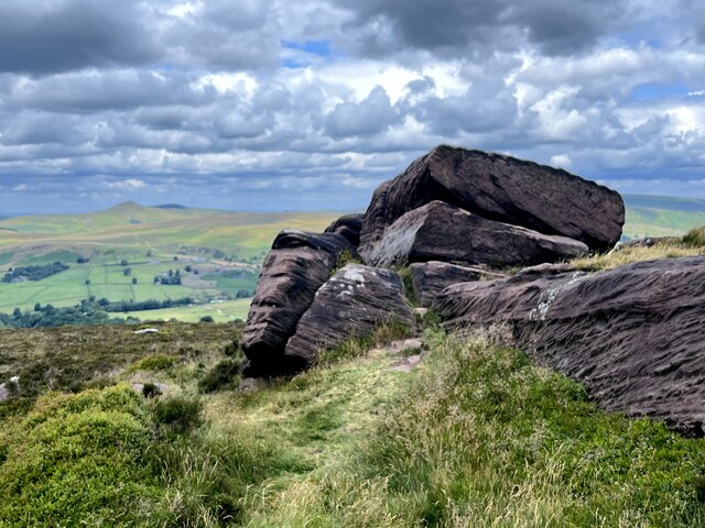
Gradbach Hill is a prominent hill located in the county of Staffordshire, England. Rising to a height of approximately 379 meters (1,243 feet), it is part of the Peak District National Park and offers stunning panoramic views of the surrounding countryside.

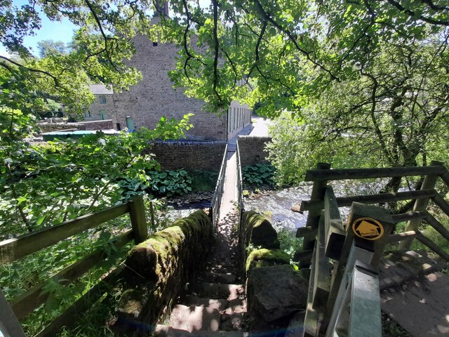
Situated near the small village of Gradbach, the hill is composed mainly of gritstone and is a popular destination for outdoor enthusiasts, hikers, and nature lovers. Its rugged and varied terrain provides an excellent opportunity for various recreational activities, including walking, cycling, and rock climbing.

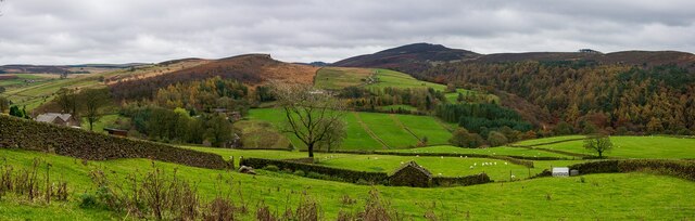
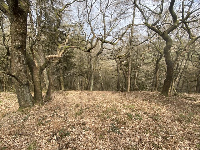
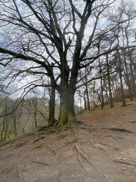
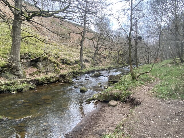
The area surrounding Gradbach Hill is rich in natural beauty, with lush green meadows, dense woodlands, and picturesque streams. The hill itself is covered in heather and grasses, creating a vibrant and colorful landscape throughout the year.

At the summit of Gradbach Hill, visitors can enjoy breathtaking vistas of the nearby Cheshire Plain, the Roaches, and the Dane Valley. On clear days, it is even possible to see as far as the Welsh mountains and the Pennines.

In addition to its natural beauty, Gradbach Hill also holds historical significance. It is believed to have been inhabited since prehistoric times, and there are traces of ancient settlements and burial mounds in the surrounding area.

Overall, Gradbach Hill in Staffordshire is a captivating destination, offering visitors a chance to immerse themselves in nature, explore its diverse landscapes, and marvel at its stunning views.

If you have any feedback on the listing, please let us know in the comments section below.

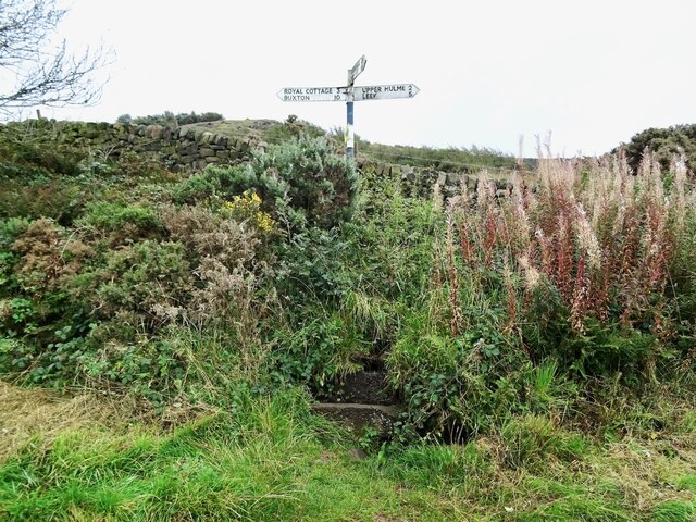
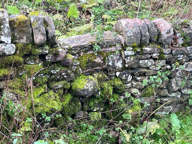
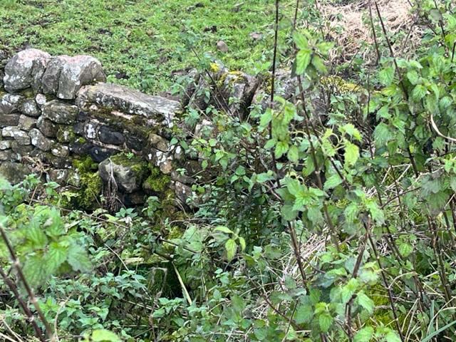
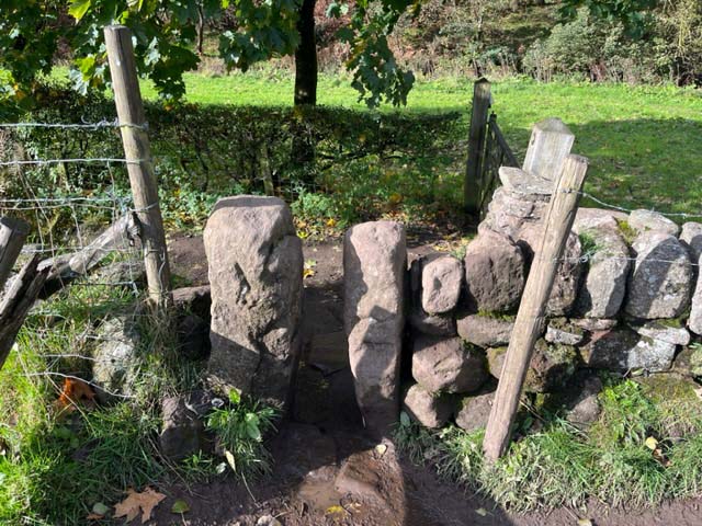
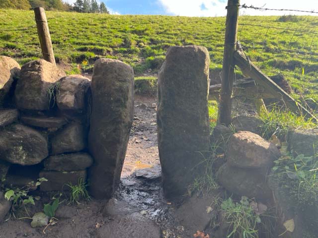
Gradbach Hill Images

Images are sourced within 2km of 53.184697/-2.0004237 or Grid Reference SK0065. Thanks to Geograph Open Source API. All images are credited.

Guide post and water trough Presumably, originally intended for watering horses but just as good for the many dogs that accompany their owners on walks around The Roaches.
Guide post and water trough
Presumably, originally intended for watering horses but just as good for the many dogs that accompany their owners on walks around The Roaches.
Gradbach, Peak District An elevated view from a road to the North.
Gradbach, Peak District
An elevated view from a road to the North.
Forest Wood Sloping steeply down to the River Dane.
Forest Wood
Sloping steeply down to the River Dane.
Back Forest escarpment
Tree with exposed roots At the edge of Forest Wood by the River Dane.
Tree with exposed roots
At the edge of Forest Wood by the River Dane.
River Dane From the Staffordshire bank.
River Dane
From the Staffordshire bank.
Approaching Roach End
Footbridge over the Dane at Gradbach Mill
Ruined sheepfold at Goosetree Farm
Gritstone outcrop on the Roaches
Stone Stile, Rushton Spencer Off Gradbach car park in Gradbach Mill Lane looking West from the car park.
The view to the car park is <a href="https://www.geograph.org.uk/photo/7638396">SJ9966 : Stone Stile, Rushton Spencer</a>.
Stone Stile, Rushton Spencer
Off Gradbach car park in Gradbach Mill Lane looking West from the car park. The view to the car park is SJ9966 : Stone Stile, Rushton Spencer.
Stone Stile, Rushton Spencer Off Gradbach car park in Gradbach Mill Lane looking East to the car park.
The view from is <a href="https://www.geograph.org.uk/photo/7638395">SJ9966 : Stone Stile, Rushton Spencer</a>.
Stone Stile, Rushton Spencer
Off Gradbach car park in Gradbach Mill Lane looking East to the car park. The view from is SJ9966 : Stone Stile, Rushton Spencer.
Stone Stile, Rushton Spencer Off Gradbach Mill Lane on Staffordshire footpath Quarnford 0.1812(a) looking North.
The view out to the lane is <a href="https://www.geograph.org.uk/photo/7639195">SJ9966 : Stone Stile, Rushton Spencer</a>.
Stone Stile, Rushton Spencer
Off Gradbach Mill Lane on Staffordshire footpath Quarnford 0.1812(a) looking North. The view out to the lane is SJ9966 : Stone Stile, Rushton Spencer.
Stone Stile, Rushton Spencer Off Gradbach Mill Lane on Staffordshire footpath Quarnford CP 2 looking South.
The view from the lane is <a href="https://www.geograph.org.uk/photo/7639191">SJ9966 : Stone Stile, Rushton Spencer</a>.
Stone Stile, Rushton Spencer
Off Gradbach Mill Lane on Staffordshire footpath Quarnford CP 2 looking South. The view from the lane is SJ9966 : Stone Stile, Rushton Spencer.
Stone Stile, Rushton Spencer A farmer's private stile near Gradbach Mill Lane.
The view from the other side is <a href="https://www.geograph.org.uk/photo/7639291">SJ9966 : Stone Stile, Rushton Spencer</a>.
Stone Stile, Rushton Spencer
A farmer's private stile near Gradbach Mill Lane. The view from the other side is SJ9966 : Stone Stile, Rushton Spencer.
Stone Stile, Rushton Spencer A farmer's private stile near Gradbach Mill Lane.
The view from the other side is <a href="https://www.geograph.org.uk/photo/7639289">SJ9966 : Stone Stile, Rushton Spencer</a>.
Stone Stile, Rushton Spencer
A farmer's private stile near Gradbach Mill Lane. The view from the other side is SJ9966 : Stone Stile, Rushton Spencer.
Stone Stile, Rushton Spencer On Staffordshire footpath Quarnford CP 22 where it jinxes onto a track looking NW.
The view back is <a href="https://www.geograph.org.uk/photo/7639307">SJ9965 : Stone Stile, Rushton Spencer</a>.
Stone Stile, Rushton Spencer
On Staffordshire footpath Quarnford CP 22 where it jinxes onto a track looking NW. The view back is SJ9965 : Stone Stile, Rushton Spencer.
Stone Stile, Rushton Spencer On Staffordshire footpath Quarnford CP 22 where it jinx onto a track looking SE.
The view back is <a href="https://www.geograph.org.uk/photo/7639306">SJ9965 : Stone Stile, Rushton Spencer</a>.
Stone Stile, Rushton Spencer
On Staffordshire footpath Quarnford CP 22 where it jinx onto a track looking SE. The view back is SJ9965 : Stone Stile, Rushton Spencer.
Show me another place!

Gradbach Hill is located at Grid Ref: SK0065 (Lat: 53.184697, Lng: -2.0004237)

Administrative County: Staffordshire

District: Staffordshire Moorlands

Police Authority: Staffordshire

What 3 Words

///annual.roaring.perform. Near Leek, Staffordshire

Nearby Locations

Gradbach Hill

Related Wikis

Lud's Church

Lud's Church (sometimes written as Ludchurch) is a deep chasm penetrating the Millstone Grit bedrock created by a massive landslip on the hillside above...

The Roaches

The Roaches (from the French les roches – the rocks) is a prominent rocky ridge above Leek and Tittesworth Reservoir in the Staffordshire Peak District...

Black Brook Nature Reserve

Black Brook is a nature reserve of the Staffordshire Wildlife Trust, about 7 miles (11 km) north-east of Leek, in Staffordshire, England. It is moorland...

Swythamley Hall

Swythamley Hall is a late 18th-century country house near Leek, Staffordshire which has been converted into four separate residences. It is a Grade II...

Flash, Staffordshire

Flash is a village in the Staffordshire Moorlands, England, and Peak District National Park. At 1,519 feet (463 m) above sea level, it is the highest village...

Quarnford

Quarnford is a village and civil parish in the Staffordshire Moorlands district of Staffordshire, England. According to the 2001 census it had a population...

Heathylee

Heathylee is a civil parish in the district of Staffordshire Moorlands in north-east Staffordshire, England. There is no village centre. The parish has...

Allgreave

Allgreave is a village in Cheshire, England. It lies on the A54 (Buxton to Congleton) road, near to the border with Staffordshire. Allgreave Methodist...

Nearby Amenities

Located within 500m of 53.184697,-2.0004237
Barrier: stile
Material: stone
Source: survey;gps
Stile: stepover
Lat/Long: 53.1883745/-2.000263
Yawning Stone
Natural: rock
Lat/Long: 53.1844145/-2.0004126
Gradbach Hill
Ele: 399
Natural: peak
Source: https://www.hill-bagging.co.uk/mountaindetails.php?qu=S&rf=16548
Lat/Long: 53.1848725/-2.0004576
The data included in this document is from www.openstreetmap.org. The data is made available under ODbL.

Have you been to Gradbach Hill?

Leave your review of Gradbach Hill below (or comments, questions and feedback).