Long Man

Hill, Mountain in Durham

England

Long Man

Cottages by Sharnberry Gill Another view of the cottages, but still not clear what function they serve (see <a href="https://www.geograph.org.uk/photo/510893">NZ0130 : Cottages by Sharnberry Gill</a>).
Cottages by Sharnberry Gill Credit: Oliver Dixon

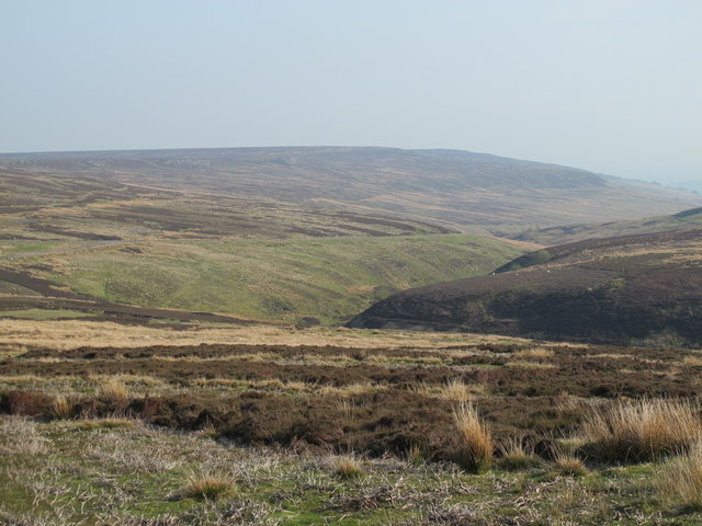
Long Man, Durham, also known as Long Man Hill or Long Man Mountain, is a prominent geological feature located in County Durham, England. Rising to an elevation of approximately 1,395 feet (425 meters), it is a popular destination for hikers, nature enthusiasts, and tourists seeking stunning panoramic views of the surrounding countryside.

Long Man is situated within the North Pennines Area of Outstanding Natural Beauty, which is renowned for its diverse landscapes and rich biodiversity. The hill/mountain boasts a distinctive long ridge, running from northwest to southeast, giving it its name. It is composed mainly of Carboniferous sandstone, which has been shaped by glacial activity and erosion over millions of years.

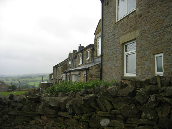
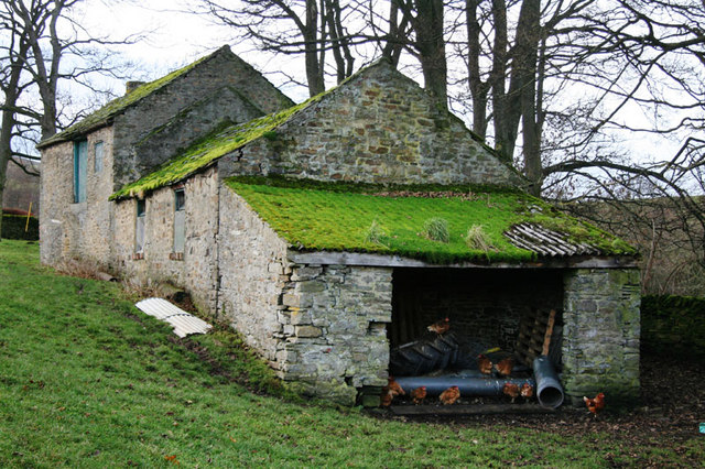
The area surrounding Long Man is characterized by rolling hills, picturesque valleys, and charming villages, making it a haven for outdoor activities such as hiking, cycling, and birdwatching. The hill/mountain itself is home to a variety of plant and animal species, including heather, bilberry, and numerous bird species.

For those interested in history, Long Man has archaeological significance. The area has evidence of human activity dating back to the Neolithic period, with several prehistoric settlements and burial mounds discovered in the vicinity.

Access to Long Man is generally available through a network of footpaths and trails, allowing visitors to explore the hill/mountain at their own pace. The summit offers breathtaking views of the surrounding landscape, including the nearby Northumberland National Park and the Cheviot Hills.

Overall, Long Man, Durham, is a captivating natural landmark, offering visitors an opportunity to immerse themselves in the beauty of the North Pennines and experience the rich history and diverse wildlife of the region.

If you have any feedback on the listing, please let us know in the comments section below.

Long Man Images

Images are sourced within 2km of 54.681733/-2.006482 or Grid Reference NY9931. Thanks to Geograph Open Source API. All images are credited.

Cottages by Sharnberry Gill Another view of the cottages, but still not clear what function they serve (see <a href="https://www.geograph.org.uk/photo/510893">NZ0130 : Cottages by Sharnberry Gill</a>).
Cottages by Sharnberry Gill
Another view of the cottages, but still not clear what function they serve (see NZ0130 : Cottages by Sharnberry Gill).
Sharnberry Gill So narrow is the valley of Sharnberry Gill at this point that the estate/mine road occupies virtually the whole of its floor. The valley stream, Sharnberry Beck flows narrowly at the side of the road.
Sharnberry Gill
So narrow is the valley of Sharnberry Gill at this point that the estate/mine road occupies virtually the whole of its floor. The valley stream, Sharnberry Beck flows narrowly at the side of the road.
Reservoir at Sharnberry Mine On the moor to the north of Sharnberry Gill there's a large spoil heap, a remnant of the upper workings of the Sharnberry Mine; this small reservoir lies close to them.
Reservoir at Sharnberry Mine
On the moor to the north of Sharnberry Gill there's a large spoil heap, a remnant of the upper workings of the Sharnberry Mine; this small reservoir lies close to them.
Pawlaw Pike Pawlaw Pike at Hawkwood Head on Bollihope Common.
Pawlaw Pike
Pawlaw Pike at Hawkwood Head on Bollihope Common.
Five Pikes Looking towards Five Pikes on Bollihope Moor.
Five Pikes
Looking towards Five Pikes on Bollihope Moor.
Hawkwood Burn View looking across Hawkwood Burn on Bollihope Burn.
Hawkwood Burn
View looking across Hawkwood Burn on Bollihope Burn.
Shaftwell Sike The culverted Shaftwell Sike at the mine workings at the head of Howden Burn.
Shaftwell Sike
The culverted Shaftwell Sike at the mine workings at the head of Howden Burn.
Moorland above Little Eggleshope Beck
Moorland above Little Eggleshope Beck (2)
Moorland above Little Eggleshope Beck (3)
Little Eggles Hope
Little Eggles Hope
Bollihope Common around the valley of Shaftwell Sike
Bollihope Common below Long Man
The B6278 Stanhope to Eggleston road (2)
The B6278 Stanhope to Eggleston road (3)
The B6278 Eggleston to Stanhope road
The B6278 road crossing from Weardale to Teesdale
Car park at the side of the B6278
Show me another place!

Long Man is located at Grid Ref: NY9931 (Lat: 54.681733, Lng: -2.006482)

Unitary Authority: County Durham

Police Authority: Durham

What 3 Words

///reported.possible.fidelity. Near Stanhope, Co. Durham

Nearby Locations

Long Man

Related Wikis

Bollihope, Pikestone, Eggleston and Woodland Fells

Bollihope, Pikestone, Eggleston and Woodland Fells is a Site of Special Scientific Interest in the Teesdale district of west County Durham, England. It...

Cornish Hush Mine

The Cornish Hush Mine was a British lead ore and fluorspar mine in Weardale. == Location == The mine was located in the Howden Burn valley in the Bollihope...

Hill End, County Durham

Hill End is a village in the civil parish of Stanhope, in County Durham, England. It is situated on the south side of Weardale, near Frosterley. ��2�...

White Kirkley

White Kirkley is a small village in the civil parish of Stanhope, in County Durham, England. It is situated on the south side of Weardale, opposite Frosterley...

Nearby Amenities

Located within 500m of 54.681733,-2.006482
Long Man
Natural: peak
Source: npe
Lat/Long: 54.6810288/-2.0058844
Image: https://www.geograph.org.uk/photo/6006281
Man Made: cairn
Lat/Long: 54.681771/-2.0081981
Archaeological Site: mineral_extraction
Historic: industrial
Man Made: ventilation_shaft
Source: NLS-OS-NatGrid-110k-1940-60
Lat/Long: 54.6802327/-2.0121943
Abandoned Landuse: quarry
Resource: clay
Source: NLS-OS-NatGrid-110k-1940-60
Lat/Long: 54.6812747/-2.0133959
Hunting Stand
Hunting Stand: grouse_butt
Lat/Long: 54.6780804/-2.0056801
Hunting Stand
Hunting Stand: grouse_butt
Lat/Long: 54.6776981/-2.0053361
The data included in this document is from www.openstreetmap.org. The data is made available under ODbL.

Have you been to Long Man?

Leave your review of Long Man below (or comments, questions and feedback).