Brown Haw
Hill, Mountain in Yorkshire Richmondshire
England
Brown Haw
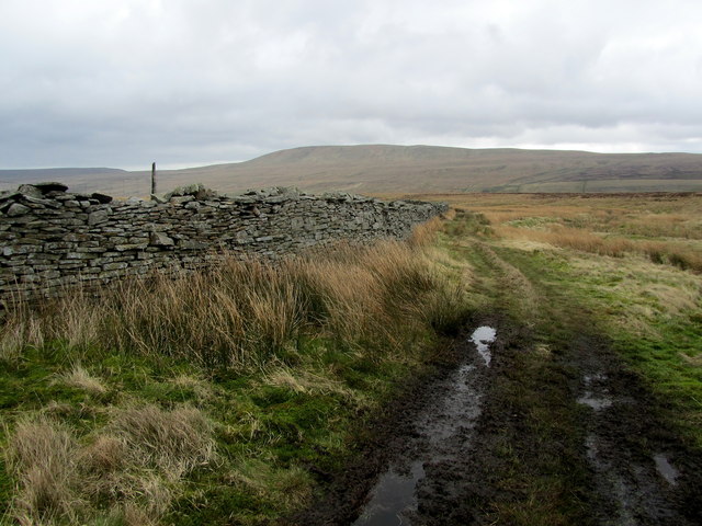
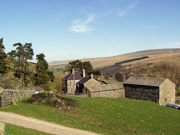
Brown Haw is a prominent hill located in the Yorkshire Dales National Park in Northern England. Situated in the county of North Yorkshire, it forms part of the Pennines, a range of hills and mountains that stretches across the center of England. With an elevation of approximately 645 meters (2,116 feet), it offers breathtaking panoramic views of the surrounding valleys and moorland.
The hill is characterized by its rugged terrain, covered in heather and grasses, making it an ideal habitat for various wildlife species. Visitors to Brown Haw may encounter a variety of bird species, including the golden plover, curlew, and red grouse, as well as occasional sightings of larger mammals such as hares and deer.
The hill is a popular destination for outdoor enthusiasts, attracting hikers, walkers, and nature lovers. Several well-maintained footpaths and trails crisscross the area, allowing visitors to explore the hill's diverse landscapes and take in the stunning vistas. The ascent to the summit can be challenging, but the rewarding views make it well worth the effort.
Brown Haw is also a favorite spot for photographers, who are drawn to the hill's natural beauty and ever-changing light conditions. From sunrise to sunset, the hill offers an array of photographic opportunities, capturing the true essence of Yorkshire's picturesque countryside.
Overall, Brown Haw is a magnificent hill that showcases the natural splendor of the Yorkshire Dales. With its stunning views, diverse wildlife, and excellent walking routes, it offers a memorable experience for anyone seeking to immerse themselves in the region's breathtaking landscapes.
If you have any feedback on the listing, please let us know in the comments section below.
Brown Haw Images
Images are sourced within 2km of 54.214805/-2.0088438 or Grid Reference SD9979. Thanks to Geograph Open Source API. All images are credited.


Brown Haw is located at Grid Ref: SD9979 (Lat: 54.214805, Lng: -2.0088438)
Division: North Riding
Administrative County: North Yorkshire
District: Richmondshire
Police Authority: North Yorkshire
What 3 Words
///cheaply.tried.gathering. Near Leyburn, North Yorkshire
Nearby Locations
Related Wikis

Walden Head
Walden Head is a hamlet in the Yorkshire Dales, North Yorkshire. It lies 5 miles (8 km) of Aysgarth and to the north is a similar village Walden. The village...
Woodale
Woodale is a hamlet in Coverdale in the Yorkshire Dales in England. It lies in the civil parish of Carlton Highdale in the Richmondshire district of North...

Carlton Highdale
Carlton Highdale is a civil parish in Coverdale, North Yorkshire, England. According to the 2001 census it had a population of 95. The parish covers the...

Walden, North Yorkshire
Walden is a dale and hamlet in the Yorkshire Dales, North Yorkshire, England. The dale is a side dale of Wensleydale, sometimes known as Waldendale or...

Buckden Pike
Buckden Pike is a fell at the head of Wharfedale, a valley in the Yorkshire Dales, that stands above the village of Buckden, England. At 702 metres (2...

Little Whernside
Little Whernside is a hill in the Yorkshire Dales, North Yorkshire, England, 2.82 miles (4.54 km) north east of Great Whernside. It is on the boundary...
Braidley
Braidley is a hamlet in Coverdale in the Yorkshire Dales, England. It lies in the civil parish of Carlton Highdale in the Richmondshire district of North...

Burton-cum-Walden
Burton-cum-Walden is a civil parish in North Yorkshire, England, in the Yorkshire Dales National Park. It had a population of 303 according to the 2011...
Nearby Amenities
Located within 500m of 54.214805,-2.0088438Have you been to Brown Haw?
Leave your review of Brown Haw below (or comments, questions and feedback).