Black Hill

Hill, Mountain in Durham

England

Black Hill

Moorland road near Hisehope Head
Moorland road near Hisehope Head Credit: Les Hull

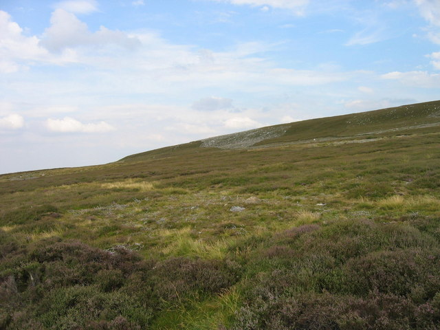
Black Hill is a prominent hill located in Durham, a historic city in northeastern England. Rising to an elevation of approximately 260 meters (853 feet), it is a popular destination for outdoor enthusiasts and nature lovers alike. The hill is situated near the village of Ushaw Moor, approximately 6 kilometers (3.7 miles) northwest of Durham's city center.

Black Hill offers stunning panoramic views of the surrounding countryside, including the nearby rolling hills and farmland. Its distinctive dark appearance, which gives it its name, is due to the presence of coal seams that were once mined in the area. These coal deposits have had a significant impact on the local landscape and history.

The hill is accessible via a network of footpaths and trails, making it an attractive spot for hikers and walkers. It is also a favorite spot for local residents seeking a peaceful and scenic escape from the city. The paths leading to the summit offer a range of difficulty levels, accommodating both casual strollers and more experienced hikers.

Additionally, Black Hill is home to a variety of wildlife, including several species of birds, mammals, and plant life. Birdwatchers often visit the hill to catch glimpses of rare or migrating species. The hill's diverse ecosystem provides a unique habitat for both common and rare fauna and flora.

Overall, Black Hill in Durham offers visitors a chance to experience the natural beauty and tranquility of the region, while also providing a glimpse into the area's industrial past. With its picturesque views, accessible trails, and abundant wildlife, it is a must-visit destination for nature enthusiasts and those seeking outdoor adventures.

If you have any feedback on the listing, please let us know in the comments section below.

Black Hill Images

Images are sourced within 2km of 54.811353/-2.0195889 or Grid Reference NY9846. Thanks to Geograph Open Source API. All images are credited.

Moorland road near Hisehope Head
Track leading towards Black Hill
Feldon Carrs
Feldon Carrs
Edmondbyers Cross (remains of) Possibly.
Edmondbyers Cross (remains of)
Possibly.
Track on Muggleswick Common Looking roughly west across the valley of Feldon Burn in <a href="https://www.geograph.org.uk/gridref/NY9946">NY9946</a> towards the lower slopes of Black Hill in <a href="https://www.geograph.org.uk/gridref/NY9846">NY9846</a>.
Track on Muggleswick Common
Looking roughly west across the valley of Feldon Burn in NY9946 towards the lower slopes of Black Hill in NY9846.
Hill 443 on Muggleswick Common
(Part of) Muggleswick Common
The valley of Feldon Burn
The valley of Feldon Burn (2) The building on the far hillside (slightly left of centre) is <a href="https://www.geograph.org.uk/photo/157134">NY9747 : Belmount</a> (photo by Oliver Dixon).
The valley of Feldon Burn (2)
The building on the far hillside (slightly left of centre) is NY9747 : Belmount (photo by Oliver Dixon).
Heather moor east of B6278 Heather covered ground managed as a grouse moor rises gently to the east side of the B6278.
Heather moor east of B6278
Heather covered ground managed as a grouse moor rises gently to the east side of the B6278.
Bog at Hisehope Head This marshy ground at Hisehope Head is the source of Hisehope Burn the water of which makes its way via Hisehope Reservoir to join the River Derwent, a tributary of the Tyne; the view is from a little east of the B6278.
Bog at Hisehope Head
This marshy ground at Hisehope Head is the source of Hisehope Burn the water of which makes its way via Hisehope Reservoir to join the River Derwent, a tributary of the Tyne; the view is from a little east of the B6278.
Hisehopeburn Head
Hisehopeburn Head
Muggleswick Common With the Cheviots on the far horizon.
Muggleswick Common
With the Cheviots on the far horizon.
Muggleswick Common and the cleugh of Feldon Burn
Muggleswick Common (2) Looking across the cleugh of Feldon Burn, The Middles and the cleugh of Eudon Burn towards <a href="https://www.geograph.org.uk/photo/2460658">NY9848 : Pedam's Oak</a>.
Muggleswick Common (2)
Looking across the cleugh of Feldon Burn, The Middles and the cleugh of Eudon Burn towards NY9848 : Pedam's Oak.
Feldon Plain The buildings just below the horizon (centre) are those at <a href="https://www.geograph.org.uk/photo/2460680">NY9747 : Belmount</a>.
Feldon Plain
The buildings just below the horizon (centre) are those at NY9747 : Belmount.
Snowpoles on the B6278 The high moorland road from Stanhope to Edmundbyers over Muggleswick Common.
Snowpoles on the B6278
The high moorland road from Stanhope to Edmundbyers over Muggleswick Common.
Muggleswick Common Looking north-west into the valley of the Feldon Burn.
Muggleswick Common
Looking north-west into the valley of the Feldon Burn.
Show me another place!

Black Hill is located at Grid Ref: NY9846 (Lat: 54.811353, Lng: -2.0195889)

Unitary Authority: County Durham

Police Authority: Durham

What 3 Words

///trickling.solar.tiny. Near Muggleswick, Co. Durham

Nearby Locations

Black Hill

Related Wikis

Muggleswick, Stanhope and Edmundbyers Commons and Blanchland Moor

Muggleswick, Stanhope and Edmundbyers Commons and Blanchland Moor is a Site of Special Scientific Interest in County Durham and Northumberland, England...

Blanchland railway station

Blanchland railway station served the village of Blanchland, Northumberland, England, from 1845 to 1965 on the Stanhope and Tyne Railway. == History... ==

Hunstanworth

Hunstanworth is a village in County Durham, England. It is situated approximately 10 miles to the west of Consett, south-west of the village of Blanchland...

Ramshaw, Consett

Ramshaw is a small village in County Durham, in England. It is situated to the south of Hunstanworth, a few miles west of Consett. Lead mining was an important...

Nearby Amenities

Located within 500m of 54.811353,-2.0195889
Hunting Stand
Hunting Stand: grouse_butt
Lat/Long: 54.8077468/-2.0194244
Hunting Stand
Hunting Stand: grouse_butt
Lat/Long: 54.8079848/-2.0199984
Hunting Stand
Hunting Stand: grouse_butt
Lat/Long: 54.8082569/-2.0205993
Hunting Stand
Hunting Stand: grouse_butt
Lat/Long: 54.808532/-2.0212162
Hunting Stand
Hunting Stand: grouse_butt
Lat/Long: 54.8088134/-2.0218223
Hunting Stand
Hunting Stand: grouse_butt
Lat/Long: 54.8090854/-2.0224553
Hunting Stand
Hunting Stand: grouse_butt
Lat/Long: 54.8093668/-2.0230562
Hunting Stand
Hunting Stand: grouse_butt
Lat/Long: 54.8096512/-2.0237052
Hunting Stand
Hunting Stand: grouse_butt
Lat/Long: 54.8099232/-2.02429
The data included in this document is from www.openstreetmap.org. The data is made available under ODbL.

Have you been to Black Hill?

Leave your review of Black Hill below (or comments, questions and feedback).