Seavy Hill

Hill, Mountain in Yorkshire Richmondshire

England

Seavy Hill

Shooting hut beside East Black Sike East Black Sike drains part of Scargill High Moor. The hut is set into a gouge into the slope on the west side of the stream; it can be approached by an estate road from the north.
Shooting hut beside East Black Sike Credit: Trevor Littlewood

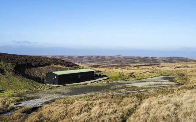
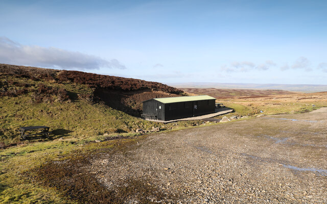
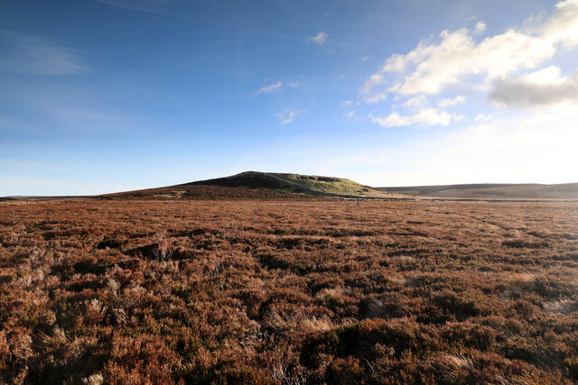
Seavy Hill, located in the county of Yorkshire, England, is a prominent hill standing at an elevation of approximately 344 meters (1,128 feet) above sea level. It is situated within the picturesque North York Moors National Park, renowned for its outstanding natural beauty, and is part of the larger Cleveland Hills range.

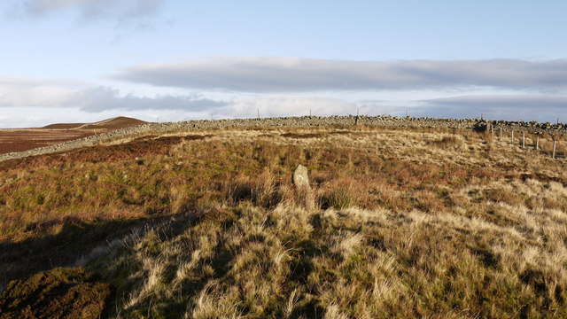
The hill itself offers stunning panoramic views of the surrounding countryside, with its steep slopes covered in heather, grasses, and scattered trees. Seavy Hill is characterized by its gently undulating terrain, providing a challenging yet rewarding hike for outdoor enthusiasts and nature lovers alike. The summit offers a breathtaking vista, stretching as far as the eye can see, encompassing the rugged moorland, rolling hills, and distant towns.

The area is home to a diverse range of wildlife, including various bird species, such as curlews and lapwings, which can often be spotted soaring overhead. The hillside is also known for its rich flora, with a vibrant display of wildflowers during the summer months.

Seavy Hill is accessible via several footpaths and trails, making it a popular destination for walkers, hikers, and cyclists. The surrounding area offers a wealth of outdoor activities, including nature photography, birdwatching, and picnicking amidst the tranquil surroundings. The hill's close proximity to nearby villages and towns provides visitors with the opportunity to explore quaint local shops, cafes, and pubs, immersing themselves in the region's unique charm and hospitality.

Overall, Seavy Hill is a captivating natural landmark, offering a sanctuary of tranquility and a chance to connect with the unspoiled beauty of the North York Moors.

If you have any feedback on the listing, please let us know in the comments section below.

Seavy Hill Images

Images are sourced within 2km of 54.470002/-2.0240213 or Grid Reference NY9808. Thanks to Geograph Open Source API. All images are credited.

Shooting hut beside East Black Sike East Black Sike drains part of Scargill High Moor. The hut is set into a gouge into the slope on the west side of the stream; it can be approached by an estate road from the north.
Shooting hut beside East Black Sike
East Black Sike drains part of Scargill High Moor. The hut is set into a gouge into the slope on the west side of the stream; it can be approached by an estate road from the north.
Grouse butt at rock band White Crag is a discontinuous rock band mainly broken into large numbers of angular boulders overlooking Scargill High Moor. A number of grouse butts has been built into the rock band using the material obviously available. A thin path runs along the crag.
Grouse butt at rock band
White Crag is a discontinuous rock band mainly broken into large numbers of angular boulders overlooking Scargill High Moor. A number of grouse butts has been built into the rock band using the material obviously available. A thin path runs along the crag.
Cuboid boulders along White Crag White Crag is a discontinuous rock band broken mainly into angular boulders overlooking Scargill High Moor. The continuing rocks can be seen running into the distance.
Further into the distance, beyond the moorland is Stang Forest.
Cuboid boulders along White Crag
White Crag is a discontinuous rock band broken mainly into angular boulders overlooking Scargill High Moor. The continuing rocks can be seen running into the distance. Further into the distance, beyond the moorland is Stang Forest.
Cuboid boulders along White Crag - 2 White Crag is a discontinuous rock band broken into angular boulders overlooking Scargill High Moor. More rocks can be seen running into the distance.
In the far distance, beyond the moorland, can be seen the coniferous trees of Stang Forest.
Cuboid boulders along White Crag - 2
White Crag is a discontinuous rock band broken into angular boulders overlooking Scargill High Moor. More rocks can be seen running into the distance. In the far distance, beyond the moorland, can be seen the coniferous trees of Stang Forest.
High Moor Lunch Hut As well as lots of Covid-related signage and hand-sanitiser at every door, the shooting hut also has a prominent sign announcing its identity to anyone coming up the track from lower down in the drainage of East Black Sike, though it seems likely that anyone with need to know would be accompanied by drivers, beaters and others who could just as easily tell them (if they hadn't already been briefed when paying out the exorbitant sums to come and shoot things). Presumably it also becomes obvious when, on Scargill High Moor, they get provided with lunch...
High Moor Lunch Hut
As well as lots of Covid-related signage and hand-sanitiser at every door, the shooting hut also has a prominent sign announcing its identity to anyone coming up the track from lower down in the drainage of East Black Sike, though it seems likely that anyone with need to know would be accompanied by drivers, beaters and others who could just as easily tell them (if they hadn't already been briefed when paying out the exorbitant sums to come and shoot things). Presumably it also becomes obvious when, on Scargill High Moor, they get provided with lunch...
Eroding sandstone on Scargill High Moor The prominent escarpment  at the top of Scargill High Moor is formed in the unnamed sandstone that lies just below the Little Limestone, towards the bottom of the Stainmore Group, of Pendleian age in the Carboniferous. It's part of what older ones among us will remember as being the Millstone Grit series. At the top of the slope, blocks of sandstone are weathering out, and have little or no peat drift covering them. Just back from the edge, a path links lines of grouse butts, making for surprisingly easy and pleasant walking. Even beyond the last grouse butt (some way to the west) the path continues as a gamekeeper's access, somewhat narrower but still giving mostly easy footing.
Eroding sandstone on Scargill High Moor
The prominent escarpment at the top of Scargill High Moor is formed in the unnamed sandstone that lies just below the Little Limestone, towards the bottom of the Stainmore Group, of Pendleian age in the Carboniferous. It's part of what older ones among us will remember as being the Millstone Grit series. At the top of the slope, blocks of sandstone are weathering out, and have little or no peat drift covering them. Just back from the edge, a path links lines of grouse butts, making for surprisingly easy and pleasant walking. Even beyond the last grouse butt (some way to the west) the path continues as a gamekeeper's access, somewhat narrower but still giving mostly easy footing.
North towards Citron Seat From the Gilmonby road, a bridleway heads south as a good track, and where it splits, the branch to Citron Seat (the small dark-topped hill right on centre in this view) continues very clear, though, like the southern branch, it ends very abruptly at no particularly obvious destination (just at a change of local authority administering the definitive rights of way map). The southern branch passes through this view just at the foot of the slope, though you'd hardly know it. Since it terminates abruptly at the boundary wall and fails to enter the Yorkshire Dales National park, its original destination is unclear, but somewhere in upper Arkengarthdale seems likely, perhaps joining the public footpath which also started life as a bridleway until it hit the National Park frontier. One suspects some severe laxity in recording the rights of way after the 1949 Countryside Act.
North towards Citron Seat
From the Gilmonby road, a bridleway heads south as a good track, and where it splits, the branch to Citron Seat (the small dark-topped hill right on centre in this view) continues very clear, though, like the southern branch, it ends very abruptly at no particularly obvious destination (just at a change of local authority administering the definitive rights of way map). The southern branch passes through this view just at the foot of the slope, though you'd hardly know it. Since it terminates abruptly at the boundary wall and fails to enter the Yorkshire Dales National park, its original destination is unclear, but somewhere in upper Arkengarthdale seems likely, perhaps joining the public footpath which also started life as a bridleway until it hit the National Park frontier. One suspects some severe laxity in recording the rights of way after the 1949 Countryside Act.
Tarnhow Hill Although apparently a very minor eminence on the map, Tarnhow Hill seems quite prominent across the otherwise rather flat bit of moorland above Bleakhow Edge (itself a rather over-grandiose name for a short steep slope with a few sandstone boulders). There's a small crag or perhaps a quarry, which I would have guessed was formed in the Little Limestone, but BGS sheet 41 (Kirkby Stephen) shows it as Richmond Chert, a little above the limestone. It also shows Tarnhow Hill covered in drift with no actual bedrock showing, which is clearly not the case, so I withhold judgement on which bed is outcropping, as I suspect that the mappers, like myself today, may not have trekked over to the hill and examined it in detail. The drystone wall which crosses its shoulder, marks the post-1974 border between North Yorkshire and County Durham (prior to that, the boundary was along the River Tees, further north) and is also the frontier of the Yorkshire Dales National Park. A number of rights of way either change status to lesser rights, or terminate abruptly on that border, suggesting that within the Park (in 1949 it was all the North Riding) recording of existing paths was far more lax than outside on the definitive map. Given the time it took for the 1949 Act to result in these definitive maps, it is possible that the discrepancy lay between the post-1974 county authorities.
Tarnhow Hill
Although apparently a very minor eminence on the map, Tarnhow Hill seems quite prominent across the otherwise rather flat bit of moorland above Bleakhow Edge (itself a rather over-grandiose name for a short steep slope with a few sandstone boulders). There's a small crag or perhaps a quarry, which I would have guessed was formed in the Little Limestone, but BGS sheet 41 (Kirkby Stephen) shows it as Richmond Chert, a little above the limestone. It also shows Tarnhow Hill covered in drift with no actual bedrock showing, which is clearly not the case, so I withhold judgement on which bed is outcropping, as I suspect that the mappers, like myself today, may not have trekked over to the hill and examined it in detail. The drystone wall which crosses its shoulder, marks the post-1974 border between North Yorkshire and County Durham (prior to that, the boundary was along the River Tees, further north) and is also the frontier of the Yorkshire Dales National Park. A number of rights of way either change status to lesser rights, or terminate abruptly on that border, suggesting that within the Park (in 1949 it was all the North Riding) recording of existing paths was far more lax than outside on the definitive map. Given the time it took for the 1949 Act to result in these definitive maps, it is possible that the discrepancy lay between the post-1974 county authorities.
Gamekeeper's path on White Crag Moss Beyond the last grouse butt on Scargill High Moor, the broad footpath serving those butts (used by off-road vehicles, one suspects) shrinks to just a footpath, though the occasional fat tyre track does suggest something motorised occasionally passes this way. Lots of predator traps and grouse medication trays imply the primary purpose is for gamekeeper's access, but being along the top of the sandstone outcrop where the peat is shallow or absent, the path is surprisingly easy underfoot and the views north over the Greta valley are rather fine.
Gamekeeper's path on White Crag Moss
Beyond the last grouse butt on Scargill High Moor, the broad footpath serving those butts (used by off-road vehicles, one suspects) shrinks to just a footpath, though the occasional fat tyre track does suggest something motorised occasionally passes this way. Lots of predator traps and grouse medication trays imply the primary purpose is for gamekeeper's access, but being along the top of the sandstone outcrop where the peat is shallow or absent, the path is surprisingly easy underfoot and the views north over the Greta valley are rather fine.
Faggergill The track above the disused mine makes for easy walking until it peters out on the slopes of Hoove.The path actually glistens in the sunlight due to the amount of Quartz crystal lying around . Geologists could fill carrier bags full of the stuff as well as rocks with Galena and other assorted minerals if given time to explore.
Faggergill
The track above the disused mine makes for easy walking until it peters out on the slopes of Hoove.The path actually glistens in the sunlight due to the amount of Quartz crystal lying around . Geologists could fill carrier bags full of the stuff as well as rocks with Galena and other assorted minerals if given time to explore.
Shooting hut Shooting hut at the disused Faggergill lead mines.
Shooting hut
Shooting hut at the disused Faggergill lead mines.
Black Sike Black Sike has cut a deep ravine through the peat moor on its journey from the plateau north of the summit of Hoove.
Black Sike
Black Sike has cut a deep ravine through the peat moor on its journey from the plateau north of the summit of Hoove.
Boundary stone on Stony Hill The boundary stone in the centre of the image has a white-painted letter B on the face towards the camera. It's one of a series of similar stones along a fence line running generally south-west and seen at the right side of the image; this stone is unusual in being located off the fence line. At the wall/fence junction in view there's a boulder embedded in the ground bearing a chiselled letter B. The conical hill to the left side of the photograph is Citron Seat.
Boundary stone on Stony Hill
The boundary stone in the centre of the image has a white-painted letter B on the face towards the camera. It's one of a series of similar stones along a fence line running generally south-west and seen at the right side of the image; this stone is unusual in being located off the fence line. At the wall/fence junction in view there's a boulder embedded in the ground bearing a chiselled letter B. The conical hill to the left side of the photograph is Citron Seat.
Cleasby Hill top The top is totally unmarked and this is close to the spot height of 511m.
The top is almost flat over 300m square.
Cleasby Hill top
The top is totally unmarked and this is close to the spot height of 511m. The top is almost flat over 300m square.
Faggergill Moor
Faggergill Moor
Moorland, Seavy Hill
Long Rigg
Long Rigg
Show me another place!

Seavy Hill is located at Grid Ref: NY9808 (Lat: 54.470002, Lng: -2.0240213)

Division: North Riding

Administrative County: North Yorkshire

District: Richmondshire

Police Authority: North Yorkshire

What 3 Words

///moguls.grownup.flitting. Near Bowes, Co. Durham

Related Wikis

Hoove

Hoove is a hill in the northern Yorkshire Dales in North Yorkshire, England, near the town of Barnard Castle in County Durham. Its elevation is 554 metres...

Arkengarthdale

Arkengarthdale is a dale, or valley, on the east side of the Pennines in North Yorkshire, England. Running roughly north-west to south-east, it is the...

Sleightholme

Sleightholme is a secluded hamlet on a dead end road in County Durham, England. It lies beside Sleightholme Beck, a tributary of the River Greta. The...

Whaw

Whaw is a hamlet in Arkengarthdale in North Yorkshire, England. It is one of few settlements in the dale and is one of the smallest. Its name derives from...

Sleightholme Beck Gorge – The Troughs

Sleightholme Beck Gorge – The Troughs is a Site of Special Scientific Interest in the County Durham district of south-west County Durham, England. The...

Arkle Beck Meadows, Whaw

Arkle Beck Meadows, Whaw (grid reference NY984041) is a 8.4 hectares (21 acres) biological Site of Special Scientific Interest (SSSI) at Whaw in Arkengarthdale...

Eskeleth

Eskeleth is a hamlet in Arkengarthdale in North Yorkshire, England. It is in the Yorkshire Dales National Park. Eskeleth sits 4 miles (6.4 km) from the...

Walney to Wear and Whitby Cycle Route

The Walney to Wear and Whitby Cycle Route (or W2W) is the name of a cross-country cycle route in Northern England. It runs from Walney Island in Cumbria...

Nearby Amenities

Located within 500m of 54.470002,-2.0240213
Little Foster Hill
Place: locality
Lat/Long: 54.4732171/-2.028865
Seavy Hill
Place: locality
Lat/Long: 54.4707486/-2.0256852
West Wike
Place: locality
Lat/Long: 54.4682421/-2.0223164
The data included in this document is from www.openstreetmap.org. The data is made available under ODbL.

Have you been to Seavy Hill?

Leave your review of Seavy Hill below (or comments, questions and feedback).