Parkhouse Hill

Hill, Mountain in Aberdeenshire

Scotland

Parkhouse Hill

The ruins of the Abbey of Deer
The ruins of the Abbey of Deer Credit: Jim Benvie

Parkhouse Hill is a prominent hill located in Aberdeenshire, Scotland. With an elevation of approximately 1,119 feet (341 meters), it is considered a notable hill in the region. Situated near the village of Cruden Bay, Parkhouse Hill offers stunning panoramic views of the surrounding landscape.

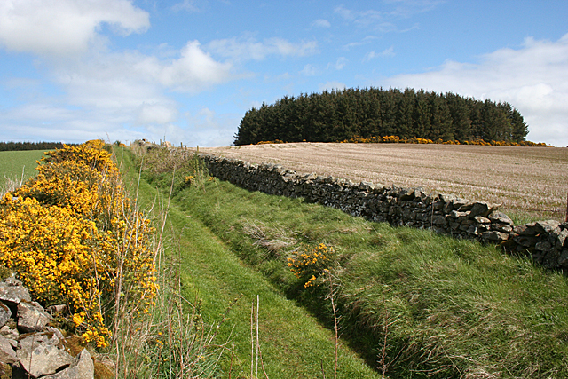
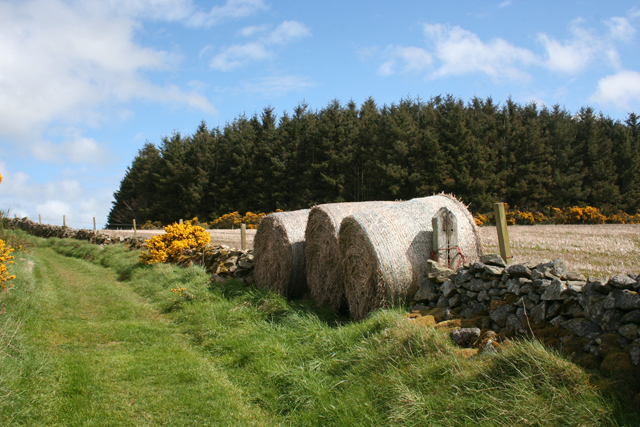
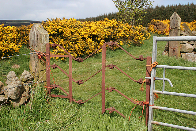
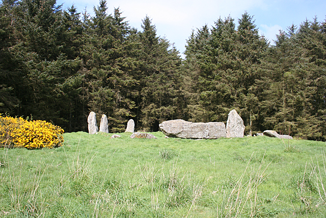
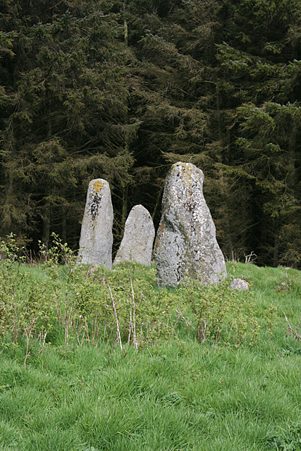
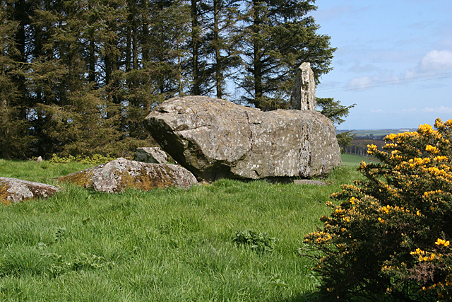
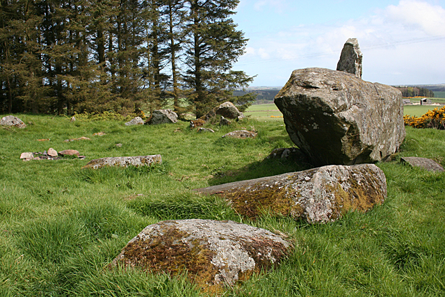
The hill is characterized by its distinctive shape and rocky terrain. Its slopes are covered with a mix of heather, grass, and scattered rocks, creating a picturesque landscape. The summit is relatively flat, allowing visitors to easily explore and enjoy the breathtaking vistas.

Parkhouse Hill is a popular destination for outdoor enthusiasts, particularly hikers and nature lovers. There are various trails that lead to the summit, providing different levels of difficulty for hikers of all abilities. The hill's location also makes it an ideal spot for birdwatching, with a diverse range of bird species inhabiting the area.

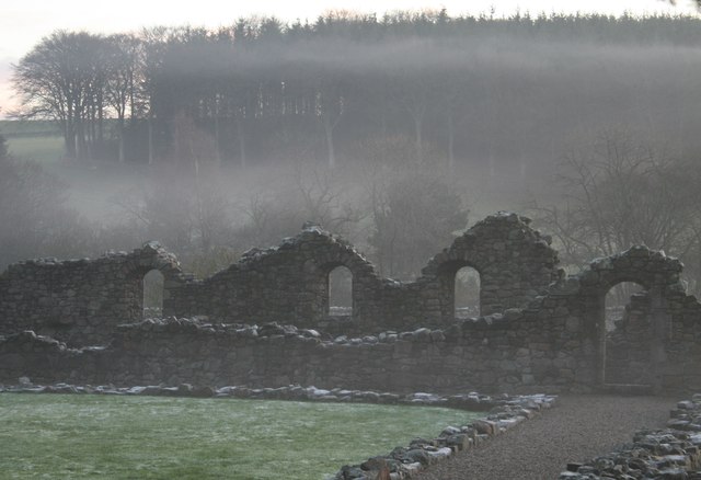
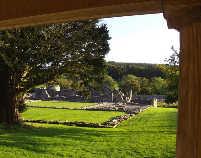
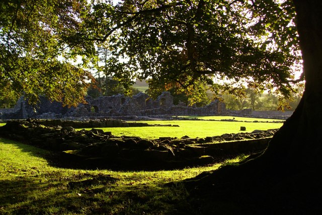
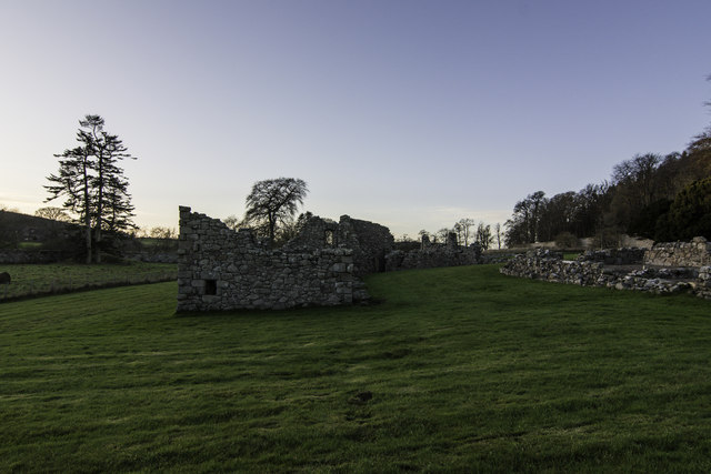
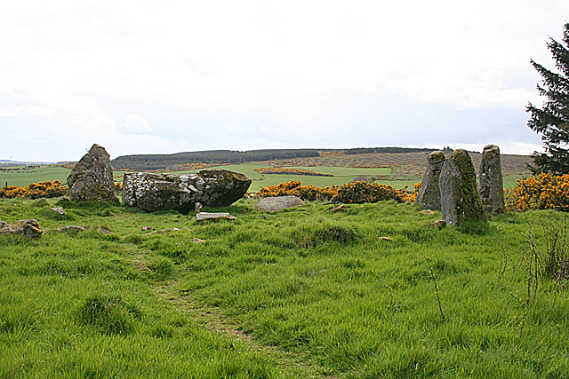
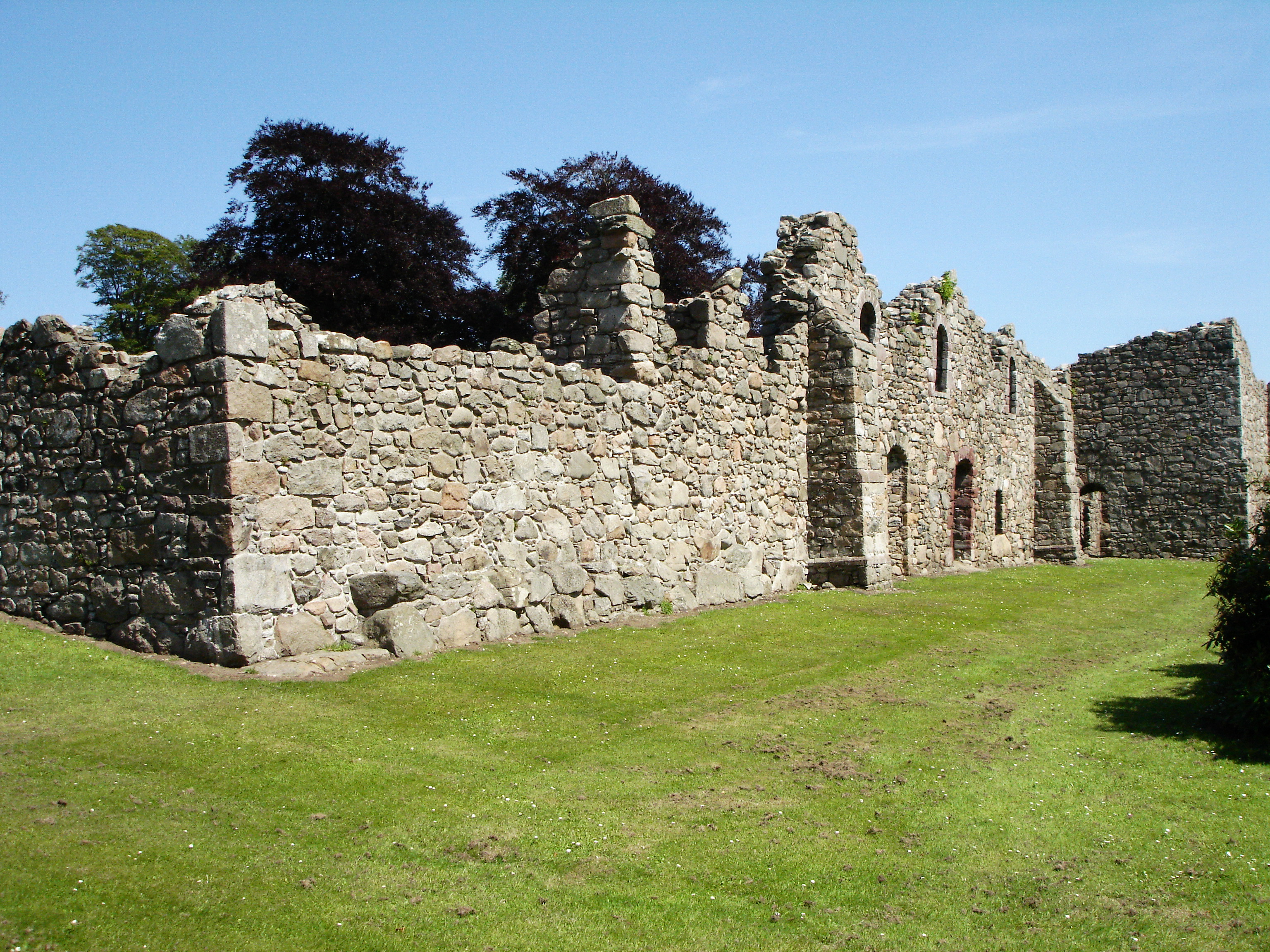
Historically, Parkhouse Hill was used as a landmark for navigational purposes due to its prominent position. Additionally, the hill holds archaeological significance, with the remains of an Iron Age fort located on its slopes. This adds an extra layer of interest for those fascinated by the area's history and heritage.

Overall, Parkhouse Hill offers visitors a chance to immerse themselves in the natural beauty of Aberdeenshire. With its stunning views, diverse wildlife, and historical significance, it is a must-visit destination for those exploring the region.

If you have any feedback on the listing, please let us know in the comments section below.

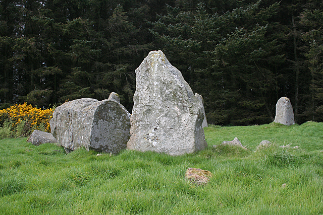
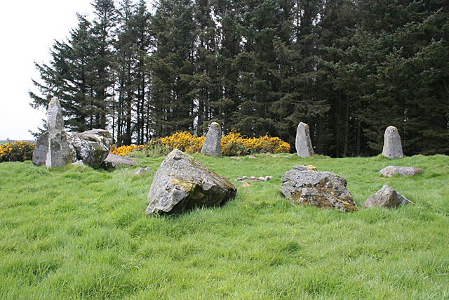
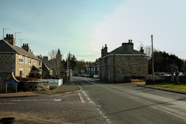
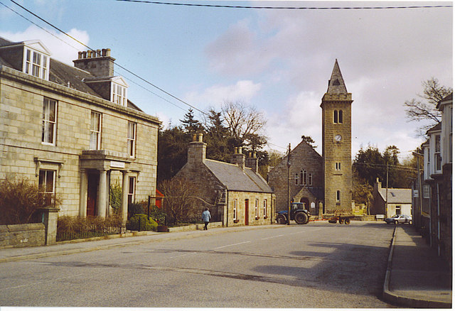
Parkhouse Hill Images

Images are sourced within 2km of 57.513883/-2.0702575 or Grid Reference NJ9547. Thanks to Geograph Open Source API. All images are credited.

The ruins of the Abbey of Deer
Portico view of Deer Abbey
Foliate bedecked view of Deer Abbey
Ruins of Deer Abbey at Dusk
Parkhouse Hill The grassy track is the way to the Aikey Brae recumbent stone circle, which is hidden from here by the clump of conifers to the right.
Parkhouse Hill
The grassy track is the way to the Aikey Brae recumbent stone circle, which is hidden from here by the clump of conifers to the right.
Edible Gate? On closer inspection, the bales are straw, not hay, so any livestock would have to be pretty desperate to munch their way through this cleverly improvised and presumably temporary gate.
Edible Gate?
On closer inspection, the bales are straw, not hay, so any livestock would have to be pretty desperate to munch their way through this cleverly improvised and presumably temporary gate.
Elaborate Gate My first thought on seeing this gate was that it had been bent out of shape, producing folds in the horizontal bars, but I think the undulations are too tidy, so it was probably made like this. I'd be interested in any other opinions on the matter.
Elaborate Gate
My first thought on seeing this gate was that it had been bent out of shape, producing folds in the horizontal bars, but I think the undulations are too tidy, so it was probably made like this. I'd be interested in any other opinions on the matter.
Aikey Brae Recumbent Stone Circle (1) You approach the circle through a dense conifer plantation, thinking gloomily that the whole thing is going to be in deep shade, then you emerge from among the trees to this view. On the left are the east flanker and the enormous recumbent, and on the right are the remaining stones of the western arc of the circle. See <span class="nowrap"><a title="http://canmore.rcahms.gov.uk/en/site/20571/details/aikey+brae/" rel="nofollow ugc noopener" href="http://canmore.rcahms.gov.uk/en/site/20571/details/aikey+brae/">Link</a><img style="margin-left:2px;" alt="External link" title="External link - shift click to open in new window" src="https://s1.geograph.org.uk/img/external.png" width="10" height="10"/></span> for more details. <a href="https://www.geograph.org.uk/photo/4468384">NJ9547 : Aikey Brae Recumbent Stone Circle (2)</a>
Aikey Brae Recumbent Stone Circle (1)
You approach the circle through a dense conifer plantation, thinking gloomily that the whole thing is going to be in deep shade, then you emerge from among the trees to this view. On the left are the east flanker and the enormous recumbent, and on the right are the remaining stones of the western arc of the circle. See LinkExternal link for more details. NJ9547 : Aikey Brae Recumbent Stone Circle (2)
Aikey Brae Recumbent Stone Circle (2) This is the opposite view from <a href="https://www.geograph.org.uk/photo/4468375">NJ9547 : Aikey Brae Recumbent Stone Circle (1)</a>, with the recumbent and east flanker on the right and the remaining three stones still standing on the left, each one shorter than the next the further away they are from the recumbent. See <span class="nowrap"><a title="http://canmore.rcahms.gov.uk/en/site/20571/details/aikey+brae/" rel="nofollow ugc noopener" href="http://canmore.rcahms.gov.uk/en/site/20571/details/aikey+brae/">Link</a><img style="margin-left:2px;" alt="External link" title="External link - shift click to open in new window" src="https://s1.geograph.org.uk/img/external.png" width="10" height="10"/></span> for more details. <a href="https://www.geograph.org.uk/photo/4468390">NJ9547 : Aikey Brae Recumbent Stone Circle (3)</a>
Aikey Brae Recumbent Stone Circle (2)
This is the opposite view from NJ9547 : Aikey Brae Recumbent Stone Circle (1), with the recumbent and east flanker on the right and the remaining three stones still standing on the left, each one shorter than the next the further away they are from the recumbent. See LinkExternal link for more details. NJ9547 : Aikey Brae Recumbent Stone Circle (3)
Aikey Brae Recumbent Stone Circle (3) These are the three stones in the western arc of the circle. Each is shorter than its neighbour nearer the recumbent setting. See <span class="nowrap"><a title="http://canmore.rcahms.gov.uk/en/site/20571/details/aikey+brae/" rel="nofollow ugc noopener" href="http://canmore.rcahms.gov.uk/en/site/20571/details/aikey+brae/">Link</a><img style="margin-left:2px;" alt="External link" title="External link - shift click to open in new window" src="https://s1.geograph.org.uk/img/external.png" width="10" height="10"/></span> for more details. <a href="https://www.geograph.org.uk/photo/4468393">NJ9547 : Aikey Brae Recumbent Stone Circle (4)</a>
Aikey Brae Recumbent Stone Circle (3)
These are the three stones in the western arc of the circle. Each is shorter than its neighbour nearer the recumbent setting. See LinkExternal link for more details. NJ9547 : Aikey Brae Recumbent Stone Circle (4)
Aikey Brae Recumbent Stone Circle (4) This is the recumbent setting. The west flanker, nearest to the camera position, has fallen, but the east flanker is still standing at the far end of the massive recumbent. See <span class="nowrap"><a title="http://canmore.rcahms.gov.uk/en/site/20571/details/aikey+brae/" rel="nofollow ugc noopener" href="http://canmore.rcahms.gov.uk/en/site/20571/details/aikey+brae/">Link</a><img style="margin-left:2px;" alt="External link" title="External link - shift click to open in new window" src="https://s1.geograph.org.uk/img/external.png" width="10" height="10"/></span> for more details. <a href="https://www.geograph.org.uk/photo/4468397">NJ9547 : Aikey Brae Recumbent Stone Circle (5)</a>
Aikey Brae Recumbent Stone Circle (4)
This is the recumbent setting. The west flanker, nearest to the camera position, has fallen, but the east flanker is still standing at the far end of the massive recumbent. See LinkExternal link for more details. NJ9547 : Aikey Brae Recumbent Stone Circle (5)
Aikey Brae Recumbent Stone Circle (5) The closest stone is one of the fallen ones, and the next one, also fallen, is the west Flanker. The recumbent is still in its original position, as is the east flanker which sticks up beyond it. More fallen stones, in the eastern arc, are visible to the left of the recumbent. See <span class="nowrap"><a title="http://canmore.rcahms.gov.uk/en/site/20571/details/aikey+brae/" rel="nofollow ugc noopener" href="http://canmore.rcahms.gov.uk/en/site/20571/details/aikey+brae/">Link</a><img style="margin-left:2px;" alt="External link" title="External link - shift click to open in new window" src="https://s1.geograph.org.uk/img/external.png" width="10" height="10"/></span> for more details. <a href="https://www.geograph.org.uk/photo/4468398">NJ9547 : Aikey Brae Recumbent Stone Circle (6)</a>
Aikey Brae Recumbent Stone Circle (5)
The closest stone is one of the fallen ones, and the next one, also fallen, is the west Flanker. The recumbent is still in its original position, as is the east flanker which sticks up beyond it. More fallen stones, in the eastern arc, are visible to the left of the recumbent. See LinkExternal link for more details. NJ9547 : Aikey Brae Recumbent Stone Circle (6)
Aikey Brae Recumbent Stone Circle (6) The nearest stone is the east flanker, and the recumbent is to its left. In the background are the three remaining standing stones in the western arc of the circle. See <span class="nowrap"><a title="http://canmore.rcahms.gov.uk/en/site/20571/details/aikey+brae/" rel="nofollow ugc noopener" href="http://canmore.rcahms.gov.uk/en/site/20571/details/aikey+brae/">Link</a><img style="margin-left:2px;" alt="External link" title="External link - shift click to open in new window" src="https://s1.geograph.org.uk/img/external.png" width="10" height="10"/></span> for more details. <a href="https://www.geograph.org.uk/photo/4468403">NJ9547 : Aikey Brae Recumbent Stone Circle (7)</a>
Aikey Brae Recumbent Stone Circle (6)
The nearest stone is the east flanker, and the recumbent is to its left. In the background are the three remaining standing stones in the western arc of the circle. See LinkExternal link for more details. NJ9547 : Aikey Brae Recumbent Stone Circle (7)
Aikey Brae Recumbent Stone Circle (7) In the foreground are fallen stones in the eastern arc, and the standing stones of the western arc are at the far side of the circle. The recumbent and remaining standing flanker are on the left. See <span class="nowrap"><a title="http://canmore.rcahms.gov.uk/en/site/20571/details/aikey+brae/" rel="nofollow ugc noopener" href="http://canmore.rcahms.gov.uk/en/site/20571/details/aikey+brae/">Link</a><img style="margin-left:2px;" alt="External link" title="External link - shift click to open in new window" src="https://s1.geograph.org.uk/img/external.png" width="10" height="10"/></span> for more details. <a href="https://www.geograph.org.uk/photo/4468375">NJ9547 : Aikey Brae Recumbent Stone Circle (1)</a>
Aikey Brae Recumbent Stone Circle (7)
In the foreground are fallen stones in the eastern arc, and the standing stones of the western arc are at the far side of the circle. The recumbent and remaining standing flanker are on the left. See LinkExternal link for more details. NJ9547 : Aikey Brae Recumbent Stone Circle (1)
Bridge end Junction Or the old Deer bypass if you're less than 2m wide and under 3 tons
Bridge end Junction
Or the old Deer bypass if you're less than 2m wide and under 3 tons
Old Deer Looking towards the churches and the centre of the village
Old Deer
Looking towards the churches and the centre of the village
Akie Brea Stone Circle The stone circle can be seen easier now the surrounding wood has gone
Akie Brea Stone Circle
The stone circle can be seen easier now the surrounding wood has gone
Railway crossing view From the old railway line looking over the fields.
Railway crossing view
From the old railway line looking over the fields.
Show me another place!

Parkhouse Hill is located at Grid Ref: NJ9547 (Lat: 57.513883, Lng: -2.0702575)

Unitary Authority: Aberdeenshire

Police Authority: North East

What 3 Words

///fuses.carting.spruced. Near Mintlaw, Aberdeenshire

Nearby Locations

Parkhouse Hill Aikey Brae

Related Wikis

Nearby Amenities

Located within 500m of 57.513883,-2.0702575
Power: pole
Lat/Long: 57.514223/-2.0620953
Power: pole
Lat/Long: 57.5143367/-2.0632431
Power: pole
Lat/Long: 57.5144675/-2.0646261
Power: pole
Lat/Long: 57.5146029/-2.065918
Power: pole
Lat/Long: 57.5147348/-2.0672184
Power: pole
Lat/Long: 57.5148668/-2.0685823
Power: pole
Lat/Long: 57.5149953/-2.0698827
Power: pole
Lat/Long: 57.5151273/-2.0710793
Power: pole
Lat/Long: 57.5152433/-2.0722971
Power: pole
Lat/Long: 57.5153559/-2.0734874
Power: pole
Lat/Long: 57.5154787/-2.0746586
Power: pole
Lat/Long: 57.5155823/-2.0757472
Power: pole
Lat/Long: 57.5157028/-2.076948
Power: pole
Lat/Long: 57.5124757/-2.0744852
Power: pole
Lat/Long: 57.5121952/-2.0736299
Power: pole
Lat/Long: 57.5119389/-2.0728512
Power: pole
Lat/Long: 57.5116863/-2.0721287
Power: pole
Lat/Long: 57.5115615/-2.0712597
Power: pole
Lat/Long: 57.5114831/-2.07034
Power: pole
Lat/Long: 57.5114002/-2.0694914
Power: pole
Lat/Long: 57.509874/-2.0736232
Power: pole
Lat/Long: 57.510458/-2.0731618
Power: pole
Lat/Long: 57.5110854/-2.0726464
Power: pole
Lat/Long: 57.5122387/-2.0716695
Power: pole
Lat/Long: 57.5127501/-2.0710686
Power: pole
Lat/Long: 57.5132953/-2.0704361
Power: pole
Lat/Long: 57.5138103/-2.0698037
Power: pole
Lat/Long: 57.5143216/-2.069214
Power: pole
Lat/Long: 57.516917/-2.0761249
Power: pole
Lat/Long: 57.5165205/-2.0763814
The data included in this document is from www.openstreetmap.org. The data is made available under ODbL.

Have you been to Parkhouse Hill?

Leave your review of Parkhouse Hill below (or comments, questions and feedback).