Green Knowe

Hill, Mountain in Northumberland

England

Green Knowe

Rocks and grass on Hogdon Law There's a mass of stones at the summit of Hogdon Law, many of them gathered into a cairn which is behind the camera position.
Beyond the stones are two of Northumberland's highest hills: to the right and most distant is The Cheviot, to the left and cloud-shadowed is Cushat Law.
Rocks and grass on Hogdon Law Credit: Trevor Littlewood

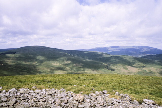
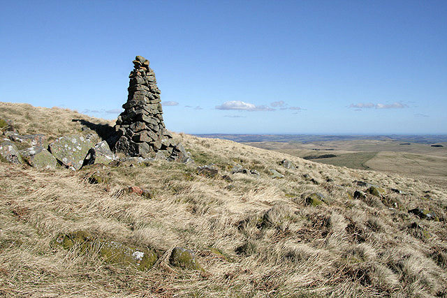
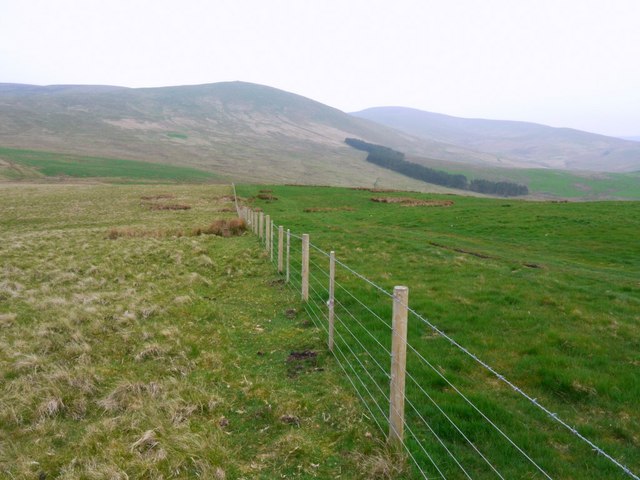
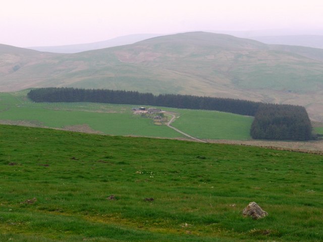
Green Knowe is a prominent hill located in Northumberland, a county in the northeastern part of England. Rising to an elevation of 345 meters (1,132 feet), it stands as one of the highest points in the region. Situated near the village of Wooler, Green Knowe is part of the beautiful and picturesque landscape of the Northumberland National Park.

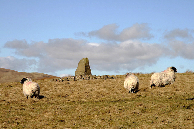
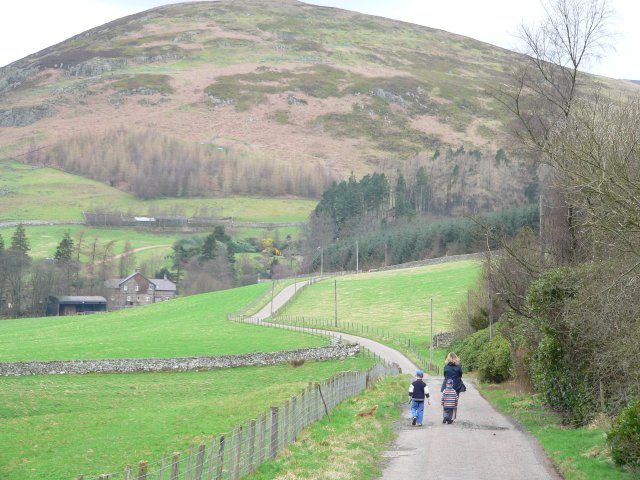
The hill is characterized by its lush green vegetation, which gives it its name. It is covered in a mix of grasses, heather, and other wildflowers, creating a vibrant and colorful display, particularly during the summer months. The slopes of Green Knowe are gentle, making it accessible for hikers and nature enthusiasts of all levels.

From the summit of Green Knowe, visitors are rewarded with stunning panoramic views of the surrounding Northumberland countryside. On a clear day, one can see the Cheviot Hills to the south, the Scottish Borders to the north, and the North Sea to the east. These breathtaking vistas make Green Knowe a popular destination for photographers, hikers, and those seeking a peaceful retreat in nature.

The area surrounding Green Knowe is also rich in wildlife, with various species of birds, mammals, and insects calling it home. It is not uncommon to spot red grouse, kestrels, or even golden eagles soaring above the hill. The diverse flora and fauna of Green Knowe make it an important ecological site within the Northumberland National Park.

Overall, Green Knowe in Northumberland is a remarkable natural feature, offering visitors the opportunity to immerse themselves in the beauty of the English countryside and enjoy breathtaking views from its summit.

If you have any feedback on the listing, please let us know in the comments section below.
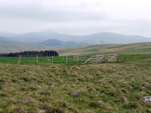
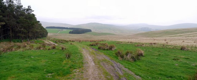
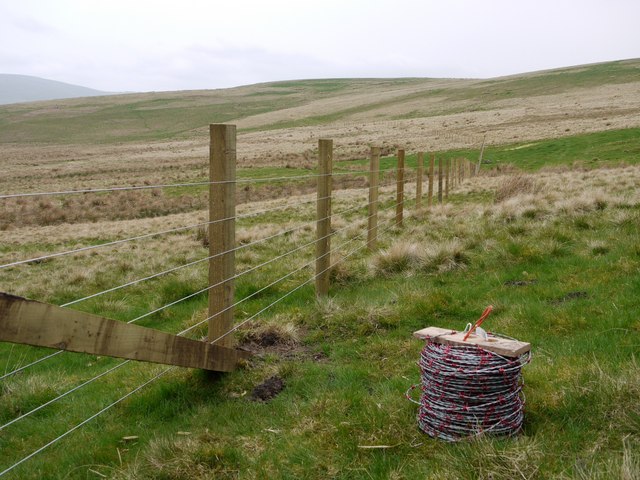
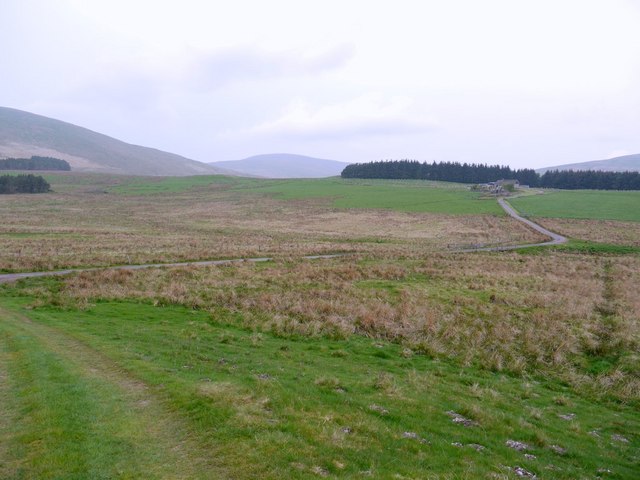
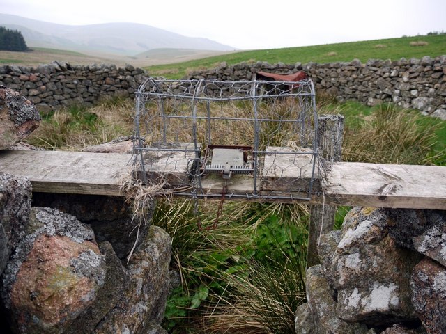
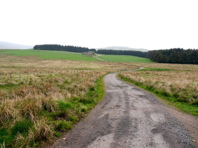
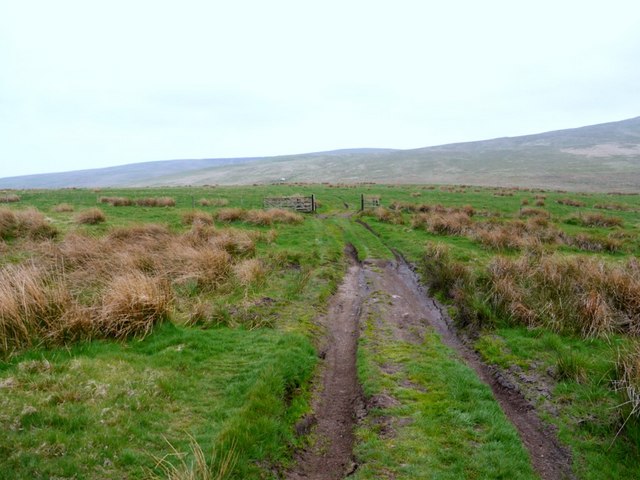
Green Knowe Images

Images are sourced within 2km of 55.41541/-2.0675783 or Grid Reference NT9513. Thanks to Geograph Open Source API. All images are credited.

Rocks and grass on Hogdon Law There's a mass of stones at the summit of Hogdon Law, many of them gathered into a cairn which is behind the camera position.
Beyond the stones are two of Northumberland's highest hills: to the right and most distant is The Cheviot, to the left and cloud-shadowed is Cushat Law.
Rocks and grass on Hogdon Law
There's a mass of stones at the summit of Hogdon Law, many of them gathered into a cairn which is behind the camera position. Beyond the stones are two of Northumberland's highest hills: to the right and most distant is The Cheviot, to the left and cloud-shadowed is Cushat Law.
A cairn on Hogdon Law This 2m high cairn is at the 490m contour on the southeast side of the hill.
A cairn on Hogdon Law
This 2m high cairn is at the 490m contour on the southeast side of the hill.
The summit cairn on Hogdon Law This is a sizable cairn with a stone shelter wall.
The summit cairn on Hogdon Law
This is a sizable cairn with a stone shelter wall.
Hushie Cairn on Hogdon Law This small cairn is at the 420m contour on the southeast side of the hill. This is a view towards the summit of Hogdon Law.
Hushie Cairn on Hogdon Law
This small cairn is at the 420m contour on the southeast side of the hill. This is a view towards the summit of Hogdon Law.
The Shepherd's Memorial Cairn This cairn on High Knowes stands near the spot where two shepherds perished in a blizzard on Saturday 17th November 1962. They were trying to reach the farm at Ewartly Shank and their bodies were not discovered until two days later lying 100 yards apart. As a result of this tragedy the Northumberland National Park Voluntary Wardens formed the Search and Rescue Team in 1963, known nowadays as the Northumberland National Park Mountain Rescue Team. The inscription on the cairn reads:

DEDICATED
IN MEMORY OF
THE SHEPHERDS
JOCK SCOTT – WILLIE MIDDLEMAS
WHO PERISHED HERE IN THE SNOW
17TH NOVEMBER 1962

ERECTED BY
NORTHUMBERLAND NATIONAL PARK AUTHORITY
AND N.N.P. MOUNTAIN RESCUE TEAM

(Source: Information board outside Alnham Church).
The Shepherd's Memorial Cairn
This cairn on High Knowes stands near the spot where two shepherds perished in a blizzard on Saturday 17th November 1962. They were trying to reach the farm at Ewartly Shank and their bodies were not discovered until two days later lying 100 yards apart. As a result of this tragedy the Northumberland National Park Voluntary Wardens formed the Search and Rescue Team in 1963, known nowadays as the Northumberland National Park Mountain Rescue Team. The inscription on the cairn reads: DEDICATED IN MEMORY OF THE SHEPHERDS JOCK SCOTT – WILLIE MIDDLEMAS WHO PERISHED HERE IN THE SNOW 17TH NOVEMBER 1962 ERECTED BY NORTHUMBERLAND NATIONAL PARK AUTHORITY AND N.N.P. MOUNTAIN RESCUE TEAM (Source: Information board outside Alnham Church).
The inscription on the Shepherd's Memorial Cairn On this cairn at High Knowes <a href="https://www.geograph.org.uk/photo/2323114">NT9612 : The Shepherd's Memorial Cairn</a>.
The inscription on the Shepherd's Memorial Cairn
On this cairn at High Knowes NT9612 : The Shepherd's Memorial Cairn.
High Knowes palisaded settlement This is the western of two similar settlements on the south-east ridge of High Knowes. The details are very impressive in aerial view <span class="nowrap"><a title="http://wtp2.appspot.com/wheresthepath.htm?lat=55.40630236287813&lon=-2.046326994895935&gz=18&oz=8&gt=1" rel="nofollow ugc noopener" href="http://wtp2.appspot.com/wheresthepath.htm?lat=55.40630236287813&lon=-2.046326994895935&gz=18&oz=8&gt=1">Link</a><img style="margin-left:2px;" alt="External link" title="External link - shift click to open in new window" src="https://s1.geograph.org.uk/img/external.png" width="10" height="10"/></span>
The homestead known as High Knowes A was excavated 1962-63 by Newcastle University. It consists of two circular palisade trenches 10ft apart enclosing an area 150ft in diameter with an entrance on the east side <a href="https://www.geograph.org.uk/photo/2386035">NT9712 : High Knowes palisaded settlement</a>. Within the interior of the palisaded settlement, there are the foundations of at least four timber built hut circles although only two are visible in aerial view. It is considered to date from the Iron Age <span class="nowrap"><a title="http://ads.ahds.ac.uk/catalogue/collections/nsmr03abstracts/1340.html" rel="nofollow ugc noopener" href="http://ads.ahds.ac.uk/catalogue/collections/nsmr03abstracts/1340.html">Link</a><img style="margin-left:2px;" alt="External link" title="External link - shift click to open in new window" src="https://s1.geograph.org.uk/img/external.png" width="10" height="10"/></span>
The settlement to the east, known as High Knowes B, is an oval palisaded enclosure. Within the interior of the settlement are the remains of at least 19 timber built hut circles. Excavation showed later Romano-British occupation overlying an Iron Age settlement <span class="nowrap"><a title="http://ads.ahds.ac.uk/catalogue/collections/nsmr03abstracts/1347.html" rel="nofollow ugc noopener" href="http://ads.ahds.ac.uk/catalogue/collections/nsmr03abstracts/1347.html">Link</a><img style="margin-left:2px;" alt="External link" title="External link - shift click to open in new window" src="https://s1.geograph.org.uk/img/external.png" width="10" height="10"/></span>
The aerial photo also shows the faint traces of prehistoric ploughing, known as cord rig, to the south-east of High Knowes B <span class="nowrap"><a title="http://www.keystothepast.info/article/10339/Site-Details?PRN=N1370" rel="nofollow ugc noopener" href="http://www.keystothepast.info/article/10339/Site-Details?PRN=N1370">Link</a><img style="margin-left:2px;" alt="External link" title="External link - shift click to open in new window" src="https://s1.geograph.org.uk/img/external.png" width="10" height="10"/></span>
High Knowes palisaded settlement
This is the western of two similar settlements on the south-east ridge of High Knowes. The details are very impressive in aerial view LinkExternal link The homestead known as High Knowes A was excavated 1962-63 by Newcastle University. It consists of two circular palisade trenches 10ft apart enclosing an area 150ft in diameter with an entrance on the east side NT9712 : High Knowes palisaded settlement. Within the interior of the palisaded settlement, there are the foundations of at least four timber built hut circles although only two are visible in aerial view. It is considered to date from the Iron Age LinkExternal link The settlement to the east, known as High Knowes B, is an oval palisaded enclosure. Within the interior of the settlement are the remains of at least 19 timber built hut circles. Excavation showed later Romano-British occupation overlying an Iron Age settlement LinkExternal link The aerial photo also shows the faint traces of prehistoric ploughing, known as cord rig, to the south-east of High Knowes B LinkExternal link
High Knowes palisaded settlement Showing the south side of the ditched enclosure <a href="https://www.geograph.org.uk/photo/2385974">NT9712 : High Knowes palisaded settlement</a>. It consists of two circular palisade trenches 10ft apart with a slight mound between the two, probably formed from the upcast. The circular feature on the ground to the right may be the site of one of the timber round houses or possibly an area used for providing addition winter feed for the hill sheep <span class="nowrap"><a title="http://ads.ahds.ac.uk/catalogue/collections/nsmr03abstracts/1340.html" rel="nofollow ugc noopener" href="http://ads.ahds.ac.uk/catalogue/collections/nsmr03abstracts/1340.html">Link</a><img style="margin-left:2px;" alt="External link" title="External link - shift click to open in new window" src="https://s1.geograph.org.uk/img/external.png" width="10" height="10"/></span>
Hogdon Law can be seen in the distance.
High Knowes palisaded settlement
Showing the south side of the ditched enclosure NT9712 : High Knowes palisaded settlement. It consists of two circular palisade trenches 10ft apart with a slight mound between the two, probably formed from the upcast. The circular feature on the ground to the right may be the site of one of the timber round houses or possibly an area used for providing addition winter feed for the hill sheep LinkExternal link Hogdon Law can be seen in the distance.
The Shepherds Memorial Cairn There is a description here <a href="https://www.geograph.org.uk/photo/2323114">NT9612 : The Shepherd's Memorial Cairn</a> and the full story outside Alnham Church <a href="https://www.geograph.org.uk/photo/2386130">NT9910 : Detail of National Park information board outside Alnham Church</a>
The Shepherds Memorial Cairn
Fence west of High Knowes View towards Hogdon Law.
Fence west of High Knowes
View towards Hogdon Law.
Ewartly Shank from High Knowes The hill behind the farm is Little Dod <a href="https://www.geograph.org.uk/gridref/NT9514">NT9514</a>
Ewartly Shank from High Knowes
The hill behind the farm is Little Dod NT9514
Gate north of High Knowes The prominent low hill in the distance is Ritto Hill near Linhope, with Hedgehope and Dunmoor Hills behind.
Gate north of High Knowes
The prominent low hill in the distance is Ritto Hill near Linhope, with Hedgehope and Dunmoor Hills behind.
Salter's Road descends towards Ewartly Shank
New fence on the flanks of South Pike
Road to Ewartly Shank from Salter's Road
Spring animal trap over sheepfold entrance The sheepfold is shown here <a href="https://www.geograph.org.uk/photo/1171318">NT9613 : Sheepfold beside road to Ewartly Shank</a>
The traps seem to be designed to trap and kill certain small animals, probably weasels, stoats or mink, by luring them across a bridge into a tunnel-type cage fitted with a loaded spring trap.
Spring animal trap over sheepfold entrance
The sheepfold is shown here NT9613 : Sheepfold beside road to Ewartly Shank The traps seem to be designed to trap and kill certain small animals, probably weasels, stoats or mink, by luring them across a bridge into a tunnel-type cage fitted with a loaded spring trap.
Minor road to Ewartly Shank
Track below Hogdon Law Provides the farmer with four-wheeled drive access to the summit of Hogdon Law and beyond.
Track below Hogdon Law
Provides the farmer with four-wheeled drive access to the summit of Hogdon Law and beyond.
Show me another place!

Green Knowe is located at Grid Ref: NT9513 (Lat: 55.41541, Lng: -2.0675783)

Unitary Authority: Northumberland

Police Authority: Northumbria

What 3 Words

///cases.pheasants.beak. Near Whittingham, Northumberland

Nearby Locations

Green Knowe Alnham

Related Wikis

Linhope

Linhope is a small village in Northumberland, England. It is located in the Cheviots on the River Breamish, and within Northumberland National Park. Linhope...

Church of St Michael, Alnham

The Church of St Michael in Alnham, in the English county of Northumberland, is a medieval structure dating from circa 1200. Built on a Roman camp site...

Kidland

Kidland is a former civil parish, now in the parish of Alwinton in Northumberland, England, about 2 miles (3 km) northwest of Alwinton village. In 1951...

Alnham

Alnham is a hamlet and civil parish in Northumberland, England. It is about 14 miles (23 km) west of Alnwick, about 6 miles (9.7 km) from Scotland and...

Nearby Amenities

Located within 500m of 55.41541,-2.0675783
Shank House
Place: locality
Lat/Long: 55.4157272/-2.0623551
Man Made: sheep pen
Lat/Long: 55.4177157/-2.0689412
Barrier: stile
Foot: yes
Lat/Long: 55.4164889/-2.0655389
Information: guidepost
Tourism: information
Lat/Long: 55.4152703/-2.063442
The data included in this document is from www.openstreetmap.org. The data is made available under ODbL.

Have you been to Green Knowe?

Leave your review of Green Knowe below (or comments, questions and feedback).