Blea Barf

Hill, Mountain in Yorkshire Richmondshire

England

Blea Barf

Tarn Seat Beacon on Tarn Seat with Summer Lodge Tarn beyond.
Tarn Seat Credit: Colin Gregory

Blea Barf is a prominent hill located in the North York Moors National Park, in the county of Yorkshire, England. It is part of the larger North York Moors range and stands at an elevation of approximately 1,300 feet (396 meters). The hill is known for its distinctive conical shape and its commanding presence within the surrounding landscape.

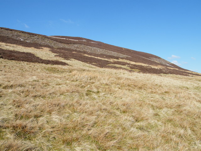
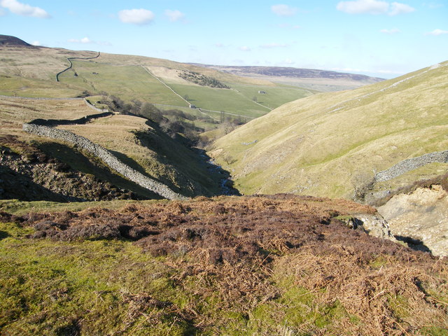
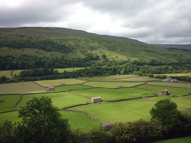
Covered in heather and grasses, Blea Barf offers stunning panoramic views of the surrounding countryside. On a clear day, visitors can see the rolling hills, moorlands, and picturesque villages that make up the North York Moors. The hill is a popular destination for hikers and nature enthusiasts, with several footpaths leading to its summit.

The name "Blea Barf" is derived from the Old Norse language, with "Blea" meaning "blue" and "Barf" meaning "hill." This name reflects the hill's moody appearance, often shrouded in mist and giving off a bluish hue. The hill is also home to a variety of wildlife, including birds of prey, such as kestrels and peregrine falcons, as well as grazing sheep and deer.

Blea Barf offers a tranquil escape from the bustle of urban life, with its peaceful surroundings and unspoiled natural beauty. It is a place where visitors can immerse themselves in the rich history and breathtaking scenery of the North York Moors, making it a must-visit destination for those exploring this picturesque region of Yorkshire.

If you have any feedback on the listing, please let us know in the comments section below.
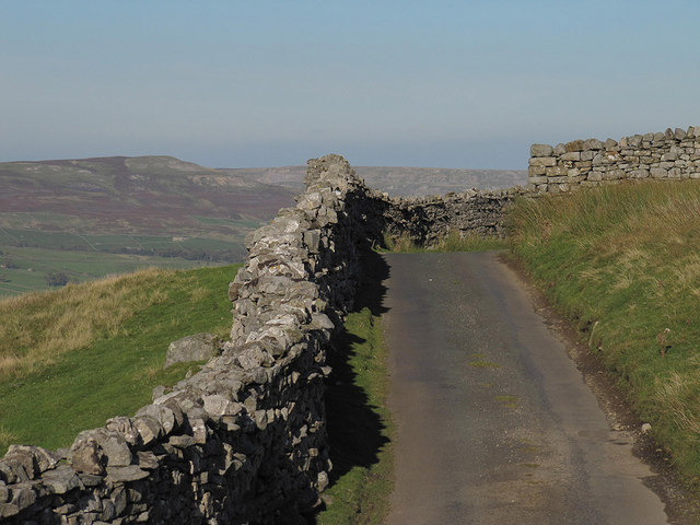
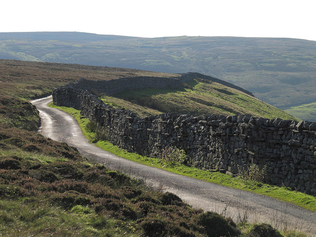
Blea Barf Images

Images are sourced within 2km of 54.361303/-2.0705851 or Grid Reference SD9596. Thanks to Geograph Open Source API. All images are credited.
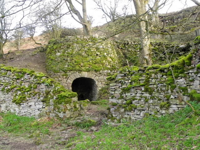
Tarn Seat Beacon on Tarn Seat with Summer Lodge Tarn beyond.
Tarn Seat
Beacon on Tarn Seat with Summer Lodge Tarn beyond.
Satron Tarn This small tarn lies half a mile west of the much larger Summer Lodge Tarn.
Satron Tarn
This small tarn lies half a mile west of the much larger Summer Lodge Tarn.
Blea Barf The southern aspect of the hill
Blea Barf
The southern aspect of the hill
Summer Lodge Looking down to  Summer Lodge with Scurvy Scar on the right.
Summer Lodge
Looking down to Summer Lodge with Scurvy Scar on the right.
Weather vane, Strands The weather vane is to be found on Strands Farmhouse.

As long as humans have farmed the land, sailed the seas and contemplated their place in nature, the wind has played a key role in their speculations. It was interpreting the wind's changing direction that helped our ancestors predict the coming weather and survive.
Weather vane, Strands
The weather vane is to be found on Strands Farmhouse. As long as humans have farmed the land, sailed the seas and contemplated their place in nature, the wind has played a key role in their speculations. It was interpreting the wind's changing direction that helped our ancestors predict the coming weather and survive.
Limekiln near Gunnerside In the 18th and 19th centuries, when lime was extensively used on acid clay soil to improve cultivation, lime kilns were widespread. Beehive shaped, with a hole in the top, kilns were usually built on the sides of steep hills and against cliff faces, to make the loading of limestone and coal easier. Alternating layers of limestone and coal were burnt to produce the lime.
Limekiln near Gunnerside
In the 18th and 19th centuries, when lime was extensively used on acid clay soil to improve cultivation, lime kilns were widespread. Beehive shaped, with a hole in the top, kilns were usually built on the sides of steep hills and against cliff faces, to make the loading of limestone and coal easier. Alternating layers of limestone and coal were burnt to produce the lime.
Valley of Summer Lodge Beck Summer Lodge Beck drains northwards into Swaledale; the hill seen across the valley is Blea Barf.
Valley of Summer Lodge Beck
Summer Lodge Beck drains northwards into Swaledale; the hill seen across the valley is Blea Barf.
Fields and their barns at Gunnerside Highlighted by fleeting sun.
Fields and their barns at Gunnerside
Highlighted by fleeting sun.
Fields and their barns at Gunnerside Emerald fields lit by passing shafts of sun.
Fields and their barns at Gunnerside
Emerald fields lit by passing shafts of sun.
Road to Summer Lodge The sign says unsuitable to vehicles
Road to Summer Lodge
The sign says unsuitable to vehicles
Field lime kiln, Bank Heads Field lime kiln close by a narrow outcrop of limestone on the southern slopes of Swaledale.
Field lime kiln, Bank Heads
Field lime kiln close by a narrow outcrop of limestone on the southern slopes of Swaledale.
Footpath at Bank Heads Grinton parish footpath 58 cuts along the hillside at Bank Heads, passing a ruined lime kiln [lower centre picture] by an outcrop of limestone. In the distance is the village of Gunnerside.
Footpath at Bank Heads
Grinton parish footpath 58 cuts along the hillside at Bank Heads, passing a ruined lime kiln [lower centre picture] by an outcrop of limestone. In the distance is the village of Gunnerside.
Walls above Summer Lodge Pasture
Wall by the road above Summer Lodge Pasture
Frozen tarn west of Blea Barf
Cairn on Blea Barf A fine 2 metre cairn with views east and north particularly good.
Cairn on Blea Barf
A fine 2 metre cairn with views east and north particularly good.
Sheepfold at the head of Bloody Vale
Disused shafts, Satron Moor
Show me another place!

Blea Barf is located at Grid Ref: SD9596 (Lat: 54.361303, Lng: -2.0705851)

Division: North Riding

Administrative County: North Yorkshire

District: Richmondshire

Police Authority: North Yorkshire

What 3 Words

///anode.situates.painter. Near Leyburn, North Yorkshire

Nearby Locations

Crackpot Moor Blea Barf

Related Wikis

Crackpot, North Yorkshire

Crackpot is a village in Swaledale, North Yorkshire, England. Its name derives from the Old English kraka (crow) and the Viking word pot (usually a pit...

Gunnerside

Gunnerside is a village in North Yorkshire, England. It is situated in Swaledale, on the B6270 road, 3 miles (5 km) east of Muker and 6 miles (10 km) west...

Satron

Satron is a hamlet in Swaledale, North Yorkshire, England. It lies 0.6 miles (1 km) south west of Gunnerside on the opposite bank of the River Swale. It...

Ivelet

Ivelet is a hamlet in the Yorkshire Dales, North Yorkshire, England about a mile west of Gunnerside in Swaledale. Ivelet Bridge crosses the River Swale...

Low Row

Low Row is a village in Swaledale, in the Yorkshire Dales, North Yorkshire, England. It lies about 3 miles west of Reeth and is between Healaugh and Gunnerside...

Melbecks

Melbecks is a civil parish in North Yorkshire, England. It is located in upper Swaledale and covers the settlements of Gunnerside, Low Row, Feetham and...

Feetham

Feetham is a hamlet opposite Low Row in the Yorkshire Dales, North Yorkshire, England. The origin of the place-name is from Old Norse and means place at...

Gunnerside Gill

Gunnerside Gill (or Ghyll) is a small valley in the Yorkshire Dales, England, which branches off Swaledale into moorland to the north of Gunnerside. The...

Nearby Amenities

Located within 500m of 54.361303,-2.0705851
Blea Barf
Ele: 540
Natural: peak
Lat/Long: 54.3613962/-2.0699327
Man Made: cairn
Lat/Long: 54.3613747/-2.0698366
The data included in this document is from www.openstreetmap.org. The data is made available under ODbL.

Have you been to Blea Barf?

Leave your review of Blea Barf below (or comments, questions and feedback).