Climer's Hill

Hill, Mountain in Worcestershire Wychavon

England

Climer's Hill

Sale Green Methodist Church I am not sure whether this is currently a functioning church/chapel.
Sale Green Methodist Church Credit: Chris Allen

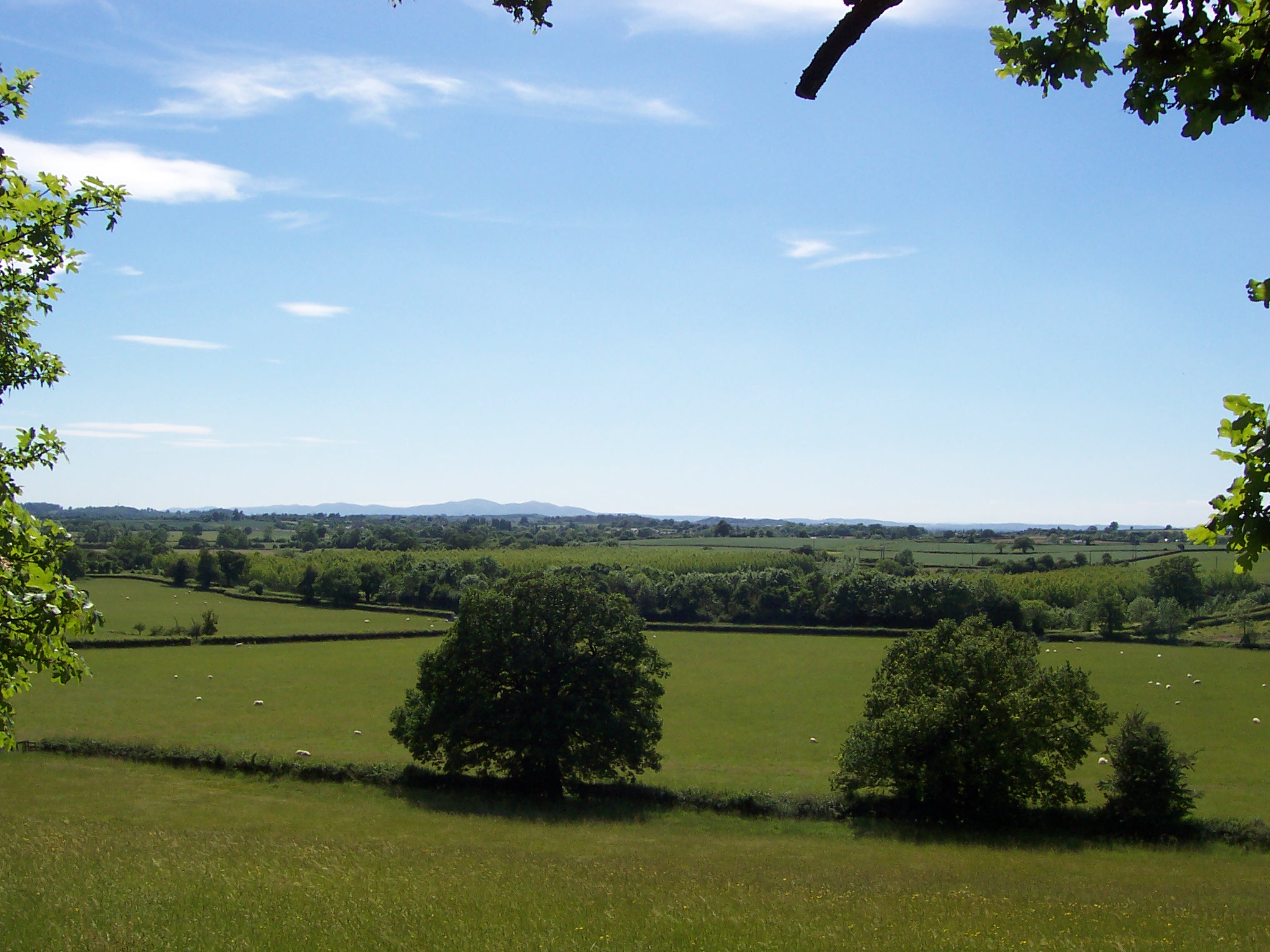
Climer's Hill is a prominent geographical feature located in Worcestershire, England. It is classified as a hill rather than a mountain, as it stands at an elevation of 283 meters (928 feet) above sea level. The hill is situated in the picturesque countryside of Worcestershire and offers stunning panoramic views of the surrounding landscape.

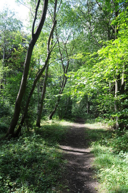
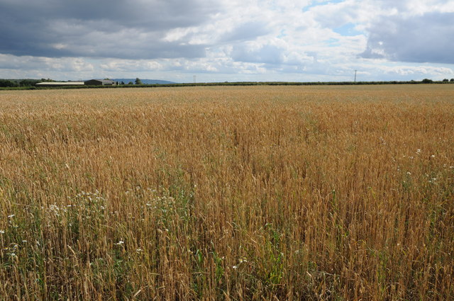
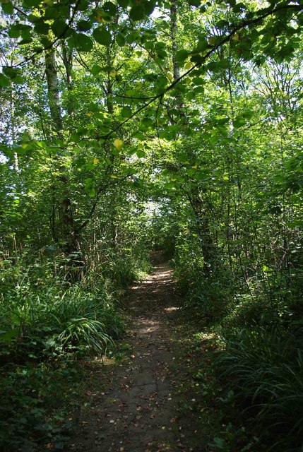
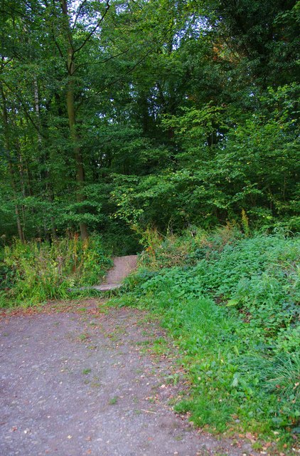
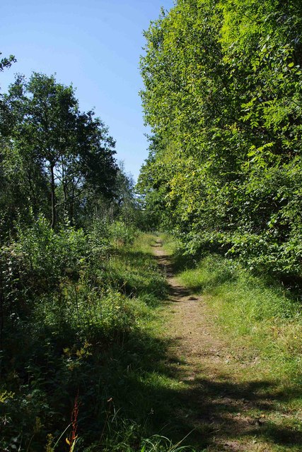
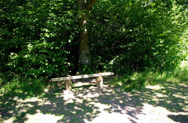
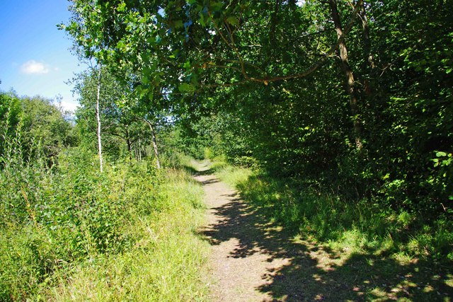
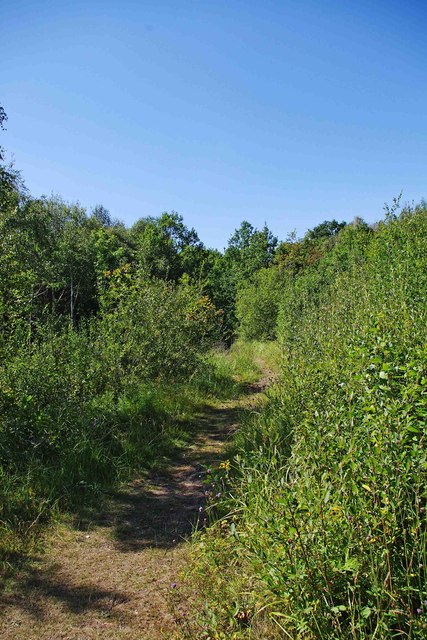
Climer's Hill is characterized by its gentle slopes and rolling terrain, which make it a popular destination for hikers, walkers, and nature enthusiasts. The hill is covered in lush green vegetation, including grasslands, heathlands, and scattered patches of woodland. Its diverse flora and fauna provide a haven for a variety of wildlife, making it an important area for conservation.

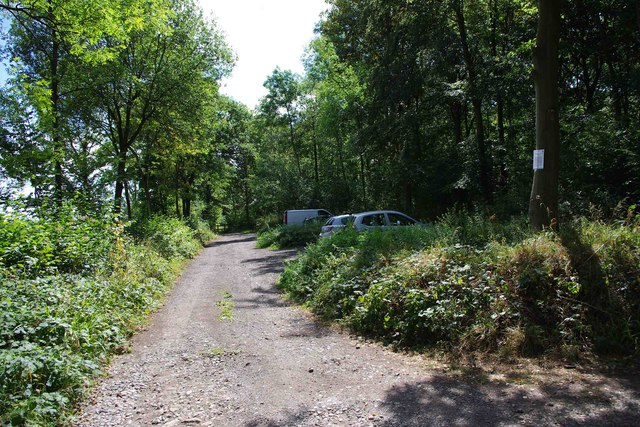
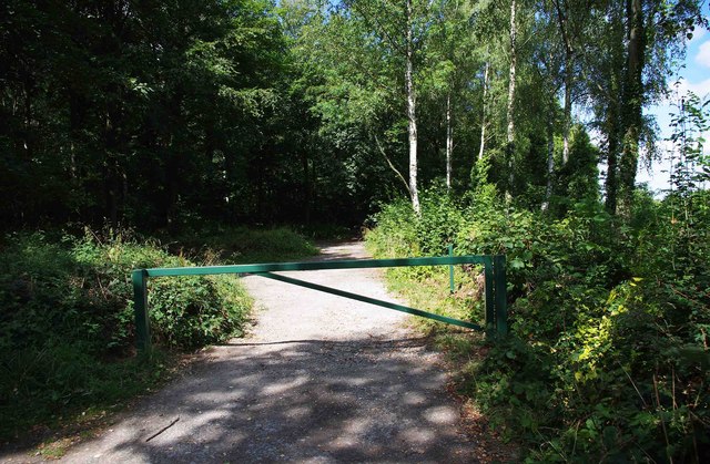
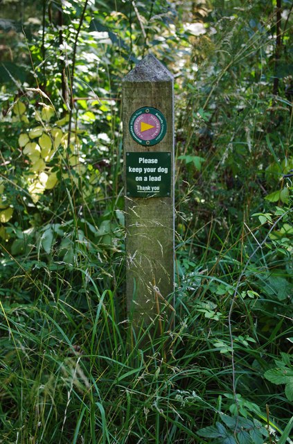
The hill is easily accessible, thanks to several well-maintained walking trails and footpaths that crisscross the area. These trails offer visitors the opportunity to explore the hill's natural beauty and take in its breathtaking vistas. On a clear day, it is said that one can even catch a glimpse of the Malvern Hills, a nearby range of ancient hills.

Climer's Hill has a rich history, with evidence of human habitation dating back to prehistoric times. The hill has been a site of archaeological interest, with discoveries of ancient artifacts and burial mounds. It is believed that the hill may have been used as a vantage point or defensive position in ancient times due to its commanding position.

Overall, Climer's Hill is a captivating natural landmark in Worcestershire, offering visitors a tranquil escape into the beauty of the English countryside. Whether one is interested in hiking, wildlife spotting, or simply enjoying the peaceful surroundings, this hill provides an ideal destination for outdoor enthusiasts and nature lovers.

If you have any feedback on the listing, please let us know in the comments section below.

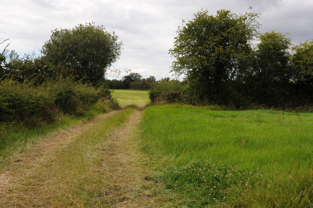
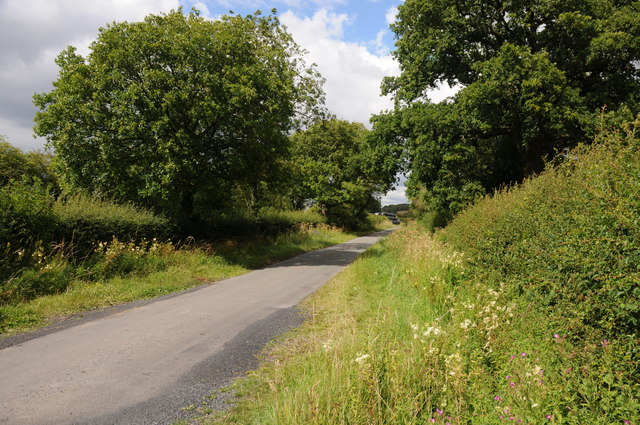
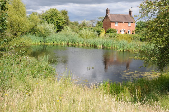
Climer's Hill Images

Images are sourced within 2km of 52.214684/-2.1185961 or Grid Reference SO9157. Thanks to Geograph Open Source API. All images are credited.

Sale Green Methodist Church I am not sure whether this is currently a functioning church/chapel.
Sale Green Methodist Church
I am not sure whether this is currently a functioning church/chapel.
Path in Trench Wood
Path in Trench Wood
Freight Train at Oddingley EWS Class 66 No 66096 heads a northbound freight train over the Level Crossing at Oddingley
Freight Train at Oddingley
EWS Class 66 No 66096 heads a northbound freight train over the Level Crossing at Oddingley
Oddingley Level Crossing Signal Box The small signal box at Oddingley which controls the level crossing with a minor road
Oddingley Level Crossing Signal Box
The small signal box at Oddingley which controls the level crossing with a minor road
Field entrance and footpath off Netherwood Lane Field entrance and footpath off Netherwood Lane to the north of Crowle.
Field entrance and footpath off Netherwood Lane
Field entrance and footpath off Netherwood Lane to the north of Crowle.
Netherwood Lane Netherwood Lane links the villages of Crowle and Oddingley.
Netherwood Lane
Netherwood Lane links the villages of Crowle and Oddingley.
Village pond and cottage, Crowle A very traditional scene of a village pond and cottage in the village of Crowle.
Village pond and cottage, Crowle
A very traditional scene of a village pond and cottage in the village of Crowle.
Path through Pope's Wood Path through Pope's Wood, part of the Worcestershire Wildlife Nature Reserve of Trench Wood near Sale Green.
Path through Pope's Wood
Path through Pope's Wood, part of the Worcestershire Wildlife Nature Reserve of Trench Wood near Sale Green.
Wheatfield at Sale Green View across a field of wheat from a footpath near Sale Green.  The buildings of Diamond Hall Farm can be seen in the middle distance with Bredon Hill on the distant horizon.
Wheatfield at Sale Green
View across a field of wheat from a footpath near Sale Green. The buildings of Diamond Hall Farm can be seen in the middle distance with Bredon Hill on the distant horizon.
A shady path in Trench Wood near Sale Green Trench Wood is a woodland nature reserve, jointly managed by Worcestershire Wildlife Trust, and Butterfly Conservation. It is ancient woodland with mature oak and ash trees. With rides and open areas, it is one of the richest woodland sites for wildlife in Worcestershire.
A shady path in Trench Wood near Sale Green
Trench Wood is a woodland nature reserve, jointly managed by Worcestershire Wildlife Trust, and Butterfly Conservation. It is ancient woodland with mature oak and ash trees. With rides and open areas, it is one of the richest woodland sites for wildlife in Worcestershire.
Car park at Trench Wood, near Sale Green The car park has been reduced in size, with the part furthest from the entrance blocked by a gate. This can be opened for genuine groups of visitors. It is hoped this will reduce the considerable problem of fly-tipping, probably by people with vans & pick-up trucks, who won't purchase a licence to tip at proper sites.  It is difficult to see why anyone else would fly-tip here, when there are so many proper disposal facilities in the larger towns.
Car park at Trench Wood, near Sale Green
The car park has been reduced in size, with the part furthest from the entrance blocked by a gate. This can be opened for genuine groups of visitors. It is hoped this will reduce the considerable problem of fly-tipping, probably by people with vans & pick-up trucks, who won't purchase a licence to tip at proper sites. It is difficult to see why anyone else would fly-tip here, when there are so many proper disposal facilities in the larger towns.
Gate near the end of the car park, Trench Wood near Sale Green The gate shuts off the part of the car park furthest from the entrance. See:- <a href="https://www.geograph.org.uk/photo/2564673">SO9258 : Car park at Trench Wood, near Sale Green</a>.
Gate near the end of the car park, Trench Wood near Sale Green
The gate shuts off the part of the car park furthest from the entrance. See:- SO9258 : Car park at Trench Wood, near Sale Green.
Trench Wood seen from the car park, near Sale Green Trench Wood has been a nature reserve for well over twenty years. Prior to this it was clear-felled in the 1940's, and replanted with species suitable for making paintbrush and broom handles. As a result the wood today contains hazel, beech, silver birch, grey alder and sycamore.
Trench Wood seen from the car park, near Sale Green
Trench Wood has been a nature reserve for well over twenty years. Prior to this it was clear-felled in the 1940's, and replanted with species suitable for making paintbrush and broom handles. As a result the wood today contains hazel, beech, silver birch, grey alder and sycamore.
Nature Trail waymarker, Trench Wood near Sale Green Worcestershire Wildlife Trust, and Butterfly Conservation, the two charitable organisations managing the wood, have created a nature trail.

<a href="https://www.geograph.org.uk/photo/2564764">SO9258 : Nature Trail, Trench Wood, near Sale Green</a>.
Nature Trail waymarker, Trench Wood near Sale Green
Worcestershire Wildlife Trust, and Butterfly Conservation, the two charitable organisations managing the wood, have created a nature trail. SO9258 : Nature Trail, Trench Wood, near Sale Green.
Nature Trail, Trench Wood, near Sale Green Part of the nature trail running through the wood. See also:- <a href="https://www.geograph.org.uk/photo/2564750">SO9258 : Nature Trail waymarker, Trench Wood near Sale Green</a>.
Nature Trail, Trench Wood, near Sale Green
Part of the nature trail running through the wood. See also:- SO9258 : Nature Trail waymarker, Trench Wood near Sale Green.
A sunny spot with a seat, Trench Wood, near Sale Green One of the many good things about this attractive wood, is that a lot of seats have been provided, which is perhaps more appreciated the older you get. Recently a programme has commenced of replacing older seats, which are showing their age, with new seats. This is one of the new seats.
A sunny spot with a seat, Trench Wood, near Sale Green
One of the many good things about this attractive wood, is that a lot of seats have been provided, which is perhaps more appreciated the older you get. Recently a programme has commenced of replacing older seats, which are showing their age, with new seats. This is one of the new seats.
A path in Trench Wood, near Sale Green One of the network of paths in the wood.
A path in Trench Wood, near Sale Green
One of the network of paths in the wood.
A path in Trench Wood, near Sale Green One of the many paths in the wood.
A path in Trench Wood, near Sale Green
One of the many paths in the wood.
Show me another place!

Climer's Hill is located at Grid Ref: SO9157 (Lat: 52.214684, Lng: -2.1185961)

Administrative County: Worcestershire

District: Wychavon

Police Authority: West Mercia

What 3 Words

///fastening.cuddling.trooper. Near Fernhill Heath, Worcestershire

Related Wikis

Crowle, Worcestershire

Crowle (rhymes with coal) is a village in Worcestershire, England situated 4 miles (6.4 km) east of the City of Worcester. Crowle is known for its Church...

Trench Wood

Trench Wood is a woodland area part managed by the Worcestershire Wildlife Trust and Butterfly Conservation. It is located around 6 miles (9.7 km) miles...

Tibberton, Worcestershire

Tibberton is a village in Worcestershire, England. It is located around 4 miles north-east of Worcester and less than a mile from junction 6 of the M5...

Dunhampstead railway station

Dunhampstead railway station served the village of Dunhampstead, Worcestershire, England, from 1841 to 1855 on the Birmingham and Gloucester Railway....
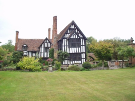
Huddington Court

Huddington Court is a 15th-century moated manor house in the village of Huddington in Worcestershire, England, some six miles east of Worcester. It was...

Huddington

Huddington is a village in Worcestershire, England. == Location == Huddington is located 5 miles (8.0 km) east of Worcester and 5 miles (8.0 km) south...

Oddingley

Oddingley is a village and civil parish in the English county of Worcestershire, approximately 9 km (5.6 mi) north-east of the county town of Worcester...

Dunhampstead

Dunhampstead is a small village in the English county of Worcestershire. It is located about 6 miles to the north-east of Worcester and around half a...

Nearby Amenities

Located within 500m of 52.214684,-2.1185961
Stanley Wood South
Power: pole
Transformer: distribution
Voltage Primary: 11000
Lat/Long: 52.2161767/-2.122023
Power: pole
Lat/Long: 52.2165646/-2.1227311
Power: pole
Lat/Long: 52.2174018/-2.1235652
Power: pole
Lat/Long: 52.2166681/-2.1237288
Power: pole
Lat/Long: 52.2160707/-2.123863
Power: pole
Lat/Long: 52.2154035/-2.1240199
Power: pole
Lat/Long: 52.2147881/-2.1241473
Power: pole
Lat/Long: 52.2143049/-2.1242666
Power: pole
Lat/Long: 52.213604/-2.1244182
Power: pole
Lat/Long: 52.2129277/-2.1245737
Power: pole
Lat/Long: 52.2122284/-2.12474
Perry Mill Barn
Power: pole
Transformer: distribution
Voltage Primary: 11000
Lat/Long: 52.2119351/-2.1178964
Power: pole
Lat/Long: 52.211548/-2.1185455
Power: pole
Lat/Long: 52.2111585/-2.1191771
Power: pole
Lat/Long: 52.2107262/-2.1198879
The data included in this document is from www.openstreetmap.org. The data is made available under ODbL.

Have you been to Climer's Hill?

Leave your review of Climer's Hill below (or comments, questions and feedback).