Cran Hill

Hill, Mountain in Kincardineshire

Scotland

Cran Hill

Portlethen from the A90
Portlethen from the A90 Credit: Mike Pennington

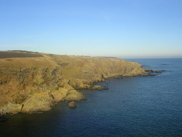
Cran Hill is a prominent landmark located in Kincardineshire, Scotland. It is a hill that rises to an elevation of approximately 380 meters (1,247 feet) above sea level. Situated on the eastern edge of the Grampian Mountains, Cran Hill offers breathtaking panoramic views of the surrounding countryside.

The hill is renowned for its diverse range of flora and fauna, making it a popular destination for nature enthusiasts and hikers. The slopes of Cran Hill are covered in heather, grasses, and scattered trees, creating a picturesque landscape throughout the year. It is home to various species of birds, including kestrels and peregrine falcons, making it a haven for birdwatchers.

The summit of Cran Hill provides spectacular views of the surrounding area, stretching as far as the North Sea. On a clear day, visitors can enjoy breathtaking vistas of the rolling hills, fields, and forests that make up the Kincardineshire countryside.

The hill is easily accessible, with several well-marked trails that lead to the summit. These paths cater to different levels of difficulty, allowing both experienced hikers and casual walkers to enjoy the beauty of Cran Hill. The hill is also a popular spot for paragliding and hang gliding enthusiasts, who take advantage of the favorable winds and stunning views.

Cran Hill is not only a natural beauty but also holds historical significance. The area surrounding the hill contains ancient archaeological sites, including stone circles and burial mounds, providing a glimpse into the region's rich past.

In conclusion, Cran Hill is a captivating hill in Kincardineshire, offering an array of natural beauty, stunning views, and historical significance. It attracts visitors from far and wide, who come to immerse themselves in its charm and explore the wonders it has to offer.

If you have any feedback on the listing, please let us know in the comments section below.
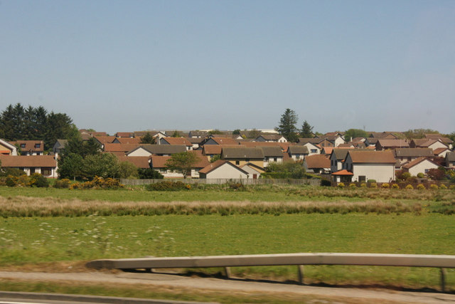
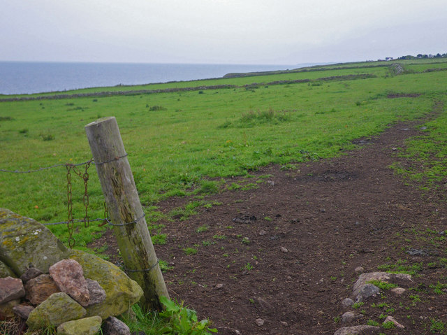
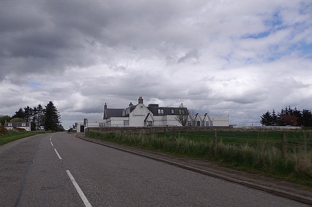
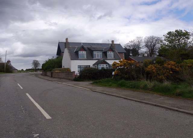
Cran Hill Images

Images are sourced within 2km of 57.037752/-2.1401908 or Grid Reference NO9194. Thanks to Geograph Open Source API. All images are credited.

Portlethen from the A90
House and fields north of Newtonhill
Quiet, but wide residential street Photographer is standing near the street edge
Quiet, but wide residential street
Photographer is standing near the street edge
Looking towards Cammachmore Bay Photographer is standing at the verge of the minor paved road.
Looking towards Cammachmore Bay
Photographer is standing at the verge of the minor paved road.
Coastal view towards Downies Access to this point only via unpaved farm track.
Coastal view towards Downies
Access to this point only via unpaved farm track.
Cammies Inn, Cammachmore Near Newtonhill, on the former main road from Stonehaven to Aberdeen (now bypassed by A90 dual carriageway).
Cammies Inn, Cammachmore
Near Newtonhill, on the former main road from Stonehaven to Aberdeen (now bypassed by A90 dual carriageway).
Bend in road, Cammachmore village
Cattle in a field, Mill of Kingaussie, Portlethen
Road into Cammachmore, near Newtonhill
Fields at Bourbushtree, west of Portleithen
Junction at Cammachmore, near Portleithen
Windyedge, Newtonhill
Fishermoss primary school, Portlethen School roll 302 (2016).
Fishermoss primary school, Portlethen
School roll 302 (2016).
Site of Newtonhill Station The station closed in 1956 although there is some talk of reopening it as Newtonhill has transformed from a fishing village to a commuter settlement.  Compare the photo from 2009 <a title="https://www.geograph.org.uk/photo/1454732" href="https://www.geograph.org.uk/photo/1454732">Link</a> for changes to track layout and signals.
Site of Newtonhill Station
The station closed in 1956 although there is some talk of reopening it as Newtonhill has transformed from a fishing village to a commuter settlement. Compare the photo from 2009 Link for changes to track layout and signals.
High Speed Train The 14:52 from Aberdeen to King's Cross passes the site of Newtonhill station.
High Speed Train
The 14:52 from Aberdeen to King's Cross passes the site of Newtonhill station.
Newtonhill parish church This modest structure dates from 1987.
Newtonhill parish church
This modest structure dates from 1987.
Newtonhill: walking to the harbour The cat was friendly...
Newtonhill: walking to the harbour
The cat was friendly...
Newtonhill Bay
Newtonhill Bay
Show me another place!

Cran Hill is located at Grid Ref: NO9194 (Lat: 57.037752, Lng: -2.1401908)

Unitary Authority: Aberdeenshire

Police Authority: North East

What 3 Words

///chilled.bulbs.sound. Near Newtonhill, Aberdeenshire

Nearby Locations

Cran Hill

Related Wikis

Burn of Elsick

The Burn of Elsick is a coastal stream in Aberdeenshire, Scotland that discharges to the North Sea. This watercourse drains primarily agricultural lands...

Newtonhill railway station

Newtonhill railway station served the town of Newtonhill in Aberdeenshire, Scotland, United Kingdom from its opening in 1851 to its closure in 1956. Newtonhill...

Newtonhill

Newtonhill is a commuter town in Kincardineshire, Scotland. It is popular due to its location, just six miles south of Aberdeen with easy reach of Stonehaven...

Cammachmore

Cammachmore (Gaelic An Camach Mòr) is a hamlet in the coastal region near the North Sea in Aberdeenshire. It lies slightly west of the A92 road and the...

Causey Mounth

The Causey Mounth is an ancient drovers' road over the coastal fringe of the Grampian Mountains in Aberdeenshire, Scotland. This route was developed as...

May Craig (island)

May Craig is a rocky island situated along the North Sea coast of Aberdeenshire, Scotland. May Craig lies about one half mile (0.8 km) south of Newtonhill...

Downies

Downies is a cliff-top village in Aberdeenshire, Scotland situated on Cammachmore Bay. Historically Downies was a fishing village, until much of the local...

Cammachmore Bay

Cammachmore Bay is an embayment of the North Sea between Stonehaven and Aberdeen in Aberdeenshire, Scotland. The fishing village of Downies is situated...

Nearby Amenities

Located within 500m of 57.037752,-2.1401908
Source: PGS
Lat/Long: 57.034353/-2.135179
Source: PGS
Lat/Long: 57.0345084/-2.1345127
Source: PGS
Lat/Long: 57.0349063/-2.1342573
Source: PGS
Lat/Long: 57.0351369/-2.1337198
Source: PGS
Lat/Long: 57.035881/-2.13397
Source: PGS
Lat/Long: 57.036139/-2.134198
Cranhill
Ele: 86
Natural: peak
Lat/Long: 57.0376226/-2.1405159
Power: pole
Lat/Long: 57.0374343/-2.1478145
Power: pole
Lat/Long: 57.0373316/-2.1468007
Power: pole
Lat/Long: 57.0369266/-2.145912
Power: pole
Lat/Long: 57.0373086/-2.1449385
Power: pole
Lat/Long: 57.0375717/-2.1443573
Power: pole
Lat/Long: 57.0381879/-2.1428281
Power: pole
Lat/Long: 57.0384268/-2.1421324
Power: pole
Lat/Long: 57.0386783/-2.1413964
Power: pole
Lat/Long: 57.0389253/-2.1406647
Power: pole
Lat/Long: 57.0391688/-2.1399733
Power: pole
Lat/Long: 57.0394203/-2.1392267
Power: pole
Lat/Long: 57.0396719/-2.138495
Power: pole
Lat/Long: 57.0400354/-2.1382129
Power: pole
Lat/Long: 57.0403954/-2.1379414
Power: pole
Lat/Long: 57.0407496/-2.1376826
Power: pole
Lat/Long: 57.0412677/-2.1372818
Power: pole
Lat/Long: 57.0419647/-2.1399436
Power: pole
Lat/Long: 57.0416116/-2.1383847
Power: pole
Lat/Long: 57.0415066/-2.1379265
Power: pole
Lat/Long: 57.0411535/-2.1367218
Power: pole
Lat/Long: 57.04127/-2.1356613
The data included in this document is from www.openstreetmap.org. The data is made available under ODbL.

Have you been to Cran Hill?

Leave your review of Cran Hill below (or comments, questions and feedback).