Black Stitchel
Hill, Mountain in Northumberland
England
Black Stitchel

Black Stitchel is a prominent hill located in the county of Northumberland, England. It is situated within the Northumberland National Park, which is known for its picturesque landscapes and diverse wildlife. The hill lies approximately 9 miles to the southwest of the town of Wooler.
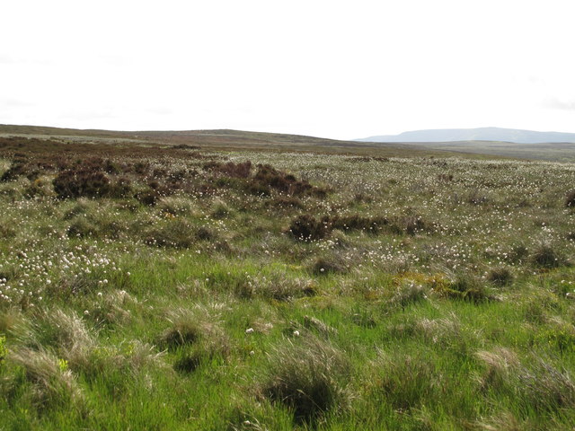
Rising to an elevation of 376 meters (1,234 feet), Black Stitchel offers breathtaking panoramic views of the surrounding countryside. Its distinctive shape and dark-colored rock formations give it a unique appearance, hence the name "Black Stitchel." The hill is predominantly covered in heather and grass, creating a vibrant and colorful landscape, particularly during the summer months.
Black Stitchel is a popular destination for hikers and nature enthusiasts, attracting visitors from both near and far. Several well-marked footpaths and trails lead to the summit, making it accessible to people of varying fitness levels. The hill provides a challenging but rewarding climb, with stunning vistas awaiting those who reach the top.
The area around Black Stitchel is home to a variety of wildlife, including birds of prey, such as kestrels and buzzards, as well as smaller mammals like rabbits and foxes. The hill also boasts a rich history, with archaeological remains dating back to the Iron Age, including the remains of an ancient hillfort.
Overall, Black Stitchel offers an opportunity to immerse oneself in the natural beauty and history of Northumberland. Whether it be for a leisurely stroll or a more adventurous hike, this hill provides a memorable experience for all who venture to its summit.
If you have any feedback on the listing, please let us know in the comments section below.
Black Stitchel Images
Images are sourced within 2km of 55.280091/-2.1441058 or Grid Reference NY9098. Thanks to Geograph Open Source API. All images are credited.


Black Stitchel is located at Grid Ref: NY9098 (Lat: 55.280091, Lng: -2.1441058)
Unitary Authority: Northumberland
Police Authority: Northumbria
What 3 Words
///warping.asterisk.order. Near Otterburn, Northumberland
Nearby Locations
Related Wikis

Billsmoor Park and Grasslees Wood
Billsmoor Park and Grasslees Wood is the name given to a Site of Special Scientific Interest (SSSI) in Northumberland, North East England, designated in...
High Cove
High Cove is a major slip feature to the west of Grasslees Burn in the Simonside Hills, Northumberland, England. It contains several small rifts and caves...

Otterburn Hall
Otterburn Hall is an English country house and estate in Otterburn, Northumberland. It is situated in 500 acres (200 ha) of deer park and woodland in...

Otterburn, Northumberland
Otterburn is a small village in Northumberland, England, 31 miles (50 km) northwest of Newcastle upon Tyne on the banks of the River Rede, near the confluence...
Otterburn Tower
Otterburn Tower (sometimes spelled Otiburne; originally Otterburn Castle; currently Otterburn Tower Hotel) is a Grade II listed castellated, three star...

Elsdon Tower
Elsdon Tower is a Grade I listed medieval tower house converted for use as a Rectory situated at Elsdon, Northumberland. Originally part of the estate...

Elsdon Castle
Elsdon Castle is a castle in the village of Elsdon about 10 miles (16 km) to the southwest of Rothbury, in Northumberland, England, and also known as Mote...
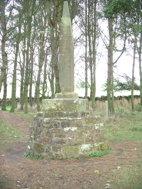
Percy Cross
The Percy Cross (also Battle Stone) is located just off the A696, 1 kilometre (0.62 mi) from Otterburn, Northumberland, England. It was erected before...
Nearby Amenities
Located within 500m of 55.280091,-2.1441058Have you been to Black Stitchel?
Leave your review of Black Stitchel below (or comments, questions and feedback).