Rushy Hill
Hill, Mountain in Yorkshire
England
Rushy Hill

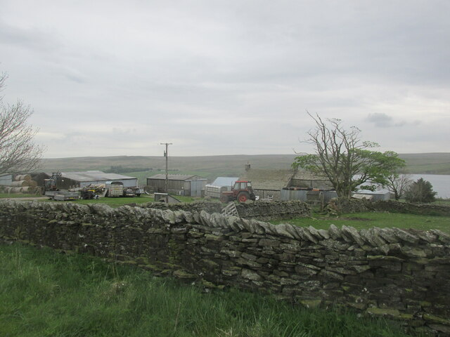
Rushy Hill is a prominent natural feature located in Yorkshire, England. Situated within the picturesque landscape of the Yorkshire Dales National Park, this hill/mountain is a popular destination for outdoor enthusiasts and nature lovers.
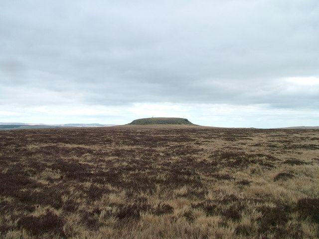
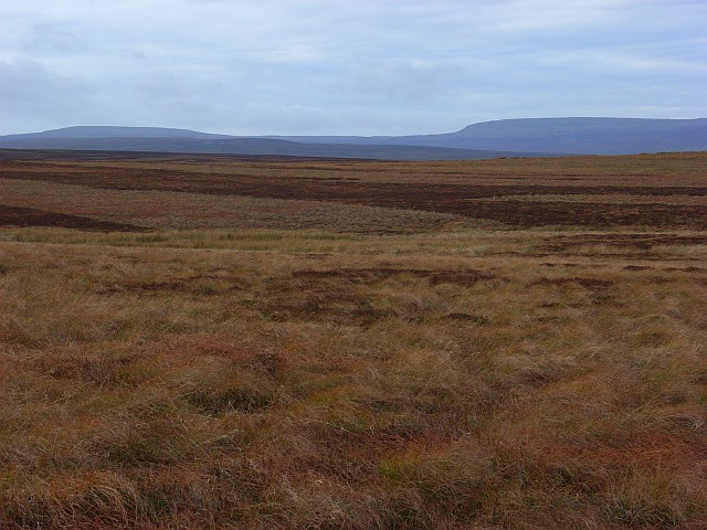
Rising to an elevation of approximately 600 meters (1,970 feet), Rushy Hill offers breathtaking panoramic views of the surrounding area. Its distinctive shape and lush greenery make it a visually striking landmark in this part of Yorkshire. The hill is covered with heather, grasses, and scattered trees, providing a diverse habitat for various flora and fauna.
The area surrounding Rushy Hill is rich in history and heritage. It is believed that the hill was formed during the last Ice Age, and evidence of human activity dating back to prehistoric times has been discovered in the vicinity. Archaeological remains, such as burial mounds and stone circles, further enhance the cultural significance of the area.
The hill is a popular destination for hikers and walkers, offering a range of trails and paths that cater to different fitness levels. These routes provide opportunities to explore the natural beauty of Rushy Hill and its surroundings, including nearby rivers, valleys, and woodland areas.
Rushy Hill is also a favorite spot for birdwatchers, as it attracts a variety of bird species throughout the year. Visitors may be fortunate enough to spot kestrels, buzzards, and even the occasional peregrine falcon soaring above the hill.
Overall, Rushy Hill serves as both a natural landmark and a recreational haven, offering a combination of stunning scenery, historical significance, and outdoor activities for all to enjoy.
If you have any feedback on the listing, please let us know in the comments section below.
Rushy Hill Images
Images are sourced within 2km of 54.552924/-2.1490247 or Grid Reference NY9017. Thanks to Geograph Open Source API. All images are credited.


Rushy Hill is located at Grid Ref: NY9017 (Lat: 54.552924, Lng: -2.1490247)
Division: North Riding
Unitary Authority: County Durham
Police Authority: Durham
What 3 Words
///discusses.edgy.gums. Near Mickleton, Co. Durham
Nearby Locations
Related Wikis
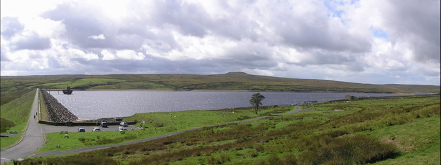
Balderhead Reservoir
Balderhead Reservoir is a reservoir in Baldersdale, County Durham, England. It is one of a chain of three reservoirs on the River Balder, a tributary of...

Hunder Beck Juniper
Hunder Beck Juniper is a Site of Special Scientific Interest in the Teesdale district of south-west County Durham, England. It lies between the Balderhead...

Hannah's Meadows
Hannah's Meadows is a Site of Special Scientific Interest in the Teesdale district of south-west County Durham, England. It consists of three fields,...
Cotherstone Moor
Cotherstone Moor is a Site of Special Scientific Interest in the Teesdale district in south-west County Durham, England. It is an extensive area of moorland...

Selset Reservoir
Selset Reservoir is a reservoir in County Durham, England. It is situated in Lunedale which is a side valley of the River Tees, about 5 miles (8 km) west...

Blackton Reservoir
Blackton Reservoir is a reservoir in County Durham, England. It is situated in Baldersdale, about 4 miles (7 km) west of Cotherstone, where the River Balder...

Baldersdale
Baldersdale is a dale, or valley, on the east side of the Pennines in England, northwest of Barnard Castle. Its principal settlements are Hury and Briscoe...

Grassholme
Grassholme is a village in County Durham, England.For centuries it lay within the historic county boundaries of the North Riding of Yorkshire, but, along...
Nearby Amenities
Located within 500m of 54.552924,-2.1490247Have you been to Rushy Hill?
Leave your review of Rushy Hill below (or comments, questions and feedback).