Cairn Hill

Hill, Mountain in Northumberland / Roxburghshire

England

Cairn Hill

The Pennine Way near Hanging Stone The junction of the PW to the Cheviot Summit with the Pennine Way.
The Pennine Way near Hanging Stone Credit: Dave Kelly

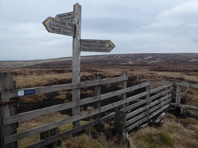
Cairn Hill is a prominent hill located on the border between Northumberland, England, and Roxburghshire, Scotland. Standing at an elevation of 570 meters (1,870 feet), it is considered one of the highest hills in the region. The hill is a part of the Cheviot Hills, a range that stretches across the border between England and Scotland.

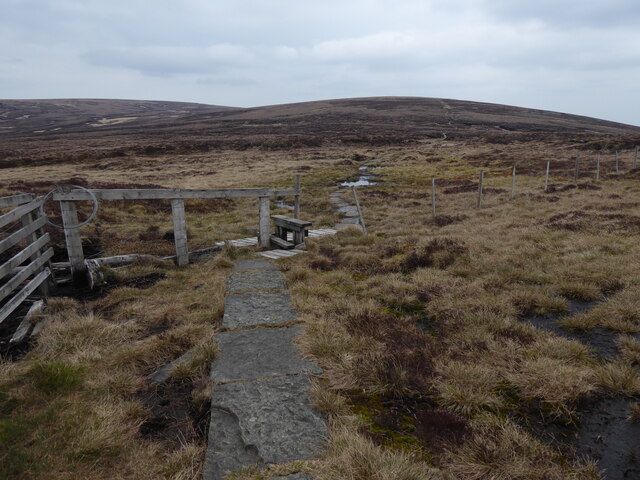
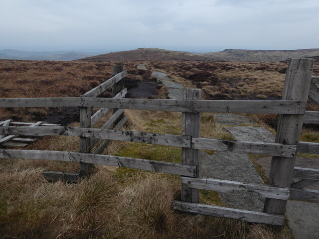
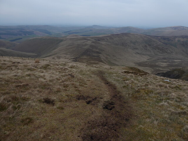
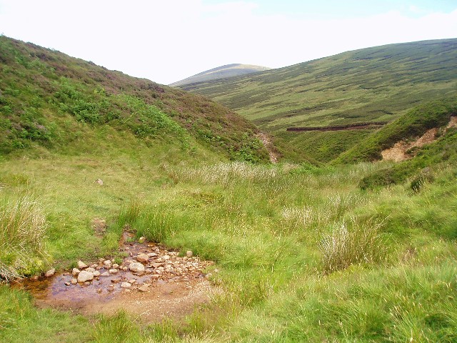
Cairn Hill offers breathtaking panoramic views of the surrounding countryside. On clear days, visitors can enjoy vistas of rolling hills, lush valleys, and distant mountain ranges. The hill is covered in heather and grass, providing a picturesque landscape that changes colors with the seasons. It is a popular destination for hikers, nature enthusiasts, and photographers.

The hill is also home to a variety of wildlife, including birds, mammals, and plant species. Birdwatchers can spot a range of species, such as peregrine falcons, red grouse, and curlews, among others. The hillside is also known for its rich biodiversity, with rare plant species like purple saxifrage and alpine bistort found in the area.

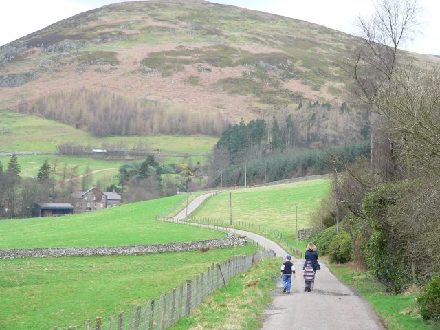
Cairn Hill is easily accessible by foot or vehicle, with several walking trails and roads leading to its summit. The hill offers a challenging yet rewarding hike for outdoor enthusiasts, with stunning views as a reward for reaching the top. Whether it's for a leisurely walk, wildlife spotting, or simply enjoying the beauty of the natural landscape, Cairn Hill is a must-visit destination for those exploring Northumberland and Roxburghshire.

If you have any feedback on the listing, please let us know in the comments section below.

Cairn Hill Images

Images are sourced within 2km of 55.469298/-2.1543184 or Grid Reference NT9019. Thanks to Geograph Open Source API. All images are credited.

The Pennine Way near Hanging Stone The junction of the PW to the Cheviot Summit with the Pennine Way.
The Pennine Way near Hanging Stone
The junction of the PW to the Cheviot Summit with the Pennine Way.
The Pennine Way leading to the Cheviot Summit
The Pennine Way towards Auchope Cairn
The Pennine Way near Hen Hole
Cairn Hill
Cairn Hill
Scotsman's Knowe
Scotsman's Knowe
Harthope Burn Very close to the top of stream (Langleeford Vale).  
Comb Fell to the left and Cairn Hill to the right.
Harthope Burn
Very close to the top of stream (Langleeford Vale). Comb Fell to the left and Cairn Hill to the right.
Harthope Valley The Harthope Burn rises on the southern side of Cairn Hill.  Its valley then turns to the north-east to run between The Cheviot and Hedgehope Hill.
Harthope Valley
The Harthope Burn rises on the southern side of Cairn Hill. Its valley then turns to the north-east to run between The Cheviot and Hedgehope Hill.
Harthope Burn A descent from The Cheviot to the south, over the top of Cairn Hill, follows the Harthope Burn closely for several miles to meet the road at Langleeford.
Harthope Burn
A descent from The Cheviot to the south, over the top of Cairn Hill, follows the Harthope Burn closely for several miles to meet the road at Langleeford.
Tree overhanging Harthope Burn The only tree for miles around, this one is clinging on bravely to the hillside.
Tree overhanging Harthope Burn
The only tree for miles around, this one is clinging on bravely to the hillside.
Comb Fell from The Cheviot
Coldlaw Cairn The top of Coldlaw Cairn looking across the hills surrounding the Upper Breamish Valley. For free detailed walking routes in the area visit <span class="nowrap"><a title="www.cheviotwalks.co.uk" rel="nofollow ugc noopener" href="http://www.cheviotwalks.co.uk">Link</a><img style="margin-left:2px;" alt="External link" title="External link - shift click to open in new window" src="https://s1.geograph.org.uk/img/external.png" width="10" height="10"/></span>
Coldlaw Cairn
The top of Coldlaw Cairn looking across the hills surrounding the Upper Breamish Valley. For free detailed walking routes in the area visit LinkExternal link
Stone Shelter/Cairn on Cairn Hill Cairn Hill an outlier of The Cheviot. For free detailed walking routes in the area visit <span class="nowrap"><a title="www.cheviotwalks.co.uk" rel="nofollow ugc noopener" href="http://www.cheviotwalks.co.uk">Link</a><img style="margin-left:2px;" alt="External link" title="External link - shift click to open in new window" src="https://s1.geograph.org.uk/img/external.png" width="10" height="10"/></span>
Stone Shelter/Cairn on Cairn Hill
Cairn Hill an outlier of The Cheviot. For free detailed walking routes in the area visit LinkExternal link
Stream valley south of The Cheviot
Fence at Breamish Head This is near the source of the River Breamish. The hill above is Coldlaw Cairn, a south-west outlier of Comb Fell. The fence turns right (south) and follows the edge of the forest over the heathery wastes of the Lint Lands.
Fence at Breamish Head
This is near the source of the River Breamish. The hill above is Coldlaw Cairn, a south-west outlier of Comb Fell. The fence turns right (south) and follows the edge of the forest over the heathery wastes of the Lint Lands.
Mist over the Lint Lands Not many people come up here and who can blame them.
Mist over the Lint Lands
Not many people come up here and who can blame them.
Fence corner , Comb Fell
Harthope Burn
Harthope Burn
Show me another place!

Cairn Hill is located at Grid Ref: NT9019 (Lat: 55.469298, Lng: -2.1543184)

Unitary Authority: Northumberland

Police Authority: Northumbria

What 3 Words

///stream.onlookers.steadily. Near Kirknewton, Northumberland

Nearby Locations

Cairn Hill

Related Wikis

Cheviot Hills

The Cheviot Hills (), or sometimes The Cheviots, are a range of uplands straddling the Anglo-Scottish border between Northumberland and the Scottish Borders...

The Cheviot

The Cheviot () is an extinct volcano and the highest summit in the Cheviot Hills and in the county of Northumberland. Located in the extreme north of England...

Hedgehope Hill

Hedgehope Hill is a mountain in the Cheviot Hills of north Northumberland in northeast England, and categorised as a Hewitt. At a height of 714 metres...

Windy Gyle

Windy Gyle is a mountain in the Cheviot Hills range, on the border between England and Scotland. Like the other hills in the area, it is rounded and grass...

Threestoneburn Stone Circle

Threestoneburn Stone Circle is an archaeological site, a stone circle near the village of Ilderton and about 5 miles (8 km) south of Wooler, in Northumberland...

Linhope

Linhope is a small village in Northumberland, England. It is located in the Cheviots on the River Breamish, and within Northumberland National Park. Linhope...

Kidland

Kidland is a former civil parish, now in the parish of Alwinton in Northumberland, England, about 2 miles (3 km) northwest of Alwinton village. In 1951...

Newton Tors

The Newton Tors are large, free-standing residual masses (rock outcrop) that form the western rim of the Great Moor which runs from the market town of...

Nearby Amenities

Located within 500m of 55.469298,-2.1543184
Cairn Hill
Ele: 777
Natural: peak
Lat/Long: 55.4694201/-2.154803
Scotsman's Cairn
Place: locality
Lat/Long: 55.4692943/-2.1540284
Information: guidepost
Tourism: information
Lat/Long: 55.4692951/-2.154369
The data included in this document is from www.openstreetmap.org. The data is made available under ODbL.

Have you been to Cairn Hill?

Leave your review of Cairn Hill below (or comments, questions and feedback).