Berry Top

Hill, Mountain in Kincardineshire

Scotland

Berry Top

Aberdeen Western Peripheral Route The excavations here are the early stages of the construction of the Aberdeen Western Peripheral Route (AWPR).
Aberdeen Western Peripheral Route Credit: Anne Burgess

Berry Top is a prominent hill located in Kincardineshire, Scotland. Situated in the eastern part of the county, it forms part of the picturesque landscape of the area. With an elevation of approximately 376 meters (1,234 feet), Berry Top offers stunning panoramic views of the surrounding countryside.

The hill is characterized by its gentle slopes and rolling terrain, making it a popular destination for outdoor enthusiasts. Hikers and walkers are drawn to Berry Top for its well-maintained trails, which allow for a relatively easy ascent to the summit. The paths wind through lush green meadows, dotted with vibrant wildflowers during the summer months.

From the top of Berry Top, visitors are rewarded with breathtaking vistas of the surrounding countryside. On clear days, it is possible to see as far as the North Sea to the east and the Cairngorms National Park to the west. The views are particularly spectacular during sunrise and sunset, when the colors of the sky paint a stunning backdrop to the landscape.

Aside from its natural beauty, Berry Top is also home to a variety of wildlife. The hill provides a habitat for several bird species, including kestrels and peregrine falcons, which can often be spotted soaring through the skies. Additionally, the surrounding woodlands are home to deer, rabbits, and other small mammals.

Overall, Berry Top offers a delightful outdoor experience for nature lovers and hikers, combining breathtaking views, diverse wildlife, and tranquil surroundings.

If you have any feedback on the listing, please let us know in the comments section below.
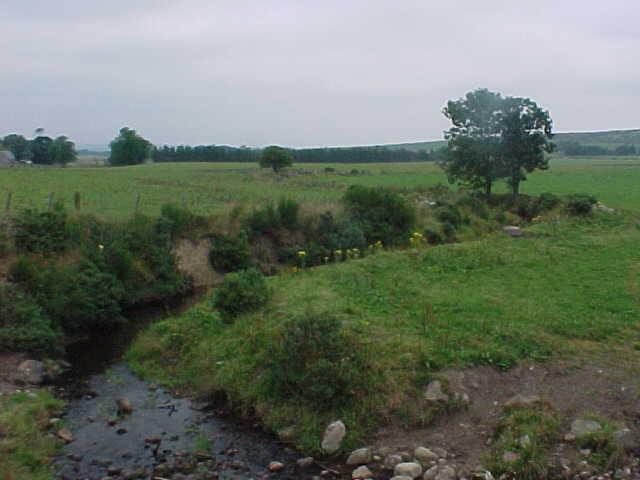
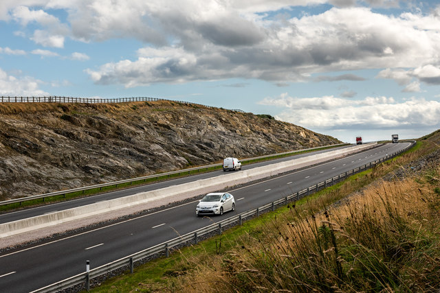
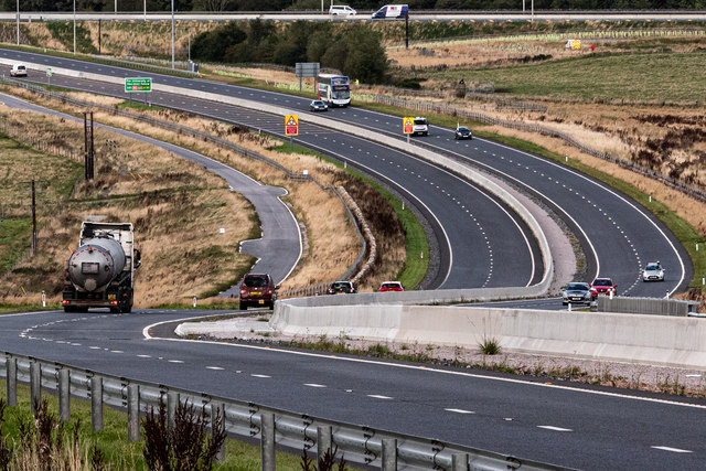
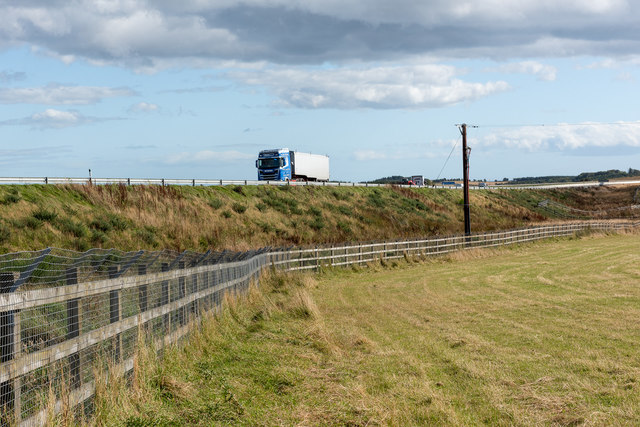
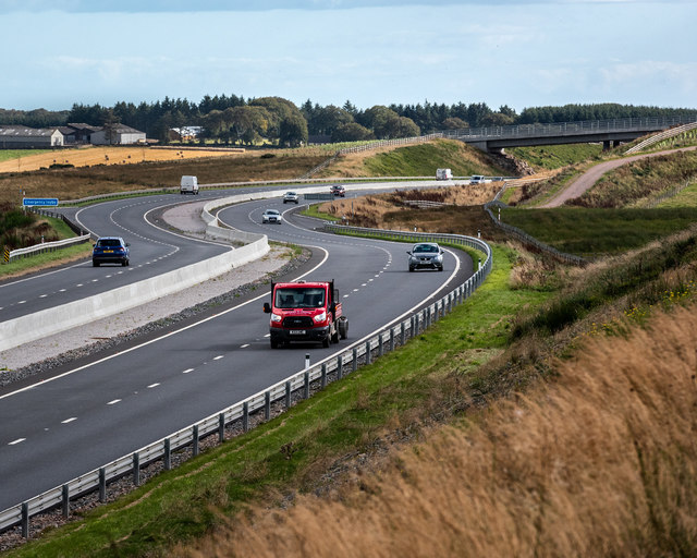
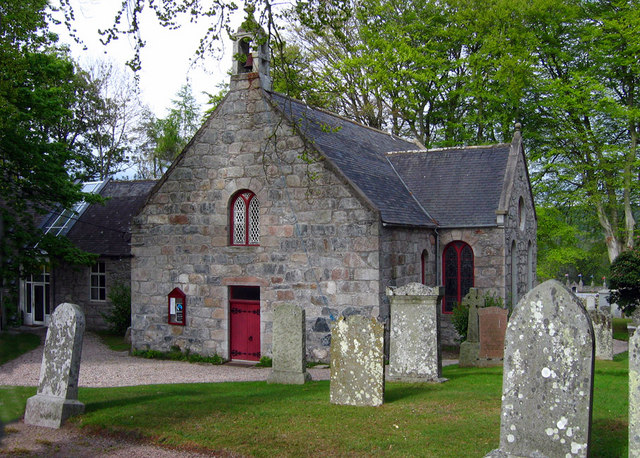
Berry Top Images

Images are sourced within 2km of 57.055755/-2.2307817 or Grid Reference NO8696. Thanks to Geograph Open Source API. All images are credited.

Aberdeen Western Peripheral Route The excavations here are the early stages of the construction of the Aberdeen Western Peripheral Route (AWPR).
Aberdeen Western Peripheral Route
The excavations here are the early stages of the construction of the Aberdeen Western Peripheral Route (AWPR).
Burn of Monquich
Burn of Monquich
B979 heading north from Netherley Daffodils in bloom at access junction for Mill of Monquich.
B979 heading north from Netherley
Daffodils in bloom at access junction for Mill of Monquich.
Access lane to Mill of Monquich, Netherley Off B979.
Access lane to Mill of Monquich, Netherley
Off B979.
Alba Power factory near Netherley Hunter airframe and engines of N-315 as restored by Alba Power. See <span class="nowrap"><a title="http://www.thunder-and-lightnings.co.uk/hunter/index.php" rel="nofollow ugc noopener" href="http://www.thunder-and-lightnings.co.uk/hunter/index.php">Link</a><img style="margin-left:2px;" alt="External link" title="External link - shift click to open in new window" src="https://s1.geograph.org.uk/img/external.png" width="10" height="10"/></span> and <span class="nowrap"><a title="http://www.thunder-and-lightnings.co.uk/hunter/survivor.php?id=263" rel="nofollow ugc noopener" href="http://www.thunder-and-lightnings.co.uk/hunter/survivor.php?id=263">Link</a><img style="margin-left:2px;" alt="External link" title="External link - shift click to open in new window" src="https://s1.geograph.org.uk/img/external.png" width="10" height="10"/></span>
Alba Power factory near Netherley
Hunter airframe and engines of N-315 as restored by Alba Power. See LinkExternal link and LinkExternal link
A90 - cutting east of Stranog Hill Cutting east of Stranog Hill on the A90, Aberdeen Western Peripheral Route (AWPR)
A90 - cutting east of Stranog Hill
Cutting east of Stranog Hill on the A90, Aberdeen Western Peripheral Route (AWPR)
A90 south of the Cleanhill junction South of the Cleanhill junction on the A90, Aberdeen Western Peripheral Route (AWPR)
A90 south of the Cleanhill junction
South of the Cleanhill junction on the A90, Aberdeen Western Peripheral Route (AWPR)
A90 near Crossley The A90, Aberdeen Western Peripheral Route (AWPR) near Crossley
A90 near Crossley
The A90, Aberdeen Western Peripheral Route (AWPR) near Crossley
A90 near Crossley The A90, Aberdeen Western Peripheral Route (AWPR), near Crossley
A90 near Crossley
The A90, Aberdeen Western Peripheral Route (AWPR), near Crossley
The A90 near Rothnick The A90, Aberdeen Western Peripheral Route (AWPR), near Rothnick
The A90 near Rothnick
The A90, Aberdeen Western Peripheral Route (AWPR), near Rothnick
A90 near Rothnick The A90, Aberdeen Western Peripheral Route (AWPR), near Rothnick
A90 near Rothnick
The A90, Aberdeen Western Peripheral Route (AWPR), near Rothnick
Paddock near Mains of Netherley
Road from Netherley towards Durris
Future Hedge Recently planted shrubs in plastic sheaths beside the approach to a bridge over the Aberdeen Western Peripheral Route.
Future Hedge
Recently planted shrubs in plastic sheaths beside the approach to a bridge over the Aberdeen Western Peripheral Route.
East Croft It won't be many years until this view is obliterated by the shrubs that have been planted beside the road. The closest buildings are at East Croft, and the further away ones are at Crossley.
East Croft
It won't be many years until this view is obliterated by the shrubs that have been planted beside the road. The closest buildings are at East Croft, and the further away ones are at Crossley.
Aberdeen Western Peripheral Route Looking north from the road overbridge at Rothnick.
Aberdeen Western Peripheral Route
Looking north from the road overbridge at Rothnick.
New Houses The nearest house, on the left, is at Rothnick Croft, and the more distant ones are at Stripeside.
New Houses
The nearest house, on the left, is at Rothnick Croft, and the more distant ones are at Stripeside.
Whiteside The farm buildings at Whiteside are surrounded by heaps of earth for some reasons.
Whiteside
The farm buildings at Whiteside are surrounded by heaps of earth for some reasons.
Show me another place!

Berry Top is located at Grid Ref: NO8696 (Lat: 57.055755, Lng: -2.2307817)

Unitary Authority: Aberdeenshire

Police Authority: North East

What 3 Words

///paces.shippers.describe. Near Peterculter, Aberdeen

Nearby Locations

Stranog Hill Berry Top

Related Wikis

Cairnie Burn

Cairnie Burn is a stream that rises in the Mounth, or eastern range of the Grampian Mountains, north of Netherley, Aberdeenshire, Scotland. Cairnie Burn...

Red Moss, Aberdeenshire

Red Moss is a wetland bog in Aberdeenshire, Scotland, located at the northwestern edge of the village of Netherley. (Grid Reference NO 955 856) The moss...

Netherley, Aberdeenshire

Netherley, Scotland is a village in Aberdeenshire, situated approximately five miles northwest of Stonehaven. Netherley is located in the Mounth area...

Netherley House

Netherley House is a mansion built by Alexander Silver in the late 18th century in Netherley, Aberdeenshire, Scotland. It is situated near the northerly...

Oldman Wood

Oldman Wood is a publicly owned forest in Kincardineshire, Scotland. Crynoch Burn, a tributary of the River Dee, flows through the Oldman Wood. == References ==
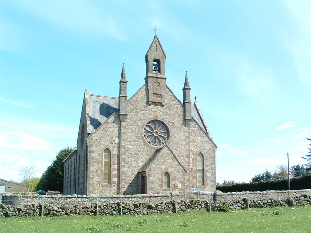
Cookney Church

Cookney Parish Church, now business premises within a converted listed building, was a Christian place of worship in the village of Cookney, Aberdeenshire...

Maryculter

Maryculter () or Kirkton of Maryculter is a village in the Lower Deeside area of Aberdeenshire, Scotland. The River Dee separates it from the town of...

Cookney

Cookney is a hamlet in Aberdeenshire, Scotland in proximity to Netherley in the Mounth of the Grampian Highlands. The community is situated on a hilltop...

Nearby Amenities

Located within 500m of 57.055755,-2.2307817
Berry Top
Natural: peak
Lat/Long: 57.0557266/-2.2308694
Power: pole
Lat/Long: 57.060178/-2.2295123
Power: pole
Lat/Long: 57.0595598/-2.2293434
Power: pole
Lat/Long: 57.0515338/-2.2290555
Power: pole
Lat/Long: 57.0519231/-2.2280577
Power: pole
Lat/Long: 57.0522865/-2.2270982
Power: pole
Lat/Long: 57.0526674/-2.2261158
Power: pole
Lat/Long: 57.0530382/-2.2251532
Power: pole
Lat/Long: 57.0535734/-2.2251898
Power: pole
Lat/Long: 57.0541267/-2.2252127
Power: pole
Lat/Long: 57.0546527/-2.2252401
Power: pole
Lat/Long: 57.054963/-2.2243523
Power: pole
Lat/Long: 57.0552517/-2.2235117
Power: pole
Lat/Long: 57.0555553/-2.2226041
Power: pole
Lat/Long: 57.0541841/-2.2381584
Power: pole
Lat/Long: 57.0545086/-2.2368047
Power: pole
Lat/Long: 57.0548208/-2.2354759
Power: pole
Lat/Long: 57.0552867/-2.2349727
Power: pole
Lat/Long: 57.0559075/-2.2348375
Power: pole
Lat/Long: 57.056681/-2.2346816
Power: pole
Lat/Long: 57.0572532/-2.2341388
Power: pole
Lat/Long: 57.0578186/-2.2335878
Power: pole
Lat/Long: 57.0587458/-2.2337209
Power: pole
Lat/Long: 57.059664/-2.2338581
The data included in this document is from www.openstreetmap.org. The data is made available under ODbL.

Have you been to Berry Top?

Leave your review of Berry Top below (or comments, questions and feedback).