Kelby

Settlement in Lincolnshire North Kesteven

England

Kelby

Walk in the nature reserve The footpath through the Ancaster Valley nature reserve takes a left turn uphill where the figure is.  The reserve itself continues further ahead.
<span class="nowrap"><a title="https://www.lincstrust.org.uk/nature-reserves/ancaster-valley" rel="nofollow ugc noopener" href="https://www.lincstrust.org.uk/nature-reserves/ancaster-valley">Link</a><img style="margin-left:2px;" alt="External link" title="External link - shift click to open in new window" src="https://s1.geograph.org.uk/img/external.png" width="10" height="10"/></span>
Walk in the nature reserve Credit: Ian Paterson

Kelby is a small village located in the county of Lincolnshire, in the East Midlands region of England. Situated approximately 7 miles east of the city of Lincoln, Kelby is a rural community with a population of around 150 residents.

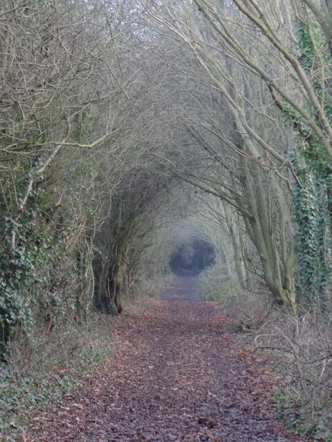
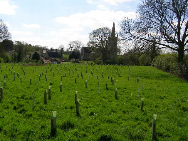
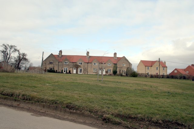
The village is nestled amidst picturesque countryside, offering beautiful views and a tranquil environment. It is surrounded by fields and farmland, which contributes to its agricultural character. The landscape is dotted with charming cottages and traditional farmhouses, adding to the idyllic charm of the area.

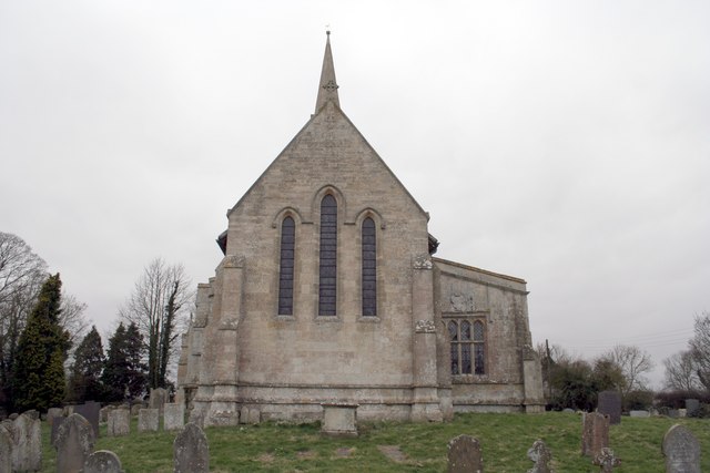
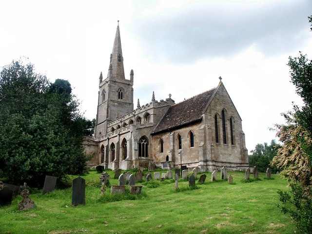
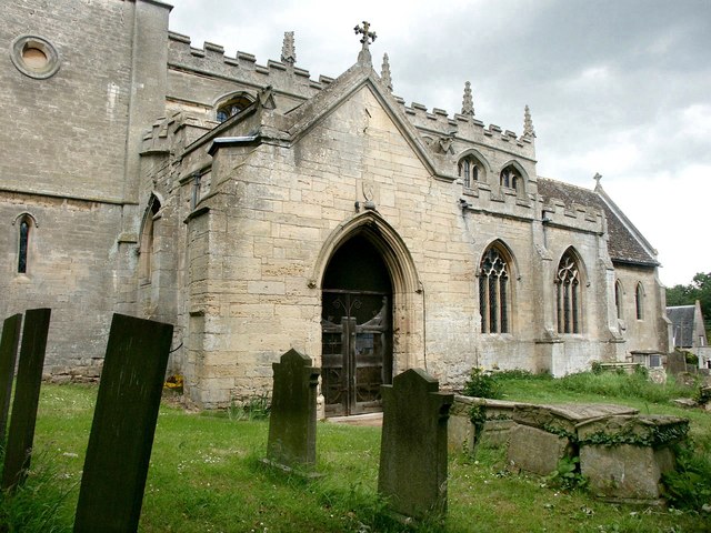
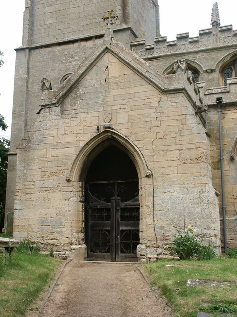
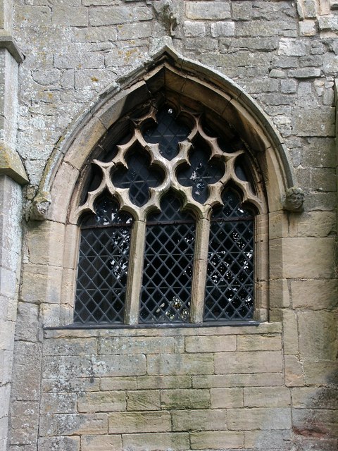
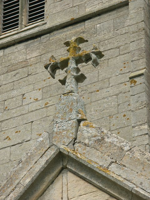
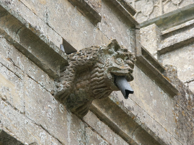
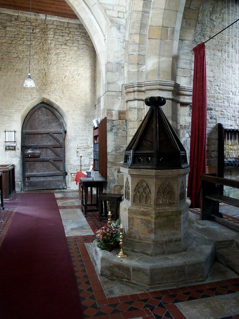
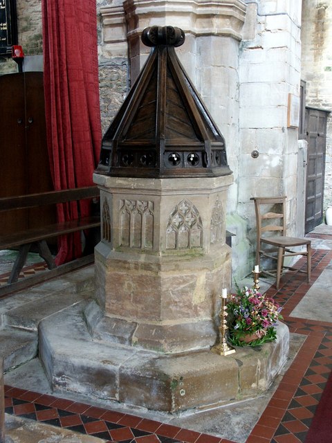
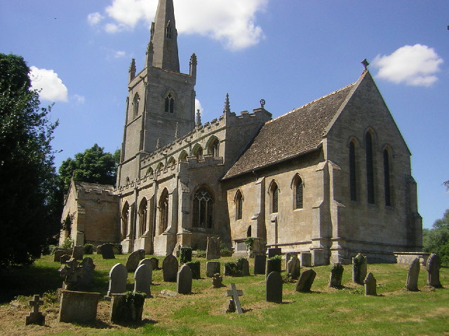
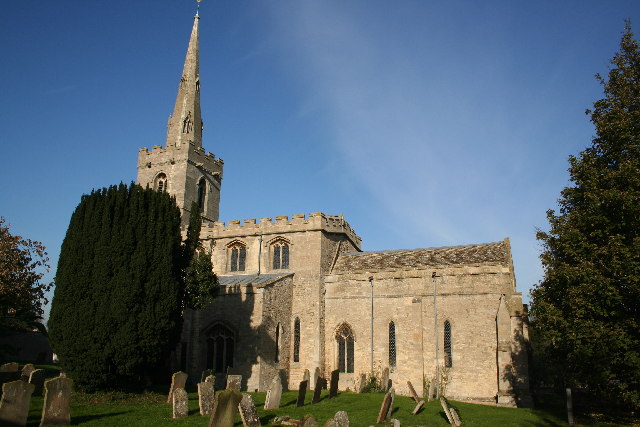
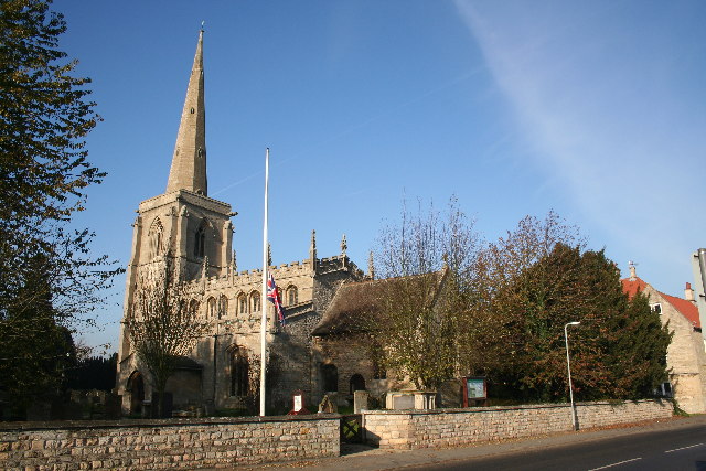
Kelby is a close-knit community that maintains a strong sense of local pride and community spirit. The village is home to St. Nicholas Church, a Grade II listed building dating back to the 13th century, which serves as a focal point for religious and social gatherings. The church's architecture and historical significance make it a notable feature of Kelby.

Despite its small size, Kelby benefits from its proximity to the city of Lincoln, offering residents access to a wider range of amenities and services. The city provides opportunities for employment, education, and entertainment, while the village itself offers a peaceful retreat away from the hustle and bustle of urban life.

Kelby is well-connected to the surrounding areas by road, with easy access to the A15 and A158 highways. This makes it convenient for both residents and visitors to explore the nearby attractions and amenities of Lincolnshire.

If you have any feedback on the listing, please let us know in the comments section below.

Kelby Images

Images are sourced within 2km of 52.961285/-0.505838 or Grid Reference TF0041. Thanks to Geograph Open Source API. All images are credited.

Walk in the nature reserve The footpath through the Ancaster Valley nature reserve takes a left turn uphill where the figure is.  The reserve itself continues further ahead.
<span class="nowrap"><a title="https://www.lincstrust.org.uk/nature-reserves/ancaster-valley" rel="nofollow ugc noopener" href="https://www.lincstrust.org.uk/nature-reserves/ancaster-valley">Link</a><img style="margin-left:2px;" alt="External link" title="External link - shift click to open in new window" src="https://s1.geograph.org.uk/img/external.png" width="10" height="10"/></span>
Walk in the nature reserve
The footpath through the Ancaster Valley nature reserve takes a left turn uphill where the figure is. The reserve itself continues further ahead. LinkExternal link
Holy moley Bit of underground activity going on at Ancaster Valley nature reserve. <span class="nowrap"><a title="https://www.lincstrust.org.uk/nature-reserves/ancaster-valley" rel="nofollow ugc noopener" href="https://www.lincstrust.org.uk/nature-reserves/ancaster-valley">Link</a><img style="margin-left:2px;" alt="External link" title="External link - shift click to open in new window" src="https://s1.geograph.org.uk/img/external.png" width="10" height="10"/></span>
Holy moley
Bit of underground activity going on at Ancaster Valley nature reserve. LinkExternal link
Tunnel vision Interesting walk through the 'tunnel' encountered along the footpath.
Tunnel vision
Interesting walk through the 'tunnel' encountered along the footpath.
O2 radio transmitter Not marked on my OS map.
O2 radio transmitter
Not marked on my OS map.
Keep to  the footpath Easy to find your way over the fields - once you clear the muddy section of path in the wooded part beside the nature reserve to the north-west that is.
Keep to the footpath
Easy to find your way over the fields - once you clear the muddy section of path in the wooded part beside the nature reserve to the north-west that is.
Wilsford Heath Triangulation Pillar Flush Bracket S4842.
Wilsford Heath Triangulation Pillar
Flush Bracket S4842.
St.Michael's church, Heydour, Lincs. fascinating architecture from Early English to Perpendicular - A big church for a small village.
St.Michael's church, Heydour, Lincs.
fascinating architecture from Early English to Perpendicular - A big church for a small village.
St Michael's Church, Heydour
New plantation to the rear of Heydour church This is a new plantation of mixed young trees; with space being left on the right for the footpath wanderers of the future - when the trees have grown and changed the view.
New plantation to the rear of Heydour church
This is a new plantation of mixed young trees; with space being left on the right for the footpath wanderers of the future - when the trees have grown and changed the view.
St Michael & All Angels, Heydour The guide to the church says that it is built of Ancaster stone in the Norman, Early English Decorated and Perpendicular styles, the entrance porch has a stone roof, and the base of the Norman tower has a small doorway with dog toothed ornament. The tower arch and lower portion of the north wall is Early English, the chancel is 13th-century and was rebuilt about 1865, the nave was rebuilt during the 14th-century and the clerestory windows were added in the 15th-century. 

The octagonal font has patterns of tracery which are incomplete. There are two medieval windows to be found in the north aisle, a collection of armour which was placed on the coffin of a soldier and there is an exceptionally good set of monuments. (Which are unfortunately hidden away in the vestry.) Not mentioned in the guide are some decorative flower paintings which can be found on the walls of the chancel.
St Michael & All Angels, Heydour
The guide to the church says that it is built of Ancaster stone in the Norman, Early English Decorated and Perpendicular styles, the entrance porch has a stone roof, and the base of the Norman tower has a small doorway with dog toothed ornament. The tower arch and lower portion of the north wall is Early English, the chancel is 13th-century and was rebuilt about 1865, the nave was rebuilt during the 14th-century and the clerestory windows were added in the 15th-century. The octagonal font has patterns of tracery which are incomplete. There are two medieval windows to be found in the north aisle, a collection of armour which was placed on the coffin of a soldier and there is an exceptionally good set of monuments. (Which are unfortunately hidden away in the vestry.) Not mentioned in the guide are some decorative flower paintings which can be found on the walls of the chancel.
St Michael & All Angels, Heydour Showing the south entrance porch and a little of the clerestory.
St Michael & All Angels, Heydour
Showing the south entrance porch and a little of the clerestory.
St Michael & All Angels, Heydour South entrance porch.
St Michael & All Angels, Heydour
South entrance porch.
St Michael & All Angels, Heydour North facing porch window.
St Michael & All Angels, Heydour
North facing porch window.
St Michael & All Angels, Heydour Stone cross finial on the entrance porch.
St Michael & All Angels, Heydour
Stone cross finial on the entrance porch.
St Michael & All Angels, Heydour Gargoyle.
St Michael & All Angels, Heydour
Gargoyle.
Interior of St Michael & All Angels, Heydour The font beneath the tower arch and looking towards the inner entrance door.
Interior of St Michael & All Angels, Heydour
The font beneath the tower arch and looking towards the inner entrance door.
Interior of St Michael & All Angels, Heydour The font and cover.
Interior of St Michael & All Angels, Heydour
The font and cover.
Interior of St Michael & All Angels, Heydour Below the niche of the bricked-up doorway is the church chest.
Interior of St Michael & All Angels, Heydour
Below the niche of the bricked-up doorway is the church chest.
Show me another place!

Kelby is located at Grid Ref: TF0041 (Lat: 52.961285, Lng: -0.505838)

Division: Parts of Kesteven

Administrative County: Lincolnshire

District: North Kesteven

Police Authority: Lincolnshire

What 3 Words

///workbook.reply.thrashed. Near Ancaster, Lincolnshire

Nearby Locations

Kelby

Related Wikis

Kelby

Kelby is a village in the civil parish of Culverthorpe and Kelby, in the North Kesteven district of Lincolnshire, England. It lies 5 miles (8 km) south...

Culverthorpe Hall

Culverthorpe Hall, Culverthorpe, Lincolnshire, England is an 18th-century country house. It is a Grade I listed building. == History == In the 17th century...

Heydour

Heydour is a hamlet and civil parish in the South Kesteven district of Lincolnshire, England. The parish population of 286 at the 2001 census rose to 311...

Wilsford, Lincolnshire

Wilsford is a village and civil parish in the North Kesteven district of Lincolnshire, England. The population of the civil parish was 400 at the 2011...

Oasby

Oasby is a hamlet in the civil parish of Heydour, in the South Kesteven district of Lincolnshire, England. It lies 7 miles (11 km) north-east of Grantham...

Culverthorpe

Culverthorpe is a hamlet in the civil parish of Culverthorpe and Kelby, in the North Kesteven district of Lincolnshire, England. It lies 5 miles (8 km...

Ancaster, Lincolnshire

Ancaster is a village and civil parish in the South Kesteven district of Lincolnshire, England, on the site of a Roman town. The population of the civil...

Aisby, South Kesteven

Aisby is a village in the civil parish of Heydour, in the South Kesteven district of Lincolnshire, England. It is situated 1 mile (1.6 km) north from the...

Related Videos

**Fake Train Horn Unit** No. 16 Foot Crossing (22/06/19)

Fake Train Horn Unit** No. 16 Foot Crossing (22/06/19) Welcome to No. 16 Foot / Pedestrian Crossing. This Crossing is situated ...

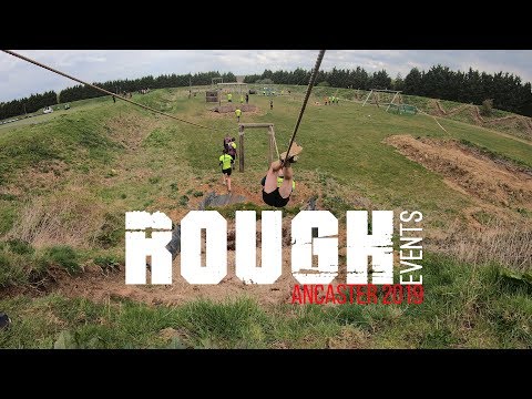
Rough Events | Rough 10k Ancaster

Rough Events 2019. Rough 10K 2019 at Ancaster in 3 minutes via GoPro Hero 7 black TimeWarp. I'm also here: ...

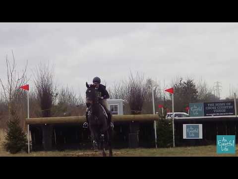
Piggy French on Graf Cavalier at Oasby (1) 2018

Watch the full cross country ride of Intermediate winner Piggy French on Graf Cavalier at the 2018 Oasby (1) Horse Trials - to view ...

Nearby Amenities

Located within 500m of 52.961285,-0.505838
Kelby
Is In: Lincolnshire, England, UK
Place: hamlet
Source: NPE
Lat/Long: 52.9604256/-0.506308
Glebe Farm
Place: farm
Lat/Long: 52.9596655/-0.5077526
Holme Farm
Place: farm
Lat/Long: 52.9598269/-0.5048662
Manor Farm
Place: farm
Lat/Long: 52.9609471/-0.507946
Manor House Farm
Place: farm
Lat/Long: 52.9615117/-0.5066367
Defibrillator
Booth: K6
Colour: red
Covered: booth
Defibrillator Location: in red phone box in Kelby
Disused Amenity: telephone
Emergency: defibrillator
Man Made: telephone_box
Ref: CHT-14-1221
Lat/Long: 52.9605377/-0.5066315
Post Box
Post Box Type: wall
Royal Cypher: GR
Royal Cypher Wikidata: Q33102273
Lat/Long: 52.9606363/-0.5066342
The data included in this document is from www.openstreetmap.org. The data is made available under ODbL.

Have you been to Kelby?

Leave your review of Kelby below (or comments, questions and feedback).