Huddinknoll Hill

Hill, Mountain in Gloucestershire Stroud

England

Huddinknoll Hill

View from Painswick Rugby Club During a Bambi Owners' Club rally.
View from Painswick Rugby Club Credit: Penny Mayes

Huddinknoll Hill is a prominent hill located in Gloucestershire, England. Situated in the picturesque countryside, it forms part of the Cotswold Hills, renowned for their natural beauty and rolling landscapes. The hill stands at an elevation of approximately 220 meters (720 feet), offering stunning panoramic views of the surrounding area.

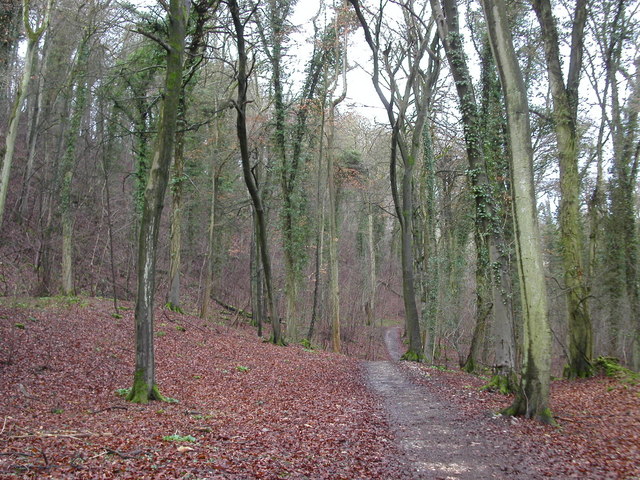
Covered with lush green grass and dotted with scattered trees, Huddinknoll Hill is a popular destination for hikers, nature enthusiasts, and locals seeking a peaceful retreat. Its gentle slopes make it an accessible climb for people of all fitness levels. The hill is home to a variety of wildlife, including rabbits, foxes, and a diverse range of bird species.

At the top of Huddinknoll Hill, visitors can enjoy breathtaking vistas of the surrounding countryside, with sweeping views of Gloucestershire and beyond. On clear days, it is possible to see as far as the distant Malvern Hills and the Brecon Beacons in Wales.

The hill also has historical significance, with evidence of prehistoric human presence in the area. Archaeological excavations have uncovered remnants of ancient settlements and burial sites, providing insights into the lives of early inhabitants.

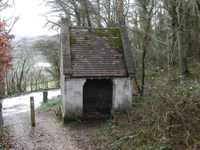
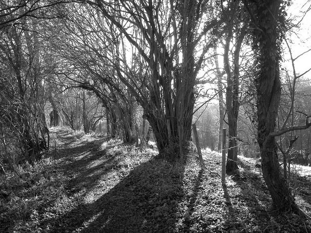
Access to Huddinknoll Hill is facilitated by a network of footpaths that crisscross the area, allowing visitors to explore the hill and its surroundings at their leisure. There are also designated picnic areas and benches, providing opportunities for relaxation and enjoying the stunning scenery.

Overall, Huddinknoll Hill offers a serene and idyllic setting for outdoor enthusiasts and those seeking a tranquil escape amidst the natural splendor of Gloucestershire.

If you have any feedback on the listing, please let us know in the comments section below.

Huddinknoll Hill Images

Images are sourced within 2km of 51.794861/-2.2246292 or Grid Reference SO8410. Thanks to Geograph Open Source API. All images are credited.

View from Painswick Rugby Club During a Bambi Owners' Club rally.
View from Painswick Rugby Club
During a Bambi Owners' Club rally.
The Edge (Glos) St John the Baptist's Church
Cliff  Well on the Cotswold Way path Standing beside the Cotswold Way path on Haresfield Hill is Cliff Well. The entrance is on the other side. The building still contains a winch although the well is capped.
Cliff Well on the Cotswold Way path
Standing beside the Cotswold Way path on Haresfield Hill is Cliff Well. The entrance is on the other side. The building still contains a winch although the well is capped.
Cotswold Way path woodland The Cotswold Way path as it runs between Maitlands Wood and Hallidays Wood not far from Edge village.
Cotswold Way path woodland
The Cotswold Way path as it runs between Maitlands Wood and Hallidays Wood not far from Edge village.
Cliff Well This photo shows the entrance to access the winding winch of the well.
Cliff Well
This photo shows the entrance to access the winding winch of the well.
Mature hazel coppice alongside footpath
Frozen quarry, Scottsquar Hill Hoar frost in a quarry on Scottsquar Hill.
Frozen quarry, Scottsquar Hill
Hoar frost in a quarry on Scottsquar Hill.
Redundant gates The Cotswold Way passes through these on its way to Painswick.
Redundant gates
The Cotswold Way passes through these on its way to Painswick.
Fork left for the Cotswold Way Junction on the A4173.
Fork left for the Cotswold Way
Junction on the A4173.
Edgemoor Inn The pub sign is nothing to write home about, being a repetition if what's on the wall of the pub, so I didn't bother.
Edgemoor Inn
The pub sign is nothing to write home about, being a repetition if what's on the wall of the pub, so I didn't bother.
Cotswold Way at Scottsquar Hill The Way descends into former quarries on both sides of the road.
Cotswold Way at Scottsquar Hill
The Way descends into former quarries on both sides of the road.
Quarry, Scottsquar Hill Cotswold quarries are usually undulating hollows and seldom have cliffs like this one.
Quarry, Scottsquar Hill
Cotswold quarries are usually undulating hollows and seldom have cliffs like this one.
Junction at Cliffwell Cottages The Cotswold Way comes along the road towards the camera and turns up to the right here, past <a href="https://www.geograph.org.uk/photo/145390">SO8309 : Cliff  Well on the Cotswold Way path</a>.
Junction at Cliffwell Cottages
The Cotswold Way comes along the road towards the camera and turns up to the right here, past SO8309 : Cliff Well on the Cotswold Way path.
Snow on the road at Edge Edge is halfway between Gloucester and Stroud and had few houses until the 1950's when an army camp was developed into a housing estate.
Snow on the road at Edge
Edge is halfway between Gloucester and Stroud and had few houses until the 1950's when an army camp was developed into a housing estate.
Brookthorpe (Glos) St Swithin's Church Now in the care of the Churches Conservation Trust
Brookthorpe (Glos) St Swithin's Church
Now in the care of the Churches Conservation Trust
Harescombe (Glos) St John the Baptist's Church
Rococo Gardens The Rococo gardens were laid out in the 18th century and were restored starting in the 1970s after being neglected. There are many follies dotted around the grounds consisting of little houses in many styles. The white structure in the image is called the Exedra. There are the usual tourist attractions there including plant nursery, cafe and gift shop.
Rococo Gardens
The Rococo gardens were laid out in the 18th century and were restored starting in the 1970s after being neglected. There are many follies dotted around the grounds consisting of little houses in many styles. The white structure in the image is called the Exedra. There are the usual tourist attractions there including plant nursery, cafe and gift shop.
Chambers Farm near Brookthorpe Looking south towards the farm across a field with an interesting holloway running from left to right.
Chambers Farm near Brookthorpe
Looking south towards the farm across a field with an interesting holloway running from left to right.
Show me another place!

Huddinknoll Hill is located at Grid Ref: SO8410 (Lat: 51.794861, Lng: -2.2246292)

Administrative County: Gloucestershire

District: Stroud

Police Authority: Gloucestershire

What 3 Words

///motor.silly.bother. Near Painswick, Gloucestershire

Related Wikis

Edge, Gloucestershire

Edge is a village in the civil parish of Painswick, Gloucestershire, England. The village is situated in an area of the Cotswolds that falls within the...

Harescombe

Harescombe is a small village in Gloucestershire, England. It is situated 5 miles (8 km) south of Gloucester. It is thought the name of the village is...

Holcombe House

Holcombe House is a large Grade II* listed country house located near Painswick, Gloucestershire. The house is a fine example of an Arts and Crafts Cotswolds...

Edge Common

Edge Common (grid reference SO847092) is a 20.47-hectare (50.6-acre) biological Site of Special Scientific Interest in Gloucestershire, notified in 1974...

Brookthorpe-with-Whaddon

Brookthorpe-with-Whaddon, formerly just Brookthorpe is a civil parish in the Stroud district of Gloucestershire, England. According to the 2001 census...

Brookthorpe

Brookthorpe is a village and former civil parish, now in the parish of Brookthorpe-with-Whaddon, in the Stroud district, in the county of Gloucestershire...

Painswick House

Painswick House is a grade I listed house in Painswick, Gloucestershire, England. It is surrounded by a Grade II* listed rococo garden.The house and a...

St Swithun's Church, Brookthorpe

St Swithun's Church is a historic Anglican church in the village of Brookthorpe, Gloucestershire, England under the care of The Churches Conservation Trust...

Nearby Amenities

Located within 500m of 51.794861,-2.2246292
Crossing: informal
Lat/Long: 51.7969517/-2.221943
Huddinknoll
Alt Name: Horsepools Hill
Natural: peak
Note: Not Huddinknoll hill, knoll means hill.
Source: local_knowledge
Lat/Long: 51.7943642/-2.2252743
Podgwell Barn
Landuse: residential
Source: NPE + survey
Wikidata: Q26624666
Lat/Long: 51.7978063/-2.2198871
Bus Stop
Sparrow Farm
Bench: no
Bin: no
Lit: no
Naptan AtcoCode: 1600GLA06424
Naptan Bearing: SE
Naptan CommonName: Sparrow Farm
Naptan NaptanCode: glogptgd
Naptan Street: Horsepool Hill
Naptan Verified: no
Shelter: no
Source: naptan_import
Tactile Paving: no
Lat/Long: 51.791731/-2.225682
Bus Stop
Harescombe Grange
Naptan AtcoCode: 1600GLS107
Naptan Bearing: SE
Naptan CommonName: Harescombe Grange
Naptan NaptanCode: glodatgt
Naptan Street: Horsepools Hill A4173
Naptan Verified: no
Source: naptan_import
Lat/Long: 51.7923625/-2.2292376
Harescombe Grange
Naptan AtcoCode: 1600GLS108
Naptan Bearing: NW
Naptan BusStopType: CUS
Naptan CommonName: Harescombe Grange
Naptan Indicator: Opp
Naptan NaptanCode: glodatdj
Naptan Street: Horsepools Hill A4173
Naptan Verified: no
Source: naptan_import
Lat/Long: 51.79255/-2.2299345
Power: pole
Lat/Long: 51.7922917/-2.2219594
Power: pole
Lat/Long: 51.7921739/-2.2194086
Power: pole
Lat/Long: 51.7923572/-2.2231999
Power: pole
Lat/Long: 51.7922336/-2.2207296
Power: pole
Lat/Long: 51.793822/-2.2303172
Power: pole
Lat/Long: 51.7919574/-2.2242741
Power: pole
Lat/Long: 51.7925189/-2.2193496
The data included in this document is from www.openstreetmap.org. The data is made available under ODbL.

Have you been to Huddinknoll Hill?

Leave your review of Huddinknoll Hill below (or comments, questions and feedback).