Blue Hill

Hill, Mountain in Aberdeenshire

Scotland

Blue Hill

Tyrebagger (Dyce) stone circle This fine, almost complete, recumbent circle is a little hard to reach, but worth the effort; see its Canmore listing (19513 <span class="nowrap"><a title="https://canmore.org.uk/site/19513/tyrebagger" rel="nofollow ugc noopener" href="https://canmore.org.uk/site/19513/tyrebagger">Link</a><img style="margin-left:2px;" alt="External link" title="External link - shift click to open in new window" src="https://s1.geograph.org.uk/img/external.png" width="10" height="10"/></span> ) for much more.  Circle 101 in Burl's guide.
Tyrebagger (Dyce) stone circle Credit: Bill Harrison

Blue Hill, located in Aberdeenshire, Scotland, is a prominent hill that stands at an elevation of approximately 1,174 feet (358 meters) above sea level. It is a part of the larger range of hills known as the Bennachie range, which is renowned for its beauty and scenic landscapes.

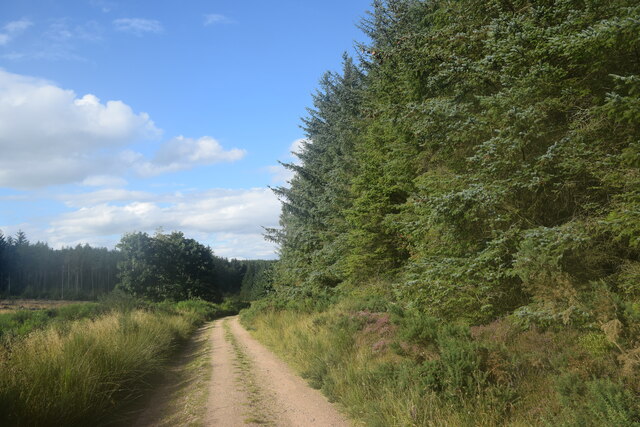
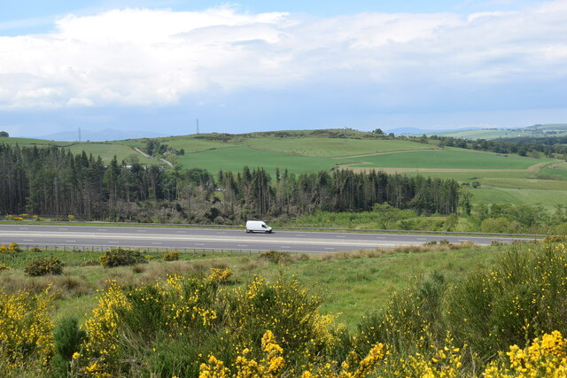
Situated about 25 miles northwest of the city of Aberdeen, Blue Hill offers breathtaking views of the surrounding countryside and is a popular destination for hikers, nature enthusiasts, and photographers. The hill is characterized by its distinctive blue-gray granite rock formations, which give it its name.

Blue Hill is accessible via well-marked trails that wind through the picturesque countryside, leading visitors to the summit. The ascent can be moderately challenging, with some steep sections, but the reward is worth the effort as the panoramic vistas from the top are simply stunning.

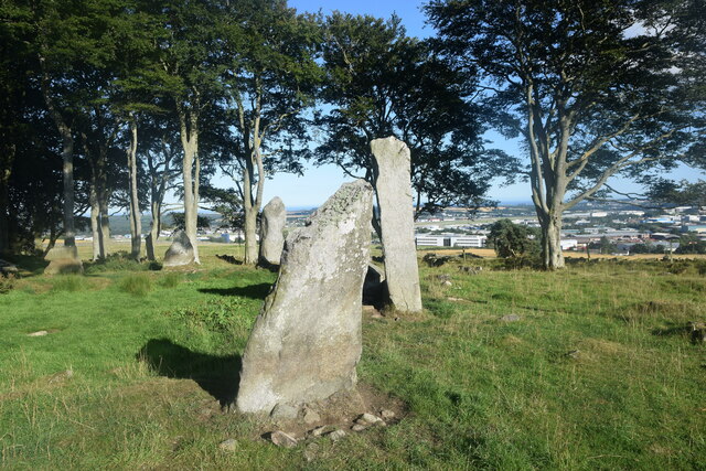
The hill is also home to a diverse range of flora and fauna, including heather, bilberries, and various species of birds and butterflies. In addition, there are several archaeological sites scattered across the hill, including ancient stone circles and burial cairns, providing a glimpse into the area's rich history and cultural heritage.

Whether it's a leisurely walk or a more rigorous hike, Blue Hill offers visitors a chance to immerse themselves in nature, soak in the breathtaking views, and experience the tranquility of the Scottish countryside.

If you have any feedback on the listing, please let us know in the comments section below.
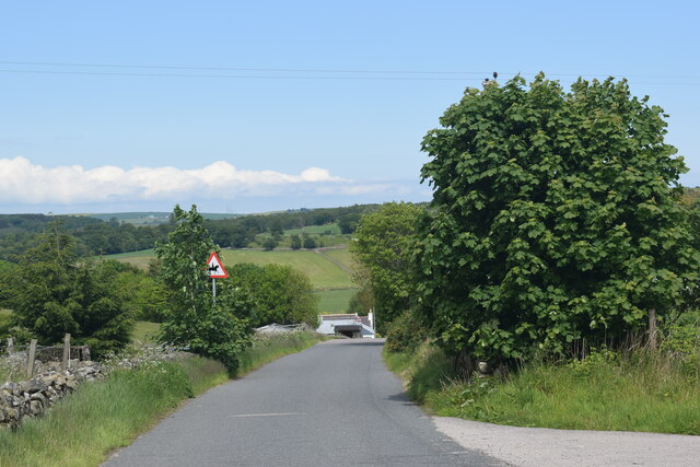
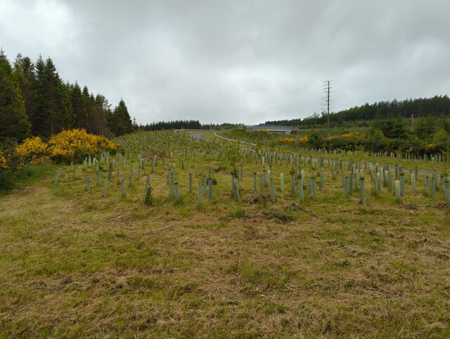
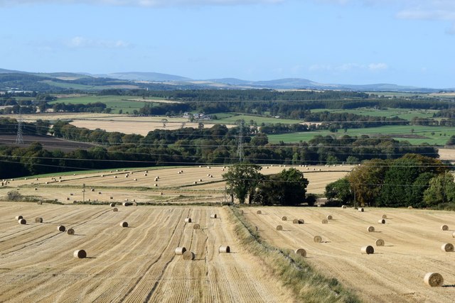
Blue Hill Images

Images are sourced within 2km of 57.220693/-2.2583228 or Grid Reference NJ8414. Thanks to Geograph Open Source API. All images are credited.

Tyrebagger (Dyce) stone circle This fine, almost complete, recumbent circle is a little hard to reach, but worth the effort; see its Canmore listing (19513 <span class="nowrap"><a title="https://canmore.org.uk/site/19513/tyrebagger" rel="nofollow ugc noopener" href="https://canmore.org.uk/site/19513/tyrebagger">Link</a><img style="margin-left:2px;" alt="External link" title="External link - shift click to open in new window" src="https://s1.geograph.org.uk/img/external.png" width="10" height="10"/></span> ) for much more.  Circle 101 in Burl's guide.
Tyrebagger (Dyce) stone circle
This fine, almost complete, recumbent circle is a little hard to reach, but worth the effort; see its Canmore listing (19513 LinkExternal link ) for much more. Circle 101 in Burl's guide.
Tyrebagger (Dyce) stone circle: recumbent and flankers According to Burl (A guide to the Stone Circles of Britain, Ireland and Brittany), the flankers are 3.4 and 2.9 metres high and the 'gigantic' recumbent stone weighs some 24 tonnes.
Tyrebagger (Dyce) stone circle: recumbent and flankers
According to Burl (A guide to the Stone Circles of Britain, Ireland and Brittany), the flankers are 3.4 and 2.9 metres high and the 'gigantic' recumbent stone weighs some 24 tonnes.
Tyrebagger (Dyce) stone circle viewed from the north-west The circle is separated from the field by a neat, low stone wall.
Tyrebagger (Dyce) stone circle viewed from the north-west
The circle is separated from the field by a neat, low stone wall.
Bend in the road The A90 or Aberdeen Western Peripheral Route, makes a sweeping bend to the right prior to crossing the River Don, just out of sight to the right.
Bend in the road
The A90 or Aberdeen Western Peripheral Route, makes a sweeping bend to the right prior to crossing the River Don, just out of sight to the right.
Kirkhill Forest track There are many kilometres of forestry tracks and paths to explore in Kirkhill Forest, which is actually within the administrative boundary of Aberdeen City.  The area to the left of the photo has been clear cut recently.
Kirkhill Forest track
There are many kilometres of forestry tracks and paths to explore in Kirkhill Forest, which is actually within the administrative boundary of Aberdeen City. The area to the left of the photo has been clear cut recently.
Occupation bridge... ...over the AWPR at Bogenjoss.  Half of the bridge carriageway has been planted with grass and trees.  According to Celtic Place-Names in Aberdeenshire by John Milne, 'Bogenjoss' means 'bog of the fir.
Occupation bridge...
...over the AWPR at Bogenjoss. Half of the bridge carriageway has been planted with grass and trees. According to Celtic Place-Names in Aberdeenshire by John Milne, 'Bogenjoss' means 'bog of the fir.
Contrasts at Tyrebagger In the foreground Tyrebagger (Dyce) recumbent stone circle from ca. 3000 BCE and in the background part of Kirkhill industrial estate and Aberdeen Airport.
Contrasts at Tyrebagger
In the foreground Tyrebagger (Dyce) recumbent stone circle from ca. 3000 BCE and in the background part of Kirkhill industrial estate and Aberdeen Airport.
Balancing pond The construction of the Aberdeen Western Peripheral Route (AWPR) led to a number of 'balancing ponds' (<span class="nowrap"><a title="https://en.wikipedia.org/wiki/Balancing_lake" rel="nofollow ugc noopener" href="https://en.wikipedia.org/wiki/Balancing_lake">Link</a><img style="margin-left:2px;" alt="External link" title="External link - shift click to open in new window" src="https://s1.geograph.org.uk/img/external.png" width="10" height="10"/></span> ) such as this one being dug to avoid excessive run-off of water or flooding.  In this case it is associated with a tiny and apparently nameless burn, which is barely a trickle of water in summer, and feeds into the River Don about 1 km away.  Note the lifebuoy.
Balancing pond
The construction of the Aberdeen Western Peripheral Route (AWPR) led to a number of 'balancing ponds' (LinkExternal link ) such as this one being dug to avoid excessive run-off of water or flooding. In this case it is associated with a tiny and apparently nameless burn, which is barely a trickle of water in summer, and feeds into the River Don about 1 km away. Note the lifebuoy.
Bridge on the AWPR This lavishly constructed bridge accommodates a tiny, apparently nameless, burn that passes under the AWPR.
Bridge on the AWPR
This lavishly constructed bridge accommodates a tiny, apparently nameless, burn that passes under the AWPR.
Pitmedden monument The monument was erected in 1898 by the Thomson family to commemorate the fiftieth anniversary of Queen Victoria's first visit to Aberdeen.  For more details, see Canmore listing 132952: <span class="nowrap"><a title="https://canmore.org.uk/site/132952/pitmedden-house-monument" rel="nofollow ugc noopener" href="https://canmore.org.uk/site/132952/pitmedden-house-monument">Link</a><img style="margin-left:2px;" alt="External link" title="External link - shift click to open in new window" src="https://s1.geograph.org.uk/img/external.png" width="10" height="10"/></span> .  Compare the 'tappie tower' in Kirkhill Forest about 2 km to the south west: <a title="https://www.geograph.org.uk/photo/6320691" href="https://www.geograph.org.uk/photo/6320691">Link</a> .
Pitmedden monument
The monument was erected in 1898 by the Thomson family to commemorate the fiftieth anniversary of Queen Victoria's first visit to Aberdeen. For more details, see Canmore listing 132952: LinkExternal link . Compare the 'tappie tower' in Kirkhill Forest about 2 km to the south west: Link .
Pitmedden monument (close up) The eroded tablet on the monument reads: Erected on the 50th anniversary of Queen Victoria's first visit to Aberdeen when she was received by George Thomson junior, Esq, The Lord Provost and afterwards MP for Aberdeen. Erected by Mr and Mrs George Thomson, Yost. Pitmedden 8th September 1898'.  Above the inscription is a  representation of a sailing ship and the Latin motto 'Per Perigulum Vivo', which can, I think, be translated as 'I live by taking risks'.
Pitmedden monument (close up)
The eroded tablet on the monument reads: Erected on the 50th anniversary of Queen Victoria's first visit to Aberdeen when she was received by George Thomson junior, Esq, The Lord Provost and afterwards MP for Aberdeen. Erected by Mr and Mrs George Thomson, Yost. Pitmedden 8th September 1898'. Above the inscription is a representation of a sailing ship and the Latin motto 'Per Perigulum Vivo', which can, I think, be translated as 'I live by taking risks'.
Lone van on the AWPR
Graffiti (AWPR underbridge) Colourful graffiti decorating(?) an underbridge for a burn under the AWPR.
Graffiti (AWPR underbridge)
Colourful graffiti decorating(?) an underbridge for a burn under the AWPR.
Single-track road in the Aberdeenshire countryside
Bridge over A90
Bridge over A90
Summit of the Tyrebagger Looking towards Bennachie
Summit of the Tyrebagger
Looking towards Bennachie
Harvested fields south of Bendauch farm 'Bendauch' means 'hill farm' according to Celtic Place-names in Aberdeenshire by John Milne.
Harvested fields south of Bendauch farm
'Bendauch' means 'hill farm' according to Celtic Place-names in Aberdeenshire by John Milne.
Boundary wall at the Slacks plantation A 'slack' is a hollow according to Celtic Place-names in Aberdeenshire by John Milne.
Boundary wall at the Slacks plantation
A 'slack' is a hollow according to Celtic Place-names in Aberdeenshire by John Milne.
Show me another place!

Blue Hill is located at Grid Ref: NJ8414 (Lat: 57.220693, Lng: -2.2583228)

Unitary Authority: City of Aberdeen

Police Authority: North East

What 3 Words

///relax.regretted.suitably. Near Blackburn, Aberdeenshire

Nearby Locations

Blue Hill

Related Wikis

Kinaldie railway station

Kinaldie railway station was a railway station in Kinaldie, Aberdeenshire. == History == The station was opened in November 1854 on the Great North of...

Pitmedden railway station

Pitmedden railway station was a railway station near Pitmedden House in Dyce, Aberdeen. == Previous services == == References == === Notes === === Sources... ===

Hatton of Fintray

Hatton of Fintray, commonly referred to as Fintray, is a village on the River Don in Aberdeenshire, Scotland, in the parish of Fintray. It was a textile...

Fintray Hillclimb

Fintray House Hillclimb is a speed motorsport event held near Hatton of Fintray, in Aberdeenshire, Scotland. Each event is a separate round of the Scottish...

Nearby Amenities

Located within 500m of 57.220693,-2.2583228
Design: barrel
Power: tower
Lat/Long: 57.2225018/-2.2649779
Design: barrel
Power: tower
Lat/Long: 57.223193/-2.2611799
Design: barrel
Power: tower
Lat/Long: 57.2239307/-2.2573604
Crossing
Lat/Long: 57.2232789/-2.2593429
The data included in this document is from www.openstreetmap.org. The data is made available under ODbL.

Have you been to Blue Hill?

Leave your review of Blue Hill below (or comments, questions and feedback).