Cley Hill

Hill, Mountain in Wiltshire

England

Cley Hill

Cley Hill On the Mid-Wiltshire Way, a popular path ascends the chalky hill to an Iron Age hillfort with sweeping views.
Cley Hill Credit: Colin Smith

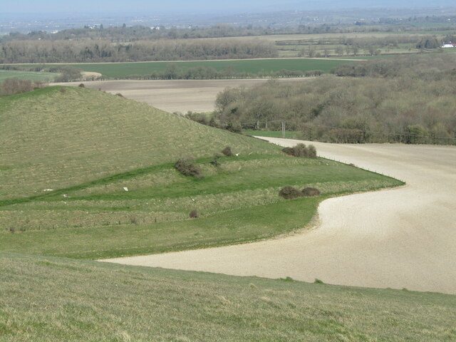
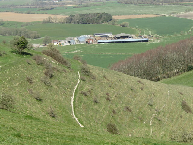
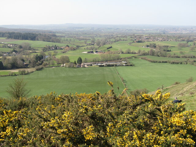
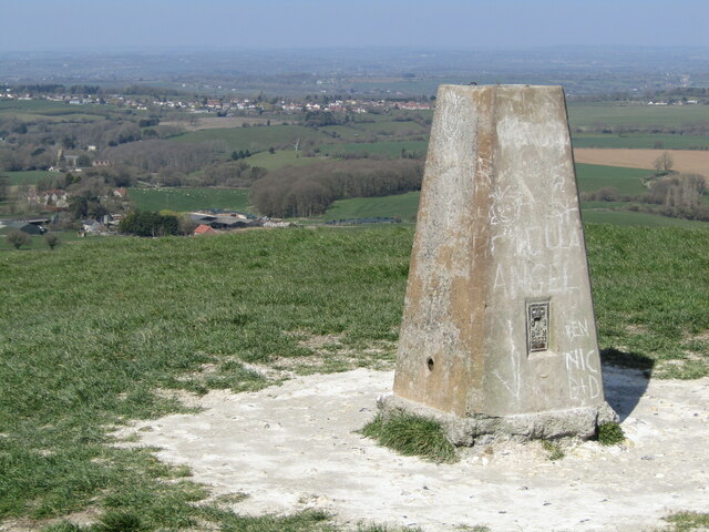
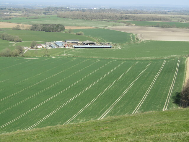
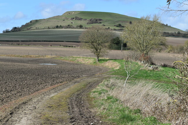
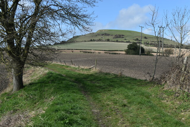
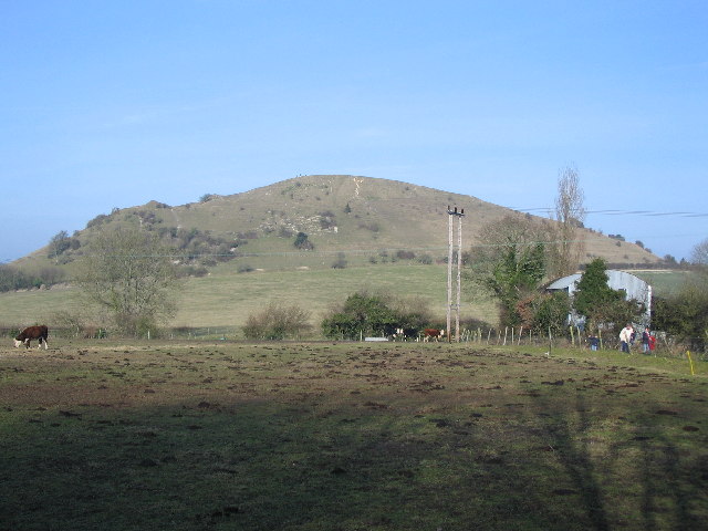
Cley Hill is a prominent hill located in the county of Wiltshire, England. It is part of the wider landscape known as the Salisbury Plain, which is renowned for its archaeological and historical significance. Rising to a height of 244 meters (800 feet), Cley Hill offers panoramic views of the surrounding countryside.

Geologically, Cley Hill is classified as a conical hill and is composed of chalk, a characteristic feature of the area. The hill is known for its distinctive shape, with a steep-sided cone-like summit that is relatively flat at the top. Its unique form has led to various theories regarding its origins, including suggestions of it being an ancient burial mound or even a man-made hill.

Cley Hill has been a popular landmark for centuries and has played a significant role in local folklore and legends. It is said to be haunted by the ghost of a monk who is believed to have been executed on the hill during the Dissolution of the Monasteries in the 16th century.

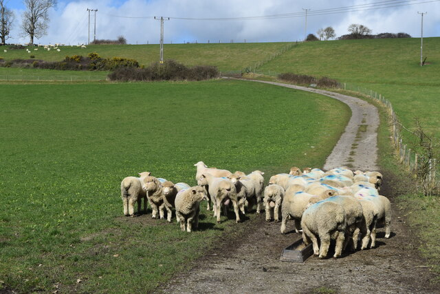
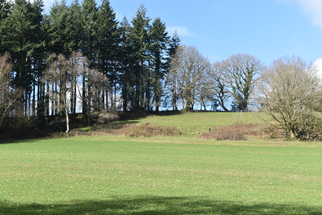
In addition to its cultural and historical significance, Cley Hill is also an important site for wildlife. The hill is home to a variety of plant species, including chalk-loving flowers such as wild thyme and orchids. It also serves as a habitat for several bird species, including skylarks and kestrels.

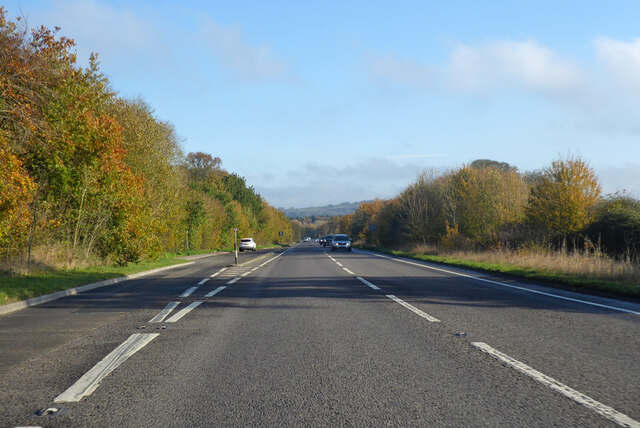
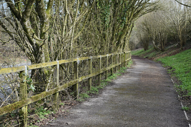
Cley Hill is easily accessible for visitors, with footpaths leading to the summit from the nearby village of Corsley. It is a popular spot for walkers, hikers, and nature enthusiasts who are drawn to its natural beauty and captivating views.

If you have any feedback on the listing, please let us know in the comments section below.

Cley Hill Images

Images are sourced within 2km of 51.202515/-2.232167 or Grid Reference ST8344. Thanks to Geograph Open Source API. All images are credited.

Cley Hill On the Mid-Wiltshire Way, a popular path ascends the chalky hill to an Iron Age hillfort with sweeping views.
Cley Hill
On the Mid-Wiltshire Way, a popular path ascends the chalky hill to an Iron Age hillfort with sweeping views.
Cley Hill This distinctive chalky hill has an Iron Age hillfort atop its grassy slopes.
Cley Hill
This distinctive chalky hill has an Iron Age hillfort atop its grassy slopes.
Cley Hill Farm Large farm to the north of Cley Hill which is covered in chalk grassland.
Cley Hill Farm
Large farm to the north of Cley Hill which is covered in chalk grassland.
Sturford Mead Farm Fieldscape to the west of Cley Hill. Pasture and hedgerows predominate.
Gorse in the foreground is in bloom.
Sturford Mead Farm
Fieldscape to the west of Cley Hill. Pasture and hedgerows predominate. Gorse in the foreground is in bloom.
Cley Hill - Trig Point 239m amsl high, sited within an Iron Age hillfort, with lines of sight in all directions.
Cley Hill - Trig Point
239m amsl high, sited within an Iron Age hillfort, with lines of sight in all directions.
Cley Hill Farm "Tramlines" in the grassy field show up the chalky soil - viewed from the Iron Age hillfort on Cley Hill.
Cley Hill Farm
"Tramlines" in the grassy field show up the chalky soil - viewed from the Iron Age hillfort on Cley Hill.
Cley Hill - Farmland Grassy fields with chalk subsoil appearing in the "tramlines".
Cley Hill - Farmland
Grassy fields with chalk subsoil appearing in the "tramlines".
A36 towards Bath Bypassing Warminster.
A36 towards Bath
Bypassing Warminster.
Foot and cycle path beside the A36
Trees beside Folly Lane Now called Folly Lane, historic OS mapping shows this as Whittock's Lane, long pre-dating the adjacent A36 Warminster by-pass just behind the trees.
Trees beside Folly Lane
Now called Folly Lane, historic OS mapping shows this as Whittock's Lane, long pre-dating the adjacent A36 Warminster by-pass just behind the trees.
Sheep on track at Cannimore Farm
Uphill view from Cannimore Road Despite the name, Cannimore Road is a very muddy bridleway and most certainly not suitable for vehicles.
Uphill view from Cannimore Road
Despite the name, Cannimore Road is a very muddy bridleway and most certainly not suitable for vehicles.
Cley Hill, from the Mid Wilts Way
Approaching Cley Hill on the Mid Wilts Way
View towards Warminster from the flank of Cley Hill
Farmland below Cley Hill With a distant view of Salisbury Plain, beyond Warminster.
Farmland below Cley Hill
With a distant view of Salisbury Plain, beyond Warminster.
Farmland below Cley Hill The view towards Chipps Farm.
Farmland below Cley Hill
The view towards Chipps Farm.
Farmland below Cley Hill Looking towards Corsley House. One of the field boundaries shown on the modern OS 1:25,000 map has been removed, enlarging the green field in the centre of this view.
Farmland below Cley Hill
Looking towards Corsley House. One of the field boundaries shown on the modern OS 1:25,000 map has been removed, enlarging the green field in the centre of this view.
Show me another place!

Cley Hill is located at Grid Ref: ST8344 (Lat: 51.202515, Lng: -2.232167)

Unitary Authority: Wiltshire

Police Authority: Wiltshire

What 3 Words

///vegetable.heeding.revealing. Near Corsley, Wiltshire

Related Wikis

Cley Hill

Cley Hill (grid reference ST838449) is a prominent hill to the west of Warminster in Wiltshire, England. Its summit has a commanding view of the Wiltshire...

St Mary's Church, Temple, Corsley

The Church of St Mary at Temple, Corsley, Wiltshire, England is a chapel-of-ease dating from the very early 20th century. It was commissioned and paid...

Corsley

Corsley is a hamlet and civil parish 3 miles (5 km) west of Warminster in Wiltshire, England. The parish is on the county border with Somerset; the Somerset...

St Margaret's, Corsley

St Margaret's, Corsley, is the Church of England parish church of Corsley in Wiltshire, England. In 1968 the church was designated as Grade II listed....

Nearby Amenities

Located within 500m of 51.202515,-2.232167
Cley Hill
Ele: 244
Natural: peak
Wikidata: Q5132359
Wikipedia: en:Cley Hill
Lat/Long: 51.2026969/-2.2322019
Cley Hill
Ele: 237
Man Made: survey_point
Source: GPS
Tpuk Ref: TP2220
Lat/Long: 51.2038909/-2.2334052
Barrier: stile
Lat/Long: 51.2036/-2.2356554
Power: pole
Lat/Long: 51.2005982/-2.2380353
Power: pole
Lat/Long: 51.1999343/-2.2367264
Power: pole
Lat/Long: 51.1989242/-2.2347416
Power: pole
Lat/Long: 51.1994217/-2.2356911
Power: pole
Lat/Long: 51.1982536/-2.2334058
Little Cley Hill
Ele: 180
Natural: peak
Lat/Long: 51.2063908/-2.2294139
The data included in this document is from www.openstreetmap.org. The data is made available under ODbL.

Have you been to Cley Hill?

Leave your review of Cley Hill below (or comments, questions and feedback).