Banno Crags

Hill, Mountain in Northumberland

England

Banno Crags

Turret 33b on Hadrian's Wall Hadrian's wall or 'Vallum Aelium' is the remains of a large Roman fortification. The wall extended west from Segedunum at Wallsend on the River Tyne to the shore of the Solway Firth, ending a short but unknown distance west of the village of Bowness-on-Solway. Construction probably started sometime in AD 122 and was largely completed within six years.

The remains were made a UNESCO World Heritage Site in 1987.
Turret 33b on Hadrian's Wall Credit: Sandy Gerrard

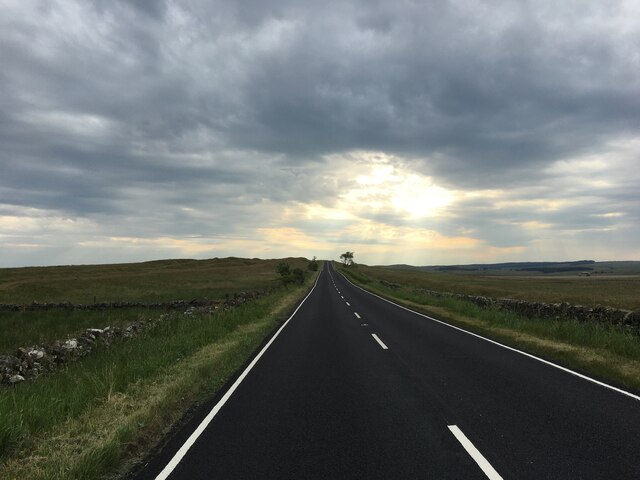
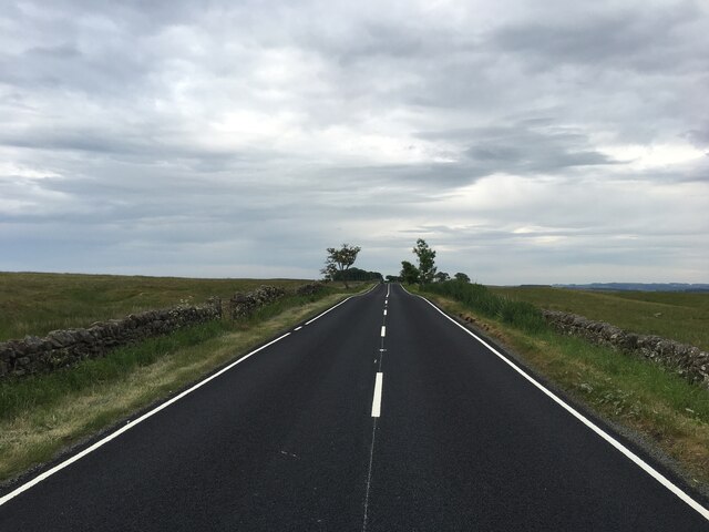
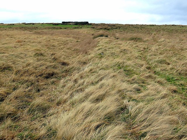
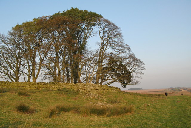
Banno Crags is a prominent hill located in the county of Northumberland, England. Situated in the northern part of the county, it forms part of the picturesque North Pennines Area of Outstanding Natural Beauty. Rising to an elevation of approximately 440 meters (1,444 feet), Banno Crags offers stunning panoramic views of the surrounding countryside.

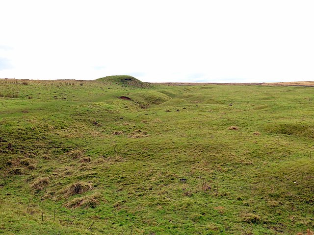
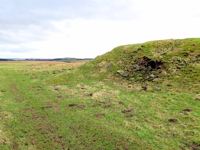
The hill is predominantly composed of limestone, which has been shaped by erosion to create distinctive craggy formations along its slopes. These crags are a popular attraction for rock climbers and hikers, providing opportunities for both recreational activities and a chance to admire the unique geological features.

Banno Crags is also known for its rich biodiversity. The hill is covered in a variety of vegetation, including heather, grasses, and wildflowers, which provide a habitat for various species of birds, insects, and small mammals. The area is particularly renowned for its birdlife, with species such as peregrine falcons and kestrels often spotted soaring above the crags.

For outdoor enthusiasts, Banno Crags offers a range of activities. The hill is crisscrossed by a network of footpaths and trails, allowing visitors to explore its slopes and enjoy the stunning natural scenery. Additionally, the surrounding area offers opportunities for mountain biking, horse riding, and birdwatching.

Overall, Banno Crags is a captivating natural landmark that showcases the beauty of Northumberland's countryside. Whether one is seeking adventure, tranquility, or simply a chance to connect with nature, this hill provides an ideal setting for all.

If you have any feedback on the listing, please let us know in the comments section below.

Banno Crags Images

Images are sourced within 2km of 55.043811/-2.2684963 or Grid Reference NY8272. Thanks to Geograph Open Source API. All images are credited.

Turret 33b on Hadrian's Wall Hadrian's wall or 'Vallum Aelium' is the remains of a large Roman fortification. The wall extended west from Segedunum at Wallsend on the River Tyne to the shore of the Solway Firth, ending a short but unknown distance west of the village of Bowness-on-Solway. Construction probably started sometime in AD 122 and was largely completed within six years.

The remains were made a UNESCO World Heritage Site in 1987.
Turret 33b on Hadrian's Wall
Hadrian's wall or 'Vallum Aelium' is the remains of a large Roman fortification. The wall extended west from Segedunum at Wallsend on the River Tyne to the shore of the Solway Firth, ending a short but unknown distance west of the village of Bowness-on-Solway. Construction probably started sometime in AD 122 and was largely completed within six years. The remains were made a UNESCO World Heritage Site in 1987.
Milecastle 33 on Hadrian's Wall Hadrian's wall or 'Vallum Aelium' is the remains of a large Roman fortification. The wall extended west from Segedunum at Wallsend on the River Tyne to the shore of the Solway Firth, ending a short but unknown distance west of the village of Bowness-on-Solway. Construction probably started sometime in AD 122 and was largely completed within six years.

The remains were made a UNESCO World Heritage Site in 1987.
Milecastle 33 on Hadrian's Wall
Hadrian's wall or 'Vallum Aelium' is the remains of a large Roman fortification. The wall extended west from Segedunum at Wallsend on the River Tyne to the shore of the Solway Firth, ending a short but unknown distance west of the village of Bowness-on-Solway. Construction probably started sometime in AD 122 and was largely completed within six years. The remains were made a UNESCO World Heritage Site in 1987.
Ruined farm building, Shield on The Wall
B6318 heading west
B6318 heading west
B6318 heading east
B6318 heading east
Sheepfold near Great Lonbrough
Great Lonbrough Lime Kiln
Disused limestone quarry & lime kiln south of Castle Burn The lime kiln is shown here <a href="https://www.geograph.org.uk/photo/4817464">NY8373 : Disused lime kiln south of Castle Burn</a>
Disused limestone quarry & lime kiln south of Castle Burn
Disused lime kiln south of Castle Burn
Valley of Hopeshield Burn A small patch of Alder trees grow beside the burn. On the far side is a small enclosed pasture situated on one of the small lenses of carboniferous limestone rock that run west to east across this land interspersed with much coarser vegetation on the more poorly drained sandstone. Above the field a lone tree grows on The Carts, a sandstone ridge <a href="https://www.geograph.org.uk/photo/1569301">NY8373 : The Carts</a>. Further over to the right is Longbrough Plantation, south-east of Longbrough Farm.
Valley of Hopeshield Burn
A small patch of Alder trees grow beside the burn. On the far side is a small enclosed pasture situated on one of the small lenses of carboniferous limestone rock that run west to east across this land interspersed with much coarser vegetation on the more poorly drained sandstone. Above the field a lone tree grows on The Carts, a sandstone ridge NY8373 : The Carts. Further over to the right is Longbrough Plantation, south-east of Longbrough Farm.
Old boundary north of Hopeshield Burn The boundary runs for a long distance across the eastern part of Simonburn Common often straight in a north to south direction. There is a sheepfold above.
Old boundary north of Hopeshield Burn
The boundary runs for a long distance across the eastern part of Simonburn Common often straight in a north to south direction. There is a sheepfold above.
Alders by Hopeshield Burn
Bridge over Hopeshield Burn The old stone bridge is on the path to the farm of Great Lonbrough.
Bridge over Hopeshield Burn
The old stone bridge is on the path to the farm of Great Lonbrough.
Alders by Hopeshield Burn
Lime kiln below Great Lonbrough The disused lime kiln with its covering of ivy stands just above Hopeshield Burn on the slopes below Barley Hill. There is a photo here <a href="https://www.geograph.org.uk/photo/1686145">NY8273 : Lime kiln near Great Lonborough (2)</a>
Lime kiln below Great Lonbrough
The disused lime kiln with its covering of ivy stands just above Hopeshield Burn on the slopes below Barley Hill. There is a photo here NY8273 : Lime kiln near Great Lonborough (2)
Great Lonbrough from north-east
Heading west on the Hadrian's Wall Trail The trail is scenically unexciting here, the Wall itself having been destroyed when the adjacent Military Road was built on its remains in the 18th century. Ahead, the skyline holds more promise with the Whin Sill ridge rising up over Sewingshields Crag.
Heading west on the Hadrian's Wall Trail
The trail is scenically unexciting here, the Wall itself having been destroyed when the adjacent Military Road was built on its remains in the 18th century. Ahead, the skyline holds more promise with the Whin Sill ridge rising up over Sewingshields Crag.
Boulder by the north ditch, Hadrian's Wall Trail This boulder between the footpath and the north ditch of Hadrian's Wall appears to have chisel marks along its length. Roman soldiers may have attempted (unsuccessfully) to split it as has been noted elsewhere.
Boulder by the north ditch, Hadrian's Wall Trail
This boulder between the footpath and the north ditch of Hadrian's Wall appears to have chisel marks along its length. Roman soldiers may have attempted (unsuccessfully) to split it as has been noted elsewhere.
Show me another place!

Banno Crags is located at Grid Ref: NY8272 (Lat: 55.043811, Lng: -2.2684963)

Unitary Authority: Northumberland

Police Authority: Northumbria

What 3 Words

///rocky.beads.upwards. Near Birtley, Northumberland

Related Wikis

Milecastle 33

Milecastle 33 (Shield on the Wall) was a milecastle of the Roman Hadrian's Wall, one of a series of small fortlets built at intervals of approximately...

Halleypike Lough

Halleypike Lough is an inland lake on Haughton Common at the southern edge of Northumberland National Park, northeast of Bardon Mill, and 1 mile (1.6 km...

Milecastle 32

Milecastle 32 (Carraw) was a milecastle of the Roman Hadrian's Wall. Its remains exist as earthworks and with no exposed masonry. The layout of the milecastle...

Milecastle 34

Milecastle 34 (Grindon) was a milecastle of the Roman Hadrian's Wall. There are no visible remains, but the site is within a small, tree-filled, walled...

Greenhaugh

Greenhaugh is a small village in Northumberland, England. It is located northwest of Bellingham and borders the Northumberland National Park. It is in...

The Goatstones

The Goatstones is a Bronze-Age four-poster stone circle located near Ravensheugh Crags in Northumberland, England. It is 2.5 miles (4.0 km) to the north...

Milecastle 31

Milecastle 31 (Carrawburgh) was a milecastle of the Roman Hadrian's Wall. Its remains exist as a turf covered platform beside (and partially covered by...

Carrawburgh

Carrawburgh is a settlement in Northumberland. In Roman times, it was the site of a 3+1⁄2-acre (1.5 ha) auxiliary fort on Hadrian's Wall called Brocolitia...

Have you been to Banno Crags?

Leave your review of Banno Crags below (or comments, questions and feedback).