Bruxie Hill

Hill, Mountain in Kincardineshire

Scotland

Bruxie Hill

Minor road at Nether Pitforthie Looking south-westward.
Minor road at Nether Pitforthie Credit: Peter Wood

Bruxie Hill is a prominent landmark located in the region of Kincardineshire, Scotland. Rising to an elevation of approximately 543 meters (1781 feet), it is classified as a hill or mountain, depending on the criteria used for classification. Situated in the northeastern part of Scotland, Bruxie Hill offers breathtaking views of the surrounding countryside and is a popular destination for hikers and nature enthusiasts.

The hill is characterized by its gentle slopes, covered in lush greenery, which make it relatively accessible for visitors of all ages and fitness levels. The terrain comprises a mix of grassy meadows, heather-covered moorland, and scattered patches of woodland, providing a diverse landscape that supports a variety of plant and animal species.

At the summit of Bruxie Hill, one can witness panoramic views of the picturesque Kincardineshire countryside, with its rolling hills, meandering rivers, and distant coastal plains. On clear days, it is even possible to catch a glimpse of the North Sea in the east.

The hill is also known for its historical significance, with remnants of ancient settlements and structures scattered throughout the area. Archaeological investigations have revealed evidence of human occupation dating back thousands of years, including stone tools and burial sites.

Bruxie Hill is easily accessible from nearby towns and villages, thanks to a network of well-maintained footpaths and trails. Its stunning natural beauty, combined with its rich history, make it a must-visit destination for those seeking a tranquil escape in the heart of Scotland's countryside.

If you have any feedback on the listing, please let us know in the comments section below.
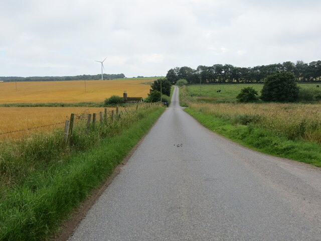
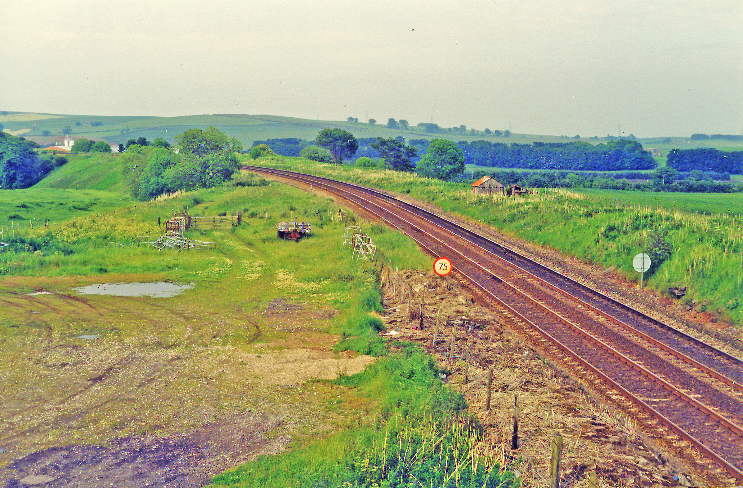
Bruxie Hill Images

Images are sourced within 2km of 56.913616/-2.2934109 or Grid Reference NO8280. Thanks to Geograph Open Source API. All images are credited.

Minor road at Nether Pitforthie Looking south-westward.
Minor road at Nether Pitforthie
Looking south-westward.
Minor road at Nether Pitforthie Looking south-eastward.
Minor road at Nether Pitforthie
Looking south-eastward.
Minor road between Barras and Pitforthie Looking north-westward.
Minor road between Barras and Pitforthie
Looking north-westward.
Minor road near to Cotbank of Barras Looking north-westward.
Minor road near to Cotbank of Barras
Looking north-westward.
Minor road near to Mitton Hill Looking north-eastward towards Mitton of Barras.
Minor road near to Mitton Hill
Looking north-eastward towards Mitton of Barras.
Minor road approaching West Town Looking north-westward.
Minor road approaching West Town
Looking north-westward.
Minor road near to Upper Westown Looking north-westward.
Minor road near to Upper Westown
Looking north-westward.
Track between fencing that protects the Communication Masts on Bruxie Hill Looking northward.
Track between fencing that protects the Communication Masts on Bruxie Hill
Looking northward.
Minor road at East Bendings Looking south-eastward.
Minor road at East Bendings
Looking south-eastward.
Minor road about to join the A90 at Meikle Fiddes Looking north-westward.
Minor road about to join the A90 at Meikle Fiddes
Looking north-westward.
Ordnance Survey Cut Mark This mark can be found on a roadside building at Ferniebrae Farm.
The recorded details give a height of 150.2877 metres above sea level.
For more detail see : <span class="nowrap"><a title="https://www.bench-marks.org.uk/bm162350" rel="nofollow ugc noopener" href="https://www.bench-marks.org.uk/bm162350">Link</a><img style="margin-left:2px;" alt="External link" title="External link - shift click to open in new window" src="https://s1.geograph.org.uk/img/external.png" width="10" height="10"/></span>
Ordnance Survey Cut Mark
This mark can be found on a roadside building at Ferniebrae Farm. The recorded details give a height of 150.2877 metres above sea level. For more detail see : LinkExternal link
Looking across the broad valley with grain fields Photographer is standing by the edge of the paved road.
Looking across the broad valley with grain fields
Photographer is standing by the edge of the paved road.
Seagulls taking flight with valley beyond This small flock of seagulls were found resting somewhat inland today; they took flight when the photographer walked slowly toward them.
Seagulls taking flight with valley beyond
This small flock of seagulls were found resting somewhat inland today; they took flight when the photographer walked slowly toward them.
Minor road near West Town
Minor road to Mitton of Barras
Minor road near Mitton of Barras
Minor road at Cotbank of Barras
Minor road near Little Barras
Show me another place!

Bruxie Hill is located at Grid Ref: NO8280 (Lat: 56.913616, Lng: -2.2934109)

Unitary Authority: Aberdeenshire

Police Authority: North East

What 3 Words

///royally.strong.gilding. Near Stonehaven, Aberdeenshire

Nearby Locations

Bruxie Hill

Related Wikis

Castle of Fiddes

The Castle of Fiddes is a 16th-century tower house in Aberdeenshire, Scotland, located around 6 kilometres (3.7 mi) south-west of Stonehaven. It is dated...

Drumlithie railway station

Drumlithie railway station served the village of Drumlithie, Aberdeenshire, Scotland from 1849 to 1956 on the Aberdeen Railway. == History == The station...

Drumlithie

Drumlithie is a village in the Howe of the Mearns in southern Aberdeenshire, Scotland. Situated seven miles south of Stonehaven in the parish of Glenbervie...

Carmont railway station

Carmont railway station, on the Aberdeen Railway, served the rural area of Carmont in Aberdeenshire, Scotland from 1855 to 1964. == History == The station...

Nearby Amenities

Located within 500m of 56.913616,-2.2934109
Man Made: tower
Tower Construction: lattice
Tower Type: communication
Lat/Long: 56.9131593/-2.2940665
Man Made: tower
Tower Construction: lattice
Tower Type: communication
Lat/Long: 56.913376/-2.2929363
Man Made: tower
Lat/Long: 56.9125194/-2.2928196
Power: pole
Lat/Long: 56.9106283/-2.2874026
Power: pole
Lat/Long: 56.9109043/-2.288755
Power: pole
Lat/Long: 56.9111584/-2.2898925
Power: pole
Lat/Long: 56.9114241/-2.2910195
Power: pole
Lat/Long: 56.9111561/-2.2920981
Power: pole
Lat/Long: 56.9108721/-2.2931935
Power: pole
Lat/Long: 56.9106018/-2.2942995
Power: pole
Lat/Long: 56.910335/-2.2953991
Power: pole
Lat/Long: 56.9100624/-2.2964966
Power: pole
Lat/Long: 56.9098036/-2.2975246
Power: pole
Lat/Long: 56.9124504/-2.2922329
Power: pole
Lat/Long: 56.911942/-2.291637
The data included in this document is from www.openstreetmap.org. The data is made available under ODbL.

Have you been to Bruxie Hill?

Leave your review of Bruxie Hill below (or comments, questions and feedback).