Bignall Hill

Hill, Mountain in Staffordshire Newcastle-under-Lyme

England

Bignall Hill

Partridge Nest Farm No longer a working farm, there are still stables for a few horses.
Partridge Nest Farm Credit: Steve Lewin

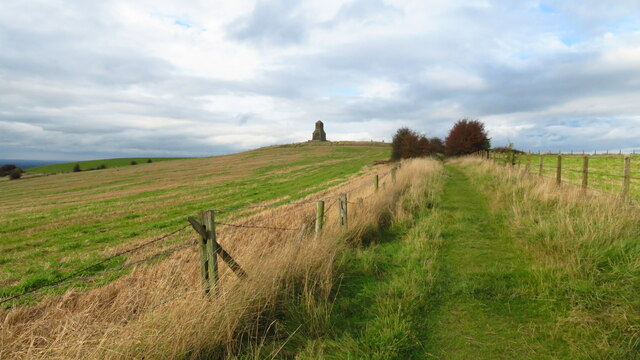
Bignall Hill, located in Staffordshire, England, is a prominent hill that forms part of the North Staffordshire Moors. It stands at an elevation of approximately 360 meters (1,180 feet) above sea level, making it one of the highest points in the surrounding area. The hill is situated near the villages of Bignall End and Halmer End, and it offers stunning panoramic views of the Staffordshire countryside.

Bignall Hill is known for its distinctive shape, with a rounded summit that provides a picturesque and easily recognizable landmark in the region. It is covered in grass and features scattered trees and shrubs, adding to its natural beauty. The hill is accessible via public footpaths and provides an excellent location for hiking and walking enthusiasts to enjoy the outdoors.

The hill has a rich history, with evidence of ancient settlements and human activity dating back thousands of years. Archaeological findings in the area have revealed remnants of Iron Age and Roman occupation, including pottery and coins. Bignall Hill also played a significant role during the Industrial Revolution, with coal mining being a major industry in the vicinity.

Today, Bignall Hill serves as a popular recreational spot for locals and visitors alike. Its elevated position offers breathtaking views of the Staffordshire countryside, and on clear days, one can see as far as the Cheshire Plain and the Peak District. The hill provides a peaceful and tranquil setting, making it a perfect destination for nature lovers and those seeking a break from the hustle and bustle of everyday life.

If you have any feedback on the listing, please let us know in the comments section below.

Bignall Hill Images

Images are sourced within 2km of 53.057516/-2.267479 or Grid Reference SJ8251. Thanks to Geograph Open Source API. All images are credited.

Partridge Nest Farm No longer a working farm, there are still stables for a few horses.
Partridge Nest Farm
No longer a working farm, there are still stables for a few horses.
New Woodhouse Farm
New Woodhouse Farm
Footpath at Wood Lane View from the footpath looking towards the houses at Wood Lane, just about visible through the trees.
Footpath at Wood Lane
View from the footpath looking towards the houses at Wood Lane, just about visible through the trees.
Van's, Newcastle Way Must have been going at some speed to get this far from the road :)
Van's, Newcastle Way
Must have been going at some speed to get this far from the road :)
Path leading north towards the Wedgwood Monument on Bignall Hill The large stone monument on the summit which is dedicated to John Wedgwood (1760–1839), a former local employer and coal mine owner. Wedgwood's monument was initially an obelisk erected in 1850. Following storm damage in 1976 it was reduced to a quarter of its original size, although the base is still substantial. The monument is a Grade II listed building.(source Wikipedia)
Path leading north towards the Wedgwood Monument on Bignall Hill
The large stone monument on the summit which is dedicated to John Wedgwood (1760–1839), a former local employer and coal mine owner. Wedgwood's monument was initially an obelisk erected in 1850. Following storm damage in 1976 it was reduced to a quarter of its original size, although the base is still substantial. The monument is a Grade II listed building.(source Wikipedia)
Trig Point on Bignall Hill near Talke
Diglake Farm Track Under The Disused Audley Line
Newcastle Way, Bignall Hill reservoir
Ungrazed lime A lime tree in a field which has not been grazed for many years. The branches are touching the ground.
Ungrazed lime
A lime tree in a field which has not been grazed for many years. The branches are touching the ground.
Newcastle Road The A34
Newcastle Road
The A34
Peacock Hay Road
Peacock Hay Road
A34 Talke Road
A34 Talke Road
Parkhouse Industrial Estate View from Talke Road.
Parkhouse Industrial Estate
View from Talke Road.
Mounds of earth along field boundary A public footpath leaves a lane at the bushes edge in the distance and crosses what was an old fence line by the stile at the centre of the image. Curiously, mounds of earth have been piled along the fence route presumably ready to create some form of earthwork along its length.
Mounds of earth along field boundary
A public footpath leaves a lane at the bushes edge in the distance and crosses what was an old fence line by the stile at the centre of the image. Curiously, mounds of earth have been piled along the fence route presumably ready to create some form of earthwork along its length.
Former railway bridge over farm track On the right of, and parallel to, the farm track, footpath Audley 31 leads up onto the old trackbed. The small purple badge on the gatepost indicates this is part of the Two Saints' Way.

Compared with an Apr 2015 view in <a title="https://www.geograph.org.uk/photo/4424260" href="https://www.geograph.org.uk/photo/4424260">Link</a> there is now a metal gate across the track, and the wooden kissing gate has been replaced by a metal one.
Former railway bridge over farm track
On the right of, and parallel to, the farm track, footpath Audley 31 leads up onto the old trackbed. The small purple badge on the gatepost indicates this is part of the Two Saints' Way. Compared with an Apr 2015 view in Link there is now a metal gate across the track, and the wooden kissing gate has been replaced by a metal one.
Path leading to Raven's Lane
You Little Beauty Hair and beauty business in Bignall End. Previously 'Purity', see <a href="https://www.geograph.org.uk/photo/4418409">SJ8051 : Bignall End: corner of Diglake Street and Ravens Lane</a> from Apr 2015.
You Little Beauty
Hair and beauty business in Bignall End. Previously 'Purity', see SJ8051 : Bignall End: corner of Diglake Street and Ravens Lane from Apr 2015.
Public footpath off Boon Hill Road The narrow gap is made difficult of access by encroaching holly. It is part of the Two Saints Way.
Public footpath off Boon Hill Road
The narrow gap is made difficult of access by encroaching holly. It is part of the Two Saints Way.
Show me another place!

Bignall Hill is located at Grid Ref: SJ8251 (Lat: 53.057516, Lng: -2.267479)

Administrative County: Staffordshire

District: Newcastle-under-Lyme

Police Authority: Staffordshire

What 3 Words

///breathing.emblem.ozone. Near Audley, Staffordshire

Nearby Locations

Bignall Hill Oldhill Wood

Related Wikis

Bignall Hill

Bignall Hill, Staffordshire is a local landmark, and forms part of an escarpment ridge 4 miles (6.4 km) north-west of Newcastle-under-Lyme. It is classed...

Diglake Colliery Disaster

The Diglake Colliery Disaster (also known as the Audley Colliery Disaster), was a coal-mining disaster at what was Audley Colliery in Bignall End, North...

Red Street

Red Street is a small, semi-rural village in the borough of Newcastle-under-Lyme, Staffordshire 6 miles (9.7 km) north west of Stoke-on-Trent, 2 miles...
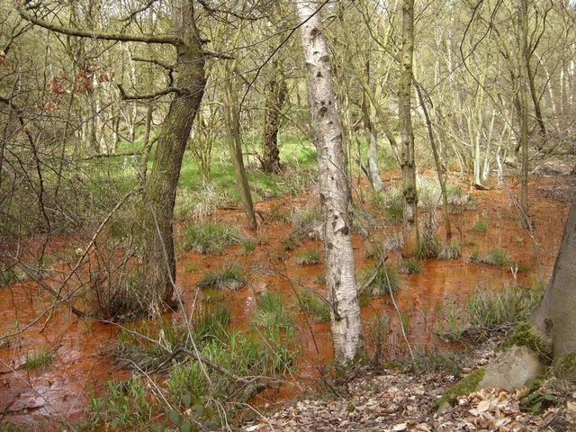
Parrot's Drumble

Parrot's Drumble is a nature reserve of the Staffordshire Wildlife Trust. It is an area of woodland next to the village of Talke Pits, and about 4 miles...

Audley and Bignall End railway station

Audley and Bignall End railway station was a station on the North Staffordshire Railway, which operated in the West Midlands county of Staffordshire, in...

Talke Pits

Talke Pits is a former mining village in the Borough of Newcastle-under-Lyme, Staffordshire, England, close to the Cheshire border and the village of Talke...

Audley and Bignall End

Audley and Bignall End was a ward in the Borough of Newcastle-under-Lyme, in the county of Staffordshire, England. It covered the villages of Audley and...
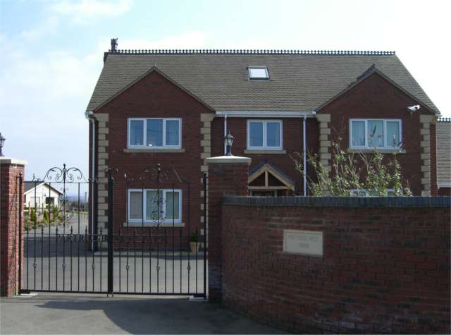
Bignall End

Bignall End is a village in Staffordshire, England, near Junction 16 of the M6 motorway. == History == It is a part of the parish of Audley Rural, which...

Related Videos

Walking along Hadrians Way Segedunum to Newburn 20.8km

Hadrians Way altogether 84 miles (135km), we are going to walk on it in 2-3 months time divided 8-10 times during the Covid 19 ...

Bathpool Kidsgrove walking in rain and wind and checking the ski slope

Bathpool Park is a public park in a rural area between Newcastle-under-Lyme and Kidsgrove, Staffordshire. The park became ...

Wedgwood Monument hike and walk, Red Street, Stoke on Trent Staffordshire

So today we walk from Jamage Farm to the Wedgwood monument.

Apedale Country Park Staffordshire

A walk around Apedale country park , Its Jan 31st 2020 and its cold.

Nearby Amenities

Located within 500m of 53.057516,-2.267479
Barrier: stile
Material: wood
Note: redundant; no barrier to northeast
Step Count: 1
Stile: stepover
Lat/Long: 53.0580017/-2.2676678
Wedgwood's Monument
HE Ref: 1374392
Historic: monument
Listed Status: Grade II
Wikidata: Q26655272
Lat/Long: 53.0580474/-2.2681108
Tourism: viewpoint
Lat/Long: 53.0580404/-2.2682326
Barrier: stile
Material: wood
Stile: stepover
Lat/Long: 53.0547717/-2.2619218
Bignall Hill
Ele: 236
Man Made: survey_point
Natural: peak
Wikidata: Q4906993
Wikipedia: en:Bignall Hill
Lat/Long: 53.0578805/-2.2677841
Barrier: stile
Lat/Long: 53.0554073/-2.2675785
Power: pole
Lat/Long: 53.0580958/-2.2607991
Power: pole
Lat/Long: 53.0572664/-2.2618613
Power: pole
Lat/Long: 53.0567127/-2.2629784
Power: pole
Lat/Long: 53.0563282/-2.2638018
Power: pole
Lat/Long: 53.0556245/-2.2647285
Power: pole
Lat/Long: 53.0551207/-2.2653897
Power: pole
Lat/Long: 53.053852/-2.2671439
Bench
Backrest: no
Material: wood
Lat/Long: 53.0575268/-2.2674268
The data included in this document is from www.openstreetmap.org. The data is made available under ODbL.

Have you been to Bignall Hill?

Leave your review of Bignall Hill below (or comments, questions and feedback).