Bargh Hill

Hill, Mountain in Yorkshire Craven

England

Bargh Hill

Fields in Ribblesdale, opposite Studfold Pen-y-Ghent can be seen in the distance.
Fields in Ribblesdale, opposite Studfold Credit: Stephen Craven

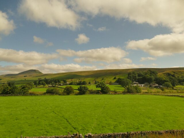
Bargh Hill is a prominent geographical feature located in the county of Yorkshire, England. Situated in the picturesque region of the Yorkshire Dales, Bargh Hill is classified as a hill rather than a mountain, with its summit reaching an elevation of approximately 400 meters (1,312 feet) above sea level.

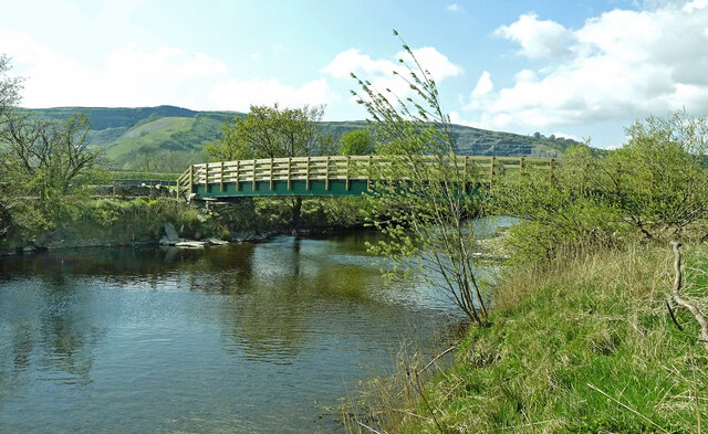
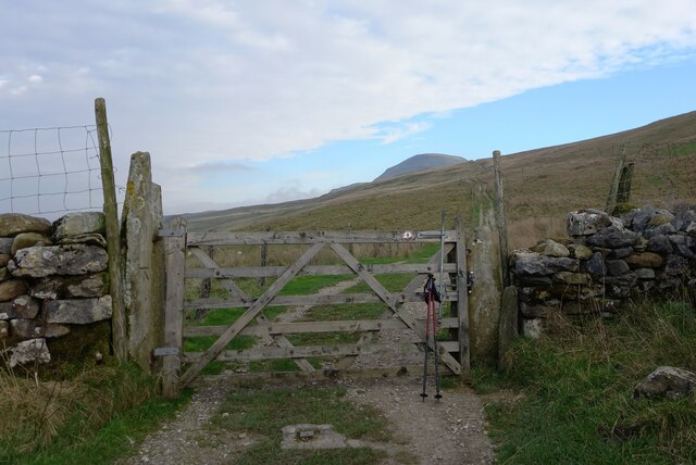
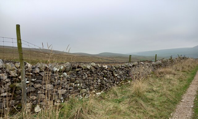
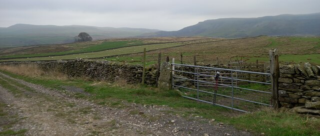
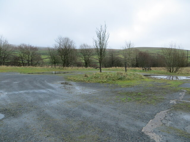
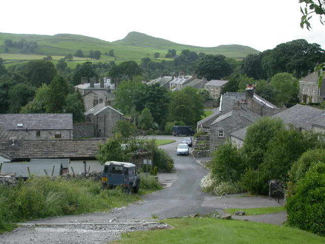
The hill is part of the beautiful countryside that characterizes the Yorkshire Dales National Park, a designated Area of Outstanding Natural Beauty. It is known for its rolling hills, lush greenery, and stunning panoramic views. Bargh Hill is no exception, providing visitors with breathtaking vistas of the surrounding landscape, including the nearby valleys and moorlands.

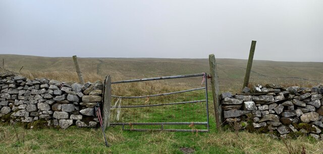
The terrain of Bargh Hill is primarily composed of grassy slopes, dotted with patches of heather and scattered rock formations. The hill is known for its relatively gentle gradient, making it a favorite destination for hikers and walkers of all abilities. Several footpaths and trails traverse the hill, allowing visitors to explore its beauty and enjoy the peacefulness of the countryside.

The hill is also home to a variety of flora and fauna. Rare species of plants can be found on its slopes, while birds such as peregrine falcons and curlews can often be spotted soaring above. Bargh Hill offers a tranquil retreat for nature enthusiasts, providing opportunities for birdwatching, photography, and simply immersing oneself in the natural surroundings.

Overall, Bargh Hill is a captivating destination within the Yorkshire Dales, offering visitors a chance to experience the beauty of the English countryside and immerse themselves in the peacefulness of nature.

If you have any feedback on the listing, please let us know in the comments section below.

Bargh Hill Images

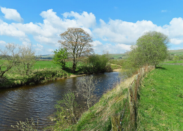
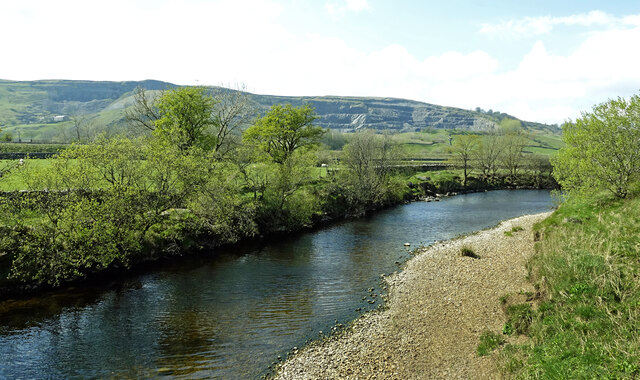
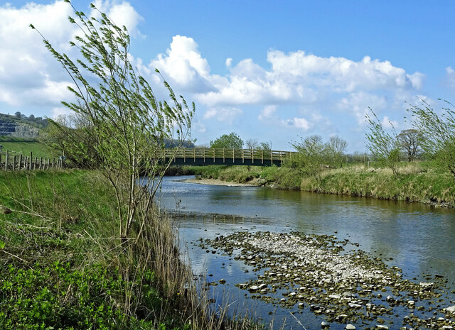
Images are sourced within 2km of 54.114648/-2.2759274 or Grid Reference SD8268. Thanks to Geograph Open Source API. All images are credited.

Fields in Ribblesdale, opposite Studfold Pen-y-Ghent can be seen in the distance.
Fields in Ribblesdale, opposite Studfold
Pen-y-Ghent can be seen in the distance.
Beside the River Ribble This view wasn’t available on our previous visits as the footbridge had been washed away.
Beside the River Ribble
This view wasn’t available on our previous visits as the footbridge had been washed away.
Down the Ribble The downstream view taken from the new footbridge. The fishermen’s access path is on the right-hand bank. Fishing is private, controlled by the Manchester Anglers Association.
Down the Ribble
The downstream view taken from the new footbridge. The fishermen’s access path is on the right-hand bank. Fishing is private, controlled by the Manchester Anglers Association.
River Ribble viewed again Looking upstream from the new footbridge on a bright late-April afternoon. Arcow Quarry is shown in the background.
River Ribble viewed again
Looking upstream from the new footbridge on a bright late-April afternoon. Arcow Quarry is shown in the background.
New bridge across the Ribble Looking upstream towards this substantial new footbridge near Helwith Bridge.  <a href="https://www.geograph.org.uk/photo/5470938">SD8170 : Footbridge over the River Ribble</a> shows the previous bridge which was washed away.
New bridge across the Ribble
Looking upstream towards this substantial new footbridge near Helwith Bridge. SD8170 : Footbridge over the River Ribble shows the previous bridge which was washed away.
The new footbridge On our previous visits, we found that the old bridge had been washed away leaving no access to this side of the River Ribble. <a href="https://www.geograph.org.uk/photo/6862909">SD8170 : No footbridge over the River Ribble</a> shows what remained in June 2021. This lovely brand-new footbridge restores the footpath circuit around Helwith Bridge. Viewed looking upstream.
The new footbridge
On our previous visits, we found that the old bridge had been washed away leaving no access to this side of the River Ribble. SD8170 : No footbridge over the River Ribble shows what remained in June 2021. This lovely brand-new footbridge restores the footpath circuit around Helwith Bridge. Viewed looking upstream.
Two trains at Arcow Quarry 35018 'British India Line' heads a Chester to Carlisle charter on the main line (Settle-Carlisle Line) while 66714 'Comer Lifeboat' waits for access to the main line with a loaded stone train exiting the quarry
Two trains at Arcow Quarry
35018 'British India Line' heads a Chester to Carlisle charter on the main line (Settle-Carlisle Line) while 66714 'Comer Lifeboat' waits for access to the main line with a loaded stone train exiting the quarry
Studfold, Long Lane The benchmark is cut into a left hand gatepost on the Long Lane track, with the summit of Penyghent in the distance.
Studfold, Long Lane
The benchmark is cut into a left hand gatepost on the Long Lane track, with the summit of Penyghent in the distance.
Studfold, Long Lane track There is a benchmark cut into the left hand gatepost on the Long Lane track, with the summit of Penyghent in the distance.
Studfold, Long Lane track
There is a benchmark cut into the left hand gatepost on the Long Lane track, with the summit of Penyghent in the distance.
Penyghent, Long Lane track According to the OS benchmark database there is a benchmark cut on one of these gateposts on the east side of the lane. Nothing was found.
Penyghent, Long Lane track
According to the OS benchmark database there is a benchmark cut on one of these gateposts on the east side of the lane. Nothing was found.
Penyghent, Long Lane track According to the OS benchmark database there is a pivot benchmark cut into the drystone wall on the east side of the track. Nothing was found.
Penyghent, Long Lane track
According to the OS benchmark database there is a pivot benchmark cut into the drystone wall on the east side of the track. Nothing was found.
Studfold, Long Lane track The benchmark is cut into the left hand gatepost at a field entrance on the west side of the lane.
Studfold, Long Lane track
The benchmark is cut into the left hand gatepost at a field entrance on the west side of the lane.
Studfold, Long Lane track There is a large benchmark cut into the left hand gatepost at the field entrance on the west side of the lane.
Studfold, Long Lane track
There is a large benchmark cut into the left hand gatepost at the field entrance on the west side of the lane.
The Scotsman flies northwards Flying Scotsman 60103 viewed at Helwith Bridge on the outward leg of an October steam special. The carriages were hidden from sight by wind-blown steam and smoke. The Arcow Quarry site is shown in the background.
The Scotsman flies northwards
Flying Scotsman 60103 viewed at Helwith Bridge on the outward leg of an October steam special. The carriages were hidden from sight by wind-blown steam and smoke. The Arcow Quarry site is shown in the background.
The Settle-Carlisle line Viewed near Helwith Bridge, looking towards the Arcow Quarry site. Flying Scotsman was approaching on her way north. <a href="https://www.geograph.org.uk/photo/7631218">SD8070 : The Scotsman flies northwards</a>
The Settle-Carlisle line
Viewed near Helwith Bridge, looking towards the Arcow Quarry site. Flying Scotsman was approaching on her way north. SD8070 : The Scotsman flies northwards
Pen-y-ghent view The distinctive outline of Pen-y-ghent viewed from a footbridge across the River Ribble near Helwith Bridge. <a href="https://www.geograph.org.uk/photo/7160054">SD8170 : The new footbridge</a>
Pen-y-ghent view
The distinctive outline of Pen-y-ghent viewed from a footbridge across the River Ribble near Helwith Bridge. SD8170 : The new footbridge
Parking and Picnic Areas at Helwith Bridge Looking south-eastward.
Parking and Picnic Areas at Helwith Bridge
Looking south-eastward.
Junction of roads at the entrance to Dry Rigg Quarry Looking north-westward.
Junction of roads at the entrance to Dry Rigg Quarry
Looking north-westward.
Show me another place!

Bargh Hill is located at Grid Ref: SD8268 (Lat: 54.114648, Lng: -2.2759274)

Division: West Riding

Administrative County: North Yorkshire

District: Craven

Police Authority: North Yorkshire

What 3 Words

///everybody.bypassed.somebody. Near Settle, North Yorkshire

Nearby Locations

Bargh Hill

Related Wikis

Stainforth, North Yorkshire

Stainforth is a village and civil parish in the Craven district of North Yorkshire, England. It is situated north of Settle. Nearby there is a waterfall...

St Peter's Church, Stainforth

St Peter's Church is in the village of Stainforth, North Yorkshire, England. It is an active Anglican parish church in the deanery of Bowland, the archdeaconry...

Pennine Cycleway

The Pennine Cycleway is a Sustrans-sponsored route in the Pennines range in northern England, an area often called the "backbone of England". The route...

Stainforth Force

Stainforth Force (also known as Stainforth Foss and Ribble Falls), is a 2.5-metre (8 ft 2 in) high cascade waterfall on the River Ribble at Stainforth...

Stainforth Bridge

Stainforth Bridge, (also known as Stainforth packhorse bridge and Knight Stainforth bridge) is a 17th century, arched packhorse bridge over the River Ribble...
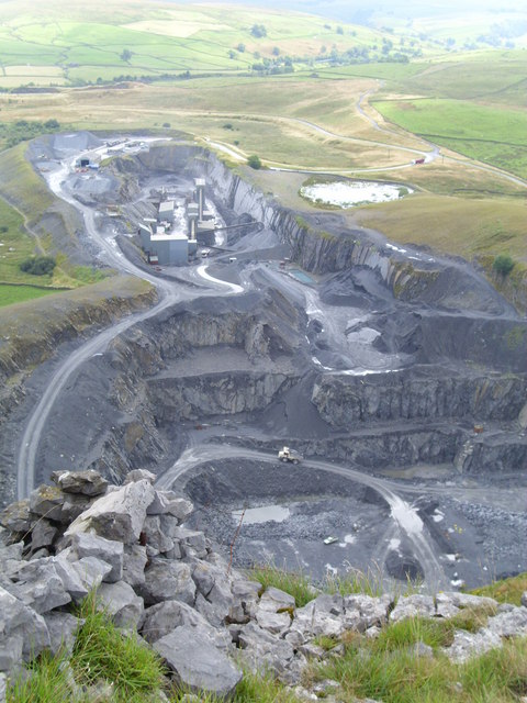
Dry Rigg Quarry

Dry Rigg Quarry is a quarry at Helwith Bridge in North Yorkshire, England, located within the Yorkshire Dales National Park. The quarry produces a hard...

Silverdale, North Yorkshire

Silverdale is a minor dale in the Yorkshire Dales in North Yorkshire, England. It is a side dale of Ribblesdale, and lies west of Fountains Fell. The dale...

Feizor

Feizor is a hamlet in the Yorkshire Dales National Park, England. The name means "Fech's summer pasture" probably in reference to a prominent local landowner...

Nearby Amenities

Located within 500m of 54.114648,-2.2759274
Bargh Hill
Natural: peak
Source: os 1893
Lat/Long: 54.11396/-2.2760557
The data included in this document is from www.openstreetmap.org. The data is made available under ODbL.

Have you been to Bargh Hill?

Leave your review of Bargh Hill below (or comments, questions and feedback).