Bowber Hill

Hill, Mountain in Westmorland Eden

England

Bowber Hill

Ruined barn west of River Belah Mickle Fell can be seen on the horizon.
Ruined barn west of River Belah Credit: John H Darch

Bowber Hill is a prominent hill located in the county of Westmorland, England. Situated within the Yorkshire Dales National Park, it offers breathtaking views of the surrounding countryside. With an elevation of 474 meters (1,555 feet), it is classified as a Marilyn, meaning it stands as a distinct hill with a prominence of at least 150 meters.

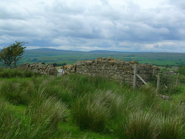
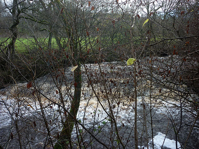
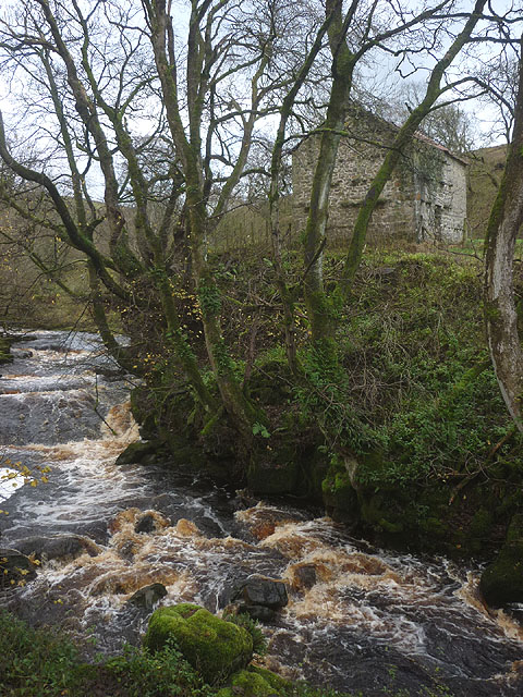
The hill is composed of limestone, which gives it a distinctive appearance and contributes to its ecological significance. It is part of a larger network of hills and valleys that form the stunning landscape of the Yorkshire Dales. Bowber Hill is known for its rich biodiversity, supporting a variety of plant and animal species, including rare wildflowers and birds.

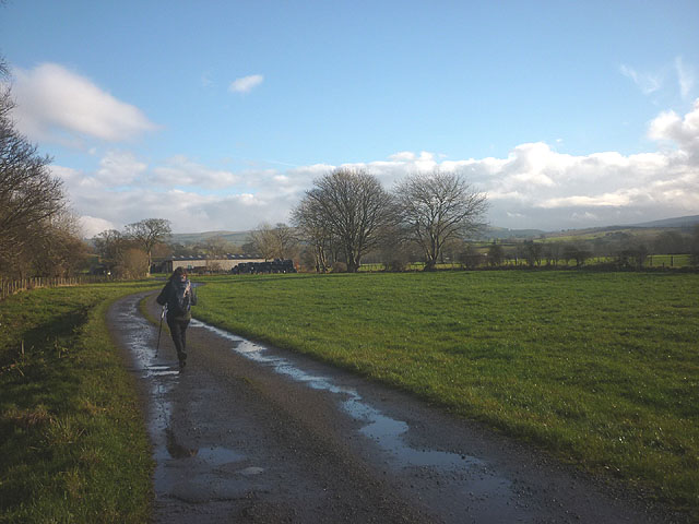
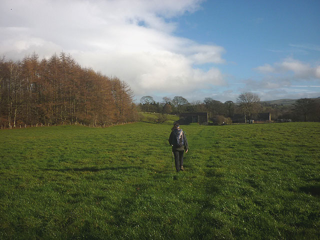
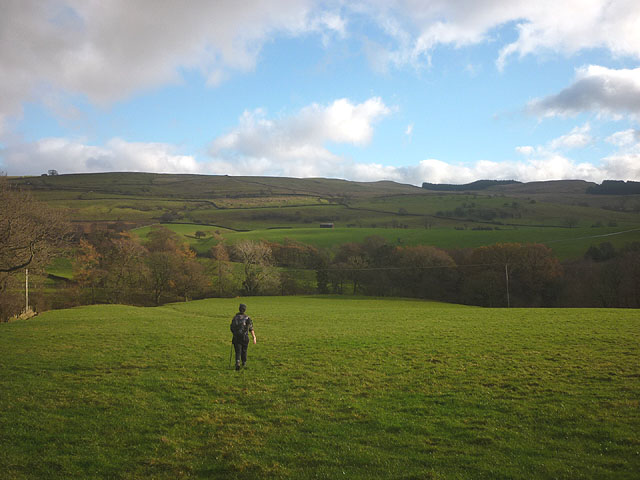
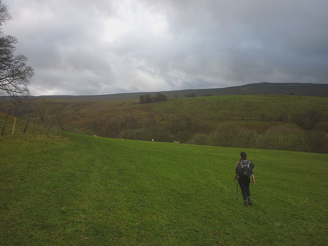
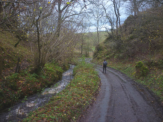
Visitors to Bowber Hill can enjoy numerous walking and hiking trails that provide access to its summit. The ascent is moderately challenging, but the reward is a panoramic view that stretches across the Yorkshire Dales, with distant mountains and rolling hills visible in the distance. On clear days, it is even possible to see the Lake District National Park to the west.

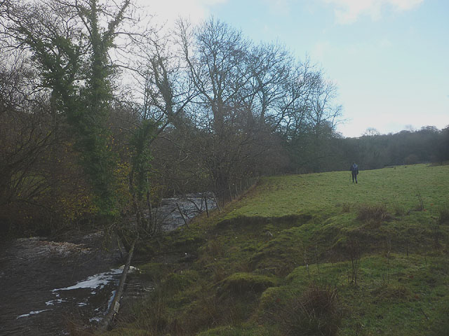
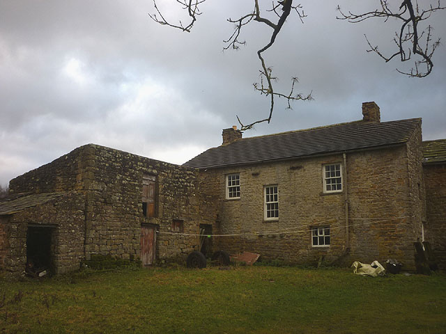
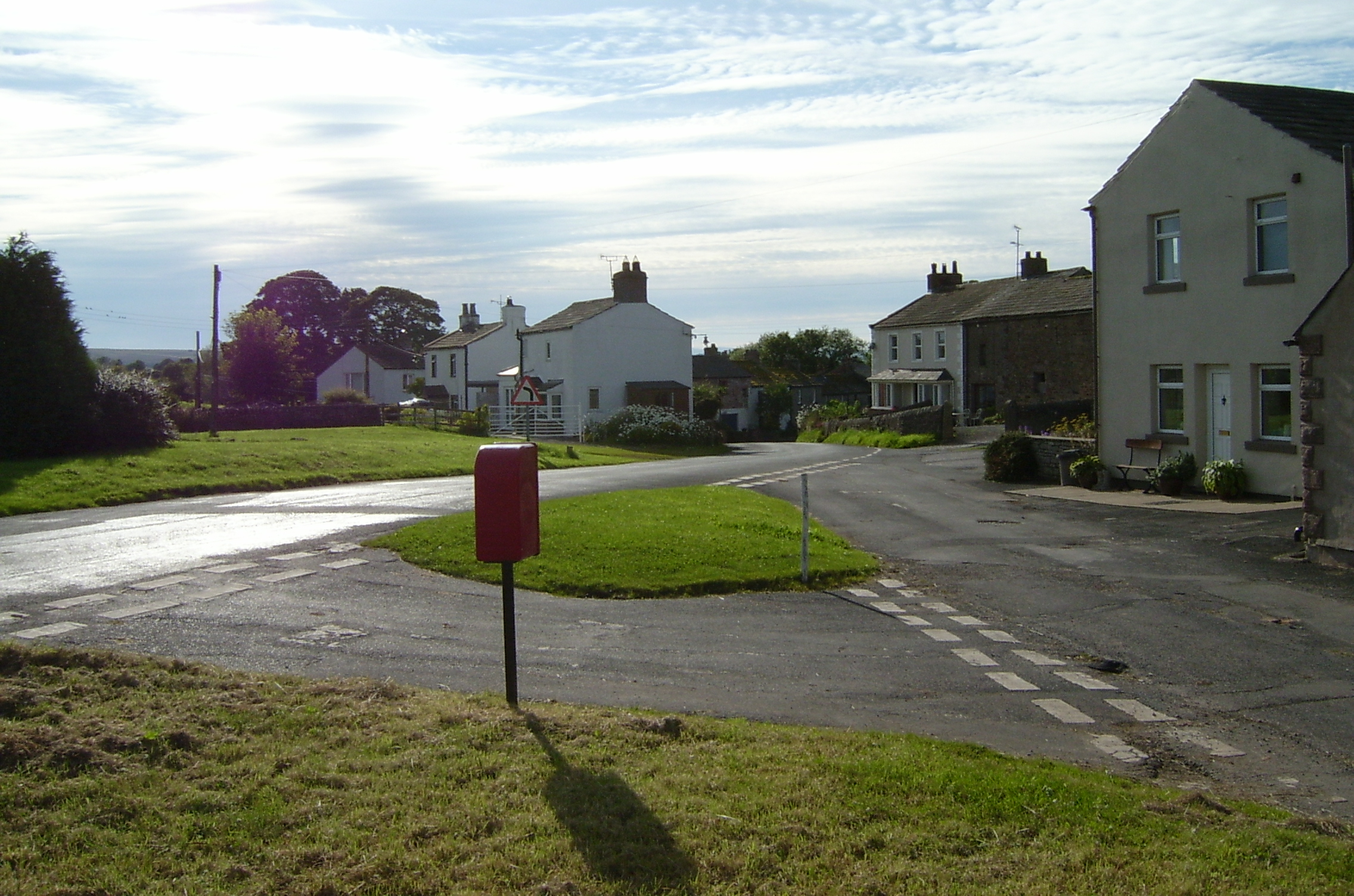
At the foot of Bowber Hill, there is a small picturesque village called Bowber Head. The village consists of traditional stone houses and buildings, adding to the charm of the area. The surrounding landscape is dotted with dry stone walls, sheep pastures, and meandering streams, creating a quintessential English countryside scene.

Bowber Hill offers a tranquil and idyllic environment for both outdoor enthusiasts and nature lovers. Its combination of striking natural beauty, varied wildlife, and accessibility make it a popular destination for those seeking to explore the stunning landscapes of Westmorland.

If you have any feedback on the listing, please let us know in the comments section below.

Bowber Hill Images

Images are sourced within 2km of 54.491953/-2.2819536 or Grid Reference NY8110. Thanks to Geograph Open Source API. All images are credited.

Ruined barn west of River Belah Mickle Fell can be seen on the horizon.
Ruined barn west of River Belah
Mickle Fell can be seen on the horizon.
Footbridge over River Belah at Field Head
Farm track from Field Head
Tree Line, Hocker Gill Looking over an empty pasture towards the purple tinged birches growing in Hocker Gill
Tree Line, Hocker Gill
Looking over an empty pasture towards the purple tinged birches growing in Hocker Gill
Fell Lane and Eden valley The end of the tarmac on Fell Lane close by the entrance to Cote Garth farm. An extensive view northwards over the upper Eden valley towards the northern Pennines with the flat topped Roman Fell [part cloud shaded] prominent in the distance.
Fell Lane and Eden valley
The end of the tarmac on Fell Lane close by the entrance to Cote Garth farm. An extensive view northwards over the upper Eden valley towards the northern Pennines with the flat topped Roman Fell [part cloud shaded] prominent in the distance.
Rookby Scarth Farm house and barns at the edge of the fells in Winton parish. This view looks north east towards the fells above the Stainmoor Gap, over which runs the A66.
Rookby Scarth
Farm house and barns at the edge of the fells in Winton parish. This view looks north east towards the fells above the Stainmoor Gap, over which runs the A66.
Looking down to Rookby Scarth Not the best view of the farm buildings from this vantage point on Fell Lane, but the panorama beyond is well worth a photograph with the scarp slope of the Northern Pennines running away in the distance. The more isolate peaks along the edge of the fells stand out well, including flat topped Roman Fell [part cloud shadowed], Murton Pike to the left and pointed Dufton Pike furthest left.
Looking down to Rookby Scarth
Not the best view of the farm buildings from this vantage point on Fell Lane, but the panorama beyond is well worth a photograph with the scarp slope of the Northern Pennines running away in the distance. The more isolate peaks along the edge of the fells stand out well, including flat topped Roman Fell [part cloud shadowed], Murton Pike to the left and pointed Dufton Pike furthest left.
Mildred and Buttercup posing on Fell Lane A herd of heifers on Fell Lane, adding their own contributions to the natural hazards on this route.
Mildred and Buttercup posing on Fell Lane
A herd of heifers on Fell Lane, adding their own contributions to the natural hazards on this route.
Bridleway approaching Bloan Farm Also the farm access track.
Bridleway approaching Bloan Farm
Also the farm access track.
Bridleway approaching Field Head Heading for the footbridge that crosses the River Belah.
Bridleway approaching Field Head
Heading for the footbridge that crosses the River Belah.
Footpath by the Belah An unmarked route heads through pastureland beside the swiftly flowing river to Oxenthwaite Bridge.
Footpath by the Belah
An unmarked route heads through pastureland beside the swiftly flowing river to Oxenthwaite Bridge.
Waterfall on the River Belah Beside the public footpath but difficult to see clearly through the trees and with a drop to the river side.
Waterfall on the River Belah
Beside the public footpath but difficult to see clearly through the trees and with a drop to the river side.
Footpath above Hocker Gill The route passes through pastureland, crossing a tributary of the wooded gill before reaching the minor road beyond.
Footpath above Hocker Gill
The route passes through pastureland, crossing a tributary of the wooded gill before reaching the minor road beyond.
Footpath to Powleyclose Bridge Below New Hall the path drops down towards the wooded Belah through pastureland. High on the far side is the southern abutment of the old Belah Viaduct.
Footpath to Powleyclose Bridge
Below New Hall the path drops down towards the wooded Belah through pastureland. High on the far side is the southern abutment of the old Belah Viaduct.
The River Belah at Powleyclose Bridge The river descends steeply over shelves and boulders of limestone and sandstone. Just above is an intact stone field barn.
The River Belah at Powleyclose Bridge
The river descends steeply over shelves and boulders of limestone and sandstone. Just above is an intact stone field barn.
The road to Wrenside
Heggerscales Lane above Coldkeld Bridge This quiet lane with Coldkeld Beck rushing alongside is actually quite pleasant to walk along.
Heggerscales Lane above Coldkeld Bridge
This quiet lane with Coldkeld Beck rushing alongside is actually quite pleasant to walk along.
Farmhouse and outbuilding at Coldkeld 'Keld' is Old Norse for a well or spring and, sure enough, there is a Coldkeld Spring just to the south east.
Farmhouse and outbuilding at Coldkeld
'Keld' is Old Norse for a well or spring and, sure enough, there is a Coldkeld Spring just to the south east.
Show me another place!

Bowber Hill is located at Grid Ref: NY8110 (Lat: 54.491953, Lng: -2.2819536)

Administrative County: Cumbria

District: Eden

Police Authority: Cumbria

What 3 Words

///mistaken.glassware.wagers. Near Kirkby Stephen, Cumbria

Nearby Locations

Bowber Hill

Related Wikis

Belah Viaduct

The Belah Viaduct was a railway viaduct on the South Durham and Lancashire Union Railway, crossing the River Belah, in Cumbria, England, about 1 mile...

Kaber, Cumbria

Kaber is a village and civil parish in the Eden District of Cumbria, England. == Location and topography == The village is located about 2 miles (3.2 km...

Barras, Cumbria

Barras is a hamlet close to the River Belah, about 4 miles (6 kilometres) south-east of Brough, Cumbria, England. Until the creation of the new county...

Barras railway station

Barras railway station was situated on the South Durham & Lancashire Union Railway between Barnard Castle and Kirkby Stephen East. == History == The station...

Brough Sowerby

Brough Sowerby is a village and civil parish in the Eden district of Cumbria, England. It is located 22.3 miles south east of the town Penrith. According...

Winton, Cumbria

Winton is a village and civil parish in the Eden District of Cumbria, England. It is 2.9 miles (4.7 km) south of Brough, and 1.6 miles (2.6 km) north of...

Hartley, Cumbria

Hartley is a village and civil parish in the Eden district of Cumbria, England. It is about 0.5 miles (0.8 km) east of Kirkby Stephen. The area has many...

Stainmore

Stainmore is a remote geographic area in the Pennines on the border of Cumbria, County Durham and North Yorkshire. The name is used for a civil parish...

Nearby Amenities

Located within 500m of 54.491953,-2.2819536
Bowber Hill
Ele: 278.3
Is In Country Code: GB
Is In County: Cumbria
Is In Municipality: Eden
Man Made: survey_point
Natural: peak
Source: NPE
Lat/Long: 54.492279/-2.2816563
Heggerscales
Place: hamlet
Lat/Long: 54.4894606/-2.2764184
Power: pole
Lat/Long: 54.4888075/-2.2766843
Power: pole
Lat/Long: 54.4888821/-2.2785331
Power: pole
Lat/Long: 54.4891497/-2.2800735
Power: pole
Lat/Long: 54.4893714/-2.2813014
Power: pole
Lat/Long: 54.4895758/-2.2824918
Power: pole
Lat/Long: 54.4898618/-2.2841429
Power: pole
Lat/Long: 54.4902052/-2.285707
Power: pole
Lat/Long: 54.4906072/-2.2875222
Power: pole
Lat/Long: 54.490907/-2.2888944
The data included in this document is from www.openstreetmap.org. The data is made available under ODbL.

Have you been to Bowber Hill?

Leave your review of Bowber Hill below (or comments, questions and feedback).