Barley Hill

Hill, Mountain in Lancashire Pendle

England

Barley Hill

Footpath and Stream, Barley The footpath leads onwards up Pendle Hill. The stream has some charming small waterfalls.
Footpath and Stream, Barley Credit: David Bremner

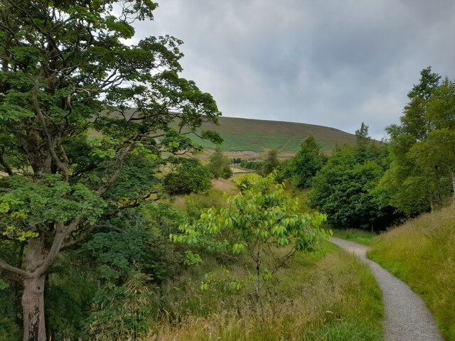
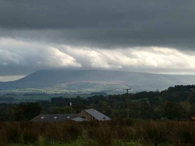
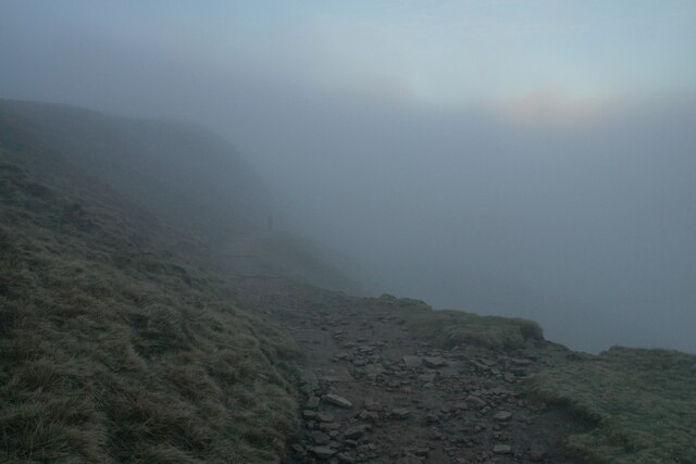
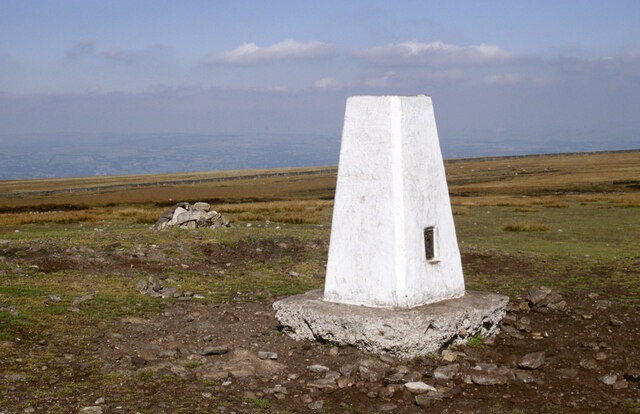
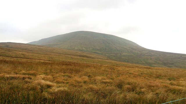
Barley Hill is a prominent hill located in the county of Lancashire, England. Situated in the southern part of the county, it is a popular destination for outdoor enthusiasts and nature lovers. Standing at an elevation of approximately 433 meters (1,421 feet), Barley Hill is known for its stunning panoramic views of the surrounding countryside.

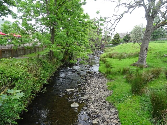
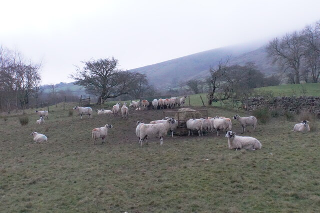
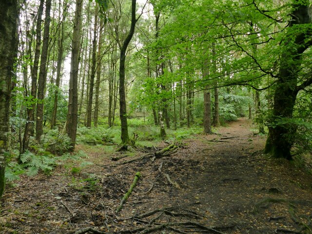
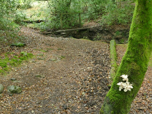
The hill is part of the Pennine range, renowned for its picturesque landscapes and diverse wildlife. Barley Hill is characterized by its rolling green slopes and is covered in lush grass and heather, providing a habitat for various plant and animal species. Visitors to the hill can expect to see an array of flora and fauna, from wildflowers and mosses to birds and small mammals.

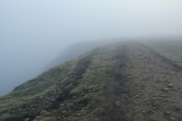
Barley Hill is also a popular spot for hiking and walking, with numerous trails and pathways crisscrossing its slopes. The hill offers a range of difficulty levels, catering to both experienced hikers and casual walkers. The trails provide the opportunity to explore the hill's natural beauty up close, with breathtaking views at every turn.

In addition to its natural allure, Barley Hill is steeped in history and folklore. The hill has been inhabited for centuries, and remnants of ancient settlements and structures can still be found in the vicinity. Local legends and tales have been woven around the hill, adding to its mystique and intrigue.

Overall, Barley Hill in Lancashire is a captivating destination that combines natural beauty, outdoor activities, and historical significance. Whether it be for a leisurely walk, a challenging hike, or simply to soak in the serene surroundings, Barley Hill offers something for everyone.

If you have any feedback on the listing, please let us know in the comments section below.

Barley Hill Images

Images are sourced within 2km of 53.858572/-2.2789059 or Grid Reference SD8140. Thanks to Geograph Open Source API. All images are credited.

Footpath and Stream, Barley The footpath leads onwards up Pendle Hill. The stream has some charming small waterfalls.
Footpath and Stream, Barley
The footpath leads onwards up Pendle Hill. The stream has some charming small waterfalls.
Set in Concrete A boot print set in the concrete. A moment captured on the footpath up Pendle Hill.
Set in Concrete
A boot print set in the concrete. A moment captured on the footpath up Pendle Hill.
A Glimpse of Pendle Hill On the footpath from Barley and a glimpse of Pendle Hill is had through the trees.
A Glimpse of Pendle Hill
On the footpath from Barley and a glimpse of Pendle Hill is had through the trees.
On Pendle Hill A pause to admire the view on the way up Pendle Hill.
On Pendle Hill
A pause to admire the view on the way up Pendle Hill.
Path on Pendle Hill On my way back down towards Barley.
Path on Pendle Hill
On my way back down towards Barley.
Barley Water, Barley Looking upstream along Barley Water from Barley Bridge, just prior to the confluence with White Hough Water.
Barley Water, Barley
Looking upstream along Barley Water from Barley Bridge, just prior to the confluence with White Hough Water.
Eastern Escarpment, Pendle Hill Looking up at the escarpment on the eastern side of Pendle Hill.
Eastern Escarpment, Pendle Hill
Looking up at the escarpment on the eastern side of Pendle Hill.
Top of the Ogden Valley Greenway, Pendle Hill Looking out towards the Ogden Valley Greenway and, beyond, the Ribble Estuary.
Top of the Ogden Valley Greenway, Pendle Hill
Looking out towards the Ogden Valley Greenway and, beyond, the Ribble Estuary.
Lower Ogden Reservoir
Stormclouds over Pendle Hill Pendle View Farm <a href="https://www.geograph.org.uk/gridref/SD7754">SD7754</a> (Shown on the map as Cracoe Hill Farm) in the foreground.
Stormclouds over Pendle Hill
Pendle View Farm SD7754 (Shown on the map as Cracoe Hill Farm) in the foreground.
Pendle Inn Inn in the very popular village of Barley.
Pendle Inn
Inn in the very popular village of Barley.
Path on the edge of Pendle Views are restricted by low cloud.
Path on the edge of Pendle
Views are restricted by low cloud.
Path down Pendle Side The slightly gentler of the two main routes from the Barley side. Views are restricted by low cloud, though a break in the cloud can be seen.
Path down Pendle Side
The slightly gentler of the two main routes from the Barley side. Views are restricted by low cloud, though a break in the cloud can be seen.
Feeding sheep at dusk Low cloud is resting on Pendle Hill behind.
Feeding sheep at dusk
Low cloud is resting on Pendle Hill behind.
Pendle Hill Pendle Hill at 557m (1,827 feet) is something of a Lancashire icon, steeped in folklore and history. The 17th century seems to have been a particularly busy period here with the Pendle witch trials in 1612, Richard Towneley's barometer experiment in 1661 and George Fox's vision of many souls coming to Christ in 1652. Of those the witch trials are perhaps the best known. Ten men and two women living in the immediate area were accused of commiting murder by witchcraft. Ten were found guilty and executed. Towneley, together with Henry Power, used the newly invented barometer to measure air pressure at different altitudes on the hill which led to an understanding of the relationship between air density and pressure.  Finally, George Fox's vision at this spot was an important event in the establishment of the Society of Friends (Quakers). 

Note how the area around the pillar has been eroded away by its many visitors. More recent pictures show how this problem has been addressed: <a href="https://www.geograph.org.uk/photo/3864654">SD8041 : Trig Point on Pendle Hill</a>.
Pendle Hill
Pendle Hill at 557m (1,827 feet) is something of a Lancashire icon, steeped in folklore and history. The 17th century seems to have been a particularly busy period here with the Pendle witch trials in 1612, Richard Towneley's barometer experiment in 1661 and George Fox's vision of many souls coming to Christ in 1652. Of those the witch trials are perhaps the best known. Ten men and two women living in the immediate area were accused of commiting murder by witchcraft. Ten were found guilty and executed. Towneley, together with Henry Power, used the newly invented barometer to measure air pressure at different altitudes on the hill which led to an understanding of the relationship between air density and pressure. Finally, George Fox's vision at this spot was an important event in the establishment of the Society of Friends (Quakers). Note how the area around the pillar has been eroded away by its many visitors. More recent pictures show how this problem has been addressed: SD8041 : Trig Point on Pendle Hill.
Pendle Big End View from Four Lane Ends
Pendle Big End
View from Four Lane Ends
Pendle Way through White Hough Plantation The Pendle Way is a footpath in the South Pennines which encircles the borough of Pendle. It was officially opened in 1987. The circuit is 45 miles. Its attractions include historical associations with the seventeenth century Pendle Witches, connections with the Brontës, stonebuilt villages in the traditional style of East Lancashire and the South Pennines, relics of the weaving and lead mining industry, and limestone meadows and millstone grit moorland culminating in the ascent of Pendle Hill.
The logo is a witch on a broomstick <a href="https://www.geograph.org.uk/photo/4622234">SD8848 : Every Witch Way</a>
Pendle Way through White Hough Plantation
The Pendle Way is a footpath in the South Pennines which encircles the borough of Pendle. It was officially opened in 1987. The circuit is 45 miles. Its attractions include historical associations with the seventeenth century Pendle Witches, connections with the Brontës, stonebuilt villages in the traditional style of East Lancashire and the South Pennines, relics of the weaving and lead mining industry, and limestone meadows and millstone grit moorland culminating in the ascent of Pendle Hill. The logo is a witch on a broomstick SD8848 : Every Witch Way
Bracket fungus in White Hough Plantation Location approximate; there is a simple plank footbridge in the background but there were at least three of these through the woods.
Bracket fungus in White Hough Plantation
Location approximate; there is a simple plank footbridge in the background but there were at least three of these through the woods.
Show me another place!

Barley Hill is located at Grid Ref: SD8140 (Lat: 53.858572, Lng: -2.2789059)

Administrative County: Lancashire

District: Pendle

Police Authority: Lancashire

What 3 Words

///third.cries.curated. Near Barrowford, Lancashire

Nearby Locations

Barley Hill

Related Wikis

Ogden Reservoirs

Upper and Lower Ogden Reservoirs are half a mile to the west of the village of Barley, in the Borough of Pendle, England. They supply drinking water to...

Barley, Lancashire

Barley is a village in the borough of Pendle, in Lancashire, England. It is in the civil parish of Barley-with-Wheatley Booth. The village lies between...

Barley-with-Wheatley Booth

Barley-with-Wheatley Booth is a civil parish in the Pendle district of Lancashire, England. It has a population of 298, and contains the village of Barley...

Goldshaw Booth

Goldshaw Booth is a civil parish in the Pendle district of Lancashire, England. It has a population of 248, and contains the village of Newchurch in Pendle...

Nearby Amenities

Located within 500m of 53.858572,-2.2789059
Barley
Place: village
Lat/Long: 53.8585241/-2.272347
Parking
Note: Converted to outdoor searing for covid-19
Opening Hours Covid19: off
Lat/Long: 53.859981/-2.2726917
Barrier: cattle_grid
Lat/Long: 53.8561322/-2.2847944
Barrier: stile
Material: wood
Stile: stepover
Lat/Long: 53.8613495/-2.2772694
Barrier: kissing_gate
Lat/Long: 53.8615872/-2.2795513
Barrier: kissing_gate
Lat/Long: 53.8565561/-2.2773648
Barrier: stile
Lat/Long: 53.8569151/-2.2825125
Beck Side
Addr Housename: Beck Side
Building: house
Lat/Long: 53.8602426/-2.2730731
Telephone
Booth: K6
Covered: booth
Operator: BT
Operator Wikidata: Q593786
Lat/Long: 53.8599155/-2.2727601
Post Box
Brand: Royal Mail
Brand Wikidata: Q638098
Brand Wikipedia: en:Royal Mail
Collection Times: Mo-Fr 16:15; Sa 10:00
Operator: Royal Mail
Operator Wikidata: Q638098
Post Box Type: lamp
Ref: BB12 168
Royal Cypher: EIIR
Royal Cypher Wikidata: Q33102113
Lat/Long: 53.8599068/-2.2727928
Bus Stop
Opposite Barley Mow
Bus: yes
Departures Board: timetable
Naptan AtcoCode: 2500LAA16314
Note: Timetable for both directions located at stop accross the road
Physically Present: yes
Public Transport: platform
Shelter: no
Lat/Long: 53.8601699/-2.2731936
Bus Stop
Barley Mow
Bus: yes
Departures Board: timetable
Naptan AtcoCode: 25003...
Naptan NaptanCode: lanawgmj
Public Transport: platform
Shelter: no
Lat/Long: 53.859902/-2.2728168
Defibrillator
Defibrillator Location: Inside of shelter
Emergency: defibrillator
Lat/Long: 53.8599249/-2.2725779
Shelter
Bench: yes
Lit: yes
Shelter Type: public_transport
Lat/Long: 53.8599286/-2.2725917
Historic: memorial
Inscription: Erected by the parish of Barley to the glorious memory of those who lost their lives in the great war 1914-1919 Ellis Edwin Cridland Gerald White Rodney Pidwell 1939-1945 Sydney Dugdale Greater love hath no man that this that a man lay down his life for h
Material: stone
Memorial: war_memorial
Note: [rest of inscription] is life for his friend.
Lat/Long: 53.8599311/-2.2726679
Bench
Backrest: yes
Lat/Long: 53.8607001/-2.2733974
Bench
Backrest: yes
Lat/Long: 53.8607114/-2.2733613
Waste Basket
Lat/Long: 53.8606952/-2.2734996
Bench
Backrest: yes
Material: metal
Lat/Long: 53.8599254/-2.2727339
Ing Ends Farm
Place: farm
Lat/Long: 53.8616829/-2.2802408
Barley House Farm
Place: farm
Lat/Long: 53.8605125/-2.272257
Barrier: kissing_gate
Lat/Long: 53.8549931/-2.2772704
Barrley with Wheatley Booth
Information: map
Tourism: information
Lat/Long: 53.8593182/-2.2723098
The data included in this document is from www.openstreetmap.org. The data is made available under ODbL.

Have you been to Barley Hill?

Leave your review of Barley Hill below (or comments, questions and feedback).