Cloch-na Hill
Hill, Mountain in Kincardineshire
Scotland
Cloch-na Hill
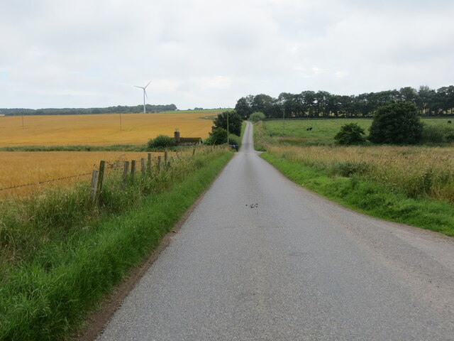
Cloch-na Hill, located in Kincardineshire, Scotland, is a prominent hill that stands at an elevation of approximately 285 meters (935 feet). It is situated near the village of Maryculter, about 10 miles southwest of Aberdeen. The hill is known for its scenic beauty and offers panoramic views of the surrounding countryside.
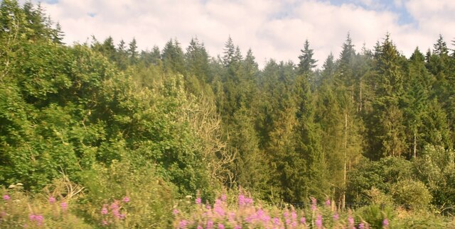
Cloch-na Hill is primarily composed of granite, which gives it a distinctive rugged appearance. It is covered with heather and grass, creating a picturesque landscape. The hill is a popular destination for hikers and nature enthusiasts, who are drawn to its peaceful atmosphere and breathtaking vistas.
At the top of Cloch-na Hill, there is a trig point, which serves as a marker for surveying and mapping purposes. This point offers an excellent vantage point for capturing the stunning views of the nearby River Dee and the surrounding hills.
The hill is also rich in historical significance. It is believed that the name "Cloch-na" is derived from the Gaelic words meaning "hill of stones." Archaeological evidence suggests that the hill was used as a burial ground during the Bronze Age, with cairns and standing stones discovered in the vicinity.
Visitors to Cloch-na Hill can access it by following well-marked footpaths. The hill provides a peaceful retreat from the bustling city life, allowing visitors to immerse themselves in the natural beauty of the Scottish countryside.
If you have any feedback on the listing, please let us know in the comments section below.
Cloch-na Hill Images
Images are sourced within 2km of 56.937554/-2.3020787 or Grid Reference NO8182. Thanks to Geograph Open Source API. All images are credited.


Cloch-na Hill is located at Grid Ref: NO8182 (Lat: 56.937554, Lng: -2.3020787)
Unitary Authority: Aberdeenshire
Police Authority: North East
What 3 Words
///steer.purified.switched. Near Stonehaven, Aberdeenshire
Nearby Locations
Related Wikis

Castle of Fiddes
The Castle of Fiddes is a 16th-century tower house in Aberdeenshire, Scotland, located around 6 kilometres (3.7 mi) south-west of Stonehaven. It is dated...
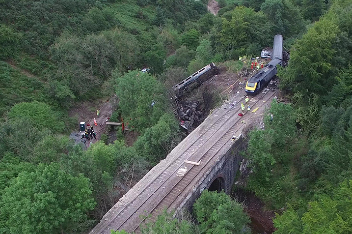
Stonehaven derailment
The Stonehaven derailment was a fatal railway accident that occurred at 09:38 BST on 12 August 2020, when a passenger train returning to Aberdeen hit a...

Tewel
Tewel is a hamlet located approximately two miles west of Stonehaven, Kincardineshire on the Auchenblae Road in Northeast Scotland. It consists of: Tewel...

Carmont railway station
Carmont railway station, on the Aberdeen Railway, served the rural area of Carmont in Aberdeenshire, Scotland from 1855 to 1964. == History == The station...
Nearby Amenities
Located within 500m of 56.937554,-2.3020787Have you been to Cloch-na Hill?
Leave your review of Cloch-na Hill below (or comments, questions and feedback).