Greenbers Hill

Hill, Mountain in Yorkshire Ribble Valley

England

Greenbers Hill

Dunbia Meat Processing Factory
Dunbia Meat Processing Factory Credit: Anthony Parkes

Greenbers Hill is a prominent landmark located in Yorkshire, England. Standing at a height of 449 meters above sea level, it is considered a hill rather than a mountain due to its relatively modest elevation. The hill is part of the Yorkshire Dales National Park, an area known for its stunning natural beauty and diverse wildlife.

Greenbers Hill offers panoramic views of the surrounding countryside, with rolling green hills and picturesque villages visible from its summit. The hill is a popular destination for hikers and outdoor enthusiasts, with several walking trails leading to the top. Visitors can enjoy a leisurely stroll through the lush green meadows and woodlands that cover the hillside, taking in the fresh air and peaceful atmosphere.

At the summit of Greenbers Hill, there is a trig point where visitors can pause to take in the breathtaking views and snap some photos of the surrounding landscape. On a clear day, it is possible to see for miles around, making it a perfect spot for a picnic or a moment of quiet reflection. Overall, Greenbers Hill is a tranquil and picturesque location that offers a peaceful retreat from the hustle and bustle of everyday life.

If you have any feedback on the listing, please let us know in the comments section below.

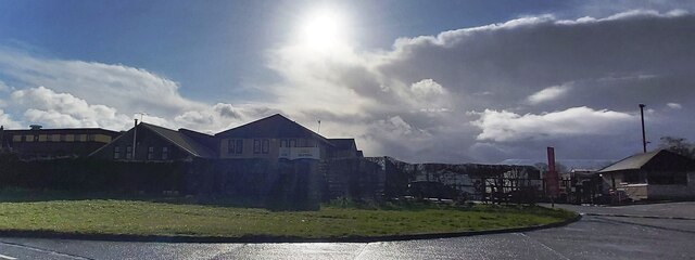
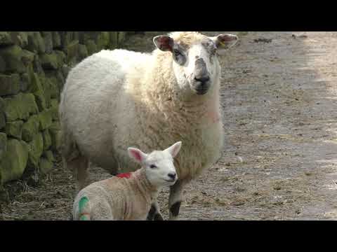
Greenbers Hill Images

Images are sourced within 2km of 53.925941/-2.2805735 or Grid Reference SD8147. Thanks to Geograph Open Source API. All images are credited.

Dunbia Meat Processing Factory
Delicious Deli and Café - Gisburn
West Portal Gisburne Park  Railway Tunnel A cut and cover short tunnel required by the landowner and decorated appropriately. The turrets of the east portal can be seen as well across this part of Gisburne Park
West Portal Gisburne Park Railway Tunnel
A cut and cover short tunnel required by the landowner and decorated appropriately. The turrets of the east portal can be seen as well across this part of Gisburne Park
Gisburne Park Railway Tunnel Turrets A curious view of mock castle turrets in parkland, disguising a railway line
Gisburne Park Railway Tunnel Turrets
A curious view of mock castle turrets in parkland, disguising a railway line
Old Guide Stone by A682, Rimington Lane junction with Hardacre Lane (East face) The Guide Stone is located in angle of minor roads, next to grey metal junction box on the West side of the road.  Parish of Rimington (Ribble Valley District). Carved stone post, erected in the 18th Century, old edge chips. An earlier photograph can be found here: <a title="https://www.geograph.org.uk/photo/6076649" href="https://www.geograph.org.uk/photo/6076649">Link</a> 

Inscription reads:- 
TO / {hand to left}  / BurnLey /(1) 2 m : : TO / {hand to right} / (?) /5 ms / TO E {hand to left} / Gisbern / 1m 

Grade II listed. 
List Entry Number: 1165264 <span class="nowrap"><a title="https://historicengland.org.uk/listing/the-list/list-entry/1165264" rel="nofollow ugc noopener" href="https://historicengland.org.uk/listing/the-list/list-entry/1165264">Link</a><img style="margin-left:2px;" alt="External link" title="External link - shift click to open in new window" src="https://s1.geograph.org.uk/img/external.png" width="10" height="10"/></span> 

Milestone Society National ID: YW_XGIS
Old Guide Stone by A682, Rimington Lane junction with Hardacre Lane (East face)
The Guide Stone is located in angle of minor roads, next to grey metal junction box on the West side of the road.  Parish of Rimington (Ribble Valley District). Carved stone post, erected in the 18th Century, old edge chips. An earlier photograph can be found here: Link  Inscription reads:- TO / {hand to left} / BurnLey /(1) 2 m : : TO / {hand to right} / (?) /5 ms / TO E {hand to left} / Gisbern / 1m Grade II listed. List Entry Number: 1165264 LinkExternal link Milestone Society National ID: YW_XGIS
Old Guide Stone by A682, Rimington Lane junction with Hardacre Lane (West Face) The Guide Stone is located in angle of minor roads, next to grey metal junction box on the West side of the road.  Parish of Rimington (Ribble Valley District). Carved stone post, erected in the 18th Century, old edge chips. East face photograph can be found here: <a title="https://www.geograph.org.uk/photo/7383066" href="https://www.geograph.org.uk/photo/7383066">Link</a> 

Inscription reads:- 
TO / {hand to left}  / BurnLey /(1) 2 m : : TO / {hand to right} / (?) / 5 ms / TO E {hand to left} / Gisbern / 1m 

Grade II listed. 
List Entry Number: 1165264 <span class="nowrap"><a title="https://historicengland.org.uk/listing/the-list/list-entry/1165264" rel="nofollow ugc noopener" href="https://historicengland.org.uk/listing/the-list/list-entry/1165264">Link</a><img style="margin-left:2px;" alt="External link" title="External link - shift click to open in new window" src="https://s1.geograph.org.uk/img/external.png" width="10" height="10"/></span> 

Milestone Society National ID: YW_XGIS
Old Guide Stone by A682, Rimington Lane junction with Hardacre Lane (West Face)
The Guide Stone is located in angle of minor roads, next to grey metal junction box on the West side of the road.  Parish of Rimington (Ribble Valley District). Carved stone post, erected in the 18th Century, old edge chips. East face photograph can be found here: Link Inscription reads:- TO / {hand to left} / BurnLey /(1) 2 m : : TO / {hand to right} / (?) / 5 ms / TO E {hand to left} / Gisbern / 1m Grade II listed. List Entry Number: 1165264 LinkExternal link Milestone Society National ID: YW_XGIS
Old milestone This milestone which would have stood at the southeast corner of the A59/B6265 Bracewll Lane is now built into steps at the back of the White Bull PH in Gisburn.  This face is engraved with a hand pointing left/To/SKipton/9 Miles/hand pointing right/Gisbor(n)/2 Ms.  The other visible face is engraved with a hand pointing left To/Settle 11 ms/hand to right/Colne 7 ms.
Old milestone
This milestone which would have stood at the southeast corner of the A59/B6265 Bracewll Lane is now built into steps at the back of the White Bull PH in Gisburn. This face is engraved with a hand pointing left/To/SKipton/9 Miles/hand pointing right/Gisbor(n)/2 Ms. The other visible face is engraved with a hand pointing left To/Settle 11 ms/hand to right/Colne 7 ms.
Gisburne Park Entrance Lodges At the south entrance at the end of Park Road from the centre of Gisburn
Gisburne Park Entrance Lodges
At the south entrance at the end of Park Road from the centre of Gisburn
Old hawthorn tree at Huckle Ing Farm near Gisburn
Ribble Way
Ribble Way
Huckle Ing
Huckle Ing
Main Street through Gisburn
The A59 out of Gisburn
The A59 to Clitheroe
Show me another place!

Greenbers Hill is located at Grid Ref: SD8147 (Lat: 53.925941, Lng: -2.2805735)

Division: West Riding

Administrative County: Lancashire

District: Ribble Valley

Police Authority: Lancashire

What 3 Words

///drifters.manifests.printout. Near Barnoldswick, Lancashire

Related Wikis

Gisburn

Gisburn (formerly Gisburne) is a village and civil parish within the Ribble Valley borough of Lancashire, England. Historically within the West Riding...

Gisburn railway station

Gisburn railway station served the small village of Gisburn, which is now in Lancashire, England, but was in the West Riding of Yorkshire at the time....

Gisburn Tunnel

Gisburn Tunnel is a short railway tunnel on the Ribble Valley line in Lancashire, England. The tunnel is 157 yards (144 m) long, just to the east of Gisburn...

Gisburne Park

Gisburne Park is an 18th-century country house and associated park in Gisburn, Lancashire, England, in the Ribble Valley some 6 miles (10 km) north-east...

Related Videos

Todber Valley Holiday Park, Lancashire

Get a preview of what you can expect at our Todber Valley Holiday Park in Lancashire. Todber Valley Holiday Park Borders rural ...

Todber Valley Holiday Park | Weekends Holidays

todbervalleyholidaypark #caravanholiday #parkdeanresorts #weekendsholidays At Todber Valley Holiday Park, located in ...

Caravans For Sale at Todber Valley Holiday Park, Lancashire

Join us to experience what it is like to own a holiday home at Todber Valley Holiday Park in Lancashire. Todber Valley Holiday ...

Weets Hill, Rimington Clitheroe, Ribble Valley

Of all the country walks we've done, Rimington & Middop, (filmed earlier this year), has to be the most relaxed. Time to stop and ...

Have you been to Greenbers Hill?

Leave your review of Greenbers Hill below (or comments, questions and feedback).