Bellshiel Law

Hill, Mountain in Northumberland

England

Bellshiel Law

Sheepfold close to square boundary Above the Bellshiel Burn.
Sheepfold close to square boundary Credit: Russel Wills

Bellshiel Law is a prominent hill located in the county of Northumberland, England. It sits within the Northumberland National Park, approximately 2 miles southwest of the village of Wark. With an elevation of 348 meters (1,142 feet), it offers breathtaking panoramic views of the surrounding landscape.

The hill is primarily composed of sandstone, which is characteristic of the geological makeup of the region. Its slopes are covered with heather and grasses, providing a colorful display during the summer months. The vegetation supports a variety of wildlife, including birds such as curlews, lapwings, and skylarks that can often be spotted in the area.

Bellshiel Law is a popular destination for outdoor enthusiasts, offering a range of recreational activities. Hiking and walking trails crisscross the hill, allowing visitors to explore its diverse terrain. The ascent to the summit is relatively gentle, making it accessible for people of various fitness levels.

At the top of Bellshiel Law, there is a trig point that marks the highest point of the hill. From here, visitors can enjoy stunning views of the surrounding Northumberland countryside, including the Cheviot Hills to the north and the Tyne Valley to the south.

The hill's location within the Northumberland National Park ensures that it remains relatively unspoiled and provides a tranquil escape for nature lovers. Whether it be for a leisurely stroll or a challenging hike, Bellshiel Law offers a rewarding experience for those seeking to immerse themselves in the natural beauty of Northumberland.

If you have any feedback on the listing, please let us know in the comments section below.

Bellshiel Law Images

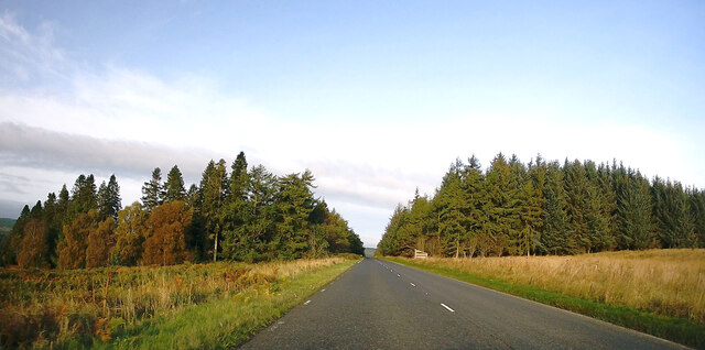
Images are sourced within 2km of 55.305834/-2.2985719 or Grid Reference NT8101. Thanks to Geograph Open Source API. All images are credited.

Sheepfold close to square boundary Above the Bellshiel Burn.
Sheepfold close to square boundary
Above the Bellshiel Burn.
Sheepfold above Bellshiel Burn The trees mark the line of the burn.
Beyond are more trees forming a wide 'X' shape.
Sheepfold above Bellshiel Burn
The trees mark the line of the burn. Beyond are more trees forming a wide 'X' shape.
Looking across the moorland To the sheepfold and cruciform forest.
With a trig point on Dour Hill.
Looking across the moorland
To the sheepfold and cruciform forest. With a trig point on Dour Hill.
The Sills Burn below Featherwood In a fenced and wooded area damaged by fire.
The Sills Burn below Featherwood
In a fenced and wooded area damaged by fire.
Sills Burn Not in spate!
Sills Burn
Not in spate!
Little Sills Burn With sheepfold by the burn and destroyed target 'tank' on the horizon.
Little Sills Burn
With sheepfold by the burn and destroyed target 'tank' on the horizon.
Looking up the valley of the Sills Burn With the devastation of the woods at Featherwood.
Looking up the valley of the Sills Burn
With the devastation of the woods at Featherwood.
Another sheepfold above the Sills Burn Looking down the valley of the Sills Burn.
Another sheepfold above the Sills Burn
Looking down the valley of the Sills Burn.
Closer look at the sheepfold With impressive dry stone walling.
A derelict tank beyond the opening.
Closer look at the sheepfold
With impressive dry stone walling. A derelict tank beyond the opening.
A68 approaching Redesdale Forest Towards Jedburgh.
A68 approaching Redesdale Forest
Towards Jedburgh.
A68 towards Jedburgh
Trig point and warning notice at fence angle The notice, which is at the edge of the MOD Otterburn range, and the trig point, are at the top of Dour Hill.
Trig point and warning notice at fence angle
The notice, which is at the edge of the MOD Otterburn range, and the trig point, are at the top of Dour Hill.
A68 leaving Redesdale Forest
Red flag, Otterburn Ranges Road from the A68 on to the range.
Red flag, Otterburn Ranges
Road from the A68 on to the range.
Military area on north side of A68 The MOD has a large training area, the Otterburn Range, to the north of the A68; the access through this gate comes with accompanying warning notices.
Military area on north side of A68
The MOD has a large training area, the Otterburn Range, to the north of the A68; the access through this gate comes with accompanying warning notices.
Forest road, Redesdale Logging road leaving the A68.
Forest road, Redesdale
Logging road leaving the A68.
Looking north-west on the A68 from the roadside layby Below the cairn on Mally's Crag.
Looking north-west on the A68 from the roadside layby
Below the cairn on Mally's Crag.
Gate leading to a field of very rough grazing At Bellshiel Farm in Northumberland.
Gate leading to a field of very rough grazing
At Bellshiel Farm in Northumberland.
Show me another place!

Bellshiel Law is located at Grid Ref: NT8101 (Lat: 55.305834, Lng: -2.2985719)

Unitary Authority: Northumberland

Police Authority: Northumbria

What 3 Words

///suckle.gearing.snug. Near Rochester, Northumberland

Nearby Locations

Bellshiel Law

Related Wikis

A68 road

The A68 is a major road in the United Kingdom, running from Darlington in England to the A720 in Edinburgh, the capital of Scotland. It crosses the Anglo...

Cottonshopeburnfoot

Cottonshopeburnfoot is a hamlet in Redesdale in Northumberland, England. It lies on the A68 road, 2 miles south east of the village of Byrness. The hamlet...

Bremenium

Bremenium (High Rochester) is an ancient Roman fort (castrum) located at Rochester, Northumberland, England. The fort is part of the defensive system built...

Rochester, Northumberland

Rochester is a small village and civil parish in north Northumberland, England. It is 5 miles (8 km) north-west of Otterburn on the A68 road between Corbridge...

Nearby Amenities

Located within 500m of 55.305834,-2.2985719
Passing Place
Lat/Long: 55.3051142/-2.2999866
Bellshiel Law
Place: locality
Lat/Long: 55.3058605/-2.298643
Passing Place
Lat/Long: 55.3069673/-2.3008935
Passing Place
Lat/Long: 55.3074365/-2.3004421
Passing Place
Lat/Long: 55.3087641/-2.2988102
The data included in this document is from www.openstreetmap.org. The data is made available under ODbL.

Have you been to Bellshiel Law?

Leave your review of Bellshiel Law below (or comments, questions and feedback).