Berth Hill

Hill, Mountain in Worcestershire Malvern Hills

England

Berth Hill

Towards Pillows Green Looking south from the Worcestershire county boundary.
Towards Pillows Green Credit: Jonathan Billinger

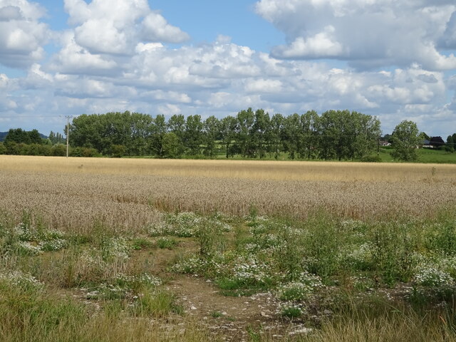
Berth Hill is a prominent hill located in Worcestershire, England. Standing at an elevation of approximately 1,000 feet (305 meters), it is considered one of the highest points in the county. The hill is situated within the picturesque Malvern Hills Area of Outstanding Natural Beauty, offering breathtaking panoramic views of the surrounding landscape.

Berth Hill is characterized by its distinctive shape, with a rounded summit and steep slopes covered in lush vegetation. The hill is predominantly composed of ancient igneous rocks, such as granite and diorite, which contribute to its unique geological features.

The area surrounding Berth Hill is rich in biodiversity, hosting a variety of flora and fauna. The hillside is adorned with a diverse range of plant species, including heather, bracken, and bluebells, creating a colorful spectacle throughout the year. It also serves as a habitat for numerous wildlife species, including birds, mammals, and insects.

The hill has historical significance, with evidence of human activity dating back thousands of years. It is believed that the summit of Berth Hill was once used as a burial ground during the Bronze Age. Additionally, remnants of Iron Age hillforts can be found on the eastern slopes, indicating the hill's strategic importance in ancient times.

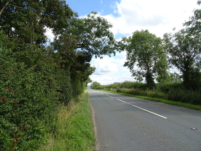
Berth Hill is a popular destination for outdoor enthusiasts, offering various recreational activities such as hiking, nature walks, and birdwatching. A network of well-maintained footpaths and trails enables visitors to explore the hill and its surroundings while immersing themselves in the stunning natural beauty of Worcestershire.

If you have any feedback on the listing, please let us know in the comments section below.

Berth Hill Images

Images are sourced within 2km of 51.974348/-2.2785899 or Grid Reference SO8030. Thanks to Geograph Open Source API. All images are credited.

Towards Pillows Green Looking south from the Worcestershire county boundary.
Towards Pillows Green
Looking south from the Worcestershire county boundary.
Pillows Green and gold Maples are colourful this year, 2015.
Pillows Green and gold
Maples are colourful this year, 2015.
Stone Walls Farm on Malvern Road, Staunton
Country road at Staunton Country road at Staunton with Lawn Farm on the right.
Country road at Staunton
Country road at Staunton with Lawn Farm on the right.
Fields and hedgerow off the B4213, Corse
B4213 towards Tewkesbury
Field off the B4213, Corse
Old Milestone on the B4211  Inscription reads - "GLOSTER 7 MILES"
Old Milestone on the B4211
Inscription reads - "GLOSTER 7 MILES"
Junction of the B4213 with the B4211, Corse
B4211, Corse Towards Gloucester.
B4211, Corse
Towards Gloucester.
Farm buildings, Walker's Farm
Barn near Flat Farm Off the B4213.
Barn near Flat Farm
Off the B4213.
B4213 towards Tirley
Cereal crop near The Folly
B4213 towards Tirley
Moorend Lane Looking north-north west away from the junction with the B4211 with the Malvern Hills in the distance on this May morning.
Moorend Lane
Looking north-north west away from the junction with the B4211 with the Malvern Hills in the distance on this May morning.
Tirley Pressure Reduction Installation Not much of the ongoing work can be seen from this angle, but construction which began in early spring 2011 is taking place beyond the ramparts to the left.
The Malvern Hills can just be seen in the distance.
See; <span class="nowrap"><a title="http://www.nationalgrid.com/uk/Gas/Pipelines/milfordhaven/corsepri/" rel="nofollow ugc noopener" href="http://www.nationalgrid.com/uk/Gas/Pipelines/milfordhaven/corsepri/">Link</a><img style="margin-left:2px;" alt="External link" title="External link - shift click to open in new window" src="https://s1.geograph.org.uk/img/external.png" width="10" height="10"/></span>
Tirley Pressure Reduction Installation
Not much of the ongoing work can be seen from this angle, but construction which began in early spring 2011 is taking place beyond the ramparts to the left. The Malvern Hills can just be seen in the distance. See; LinkExternal link
Straight road to Corse Hill Viewed from the B4213 by The Folly.
Straight road to Corse Hill
Viewed from the B4213 by The Folly.
Show me another place!

Berth Hill is located at Grid Ref: SO8030 (Lat: 51.974348, Lng: -2.2785899)

Administrative County: Worcestershire

District: Malvern Hills

Police Authority: West Mercia

What 3 Words

///irritate.sober.gliders. Near Corse, Gloucestershire

Nearby Locations

Berth Hill

Related Wikis

Eldersfield

Eldersfield is a village and civil parish in the Malvern Hills district of Worcestershire, England. It had a population of 584 in 2021.It stands exactly...

South Wales Gas Pipeline

The South Wales Gas Pipeline (also known as the Milford Haven pipeline) is the UK's largest high-pressure gas pipeline. The 197-mile (317 km) pipeline...

Staunton (near Gloucester)

Staunton is a village that lies close to the village of Corse. Staunton is eight miles north of the city of Gloucester. To the south-west of Staunton is...

Gadfield Elm Chapel

The Gadfield Elm Chapel near the village of Pendock in Worcestershire, England, is the oldest extant chapel of the Church of Jesus Christ of Latter-day...

Nearby Amenities

Located within 500m of 51.974348,-2.2785899
Berth Hill
Ele: 53
Natural: peak
Lat/Long: 51.9742373/-2.2785552
Description: Marl Pit
Historic: archaeological_site
Lat/Long: 51.9778525/-2.2747289
Power: pole
Lat/Long: 51.9777409/-2.2829045
Power: pole
Lat/Long: 51.9768066/-2.2821575
Power: pole
Lat/Long: 51.9760912/-2.281255
Power: pole
Lat/Long: 51.9761457/-2.2796872
Power: pole
Lat/Long: 51.9761937/-2.2783729
Power: pole
Lat/Long: 51.9758318/-2.2768186
Power: pole
Lat/Long: 51.9754683/-2.2752871
Power: pole
Lat/Long: 51.9751189/-2.2737984
Power: pole
Lat/Long: 51.9749024/-2.2721878
Turkey Hall
Power: pole
Transformer: distribution
Voltage Primary: 11000
Lat/Long: 51.97202/-2.2816426
Power: pole
Lat/Long: 51.9728404/-2.2805536
Berth Hill
Power: pole
Transformer: distribution
Voltage Primary: 11000
Lat/Long: 51.974059/-2.2809988
Power: pole
Lat/Long: 51.9737103/-2.2808681
Power: pole
Lat/Long: 51.9723372/-2.2803685
Power: pole
Lat/Long: 51.9718576/-2.2808795
Power: pole
Lat/Long: 51.9714532/-2.2817539
Moor End Farm
Power: pole
Transformer: distribution
Voltage Primary: 11000
Lat/Long: 51.9706745/-2.281894
The data included in this document is from www.openstreetmap.org. The data is made available under ODbL.

Have you been to Berth Hill?

Leave your review of Berth Hill below (or comments, questions and feedback).